Features
Videos
Podcasts
Specials
Articles
Shorts
Donate
English
Español (Spanish)
Français (French)
Bahasa Indonesia (Indonesian)
Brasil (Portuguese)
India (English)
हिंदी (Hindi)
বাংলা (Bengali)
Swahili
Videos
Podcasts
Articles
Short News
Feature Stories
The Latest
Explore All
Mapping News
RSS
230 stories
L
G
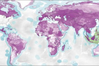
New maps show how our consumption impacts wildlife thousands of miles away
Shreya Dasgupta
6 Jan 2017
Indonesia’s forestry ministry takes Greenpeace to court over freedom of information request
Basten Gokkon
19 Dec 2016
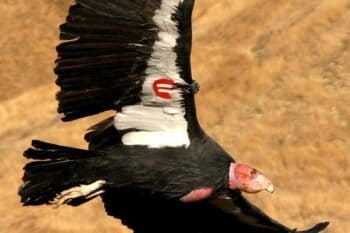
Field Notes: Mapping condor conservation strategies
Elizabeth Devitt
5 Oct 2016
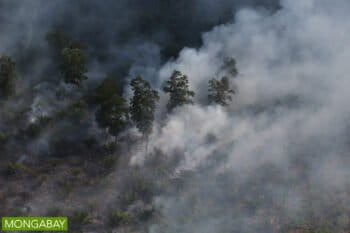
Indonesia seeks foreign funds to aid peat restoration drive
Mongabay Haze Beat
26 Sep 2016
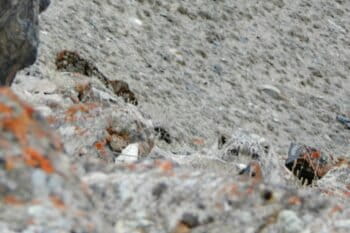
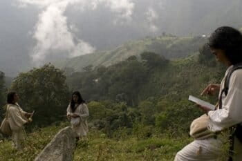
Understanding the ghost of the mountain
Julia John
10 Aug 2016
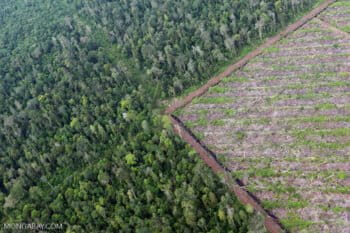
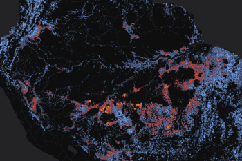
Identifying the drivers of Amazon deforestation through high-tech maps and stories
Sue Palminteri (1965-2019)
5 Aug 2016
New initiative to further creation of a single map in Indonesia’s Riau
Mongabay.com
27 Jul 2016
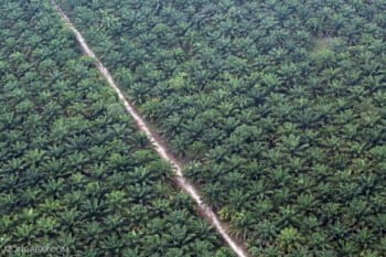
Piloting PALM Risk to detect palm oil-driven deforestation
Julia John
20 Jul 2016
New map of Malaysia’s limestone hills will help set conservation priorities
Mike Gaworecki
11 Jul 2016
Combining high-tech and low-tech to turn satellite images into action
Nathan Hahn
24 Jun 2016
Online forest mapping made easy
Sue Palminteri (1965-2019)
4 Jun 2016
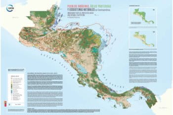
Indigenous territories occupy 40 percent of protected land and marine areas in Central America
Mike Gaworecki
20 May 2016
Singapore, Indonesia jostle over anti-haze measures
Mongabay Haze Beat
16 May 2016
Search, map, measure, and count
Sue Palminteri (1965-2019)
14 May 2016
Malaysian palm oil companies say their concession maps are state secrets
Mongabay.com
6 May 2016
Could conservation education in virtual reality help change the real world?
Julia John
3 May 2016
Companies asked to pitch in to Indonesia’s peat restoration drive as early fires flare in Sumatra
Mongabay Haze Beat
8 Apr 2016
Participatory Mapping in the Mobile Age
Nathan Hahn
6 Apr 2016
Breakthrough: Indonesia’s highest court orders release of mining data
Yustinus S. Hardjanto
30 Mar 2016
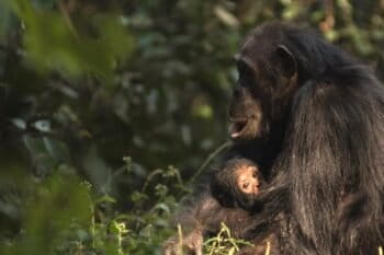
CyberTracking for Africa’s most endangered ape
Julia John
25 Mar 2016
Indonesia’s oil palm maps remain hidden from public view. Why?
Mongabay.com
23 Mar 2016
$1m for devising best way to map Indonesia’s peatlands
Sapariah Saturi
5 Mar 2016
Want to keep tabs on that new logging road in Peru? Well, now you can
Morgan Erickson-Davis
2 Mar 2016
Indonesia could collaborate with RSPO, official study finds
Jonathan Vit
19 Feb 2016
New mapping platform sees the forest for the carbon
Morgan Erickson-Davis
2 Dec 2015
First-of-its-kind mapping platform could help protect land held by Indigenous communities
Basten Gokkon, Shreya Dasgupta
13 Nov 2015
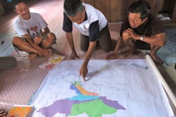
A Borneo village maps its land to protect against encroachers
Christopel Paino
3 Nov 2015
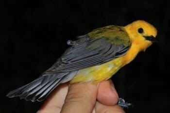
Sunrise to sunset: documenting warbler migrations with cheap, light geolocator tags
Katie Taylor
22 Oct 2015
Plantation companies challenged by haze-causing fires in Indonesia
Rhett Ayers Butler
14 Oct 2015
Researchers find ‘hidden tapestry’ of plant chemicals in Amazon forest
Shreya Dasgupta
3 Jul 2015
Satellite-based forest mapping platform hits its stride
Victor Montoro
26 Jun 2015
First-of-its-kind mapping technique sheds new light on tropical forests
Shreya Dasgupta
29 May 2015
« Previous
1
…
4
5
6
7
8
Next »
you're currently offline