Features
Videos
Podcasts
Specials
Articles
Shorts
Donate
English
Español (Spanish)
Français (French)
Bahasa Indonesia (Indonesian)
Brasil (Portuguese)
India (English)
हिंदी (Hindi)
বাংলা (Bengali)
Swahili
Videos
Podcasts
Articles
Short News
Feature Stories
The Latest
Explore All
Mapping News
RSS
230 stories
L
G
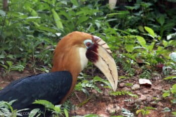
‘Eye of Papua’ shines a light on environmental, indigenous issues in Indonesia’s last frontier
Hans Nicholas Jong
14 Feb 2018
Indonesia prepares to adopt standardized peat-mapping technology
Hans Nicholas Jong
29 Jan 2018
Data fusion opens new horizons for remote imaging of landscapes
Sue Palminteri (1965-2019)
25 Jan 2018
New satellite data reveals forest loss far greater than expected in Brazil Amazon
Sue Palminteri (1965-2019)
18 Jan 2018
10 top conservation tech innovations from 2017
Sue Palminteri (1965-2019)
4 Jan 2018
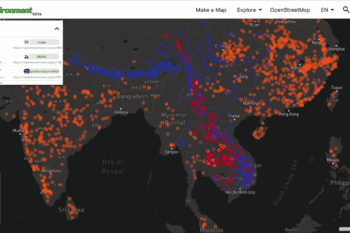
Combining computing power and people power to identify key deforestation hotspots
Sue Palminteri (1965-2019)
26 Dec 2017
Where one predator meets another: tracking sharks and fishing effort
Sue Palminteri (1965-2019)
25 Nov 2017
As Indonesia pushes flagship land reform program, farmers remain wary
Hans Nicholas Jong
21 Nov 2017
An early warning system for locating forest loss
Sue Palminteri (1965-2019)
16 Nov 2017
Mapping how to feed 9 billion humans, while avoiding environmental calamity
Rhett Ayers Butler
8 Nov 2017
Scientists plan to map a ‘safety net’ for Planet Earth
Mike Gaworecki
7 Nov 2017
Study maps out reptiles’ ranges, completing the ‘atlas of life’
Mongabay.com
17 Oct 2017
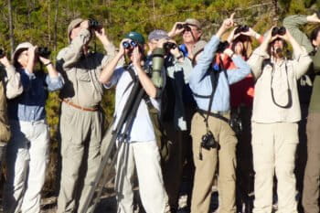
Birdwatching poised to take flight in Colombia, study reveals
John Cannon
10 Oct 2017
Citizen scientists use mobile apps to help “green” the ocean
Sue Palminteri (1965-2019)
20 Sep 2017
Indonesia’s decision to share vessel tracking data ‘ill-advised,’ some say
Basten Gokkon
21 Aug 2017
Scientists combine crowd-sourced field observations with land-use and climate models to identify steps for migratory bird protection
Sue Palminteri (1965-2019)
18 Aug 2017
Land-swap rule among Indonesian President Jokowi’s latest peat reforms
Hans Nicholas Jong
11 Aug 2017
Why the Suy’uk are fact-checking their Dayak origin myth
Andi Fachrizal
4 Aug 2017
Open-source species location data supports global biodiversity analyses
Colleen O'Brien
31 Jul 2017
Ongoing mass extinction causing ‘biological annihilation,’ new study says
John Cannon
11 Jul 2017
Story-telling app and website help communities improve their ‘backyards’
Danielle Bettermann
23 Jun 2017
Creating corridors: researchers use GPS telemetry data to map elephants’ movements
Danielle Bettermann
21 Jun 2017
Location, location, location: Facts and FAQs about radio telemetry
Sue Palminteri (1965-2019)
12 May 2017
An interactive map connects landowners and forest change in one of the world’s most biodiverse places
Sue Palminteri (1965-2019)
28 Apr 2017
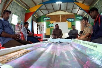
Mapping indigenous lands in Indonesia’s tallest mountains
Wahyu Mulyono
21 Apr 2017
‘We can save life on Earth’: study reveals how to stop mass extinction
Morgan Erickson-Davis
18 Apr 2017
Indonesian Supreme Court orders Jokowi administration to hand over palm oil permit data
Mongabay.com
10 Mar 2017
Greenpeace to take Indonesian forestry ministry to Supreme Court over environmental data
Mongabay.com
9 Mar 2017
Building environmental community and transparency through maps
Sue Palminteri (1965-2019)
7 Mar 2017
Protecting Marine Protected Areas
Elizabeth Devitt
1 Feb 2017
Indonesia adds more than 1,100 to the official tally of its islands
M Ambari
12 Jan 2017
Free online analysis of forest change
Sue Palminteri (1965-2019)
6 Jan 2017
« Previous
1
…
3
4
5
6
7
8
Next »
you're currently offline