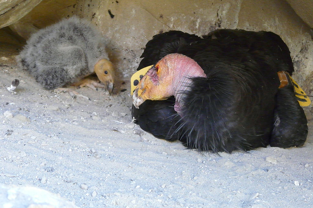
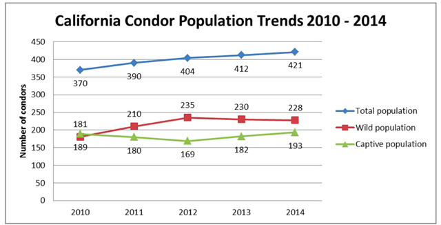
- Nearly extinct in the wild in the 1980’s, the California condor is experiencing a recovery thanks to an intense management plan and a partial ban on lead ammunition. Unfortunately for captive condors released to the wild, lead poisoning is still a problem.
- Holly Copeland’s GIS mapping study has shown that condors close to the coast suffer less from lead poisoning than those inland. Mapping also helps locate less risky release sites, and predict locales where birds might be most at risk from lead.
- The mapping study detected increased wild behavior in the condors, meaning they are ranging farther from captive release sites. That is good news, but also means the birds that fly farther inland are being exposed to a greater risk of lead poisoning.
- Copeland hopes that when the comprehensive California ban on lead ammunition takes full effect in 2019, the wild condors will benefit. The researcher is also applying her mapping experiences with condors, to eagles and other raptors in Wyoming.
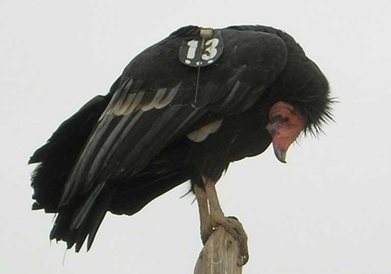
Vulture populations worldwide are at lethal risk from toxins that accumulate in the carcasses on which they feed — from poisonous painkillers in cattle in India, pesticides that have killed lions preying on cattle in Africa, to hunter’s lead-based ammunition in California’s wildlife.
The California condor (Gymnogyps californianus), was almost wiped out in the early 1980s, with only 22 of the birds left alive in the wild. Poisoning from lead-based ammunition — contained in the carrion they ate — was the leading cause of death for these great gliding birds known for their wingspans stretching out up to nine feet wide.
Despite a comeback prompted by an intensive management program, and a partial ban on hunting with lead-based ammunition, routine monitoring shows at least 20 percent of free-flying condors still have blood lead levels high enough to warrant medical treatment, and nearly every bird in the wild will require emergency treatment for lead poisoning before reaching breeding age.
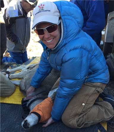
Holly Copeland, an ecologist for The Nature Conservancy in Wyoming, worked with a team that amassed data about California condor behavior, landscapes and hunting sites. The map she generated shows high-risk areas for lead poisoning, something she hopes will help improve management strategies. The map also reveals something else: that condors are regaining more of their wild behaviors, which is good news for a species that almost went extinct.
“Maps are powerful,” says Copeland. “They take data out of the abstract and put it very much in the real.”
Mongabay: How did a Wyoming conservation scientist end up mapping endangered condors in California?
Holly Copeland: I’m a spatial ecologist and especially interested in how animal movement relates to conservation. The Nature Conservancy has a Coda Fellowship which allows employees to work on projects across state chapters. With that award, I joined a team funded by the US Fish and Wildlife Service to see if we could make some sense from GPS data about poisoned condors in central and southern California. Could this information tell us something about behaviors that are risky for condors, or places that are trouble spots?
Even though the wild condor population finally outnumbers the captive population, the birds are still highly managed. Birds are released with telemetry tags. “Safe” carcasses are put out for the wild condors to feed on, trash is regularly picked up around nesting sites, and every six months the condors get checkups that include blood tests for lead levels.
So we have blood samples from condors we know are highly poisoned. We looked at what they were doing two weeks prior to when they were poisoned: where were they? And where were they compared to the condors that were not poisoned?

Mongabay: GIS maps provide ways to look at relationships among different types of geographic data. What did your maps reveal?
Holly Copeland: First, I have to say that unlike most fieldwork, this was a desk job for me. Once tracking devices are put on the animals it’s a matter of manipulating the data, although if I was in California I would have gone out for the condor captures…
So, with the birds’ GPS or telemetry collars we knew where they went. But the data also [pinpointed] landscape information like vegetation and urban development, areas where pig hunting is concentrated, and “safe food” locations where the condor program puts out untainted carcasses.
We wanted to know if there were areas where these birds were getting chronically poisoned. Although we’re still analyzing all the data, in central California we’re finding that there is a higher lead risk to birds that are inland, versus those that spend more time on the coast.
The good news is these birds are exhibiting “wilder” behaviors. When the first captive birds were released in 1992, the wild population was essentially zero. Now, we’re seeing more wild behavior, meaning the birds are ranging farther from their release sites — and that’s good. But that behavior also carries more risk. The birds with higher lead levels travel farther inland.
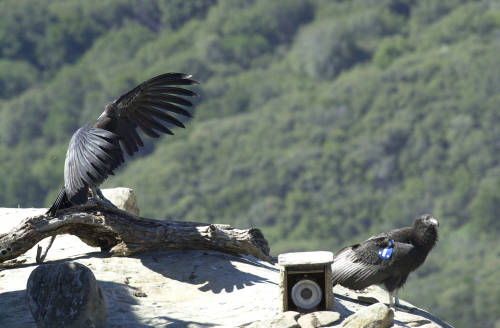
The data shows that the condors are still being poisoned despite the 2007 Ridley-Tree Condor Preservation Act, which banned hunting with lead-based ammunition within the California condor’s range. That ban didn’t cover all the sources of lead on the landscape. The continued toxicity is believed to be because the ban was not comprehensive as well as some confusion about what it applied to — did it cover squirrels, rabbits, or depredation hunting of coyotes? Hopefully when the comprehensive ban on lead ammunition takes full effect in 2019, we will see the benefits.
Right now, mapping could help select less risky release sites, or predict where birds might get in trouble. And the lead issue isn’t just a California condor problem. I’m applying what I’ve learned to eagles and other raptors in Wyoming.
Mongabay: What do you want your GIS work to accomplish?
Holly Copeland: It’s really about becoming smarter about how we manage wildlife for their benefit.
Maps take data out of the abstract realm. Whether it’s showing where condors are more at risk for lead poisoning or where mule deer are more likely to get hit by cars, I find it’s very compelling for people to see movement of real animals across the landscape.
For example, in another project where we mapped mule deer movement in Wyoming, when people could see a migration corridor that real animals are using –– as opposed to just putting a line on a map and saying “we know animals go here” — that’s something much more tangible. And I think it moves people to do good things for wildlife.
For more on the topic:
Bakker VJ, Smith DR, Copeland H, et al. Effects of Lead Exposure, Flock Behavior, and Management Actions on the Survival of California Condors (Gymnogyps californianus). EcoHealth (2016). doi:10.1007/s10393-015-1096-2
Kurle CM, Bakker VJ, Copeland H, et al. Terrestrial Scavenging of Marine Mammals: Cross-Ecosystem Contaminant Transfer and Potential Risks to Endangered California Condors (Gymnogyps californianus). Environ. Sci. Technol. (2016). doi: 10.1021/acs.est.6b01990.
Finkelstein ME, Doak DF, George D, et al. Lead poisoning and the deceptive recovery of the critically endangered California condor. PNAS (2012) doi:10.1073/pnas.1203141109.
Holly Copeland’s blog about the mapping migrations project
