• Features
  • Explore
  • Videos
  • Podcasts
  • Specials
  • Articles
  • Shorts
Donate
  • English
  • Español (Spanish)
  • Français (French)
  • Bahasa Indonesia (Indonesian)
  • Brasil (Portuguese)
  • India (English)
  • हिंदी (Hindi)
  • বাংলা (Bengali)
  • Swahili
  • Videos
  • Podcasts
  • Articles
  • Short News
  • Feature Stories
  • The Latest
  • Explore All
  • About
  • Team
  • Contact
  • Donate
  • Subscribe page
  • Submissions
  • Privacy Policy
  • Terms of Use
  • Advertising
  • Wild Madagascar
  • For Kids
  • Mongabay.org
  • Reforestation App
  • Planetary Health Check
  • Conservation Effectiveness
  • Mongabay Data Studio

Latest

In Peru’s high Andes, restoring ancient ecosystems could help protect water security

Euan Wallace 23 Sep 2026

New Galápagos Atlas charts the islands’ biodiversity and the mysteries that remain

David Brown 23 Sep 2026

4 million lakes in ‘Lost Lakes’ map offer clues to Arctic permafrost

Shreya Dasgupta 23 Sep 2026

A ‘devil-like’ flower from Thailand is new to science — and critically endangered

Naina Rao 23 Sep 2026

As fires spread in Indonesia, Bornean orangutans run out of forest to flee

Hans Nicholas Jong 23 Sep 2026

Reptiles, gold and money: How Australia is cracking down on wildlife trafficking

Johan Augustin 23 Sep 2026
All news

Top stories

A herd of vicuña in Salar de Chalviri, Bolivia

Copper boom fueling energy transition puts Earth’s wildlands at risk

Swami Gowda stands with his herd of sheep and cattle

India’s tiger success brings a new challenge: Living alongside the big cats

Arathi Menon 17 Sep 2026

‘Don’t shoot. Listen’: The AI-aided quest to understand Yellowstone’s wolves

Justin Catanoso 16 Sep 2026
KWD1980, a wild dog from Zambia’s Kafue National Park

‘A good way to die’: triumph and tragedy among dispersing African wild dogs

Ryan Truscott 16 Sep 2026
Saruni, a male giant ground pangolin

Electric fences that kill and the Maasai trying to save Kenya’s last giant pangolins

Pauline Kairu 15 Sep 2026

Subscribe

Stay informed with news and inspiration from nature’s frontline.
Newsletter

We’re a nonprofit

Help us tell impactful stories of biodiversity loss, climate change, and more
Donate

News and Inspiration from Nature's Frontline.

Gold nugget
Videos
Articles
Podcasts

Special issues connect the dots between stories

Guinea’s Iron Frontier

The Nimba mountain range as seen from southern Guinea. Image by Maarten van der Bent via Flickr (CC BY-SA 2.0).

In the Nimba Mountains, a film examines the paradox of mining-funded conservation

Ashoka Mukpo 8 May 2026
Loading a barge with iron ore from Simandou. Image by Paul Kagame via Flickr (CC BY-NC-ND 4.0)

Hopes and fears as Guinea exports iron ore from Simandou mines

Ashoka Mukpo 16 Jan 2026
Myotis nimbaensis, shown here, is a new species of bat named for the mountain range in which it is found, the Nimba Mountains in West Africa. Photo © Kendra Snyder / Bat Conservation International.

Rare bats at risk as iron ore mine advances in Guinea’s Nimba Mountains

Victoria Schneider 30 Dec 2025
a western chimpanzee in a tree

Setback for Guinea mine that threatens World Heritage chimp reserve

Ashoka Mukpo 15 May 2024

What does it take to turn one of the world’s richest iron deposits into a global export hub? Eastern Guinea has become a focal point in the global race for high-grade iron ore. Mongabay has traced the rapid expansion of two of Guinea’s largest iron ore projects in the Simandou range and the Nimba Mountains, […]

Guinea’s Iron Frontier series

More specials

Samburu pastoralists walking with their herd.
10 stories

Pastoralists in a Changing World

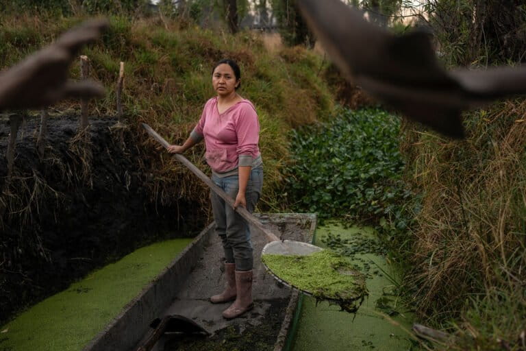
Cassandra Garduño in a wooden boat.
4 stories

Hands On: Stories that build change

16 stories

Forest Restoration Solutions

Free and open access to credible information

Learn more

Listen to Nature with thought-provoking podcasts

The Home Planet Fund succeeds by giving directly to local communities

Mike DiGirolamo 22 Sep 2026

Watch unique videos that cut through the noise

Gold nugget

The push for a sustainable artisanal mining in the Peruvian Amazon

Lionfish hunted

Turning the tables on invasive lionfish: How Honduran divers are fighting back

Fritz Pinnow, Sandy Watt 29 Aug 2026
Anden Condor

The king of the Andes: How a village learned to coexist with condors

Christina Noriega, Monica Wise Robles, Julia Lima 15 Aug 2026

How rescued orangutans are rebuilding a new wild population in Sumatra

Nanang Sujana, Sandy Watt 3 Aug 2026
A collage featuring Ashoka Mukpo, a Mongabay reporter, and a cocoa bean

Why are forests vanishing in southeastern Liberia?

Juan Maza, Ashoka Mukpo 18 Jul 2026

We’re a nonprofit

Help us tell impactful stories of biodiversity loss, climate change, and more
Donate

In-depth feature stories reveal context and insight

Codamozza (Italian for “Cut Tail”), a fin whale often sighted by the Italian marine conservation nonprofit Tethys Research Institute in the Pelagos Sanctuary
Feature story

Can we stop ships from killing the Mediterranean’s last great whales?

Clea Skopeliti, Federica Rossi, Wouter Massink 14 Sep 2026
Huge AI data center project blindsides water-stressed town in Brazil. Illustration by Giovana Abreu/Intercept Brasil.
Feature story

Huge AI data center project blindsides water-stressed town in Brazil

Naira Hofmeister 10 Sep 2026
Log pile. Image by Martyn Fletcher via Flickr. CC BY 2.0.
Feature story

The EU approved an antideforestation law. The US paper lobby sought to weaken it

Elizabeth Schell 10 Sep 2026
Donald Trump Jr. poses for photos following a morning of pheasant hunting at Hole in the Wall Lodge near Akron, Iowa, Saturday, October 27, 2017. Image by Jim Lee ©Sioux City Journal.
Feature story

Vantara works with lobbyist tied to Trump Jr. and pro-hunting groups

Spoorthy Raman 9 Sep 2026

Quickly stay updated with our news shorts

New Galápagos Atlas charts the islands’ biodiversity and the mysteries that remain

David Brown 23 Sep 2026

A new atlas of biodiversity of the Galápagos Islands highlights the unique evolutionary and ecological diversity of life in the famed archipelago that helped Charles Darwin develop the theory of natural selection.

The Galapagos Atlas, created by the Darwin Foundation, highlights 68 species and species groups in the island chain. These include the celebrities of Galápagos biodiversity, such as the giant tortoises (genus Chelonoidis), marine iguanas (Amblyrhynchus cristatus), and Darwin finches (genus Geospiza). It also features less famous plants and animals, such as the Galápagos kelp (Eisenia galapagensis), lichens, and Galápagos carpenter bees (Xylocopa darwini).

The freely available atlas was created by a team of 87 authors and artists including scientists, park rangers, and conservationists. Profiles of every species highlight both what’s known about them, but also what still remains unknown about their ecology, behavior, and conservation needs.

“There is still so much we don’t fully understand about Galapagos flora and fauna, and that’s part of what makes it so fascinating,” Darwin Foundation executive director Rakan Zahawi told Mongabay by email.

Zahawi called the Galapagos Atlas a starting point for people wanting to solve some of the scientific mysteries of life in the islands.

“Each species entry comes with citations and references, so my first piece of advice to a young person who’s captivated by a species is to follow those leads,” he added. “Dig into the research behind the entry, see who’s been studying it and what they’ve found, and let that pull you further into the subject.”

The Galapagos Atlas also includes primers on the natural history, human history, ecology, evolution, and geology of the Galápagos Islands. Furthermore, it highlights animals and plants that have become invasive to the islands.

“Galapagos today has around 1,500 introduced species, of which just over 60 are classified as invasive, meaning they’re throwing the ecosystems out of balance and impacting native flora and fauna,” Zahawi said.

He added he hopes the atlas will raise the awareness needed to keep other potentially invasive species from reaching the Galápagos in the first place. “The picture could be far worse: Galapagos authorities do strong work controlling entries into the archipelago, but every bit helps, and the more tourists understand their own potential to accidentally introduce a species, the better our odds of preventing it.”

Galapagos Atlas editor-in-chief Gustavo Jiménez told Mongabay by email that he hopes that future editions will include more species, and will be published in both English and Spanish.

Penny Becker, CEO of conservation group Island Conservation, told Mongabay by email that the Galapagos Atlas is a valuable addition to the conservationist’s toolbox. “By combining current knowledge with clearly identified research and management needs, the Atlas can help inform decisions and support more effective conservation action across the Galapagos,” she said.

Banner image: A Galápagos giant tortoise. Image by Rhett A. Butler/Mongabay.

A Galápagos giant tortoise. Image by Rhett A. Butler/Mongabay.

4 million lakes in ‘Lost Lakes’ map offer clues to Arctic permafrost

Shreya Dasgupta 23 Sep 2026

The Arctic is dotted with millions of lakes that sit on persistently frozen soil called permafrost. These lakes are crucial for the region’s wildlife and local communities. However, as temperatures rise, the permafrost thaws, which causes new lakes to form or existing lakes to abruptly disappear as lake water drains away through newly created channels.

Researchers have now created an interactive map called Lost Lakes that allows people to monitor changes in around 4 million Arctic lakes in near real time. It can also show how the lakes have changed since 2016. Monitoring lake dynamics can offer important clues for the underlying permafrost, the researchers say.

“LostLakes is completely free and designed to be used by experts and non-experts at the same time,” Ingmar Nitze, a remote sensing researcher at Germany’s Alfred Wegener Institute, which helped create the database, told Mongabay by email.

Much of the Arctic’s ground sits on ice-rich permafrost. Over hundreds and thousands of years, this permafrost has accumulated massive amounts of carbon as plant, animal and microbe matter got trapped in the frozen soil. However, as the Arctic warms faster than the global average due to climate change, much of the region’s permafrost is thawing.

“Once the permafrost thaws, some of this carbon, which was freeze-locked there for thousands of years, can go to the atmosphere and further fuel the warming, which may lead to a faster permafrost thaw,” Nitze said.

Permafrost itself is challenging to monitor directly at large scale because it lies beneath the ground and researchers typically dig into it for measurements. However, the lakes, which often form or disappear with changes in the underlying permafrost, can be easily monitored by satellite imagery.

When the ground temperature rises above freezing (0° Celsius, or 32° Fahrenheit), ice starts to thaw, causing the ground to sink and water to collect. This forms a pool, which over years and centuries can become a lake, Nitze said. “In west Alaska we have some ponds that started forming in the mid 20th century. Many Arctic lakes started forming around 12,000 years ago.”

As more surrounding permafrost thaws, channels can appear through which water can drain out of lakes. In northwestern Alaska, for instance, nearly 200 lakes shrank in the summer of 2018, following an unusually warm winter, Nitze and Anna Liljedahl of the University of Alaska Fairbanks wrote in The Conversation.

Arctic lake formation and drainage is a natural process. However, the number of lakes and speed at which they’re changing over time can indicate permafrost degradation, Nitze told Mongabay.

Understanding permafrost can help communities as well: regions with more ice-rich permafrost may be more unstable and a bad choice for building sites, while regions with less ground ice could be safer, wrote Nitze and Liljedahl.

Banner image: Aerial photograph of a lake that has recently drained, showing eroded ice wedge polygons and the outlet channel, top right. Image courtesy of Alfred Wegener Institute/Ingmar Nitze.

Aerial photograph of a lake that has recently drained, showing eroded ice wedge polygons and the outlet channel, top right. Image courtesy of Alfred Wegener Institute/Ingmar Nitze.

A ‘devil-like’ flower from Thailand is new to science — and critically endangered

Naina Rao 23 Sep 2026

Botanists in Thailand have identified a new-to-science species of “fairy lantern” — plants that live almost entirely buried under leaf litter, emerging aboveground only occasionally to flower.

Researchers were surveying evergreen forests in the mountains of Thong Pha Phum National Park when they chanced upon a plant none of them had ever seen before, at an elevation of almost 1,000 meters (about 3,300 feet).

They’ve since named it Thismia daemona, according to a recent study.

Like other plants within the Thismia genus, commonly referred to as fairy lanterns, T. daemona lacks chlorophyll, meaning it can’t photosynthesize. Instead, it spends much of its life hidden from view under leaf litter, deriving all its nutrients from soil fungi, the study authors reported.

“Finding Thismia daemona in Thong Pha Phum National Park was indeed a major surprise,” study co-author Sahut Chantanaorrapint of Thailand’s Prince of Songkla University said in a press release. “Typically, Thismia species are known to occur in perennially humid lowland rainforests, however, this population was discovered in a seasonal, montane evergreen forest at an elevation of nearly 1,000 meters above sea level.”

T. daemona has a dramatic, “devil-like” appearance, the authors write — hence the name they chose for it. Its flower features a blackish floral tube crowned with dark, horn-like appendages and vivid reddish-orange outer petals near its base.

“Combined with its hidden, subterranean and mysterious lifestyle on the forest floor, our team unanimously agreed that naming it Thismia daemona perfectly captured its enigmatic and devil-like essence,” Chantanaorrapint said.

Despite its recent discovery, the species’ future is precarious. T. daemona is currently only known from a single site within Thong Pha Phum National Park, with a population numbering fewer than 50 individuals confined to an area smaller than about 5 hectares (12 acres).

This sole known habitat also sits along trails regularly traversed by tourists, posing a threat of habitat disturbance, the authors write.

Based on the IUCN Red List criteria, they’ve provisionally classified T. daemona as critically endangered.

Chantanaorrapint said in the press release that inspiring local people to take pride in their natural heritage would both safeguard the plant’s microhabitat and “support sustainable, community led ecotourism.”

Banner image: Thismia daemona in its natural habitat. Image by Sahut Chantanaorrapint (CC BY 4.0).

Thismia daemona in its natural habitat. Image by Sahut Chantanaorrapint (CC BY 4.0).

Cigarette butts make up 12% of aquatic litter, global review finds

Shanna Hanbury 22 Sep 2026

Cigarette butts account for roughly 12% of the litter found in rivers, lakes and beaches surveyed for a recent global review.

Researchers pooled data from 130 studies conducted in 55 countries between 2013 and 2024. Across all ecosystems, including both aquatic and terrestrial, researchers found on average a density of 1 cigarette butt every 4 square meters, or roughly 1 butt every 43 square feet.

The proportion was even higher in aquatic ecosystems. Researchers found that roughly one out of every nine pieces of litter, or 12%, of litter found in aquatic ecosystems was from cigarettes. In some studied coastal sites in Iran, Chile, Brazil and Peru, more than half of all the litter was cigarette butts.

“This shows the impact that a seemingly everyday human activity can leave even in some of the environments we try hardest to preserve,” lead author Victor Vasques Ribeiro, a researcher at Brazil’s Federal University of São Paulo, told Mongabay by email.

Cigarette filters are made of cellulose acetate, a plastic that can break down into microplastics, while the rest of the partially burnt butt — paper, ash and leftover tobacco — can leach toxic substances such as heavy metals, polycyclic aromatic hydrocarbons (PAHs), nicotine, and phenolic compounds into water.

“It’s often described as a kind of ‘chemical bomb’: when it comes into contact with water, these substances can be released and cause severe toxic effects in different animals,” Ribeiro said.

Beaches were identified as a main hotspot for contamination, likely because they’re recreation areas where large groups of people gather. Across 17 countries, the top 5% of hotspots with the most litter were mostly beaches.

Smoking bans on beaches were highlighted in the review as an effective measure to protect coastal ecosystems from these pollutants. Such bans in several countries, including Malaysia, Spain, Mexico and Italy, have been successful in reducing cigarette butt litter, especially when the ban also carries a fine, the study notes.

The review also found an average of 0.29 cigarette butts per square meter (one per 11 ft2) in unprotected sites, compared with 0.06 in protected areas. In other words, cigarette butts were nearly five times more common in unprotected areas, but even highly protected areas were subject to cigarette litter, the study notes.

“It may seem obvious, but it is important to say: there wouldn’t be butts in these environments if there wasn’t cigarette consumption,” Ribeiro said. “Reducing the consumption of tobacco has a double benefit: it reduces the enormous impacts on human health, and at the same time, reduces the production of this kind of litter and the environmental impacts it produces.”

Banner image: A volunteer counts cigarettes following a 2012 beach cleanup in Hawai‘i, United States. Image courtesy of the NOAA Marine Debris Program.

A volunteer counts cigarettes following a 2012 beach cleanup in Hawai‘i, United States. Image courtesy of the NOAA Marine Debris Program.

Brazil creates four Amazon reserves as plans to pave rainforest highway advance

Shanna Hanbury 22 Sep 2026

The Brazilian government has created four new sustainable development reserves in the Amazon as part of an effort to mitigate environmental damage from the controversial plan to fully pave the BR-319 highway. The road will pass through one of the most intact parts of the rainforest, which conservationists warn will lead to increased deforestation.

President Luiz Inácio Lula da Silva signed on Sept. 8 the decrees that would protect more than 668,000 hectares (1.65 million acres) of Amazon rainforest under a sustainable-use model, which allows existing residents to remain on the land and extract forest products.

“The federal government is working … to build a solution capable of enabling the highway’s paving, while ensuring environmental protection and encouraging sustainable economic development in the region,” João Paulo Capobianco, the minister of environment and climate change, said at an event announcing the new conservation areas.

Map by Andrés Alegria/Mongabay.

The four reserves will be managed by Brazil’s Chico Mendes Institute for Biodiversity Conservation, a federal agency under the environment ministry.

The decrees also establish buffer zones around three of the four largest reserves, putting another 109,718 hectares (271,119 acres) of land under some level of protection, though mining could be permitted in those areas.

The BR-319 highway, which connects the cities of Manaus and Porto Velho in Brazil’s northern Amazon, was built during Brazil’s military dictatorship in the 1970s and later fell into disrepair. The highway’s 339-kilometer (211-mile) middle section is largely impassable in the rainy season, though many still try to traverse it.

A truck stuck in the mud of BR-319. Image courtesy of Marcio Isensee e Sá/InfoAmazonia.

Former president Jair Bolsonaro pledged to fully repave the BR-319 when he took office in 2019. He never did, but speculation fueled a 144% jump in deforestation between 2019 and 2022. The deforestation was in the classic “fishbone” pattern in which smaller roads branch off from main roads, each with an area of deforestation around it.  

Capobianco said deforestation subsequently fell 73% between 2022 and 2025, following Bolsonaro’s exit from office, and an additional 43% by July 2026.

While protection on paper and a slowdown in deforestation are a good start, enforcement on the ground remains a huge concern in a region where public servants have been ambushed and threatened and environmental agencies set on fire.

“Creating conservation units alone isn’t enough. Is it good to create them? Yes, but it doesn’t solve anything, it’s not enough,” Suely Araújo, a senior public policy specialist at the Climate Observatory, told Mongabay in an audio message.

“The Chico Mendes Institute has a budget far below what’s needed for protected areas, and that hasn’t increased. So nothing guarantees these [sustainable-use reserves] will be effectively implemented,” she said. “You need to show how enforcement will actually happen in the region. That hasn’t been demonstrated.”

Banner image: The BR-319 highway in Amazonas state, Brazil, surrounded by forest. Image courtesy of DNIT.

The paving of the BR-319 highway would open the Amazon to further deforestation, affecting Brazil's rain cycle and endangering Indigenous communities. Image courtesy of the National Department of Transport Infrastructure (DNIT).

World Rhino Day: What does it take to save a species?

Mongabay 22 Sep 2026

In honor of World Rhino Day, on Sept. 22, here’s a snapshot of Mongabay’s reporting from the past year on the actions being taken to save rhinos from extinction:

Reintroduction in Uganda

In 1983, the last wild northern white rhino (Ceratotherium simum cottoni) living in Uganda was killed for its horn. But now rhinos are back in the country, contributor Benjamin Jumbe reported in March.

In the last year, at least four southern white rhinos (Ceratotherium simum simum) were brought to northern Uganda’s Kidepo Valley National Park and another four to Ajai Wildlife Reserve. The reintroduced rhinos are a different subspecies, because just two northern white rhinos are alive today; both are females.

“The translocation helps us not keep all eggs in one basket and create opportunities to mitigate … risks,” Robert Aruho, a veterinary specialist with the Uganda Wildlife Authority told Mongabay.

Mozambique’s ‘silent park’ receives rhinos

Zinave National Park in Mozambique, the site of a decades-long civil war, came to be known as a “silent park,” because the war nearly decimated its wildlife. Since 2022, 64 white rhinos (Ceratotherium simum) and black rhinos (Diceros bicornis) have been reintroduced to the park, Mongabay’s Shanna Hanbury reported in June.

As grazers, rhinos help maintain the grassland ecosystem, creating habitat for other wildlife and mitigating fire risk.

“You can imagine if you don’t have rhinos in the park, [there are] very high grass levels, which is a very large fire hazard,” said Antony Alexander, with the Peace Parks Foundation.

At least five healthy black rhino calves have been born in the former war zone of Zinave National Park.

Rhinos reintroduced in India are breeding

In India, reintroduced rhinos are successfully breeding. Between 2006 and 2021, 42 greater one-horned rhinos (Rhinoceros unicornis) were brought to India’s Manas National Park. Researchers followed their progress and found 40 calves have been born there, raising hope among conservationists for the future of the population, though poaching remains a threat, contributor Sneha Mahale reported in May.

“Breeding and calving are among the most important indicators that reintroduced rhinoceroses have adapted well to their new environment,” wildlife biologist Deba Kumar Dutta, told Mongabay India.

Growing rhino populations need quality habitat

Nepal has also reintroduced populations of greater one-horned rhinos to new areas including in Bardiya National Park. The rhino population in the country grew by 16.6% to 752 individuals from 2015-2021. However, the conservation success story comes with a caveat, contributor Bibek Bhandari reported in June.

Using GPS collars, researchers tracked five reintroduced rhinos in Bardiya. They found the animals traveled longer than expected distances, likely in search of water and better-quality grasslands and wallowing sites.

“Conservation success should not be measured only by population numbers, but also by the health and resilience of the habitats that support them,” rhino researcher Balram Awasthi told Mongabay.

Banner image: A greater one-horned rhino in Chitwan, Nepal. Image by Aditya Pal via Wikimedia Commons (CC BY-SA 4.0).

Share Short Read Full Article

Share this short

If you liked this story, share it with other people.

Facebook Linkedin Threads Whatsapp Reddit Email

Subscribe

Stay informed with news and inspiration from nature’s frontline.
Newsletter

News formats

  • Videos
  • Podcasts
  • Articles
  • Specials
  • Shorts
  • Features
  • The Latest

About

  • About
  • Contact
  • Donate
  • Impacts
  • Newsletters
  • Submissions
  • Terms of Use

External links

  • Wild Madagascar
  • For Kids
  • Mongabay.org
  • Reforestation App
  • Planetary Health Check
  • Conservation Effectiveness
  • Mongabay Data Studio

Social media

  • LinkedIn
  • Instagram
  • Youtube
  • X
  • Facebook
  • Tiktok
  • Reddit
  • BlueSky
  • Mastodon
  • Android App
  • Apple News
  • RSS / XML

© 2026 Copyright Conservation news. Mongabay is a U.S.-based non-profit conservation and environmental science news platform. Our EIN or tax ID is 45-3714703.

you're currently offline