- With Indonesia planning to shift its capital from Jakarta to the Bornean province of East Kalimantan, infrastructure development pressures on the island have intensified.
- Neighboring Malaysia is adding new stretches to the Pan Borneo Highway to capitalize on spillover economic benefits; within Indonesia, East Kalimantan’s developmental gains are also expected to trickle to other provinces through the transboundary highway.
- While the new roads could spur economic development in remote villages, they also carve into protected areas in the Heart of Borneo, opening them up for resource extraction.
- In particular, the roads could fast-track development of a new “oil palm belt,” with disastrous consequences for the wildlife and Indigenous peoples of Borneo, and for global climate, experts say.
Every few years, stretches of Borneo’s towering dipterocarp trees fruit in a synchronized pulse. In those months, the air is rich with brown, winged fruit, which fall and spin to the forest floor. These are sites where life gathers to feast in momentary abundance: bearded pigs (Sus barbatus), sun bears (Helarctos malayanus), orangutans (Pongo pygmaeus) and more.
To get to these fruiting sites, some species trek for hundreds of kilometers. Their migration is critical to Borneo’s ecosystems, which are some of the richest in the world. They cross forests but also national borders: Malaysia, Indonesia and Brunei all own parts of Borneo, making it one of the largest transboundary rainforests on the planet.
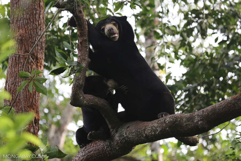

In 2007, the three countries signed a voluntary pact to conserve one-third of its land: a mostly intact, 22-million-hectare (54-million-acre) stretch named the Heart of Borneo. Now, this agreement is breaking up as they pursue a new collective ambition: the Pan Borneo Highway, a 5,324-kilometer (3,308-mile) road network that will link Sabah and Sarawak in Malaysia to Kalimantan in Indonesia, and Brunei.
While the new highway could spur economic development in remote villages, it also carves into protected areas in the Heart of Borneo, opening them up for resource extraction. In particular, the roads could fast-track development of a new “oil palm belt,” with disastrous consequences for both wildlife and Indigenous people in Borneo, experts say.
“We’re not just talking about land taken for road construction, but also what these roads facilitate, which is for extractive companies to enter these isolated areas and realize their concessions,” Angus MacInnes, a consultant at U.K.-based nonprofit Forest Peoples Programme, told Mongabay. “Once the roads enter, the palm oil companies will follow.”
After the roads, come the plantations
In 2019, President Joko Widodo announced plans to shift Indonesia’s administrative capital from Jakarta to East Kalimantan province. Since then, focus on the transboundary highway has intensified.
Neighboring Malaysia is adding new stretches to capitalize on spillover economic benefits from the move. Within Indonesia, East Kalimantan’s developmental gains are expected to trickle down to the other provinces through the highway network, Slamet Brotosiswoyo, chairman of the local branch of the Indonesian Employers Association, told the South China Morning Post.
As previously isolated areas become more accessible by road, Brotosiswoyo said he hoped that companies would “invest in developing industries, not only sucking up … natural resources.” But according to the Indonesian government’s master plans, logging and palm oil industries are expected to play an outsize role in transforming Borneo into eastern Indonesia’s new growth engine, and uplifting rural communities.
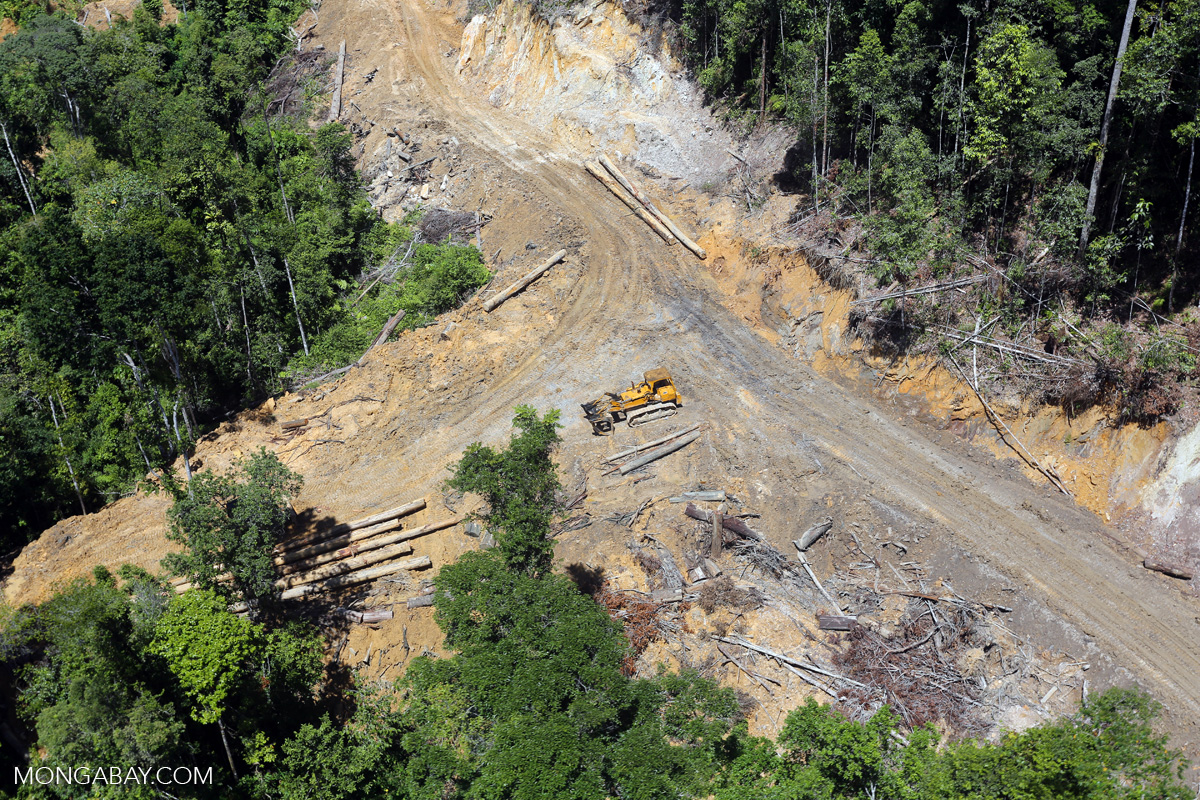
Ujoh Bilang is one of those remote villages in the Heart of Borneo. Situated in Mahakam Ulu district in the province of East Kalimantan, its people rely mainly on the nearby Mahakam River for transport to larger towns. When the river floods or recedes drastically, mass inflation occurs; a bag of rice can cost twice as much as in the provincial capital.
In recent years, Mahakam Ulu has gotten funding to build new roads: to economic centers in East Kalimantan; to nearby districts; and to settlements along the Malaysian border.
When these infrastructure projects, which are part of the Pan Borneo Highway (known as the Trans-Kalimantan Highway in Indonesia), are completed, “the development of other sectors such as agriculture, plantations, and other priority programs will easily follow,” its district head said in 2018. These plantation products could then “be sold to neighboring countries by using the Trans-Kalimantan highway.”
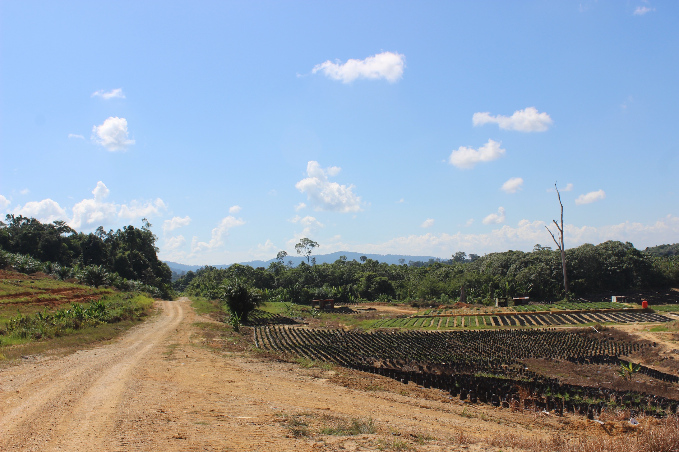
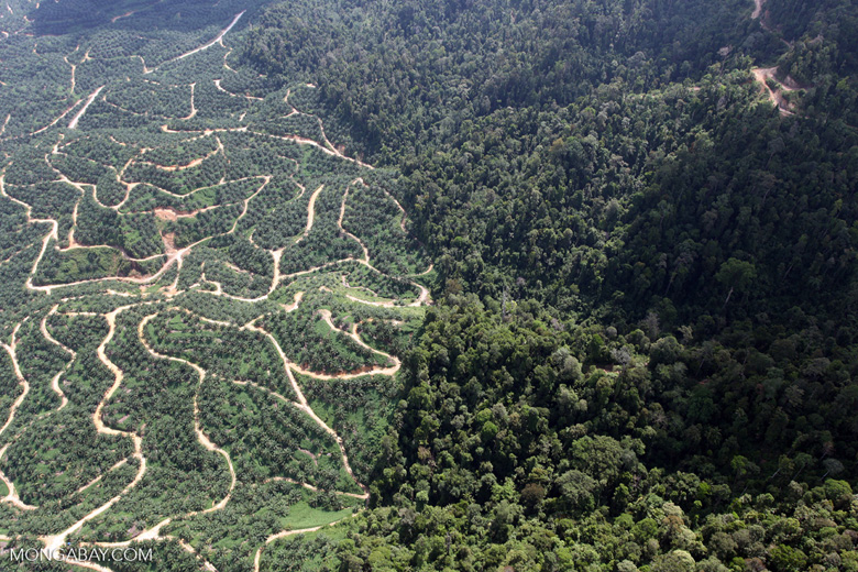
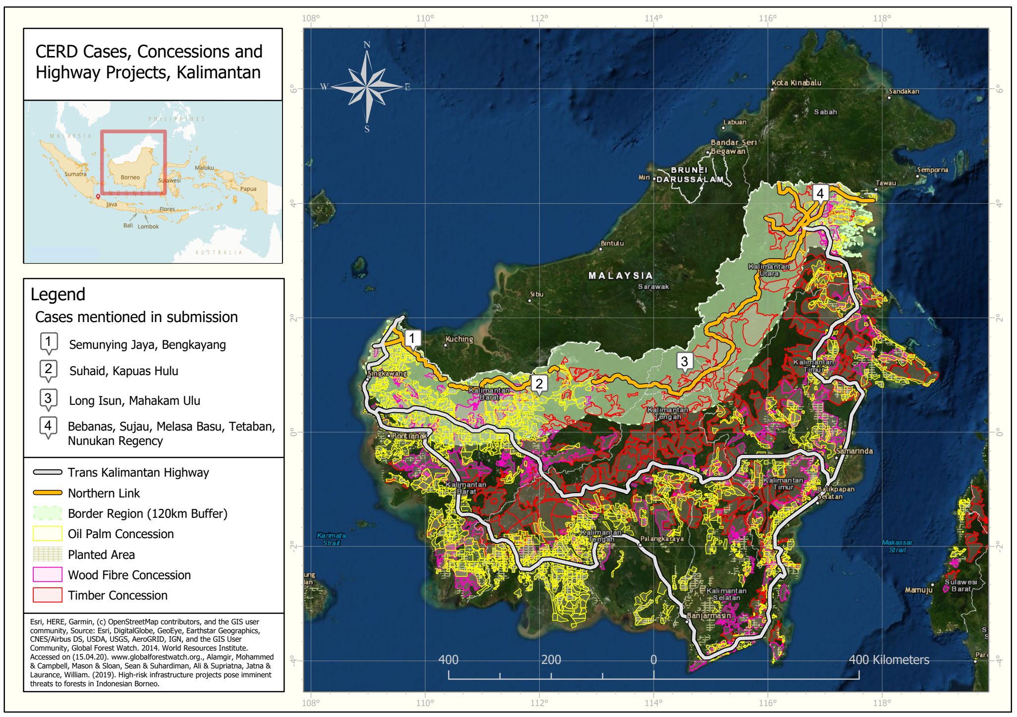
In 2013, the total plantation area in Mahakam Ulu was just over 3,000 hectares (8,000 acres). By 2019, it had grown exponentially to some 25,000 hectares (62,000 acres), with more than 80% of the land dominated by oil palm companies. At least 13,000 hectares (32,000 acres) of concessions come from the ancestral lands of the Indigenous Dayak community.
If history is any indication, the plantations still have room to grow. In West Kalimantan’s Kapuas Hulu district, infrastructure improvements were followed by the substantial issuance of concessions, and development of large oil palm plantations. When Mongabay visited Mahakam Ulu in 2019, it found a palm oil company building a new mill to cater to future expansions.

The same situation is playing out in other districts and provinces across Borneo. Local Indigenous activists, who have for years been pushing for their customary land rights to be recognized, lodged a complaint with the United Nations in 2020 over the “takings of indigenous lands for roadbuilding, plantations and mining along the Indonesia-Malaysia border, all of which threatens to cause imminent, gross and irreparable harm to the Dayak and other indigenous peoples.”
Breaking the Heart of Borneo
Of all the sections in the Trans-Kalimantan Highway in Indonesia, the northern link is the “most worrying,” according to MacInnes. It carves across the Heart of Borneo and the ancestral territories of numerous Dayak Indigenous groups.
“Our communities do need these roads, because we have been isolated for many years. But the cons outweigh the pros,” said Darwis, a project officer at Green of Borneo, an Indigenous-led NGO operating in North Kalimantan’s Nunukan district. “These roads are going to destroy ecosystems and take away our customary lands. The government says it’s for us, but it’s really for the palm oil industry and their plantations.”

Roads to Nunukan, which are under construction and expected to be completed by 2023, will cut through several protected areas, including Kayan Mentarang National Park, which contains the largest unbroken stretch of rainforest in North Kalimantan. The 1.36-million-hectare (3.36-million-acre) area — more than twice the size of Bali — is central to the Heart of Borneo initiative and home to more than 10 Indigenous communities.
“If these roads come in before their land rights are secured, we could witness a huge land grab, and the impoverishment of communities they’re trying to, quote unquote, develop,” MacInnes said. The flood of transmigrant workers required to establish and run the new, large-scale plantations would likely overwhelm local populations, he added.

Across the border, the Pan Borneo Highway in Malaysia disproportionately impacts Indigenous communities too, a 2021 report from local NGO Coalition Humans Habitats Highways (Coalition 3H) found.
The report also highlighted a planned stretch between the towns of Kalabakan and Sapulut near Sabah’s southern border as being particularly harmful to Borneo’s forest ecosystems. “It permanently cuts off the head of the Heart of Borneo and isolates Sabah’s most biodiverse forests from the rest,” spokesperson Cynthia Ong said.
Experts say the ecological impacts of the roadworks don’t just affect individual states and provinces, but will reverberate for years across the broader ecosystem the Heart of Borneo was designed to protect.

“It’s going to be very, very bad for Borneo,” said Mohammed Alamgir, an ecologist at James Cook University in Australia. “Once the construction happens, it’ll reduce forest connectivity between the Indonesian and Malaysian Borneo. There are a lot of endangered wildlife species in this region, that move from one part to another. If you lose that critical connectivity, it’s going to endanger their survival.”
‘Impacts don’t stop at boundaries’
What’s the first thing that happens when you construct a road in a forest?
“Deforestation,” Alamgir said. “And definitely carbon emissions, because you’re destroying biomass.” Then come the secondary impacts: loss of forest connectivity, increased roadkill of wildlife, easier access by hunters and poachers, settlements built along the road, plantations, and more.
The third-largest island in the world, Borneo accounts for 1% of the world’s land, but holds 6% of global biodiversity in its rich, tropical forests. Clouded leopards (Neofelis diardi) prowl the understory, while orangutans weave nests high up in the trees. Sun bears roam solo as Bornean pygmy elephants (Elephas maximus borneensis) mingle in herds.
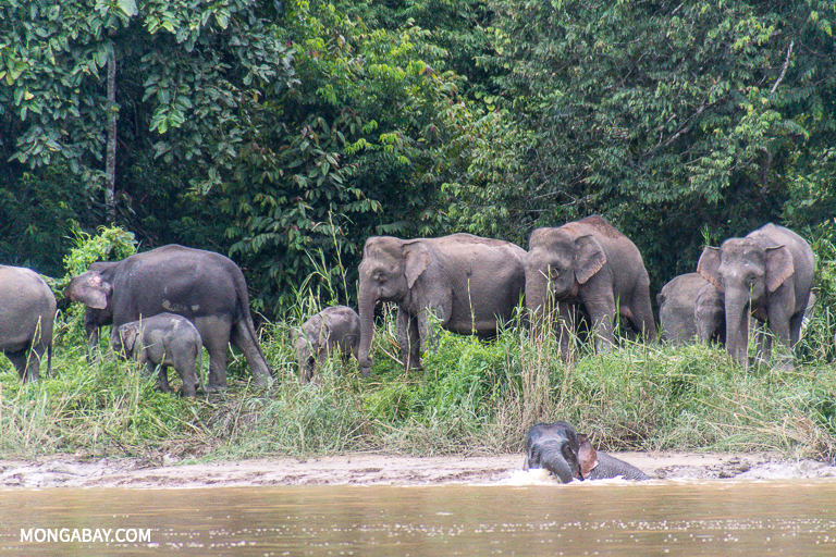

But Borneo has already lost more than half its forests to human activity. Much of this has been lowland forest; if the transboundary highway is constructed as planned, it would open up the less accessible, more pristine highlands too.
More than a home for endangered wildlife, preserving Borneo’s diminishing forests — along with rainforests in Africa and South America — is seen as key in the fight against the global climate catastrophe.
Forest fragmentation, which happens when trees are cleared to make room for new roads, plantations and settlements, hurts Borneo’s ability to serve as a carbon sink. In 2017, scientists studying isolated patches of Bornean forests, including those adjacent to oil palm plantations and farmers’ fields, found that such forests tended to lose carbon to the atmosphere instead.
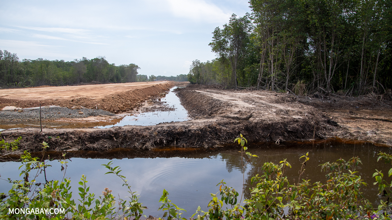
To minimize the highway’s impact on Borneo’s forests, wildlife and local communities, activists are pushing for Indigenous land rights to be recognized, with the latter being the “best guardians” of their forests. “No roads without rights,” Darwis said. “We want the construction to be suspended until our land rights are recognized, and until the government ensures there’s no big environmental impact.”
Coalition 3H is also calling for a joint committee to be formed between government and civil society that would allow for two-way feedback. “We want to share our research and ground data [with the road planners] in a timely and useful way,” Ong said. “That way, better decisions can be made.”
In Sabah, the group has coupled geospatial and animal tracking data with local consultation to come up with alternative routes for particularly damaging sections of the Pan Borneo Highway. These proposed options would still serve developmental needs, but without displacing communities and fragmenting key habitats, Ong said.
Ong added that discussions on the Heart of Borneo should involve governments on all sides. “It may not be common behavior, but we have come to a place where we must address these issues collaboratively. Because impacts don’t stop at boundaries.”
Banner image of an orangutan in Sabah, Borneo. Image by Rhett A. Butler/Mongabay.
Citations:
Qie, L., Lewis, S. L., Sullivan, M. J., Lopez-Gonzalez, G., Pickavance, G. C., Sunderland, T., … Phillips, O.L. (2017) Long-term carbon sink in Borneo’s forests halted by drought and vulnerable to edge effects. Nature Communications, 8(1). doi:10.1038/s41467-017-01997-0
Sloan, S., Campbell, M. J., Alamgir, M., Lechner, A. M., Engert, J., & Laurance, W. F. (2019). Trans-national conservation and infrastructure development in the Heart of Borneo. PLOS ONE, 14(9). doi:10.1371/journal.pone.0221947
FEEDBACK: Use this form to send a message to the author of this post. If you want to post a public comment, you can do that at the bottom of the page.


