- When Leonardo Brito became chief of police at the Police Specialized in Crimes Against the Environment (DEMA) in Brazil’s Amapá stated, he noticed that the department hardly ever investigated environmental crimes. The reason: locating isolated illegal deforestation events in Amapá’s Nepal-size rainforest was like finding a needle in a haystack.
- So Brito started researching methods to make this easier. In the process, he discovered the online forest monitoring platform Global Forest Watch and its mobile app, Forest Watcher. These tools visualize areas of tree cover loss detected by satellites.
- Using Forest Watcher, DEMA has been able to detect 5,000 areas of deforestation in Amapá and conduct more than 50 operations combatting illegal deforestation over the past eight months.
- Brito and his team are sharing their knowledge and techniques with environmental police and conservation officials in other states.
Before becoming the chief of police at the Police Specialized in Crimes Against the Environment (DEMA) in the northern Brazilian state of Amapá, Leonardo Brito had never worked in the environmental field or dealt with satellite imagery or mapping. However, this all changed when he started his new job in May 2018.
When he arrived at the DEMA office in Amapá last May, 35-year-old Brito found that the environmental police there rarely investigated environmental crimes. Most of their cases involved land disputes, thefts, and noise pollution from bars playing loud music. Cases involving deforestation arose rarely and only when there was a complaint.
“The environment was in last place, so I tried to change that situation,” said Brito, who before being hired as environmental sheriff in Amapá worked as a lawyer in the state of Bahia. “First I reached out to the environmental public bodies, but I found a lot of inertia. Most public servants just want to receive their salaries and stay in their desks. Also there is a lot of political interest to not investigate environmental crimes.”
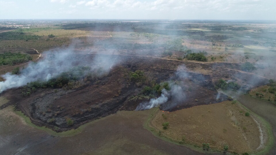
To make matters worse, Brito discovered DEMA’s infrastructure is quite limited. The agency consists of 12 employees, two vehicles, a boat and a drone, which collects only 20 minutes of footage at a time, to patrol an area of forest the size of Nepal. Last month, DEMA’s two phone lines were cut for lack of payment from the state government. The staff would like to buy a second drone, but there is no money to do so.
Brito, however, went ahead. “If we lacked [material] resources, we would invest in knowledge,” he said. He started researching satellite systems that detect deforestation and found PRODES and DETER, run by Brazil’s national space research agency.
However, these systems do not meet DEMA’s needs. PRODES provides only annual deforestation data, which is not very useful if you’re trying to stop logging activities as they’re happening. DETER only detects areas of deforestation larger than 250 square meters and updates its public-access satellite images every three months. Brito said that using these systems meant that when they “arrived at a site of deforestation, the criminals had already left.”
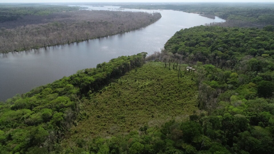
Then he came across Forest Watcher, a free app produced by the online forest-monitoring platform Global Forest Watch (GFW). Forest Watcher is able to detect much smaller areas of tree cover loss than can PRODES and updates much more often than DETER, allowing Brito and his team to intercept deforestation events as they’re happening.
“While DETER uses spatial resolution images of 250 [square] meters (820 square feet), Forest Watcher alerts have a resolution of 30 [square] meters (98.4 feet), and therefore detect losses on a much more accurate spatial scale,” Brito told Mongabay.
DEMA police discovered that deforesters, aware of DETER, were clearing areas smaller than 250 square meters to avoid detection. But by using Forest Watcher and its higher resolution data, Brito and his team have been able to locate logging operations and identify and indict offenders.
Fast results
Brito said that since they starting using the app, Amapá’s environmental police have been able to detect 5,000 areas of deforestation in the state, both legal and illegal. He adds that every day he sees new locations to add to the ever-growing list.
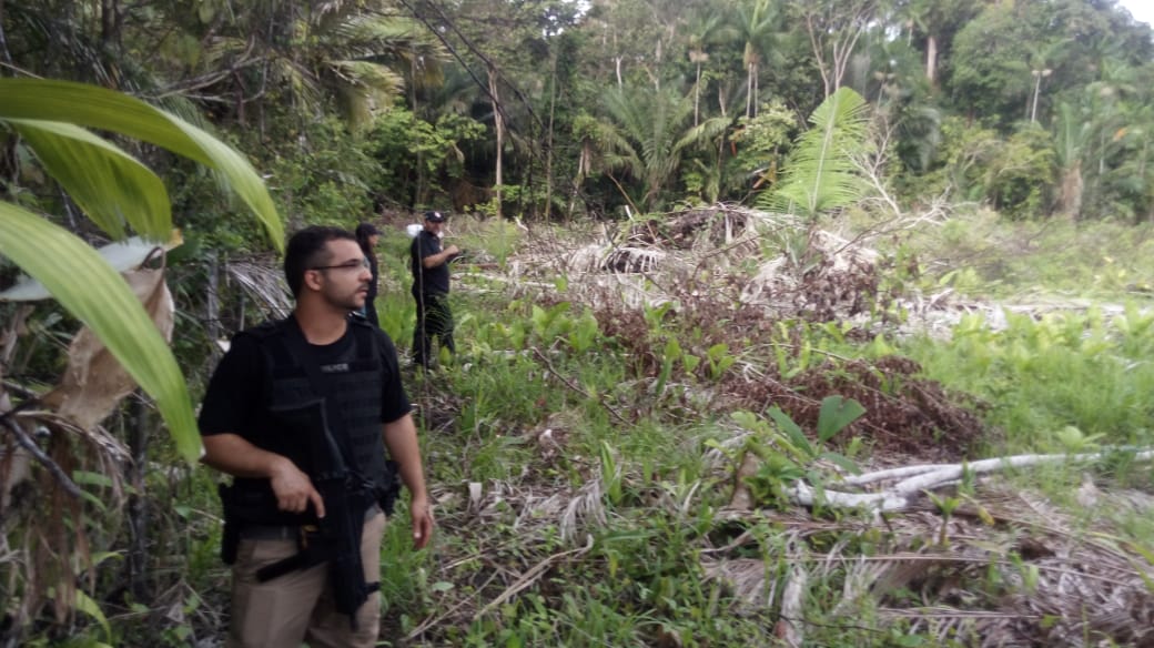
When a new deforestation point is identified, the agents first investigate remotely to confirm the deforestation and determine whether or not it is happening legally. To do this, they use a combination of several systems together with Forest Watcher, including Google Maps, NASA’s Earth Observing System, Esri’s ArcGIS, GFW Fires and GFW Water. When they confirm deforestation is happening illegally, a field team goes to the scene to arrest the offenders and seize equipment.
Brito, who doesn’t speak English, used Google Translator to contact staff at the World Resources Institute (WRI) who helped him refine his searches. WRI is the parent organization of Global Forest Watch.
“Forest Watcher was originally piloted by the Jane Goodall Institute in 2016 with forest rangers and community monitors in Uganda,” said Liz Bourgault, a WRI research analyst for Global Forest Watch. “The thought was that if we could get the deforestation data into the hands of these forest defenders, they could have more effective patrolling and land management.
“Around this time the [Global Land Analysis and Discovery] lab began producing weekly deforestation alerts, and we also had access to daily fires alerts through NASA, so we knew this was a great opportunity to scale up the actionability of deforestation data for those on the frontlines.”
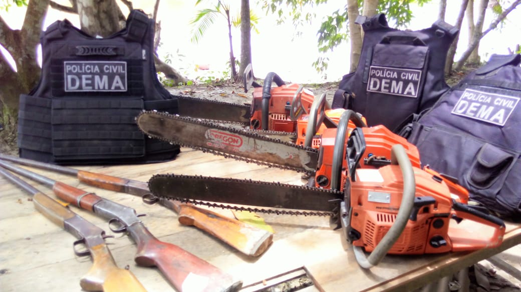
Over the past eight months, DEMA has carried out more than 50 operations combatting deforestation at sites found through Forest Watcher, several catching loggers in the act. Brito and his team have made several arrests and seized five logging trucks, 12 chainsaws and 11 firearms. Brito said 80 percent of those responsible for these deforestation events have been identified, some of them local politicians.


“There are a lot of soy farmers planting here, but also people who smuggle timber, most of them from São Paulo state, Belgium and China,” Brito told Mongabay. “Foreigners are the most difficult to identify. When we arrive at the port with the number of the ferry boat on which the cargo is going to board, we find the country of destination at the most.”
In addition to arresting transgressors, DEMA also compiles cases on locations of illegal deforestation that they detect after clearing has stopped. DEMA sends these cases to the Public Ministry of the state of Amapá, which files public civil action requests to help reforest affected areas.
According to Brito, those found guilty of illegal deforestation can face prison terms of between one and four years. But he cautioned that “the judicial system in Brazil is very slow; it takes a long time for a person to be punished,” which can further complicate the situation.
Sharing their success
Encouraged by the results, the DEMA team keeps refining its investigative techniques. Some of them are studying how to calculate the volume of timber found on trucks. Brito has been researching how family farming and solidarity economies (e.g., an association of local businesses) can help deforesters change their livelihoods.
“I am talking with technical agencies such as Embrapa to see how and who could teach those people to cultivate without the use of pesticides and deforestation,” Brito said. “How to issue an environmental license and to verify in a few days, through satellite images and Google Maps, if a certain area is allowed for that activity.”
However, that there are still many obstacles to overcome. For instance, the environmental police in the state of Bahia do not work exclusively with environmental cases and their focus on other sorts of crimes often leaves no time to devote to environmental investigation, according to Brito.
Mongabay reached out to Brazil’s Ministry of the Environment, but a spokesperson for the ministry declined to comment. However, on March 27, Minister Ricardo Salles hinted on Twitter that he is preparing an alternative system to monitor deforestation in the country. According to Folha de S.Paulo, the system would use satellite imagery from the U.S.-based organization Planet Labs, which has a spatial resolution of between 3 and 5 meters (9.8 to 16.4 feet).
In terms of resolution and updates, imagery from Planet Labs would be an improvement over monitoring systems like PRODES and DETER. However, some say that the systems that are currently used are adequate for most purposes and adopting a new one would be prohibitively expensive. The cost for Planet Labs coverage for the entire country is estimated to be R$ 33 million (US$ 8.5 million) per year – about 55 times more than the annual operating costs for Brazil’s national space research agency. In addition, Salles was convicted of “administrative impropriety” while he was heading a state environmental agency in 2016, leading some to question his effectiveness in his new position as environment minister.
Critics say that Brazil would pay twice to have essentially the same forest monitoring system it does now, and even Brito said that this potential purchase would be a waste of public money. He is in favor of using GFW and Forest Watcher to augment current systems.

In the meantime, Brito is working to share the techniques he and his team have learned to other Brazilian states. He has contacted the environmental police in Pará, Rondônia and Tocantins, as well as in Bahia, his home state, to encourage them to use the GFW system and to show how it can be combined with other systems.
With the exception of Pará, other states’ police teams have shown interest in using satellite data and imagery to locate illegal deforestation, and the Amapá team is preparing a course to help them do so. Brito said the head of the environmental police of Rondônia is even planning to visit DEMA-Amapá to learn about the techniques they use. In Rio de Janeiro, the director of Desengano State Park conferred with Brito’s team and, after instruction, the park’s conservation unit has begun using GFW to protect its forest.
“We, as Brazilians, think we are the owners of the Amazon and that it will exist forever, because it is huge and well preserved, but this is not true,” Brito said. “When we get out of or own ignorance and become aware of the unscrupulous exploitation of the Amazon, it gives us a sense of impotence and shame.
Brito said this feeling of shame and helplessness motivated him to research and use GFW and Forest Tracker in an effort to help stop Amazon deforestation.
“I know I still do very little for the preservation of nature, but I want at least [for] this wound to be wide open and that people change their thinking about the conservation of the Amazon,” he said. “At least now I sleep with a clear conscience… which I could not before.”
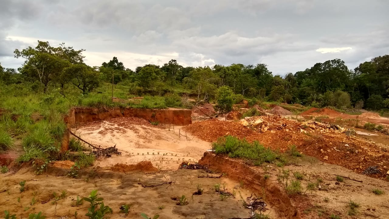
Banner image: An area between Macapá and Porto Grande recently burned of native vegetation to convert it for agriculture. Image courtesy of DEMA-AP.
Feedback: Use this form to send a message to the editor of this post. If you want to post a public comment, you can do that at the bottom of the page.


