- Indigenous communities neighboring the peoples living in isolation in Colombian Amazon have spent more than a decade helping the latter remain separate from the outside world.
- Members of the Curare-Los Ingleses Indigenous Reserve and of the community of Manacaro use traditional knowledge and technology alike to monitor threats to their territory and to protect nearby communities living in isolation.
- In Manacaro, women take on traditionally masculine roles by patrolling the rivers, collecting data, and safeguarding their neighbors’ lives amid the advance of armed actors and illegal mining.
- Surveillance work has provided evidence of uncontacted peoples, such as the Yuri and Passé ethnic groups, which was fundamental in the federal government’s decision to formally recognize them.
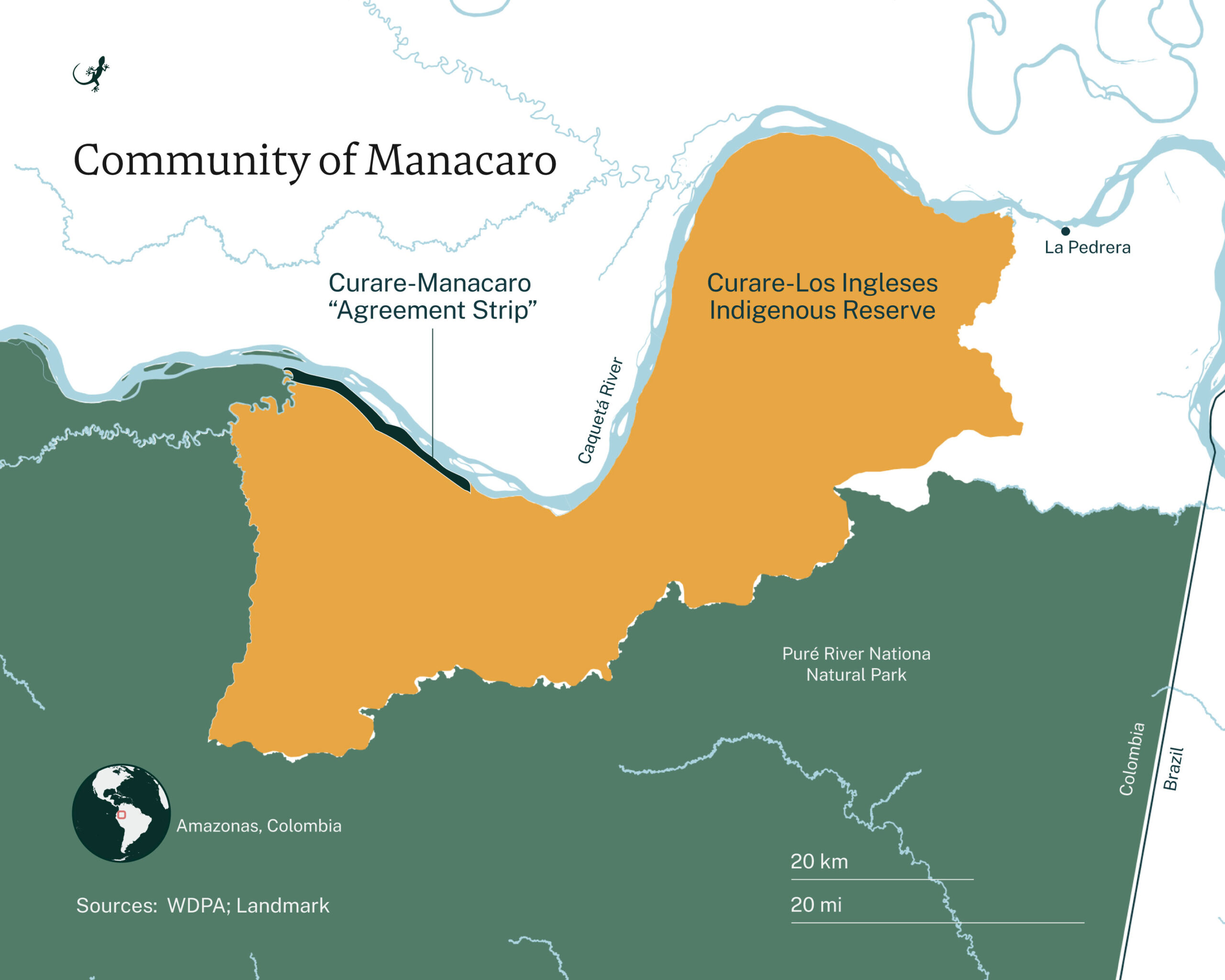
In Colombia’s Amazon, two communities have worked for more than a decade to guard their territory and to protect the right of other Indigenous peoples to remain isolated. The community of Manacaro and the Curare-Los Ingleses Indigenous Reserve, located in the lower Caquetá River region, were fundamental in the federal government’s decision to formally recognize the existence of two voluntarily isolated peoples in Colombia: the Yuri and the Passé.
Since the late 1800s, there have been reports of at least 18 Indigenous communities that have chosen not to have contact with the outside world, or who — after colonization, the rubber boom and the trafficking of Amazonian animal skins — decided to flee and remain isolated. However, it wasn’t until October 2024, 15 years after the first hints of isolated peoples (some footsteps and scattered seeds on the ground), that the Ministry of the Interior issued a resolution confirming the presence of two of those 18 communities.
That resolution would never have been possible without the monitoring work of these communities’ Indigenous neighbors.
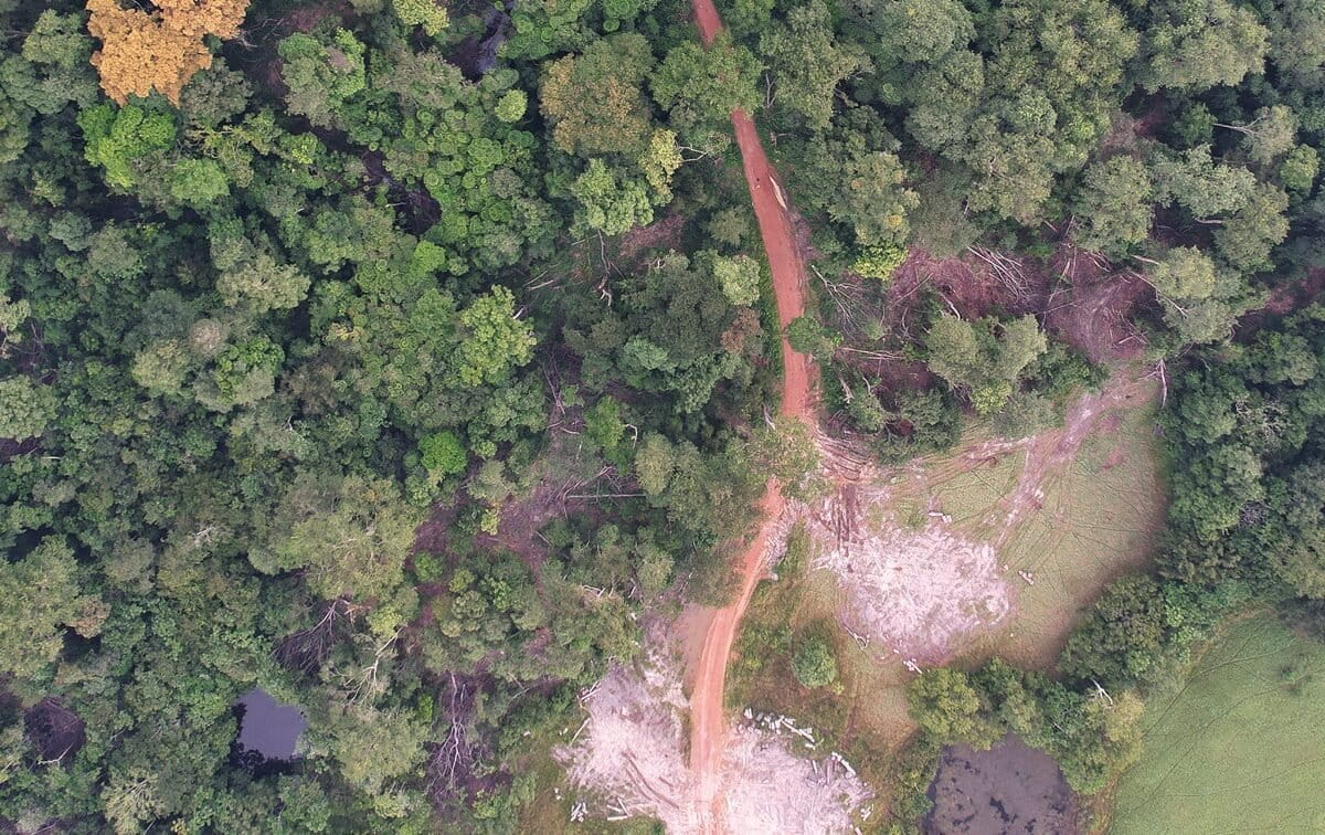
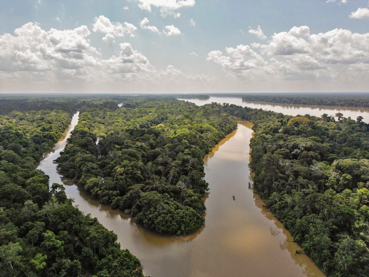
The territory inhabited by the Indigenous communities living in voluntary isolation is surrounded by threats that put their way of life at risk: missionaries who try to contact them, armed actors, drug trafficking and the advance of illegal mining. The Ombudsman has issued several alerts about these risks. The most recent ones, in February 2025, are the new territorial disputes between former commanders of the Revolutionary Armed Forces of Colombia (FARC in Spanish) who did not agree to the Peace Agreement in 2016: the ‘Iván Mordisco’ dissidents and the group that uses the alias ‘Calarca.’
Colombia’s National Natural Parks System told Mongabay Latam that, since March 2020, its park rangers and officials cannot enter the protected areas in the zone — Cahuinarí, Río Puré and the northern portion of Amacayacu National Park — because of the threat of armed actors. Activities to safeguard the land must be conducted from the headquarters in Leticia, in Amazonas, which “[makes it] difficult to carry out research and biodiversity monitoring, limits the possibility of conducting walkthroughs for prevention, surveillance and control, and obstructs the improved identification of these pressures,” according to the National Natural Parks System.
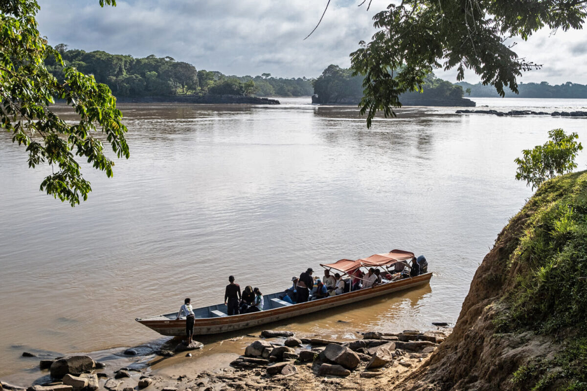
Despite the threats, residents of Manacaro and Curare-Los Ingleses have managed to create a defensive barrier using their traditional, spiritual and cultural knowledge for years. More recently, their defense has strengthened with the use of mapping, data analysis, georeferencing programs and other advanced technology. Their work — although silent, as a protective measure — continues to this day.
A collective effort
Protecting the Indigenous peoples who have chosen to remain isolated has required a united effort by the Western world and other Indigenous Amazonian communities. In this region, the key is a coordinated strategy between the communities, the Association of Indigenous Authorities of La Pedrera-Amazonas (AIPEA), the Association of Traditional Indigenous Authorities of the Miraña and Bora People of Central Amazonas (PANI in Miraña), and the Amazon Conservation Team (ACT), which leads strategies in the defense of the voluntarily isolated communities.
The community of Manacaro, which is part of the PANI Indigenous association, has an agreement with Curare-Los Ingleses, its neighbor to the south, for the use of 2,338 hectares (5,777 acres) for fishing, hunting and resource harvesting. According to Camila González Coca, a researcher from the ACT, this strip of land serves as a buffer zone for the area, used for the conservation and protection of the voluntarily isolated peoples.
Every month, the communities meet to discuss which natural resources were extracted in what is known as the “agreement strip.” These meetings provide community members with control over the territory, enabling them to understand its workings and make decisions that support their subsistence practices and commercial activities. The meetings also allow members of the Manacaro community to learn about the monitoring and surveillance work done by the Curare-Los Ingleses Indigenous Reserve, with support from ACT, to safeguard those living in voluntary isolation.
In 2014, the Manacaro community decided to join this protection work. Surveillance tours along the shared “agreement strip” were established, and participants agreed to hold a meeting every two years to determine whether it is necessary to modify any geographic limits. Until that time, the surveillance tours through Curare-Los Ingleses reached as far as the Manacaro community. Now, with Manacaro’s support, monitors can travel a much larger area.
“Using the ‘agreement strip’ that we have, we are uniting to protect our isolated brothers, because the territory is very large, and the geographic size does not allow us to care for all the areas they spend time,” said Ezequiel Cubeo, the highest authority of the Curare-Los Ingleses Indigenous Reserve.
The Indigenous people from Manacaro are also located in a key area. Their ancestral territory comprises the Cahuinarí National Natural Park, the large Predio Putumayo Indigenous Reserve, as well as the Mirití Paraná Indigenous Reserve and a small area of the Curare-Los Ingleses Indigenous Reserve. The land inhabited by the Manacaro people is known as “Bora Miraña” and is located between a National Natural Parks System control post in Cahuinarí (created by the entity in 2016 to control access to several rivers) and the Puerto Caimán cabin, which is the lookout point that members of the Curare-Los Ingleses Indigenous Reserve built in 2014.
“Our proposal was to continue from the Vilsoda [collection of farms], for 12 kilometers [7.5 miles], to the inlet of the Bernardo River,” said Heriberto Martínez, the coordinator of Manacaro.
Residents of the Curare-Los Ingleses Indigenous Reserve, who have led much of the conservation process, do not live in their ancestral territory. Rather, they come from several different regions in the Amazon. Many arrived after they fled or were enslaved during several economic booms (from the rubber boom in the early 20th century to the coca boom in 1970). These residents have a profound understanding of what it means to isolate in order to survive.
Spiritual traditions and new tools
The monitoring of Curare-Los Ingleses and Manacaro began in a similar way: with the creation of maps based on community members’ knowledge of, and experience in, the territories (which researchers call social cartography).
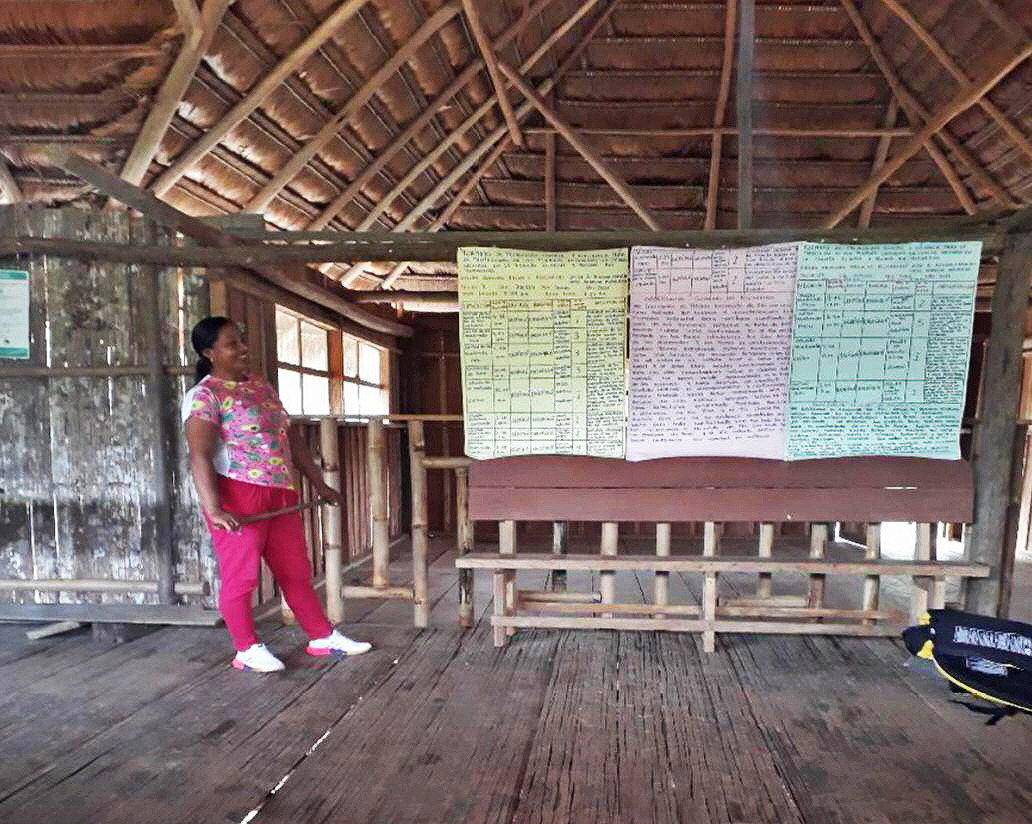
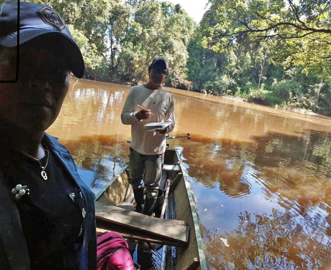
Later, they began implementing other digital technology, such as GPS, which allows the monitors to record the precise coordinates of their surveillance tours in their notebooks. Now, the monitors are familiarizing themselves with tablets to record the information using fewer steps. The use of tablets also means that the data can be stored in an archive and sent to entities that may request it.
Those who have developed an interest in this type of digital tool have also learned to operate complex programs, such as QGIS and ArcGIS, and to visualize satellite images, which helps them plan their surveillance tours in a more streamlined manner. For example, they can learn the locations of bodies of water or the routes that they will take to guard the territory.
But reaching that point has required a multi-year effort. In 2014, González Coca of the ACT initiated a series of conversations with residents of Curare-Los Ingleses to present them with the existing research, from a Western perspective, on the voluntarily isolated peoples.
“We told them that we knew who they were, more or less where they were, and [information on] the accounts that anthropologists had compiled,” González Coca said.
Although the residents of the reserve already had experience monitoring wild animals and had worked with other organizations, it was thanks to this closer connection that they decided to open up to discussing the voluntarily isolated peoples with greater trust and closeness, and to work together.
“Before discussing the voluntarily isolated peoples, we designated an area for the protection and strategic conservation of the lakes and the salados [which are natural areas rich in salts and minerals found in the middle of the rainforest] for species reproduction,” said Darío Silva Cubeo, a historic leader of the area who, with others, promoted the designation of this area.
In 2008, of the 212,000 hectares (523,860 acres) that comprise the Curare reserve, one portion (129,408 hectares, or 319,775 acres) was allocated as a conservation area, and another portion (82,592 hectares, or 204,090 acres) was designated as a harvesting area.
The conservation area included, for example, a project designed to monitor and protect the black caiman (Melanosuchus niger). At the time, the conservation status of this species was unknown. But it was known that its population was small: several consecutive hunting crazes — for fur — had occurred long before the Indigenous territory was allotted in 1995.
There, they built a cabin, Puerto Caimán, as their control post along a branch of the Caquetá River. From that spot, they could travel towards the salt ponds, where South American tapirs (Tapirus terrestris) and other animals come to feed, or towards the enormous concentrations of Spanish cedar trees (Cedrela odorata), which were heavily exploited by settlers in the 1990s.
“It all began by recovering the territory,” Silva said.
After confirming the presence of communities living in isolation, the control post also became an opportunity to guard their neighbors.
“We came to support the work [of Curare-Los Ingleses and Manacaro] with more infrastructure, logistics, and personnel, so that they could be stronger. Not only for the species and the places that they were already monitoring, but also for the voluntarily isolated people and the monitoring of threats to the Caquetá River,” said González Coca of the ACT.
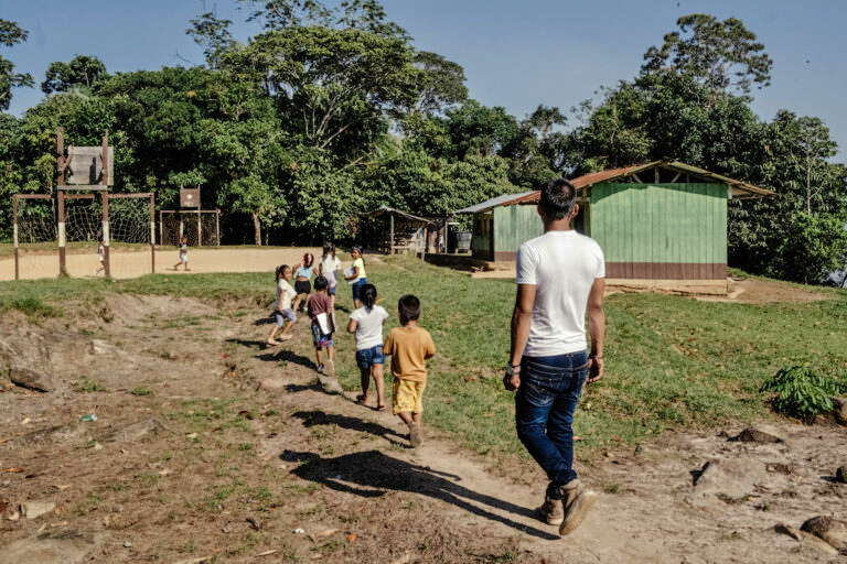
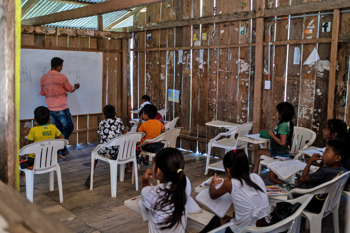
In addition to the new technology, the communities have begun to protect their ecosystems, species and neighbors living in isolation using education. On their tours through the territory, women in Manacaro educate their children about the land. On the Curare reserve, the youngest children learn the history of the place they live in and go on excursions to the Caquetá River. Children are also taught about the most important sites for protecting endangered animals and their neighbors living in isolation.
Before each trip through the territory, an elder — a traditional community authority — travels to Puerto Caimán and performs various rituals to protect the family that will come to conduct the surveillance tours that month. Using spiritual knowledge, the elder also communicates with the communities living in isolation to find out how they are and whether any sites need particular attention.
According to Ezequiel Cubeo, it is crucial that “the elder takes that precaution, from the cultural side, so that the lookout guards can arrive in their area. In the event that the elder finds, in his thoughts, that the family cannot go, that mandate is respected.”
Networks that reach farther
Alliances have strengthened the Indigenous communities’ capacity to record threats to their territory. Now, from Curare, they can travel greater distances in boats with small motors. Initially, they only recorded large animals, like monkeys, pigs, South American tapirs, paujiles (birds from the Cracinae subfamily), toucans, otters and wolves.
“Now, other senses are incorporated — for example, which animals are heard,” said González Coca of the ACT.
With the passage of time, records of threats and observations have increased in number and become more detailed. Now, not only is it written that an animal was seen or heard, but also how many individuals there were and what they were doing. There are also notifications about the presence of any boat, human footprint, hunter or fisher that does not belong to the communities. Thanks to these added details, two situations related to the isolated communities have been identified since this surveillance began: a bonfire on the riverbanks and smoke emanating from within the rainforest.
The Indigenous people from Manacaro, unlike those from Curare, do not need to head to the cabin for a month. Because of the arrangement of the territory, those in charge of the work that began in 2017 with the ACT are mostly women who navigate the river, checking for animals and recording any threats. They leave their homes in the morning and return in the afternoon.
The initiative, which began as a way to monitor the dangers that threaten peoples living in voluntary isolation, led to women taking on roles traditionally done by men. According to González Coca, Indigenous people are indispensable in carrying out this protection initiative.
“This became an opportunity to show the children the territory and [an opportunity] for the men to work on collecting timber, fishing, and doing other harvesting. [The women], from their place of protection, could earn money and contribute to their communities,” González Coca said.
Recently, the women have begun to use spreadsheets like Excel and have learned to organize data. “The idea is to facilitate analysis. It is important that they have that information — not just because it is theirs, but also because it can help them make decisions,” González Coca said.
Contributions to decision-making
In 2018, after the requests of Indigenous and civil society organizations to recognize the presence and guarantee the protection of the Indigenous communities choosing to live in isolation, Colombia’s Ministry of the Interior issued an order containing a series of measures to safeguard them. Among them was the creation of the National Commission for the Prevention and Protection of the Rights of Indigenous Peoples in Isolation (CNPIA).
According to David Novoa, the ACT’s territorial coordinator for Indigenous peoples in isolation, the committee is also “the agency to make decisions and understand the territorial protection of these communities. In addition, it allows community matters to be brought to a space for inter-institutional and inter-governmental decision-making.”
This is why Darío Silva, the Indigenous leader, said he hopes that the CNPIA will consider the results of this monitoring work. “We want the collected information to contribute to the protection of the territory, of the Yuri and Passé peoples and of the other 16 peoples, living in a natural state, whose existence we have indications of.”
According to González Coca, a joint strategy is being developed to integrate local information with departmental and national information, thereby contributing to informed decision-making.
That coordination allows for action to be taken. One example is the preventative measure taken by the Land Restitution Unit — the entity that protects the territorial rights of victims of armed conflicts and aims to return their dispossessed and abandoned land to them — in 2023. This preventative measure requires protective mechanisms for the Yuri and Passé peoples and the surrounding communities amid mining activities in the Puré River.
According to Juana Hoffman, the territorial advisor from the ACT, “community monitors are in the best position to track biodiversity and environmental pressures, since they are the ones who are permanently in the territory. This data helps the partner communities to act quickly in crises, such as the entry of illegal miners, and to inform internal decisions on territorial management.”
For that reason, while the violence and territorial disputes between armed actors increase in the area, residents of the Curare-Los Ingleses Indigenous Reserve and the Manacaro community continue to work to respect the rights of other Indigenous peoples to remain isolated. The work they have done, with support from civil society organizations, could serve as an example and be replicated in other communities, such as those in the Arica territory in Colombia’s southern Putumayo department, near the country’s border with Peru and Brazil.
This publication is part of a journalistic alliance between Rutas del Conflicto and Mongabay Latam.
Banner image: Illustration by Sara Arredondo – Baudó Agencia Pública.
This article was first published in Spanish on May 7, 2025.
Editor’s note: This article is part of the project “The Rights of the Amazon in Sight: The Protection of Communities and Forests,” a series of investigative reports about the situation surrounding deforestation and environmental crimes in Colombia, funded by Norway’s International Climate and Forest Initiative. Editorial decisions are made on an independent basis and are not based on donor support.