- Satellite data show several surges in deforestation in Kerinci Seblat National Park in 2020.
- Kerinci Seblat provides vital habitat for critically endangered Sumatran tigers, as well as many other species.
- The primary driver of this deforestation appears to be the expansion of small farms.
- Initiatives in the area are attempting to reduce smallholder expansion by encouraging the adoption of more sustainable farming practices.
Indonesia’s Kerinci Seblat National Park is the largest national park on the island of Sumatra and the second-largest park in Southeast Asia. It is home to a wide variety of jungle cat species and is considered one of the world’s last great strongholds for critically endangered Sumatran tigers (Panthera tigris sondaica). The park is one of three that make up the UNESCO Tropical Rainforest Heritage of Sumatra, along with Gunung Leuser National Park to the north and Bukit Barisan Selatan National Park to the south.
“Kerinci Seblat, home to Indonesia’s largest volcano, provides the second biggest native forest area for Sumatran tigers remaining,” said Matthew Luskin, a wildlife ecologist who has conducted research in the park. “Kerinci Seblat also represents an important genetic corridor for connecting smaller tiger subpopulations remaining in to the south and north.”
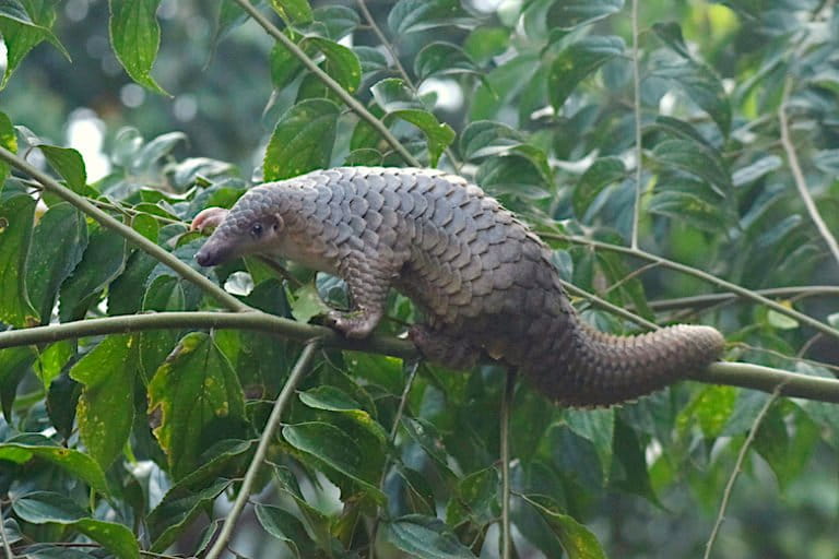
The park has been designated an Important Bird Area for its importance to a range of Sumatran mountain bird species, and provides key forest habitat for endangered fishing cats (Prionailurus viverrinus), Sunda pangolins (Manis javanica), and siamangs (Symphalangus syndactylus).
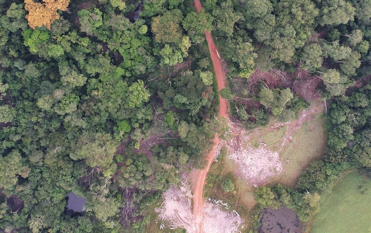
But human disturbance has threatened the park’s remarkable biodiversity, earning Kerinci Seblat a place on UNESCO’s Danger List in 2011 following concerns over road construction, logging, poaching, and agricultural encroachment. While many of these threats have been addressed in the years since, satellite data from the University of Maryland visualized on Global Forest Watch show several spikes in deforestation activity in the park in 2020. According to World Resources International, this clearing was likely done for smallholder agriculture.

Illegal clearing undercuts conservation victories
Since UNESCO added it to its Danger List, Kerinci Seblat has been spared several of the developments that once threatened it. Much of the proposed road construction that concerned UNESCO in 2011 has since been cancelled. Indonesian President Joko Widodo also made permanent a moratorium on new logging concessions in primary forest throughout the country in 2019.
Poaching in Kerinci Seblat has been curbed by the efforts of Tiger Protection and Conservation Units (TPCUs), which patrol the park and surrounding forests. The TPCU project is the result of collaboration between conservation NGO Flora & Fauna International and park officials, surrounding communities and local government and began in 2000.
Fewer than 400 Sumatran tigers are alive in the wild today, and over one-third of those remaining live in Kerinci Seblat. In the first half of 2020 alone, six TPCUs trekked over 500 miles looking for snares and other signs of poaching activities. In December, their efforts reportedly helped lead to the arrest of a kingpin tiger poacher active in the area.
These on-the-ground monitoring activities help more than just tigers, as TPCUs look out for poaching activities affecting other animals as well. In their interim report, released in September 2020, FFI noted that wild bird hunting for the songbird trade had fallen sharply during the COVID-19 pandemic.
But while poaching is down, agricultural encroachment appears to be on the rise at the edges of the park. In a 2019 update, UNESCO cited encroachment as “the most serious long-term threat” to the world heritage site – a threat that may be growing, according to 2020 satellite data from the University of Maryland that show tree cover loss alerts spiked to “unusually high” levels in August, September, October and December.

Clearing inside Kerinci Seblat was confirmed by Ali Akbar, a representative of environmental advocacy group Kanopi Hijau Indonesia, and Musri Nauli, a local lawyer and environmental advocate. Akbar added that it is happening illegally.
While some areas of the park are open to community management for subsistence agriculture, new clearing for cash crops like coffee and cinnamon is considered harmful to wildlife and is not allowed within the park. While conservation groups haven’t reported any impacts to the park’s tiger population yet, recent encroachment in the Sipurak area of the park is close to FFI’s “core area” for monitoring Sumatran tigers via camera traps and research has shown that habitat fragmentation is one of the biggest threats to Sumatra’s tigers.

Neither Indonesia’s Ministry of Environment and Forestry nor Kerinci Seblat National Park authorities responded to requests for comment.
Another way
In a 2017 paper published in in Nature Communications, Luskin and his colleagues found that tiger densities in Sumatra were nearly 50 percent higher in primary forest than in areas where the forest had been degraded by human activities like logging and agriculture. They also determined that forest loss and degradation—not poaching—was the main culprit behind 21st century declines in Sumatran tiger populations.
“Tigers and their prey are forest-dependent in Sumatra, so while tigers may leave the forest temporarily to cross human-dominated landscapes or even kill livestock, they require forest safe havens to breed and raise their cubs successfully,” Luskin said. “Deforested areas often lose their tigers forever.”

The study cited Kerinci Seblat as one of only two “secure source populations” of wild Sumatran tigers, calling the park “crucial to the long-term persistence of Sumatran tigers in the wild.” The authors concluded that “Sumatran tigers still face a high risk of extinction unless deforestation can be controlled.”
But there are already projects underway to help dissuade clearing for agriculture in Sumatra’s parks. The ALKO coffee collective is one such project that operates near Kerinci Seblat. Over 400 member farmers around the village of Sungai Penuh near the base of Mount Kerinci grow coffee on small plots. The hope is that these plots, located on the edge of the park, will act as a natural buffer against encroachment while offering an economically viable alternative to more destructive forms of agriculture.

To the north, the Orang Utan Coffee Project launched in 2010 also operates with the goal of producing deforestation-free coffee and offering a more sustainable and economically viable alternative to local farmers who might otherwise clear forest in the Leuser Ecosystem, which is one of the richest tracts of rainforest on the planet and part of the Tropical Rainforest Heritage of Sumatra UNESCO site. Orang Utan Coffee works with nearly 500 farmers in seven villages near important orangutan habitat to model more sustainable farming practices.
By making the most out of existing plots of land and splitting profits 50-50 between farmers and agriculture, Orang Utan Coffee hopes to show that it’s possible for coffee production to develop sustainably on Sumatra. The project sells coffee to nearly 200 roasters internationally, using blockchain to ensure transparency.
“We secure safe sourcing areas and traceable coffee and then increase agricultural capacity for the smallholders,” said Diana Kosmanto, the project manager for Orang Utan Coffee in North America. “The coffee that we source from is not grown in the Leuser Ecosystem. The project contributes to maintaining the critical ecosystem services in the area.”
But projects like ALKO and Orang Utan Coffee hope to set an example for deforestation-free agricultural development that others across Sumatra can follow. “It’s not necessary to have huge plantations,” Kosmanto said. “We are working to show the sustainable, transparent way that maintains critical ecosystems is possible.”
Banner image of a Sumatran tiger by Rhett Butler/Mongabay.
Editor’s note: This story was powered by Places to Watch, a Global Forest Watch (GFW) initiative designed to quickly identify concerning forest loss around the world and catalyze further investigation of these areas. Places to Watch draws on a combination of near-real-time satellite data, automated algorithms and field intelligence to identify new areas on a monthly basis. In partnership with Mongabay, GFW is supporting data-driven journalism by providing data and maps generated by Places to Watch. Mongabay maintains complete editorial independence over the stories reported using this data.
Feedback: Use this form to send a message to the editor of this post. If you want to post a public comment, you can do that at the bottom of the page.


