- Late last month, the Peruvian government made public its satellite surveillance data on 1,300 commercial fishing vessels plying Peru’s waters via the open-access platform Global Fishing Watch.
- Only the Peruvian government and companies in the fishing sector had access to the data previously.
- With this move, Peru became the second country in the world, following Indonesia, to make public data from fishing vessels’ Vessel Monitoring Systems, a method of satellite surveillance.
- The country aims to use GFW as a tool to fight illegal fishing and overfishing.
LIMA, Peru — On Oct. 25, the Peruvian government made public its satellite surveillance data on 1,300 commercial fishing vessels plying Peru’s waters via the open-access platform Global Fishing Watch. Only the Peruvian government and companies in the fishing sector had access to the data previously.
“This is the beginning of a global-scale revolution in the transparency of industrial fisheries,” said Juan Mayorga, a researcher at the Sustainable Fisheries Group, referring to the Peruvian government’s decision.
The Global Fishing Watch (GFW) platform bases its monitoring on data from the Automatic Identification System (AIS), a radio transmission system installed in a large part of the world fleet. However, not all vessels use this tool. In Peru, most use the Vessel Monitoring System (VMS), a method of satellite surveillance that GFW has now incorporated.
The Global Fishing Watch platform monitors fishing vessels around the world. Image courtesy of GFW.
Peru has become the second country in the world, following Indonesia, to make its VMS data publicly available. This has contributed to the expansion of the GFW database, which already had the data of 70,000 boats worldwide. “These countries are setting an example to the world, showing a way to improve ocean sustainability,” said Mayorga.
Adding that information to GFW opens up many possibilities for improving the management of fisheries. Users can detect, for example, if a boat is fishing during the closed season of a species, if it enters an unauthorized area or if it sails into a protected area. According to Mayorga, the free-access surveillance system also allows users to check if maritime agreements between countries are being fulfilled. “Any boat with suspicious or different behavior turns on an alarm,” he said.
An instrument to confront illegal fishing
For Miguel Ángel Vallejos, director of supervision and inspection with Peru’s Ministry of Production (a.k.a. PRODUCE), the country’s move is a tool to fight illegal fishing and overfishing. “Sharing and publishing this information is an example of transparency that seeks to combat illegal activities at sea and promote the sustainable use of the extraordinary marine productivity that the country has,” he said.

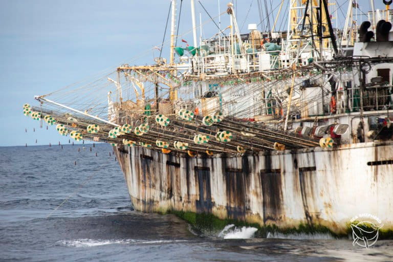
An example of how GFW can help combat illegal fishing in Peru occurred a month ago when authorities intercepted a Chinese vessel near the northern port city of Chimbote for not having a permit to operate in Peruvian waters. Inside the vessel, they found 19 tons of Humboldt squid (Dosidicus gigas) that had probably been illegally extracted inside Peru’s exclusive economic zone, which extends 200-miles from its coast.

GFW flagged the ship, which had entered Peruvian waters without authorization. Peruvian authorities were able to track the vessel’s route over the preceding months, a feature offered by the Global Fishing Watch portal.
“You know what [a vessel] is fishing and at what time of the year,” said Juan Carlos Sueiro, Fisheries director of the NGO Oceana Peru. “Also, if it has sailed in an authorized place or has entered prohibited waters.”

Sueiro pointed out that illegal fishing costs Peru about $360 million a year. An investigation by Oceana Peru revealed that between January 2015 and September 2016 at least a dozen Chinese vessels had entered the Peruvian exclusive economic zone without authorization and, possibly, engaged in illegal fishing while there. The follow-up was done through the GFW platform.
The trail of night fishing
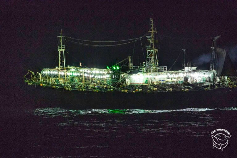
GFW also enables the monitoring of fishing fleets during the night, with an option called “night light” on the website. “This function is very important to follow the boats that fish giant squid and discover if they are making illegal catches,” Sueiro said.
Squid fishing is done only at night; vessels shine bright lights to attract squid. Although vessels sometimes deactivate their AIS systems to prevent being located, a satellite can detect the lights they use to capture the squid. This is very important for Peru because Chinese vessels enter Peruvian territory exclusively to fish Humboldt squid.

Sueiro said he believes having all this information available freely and publicly will improve the management of fisheries, not only from the government’s perspective but also that of the companies in the sector. “Transparency is vital for fisheries management because it allows ship owners to plan their operations and make decisions, and it also facilitates the traceability of catches,” he said.
A mechanism used for “fish washing” — making illegal catches appear to be legal — is transshipment, in which ships continue fishing for months or years, periodically transferring their catches to larger vessels. In these cargo ships, illegal catches are easily mixed with legal ones, obscuring their origins, since different vessels unload their catches into the same hold.
“With Global Fishing Watch you can see if these encounters are taking place. One is able to see the routes and the number of hours a boat stays next to another. That way you know if a transfer is being made,” Mayorga said. “If a vessel fished illegally in a prohibited area and unloaded in another vessel, traceability is lost.”

The Peruvian business sector has also expressed its support for improving the transparency of information. Elena Conterno, president of the National Fisheries Society, recognizes the importance of making the satellite data on fishing vessels public so that anyone can see if fishing is taking place in unauthorized areas.
“The Global Fishing Watch initiative responds to the growing interest of fishing companies in offering greater transparency for their activities, so violators can be clearly identified and sanctioned,” said Conterno. In this way, she added, responsible companies submit their operations to public scrutiny and expect those with bad practices to be sanctioned.
Another advance for science
Renato Gozzer Wuest, a fisheries specialist with the Peruvian NGO REDES, which promotes sustainable fisheries, says artisanal fishermen are using GFW, too. For example, fishers from the northwestern city of Paita use it to learn where the Chinese fleet is fishing for squid. “The artisanal fishermen of Paita use GWF before going out to work; in this way they save time and costs because they know in advance where the resource is.”

According to Gozzer, satellite monitoring generates knowledge as users can observe how fishing activity develops and how fleets behave around the world.
“If in 100 years we want to reconstruct the history of fishing, we can do it,” said Gozzer. Beyond that, it is also possible to characterize certain fisheries through the movement of their fleets and to understand why certain fishing decisions are made.
After Peru joined GFW, countries like Costa Rica have expressed readiness to share their information and may be followed by Panama, Ecuador and Colombia. Juan Mayorga said that negotiations have begun with these governments. Options for knowing what happens at sea are growing, an advance that could eventually become a true revolution for ocean conservation.
Banner image: Chinese squid vessel being refuelled by Peruvian tanker. Image by: Sea Shepherd.
This story was first published in Spanish on our Latam site on November 7, 2018.


