Features
Videos
Podcasts
Specials
Articles
Shorts
Donate
English
Español (Spanish)
Français (French)
Bahasa Indonesia (Indonesian)
Brasil (Portuguese)
India (English)
हिंदी (Hindi)
বাংলা (Bengali)
Swahili
Videos
Podcasts
Articles
Short News
Feature Stories
The Latest
Explore All
Tsunami News
RSS
42 stories
L
G
Study finds 2,000+ species restricted to natural disaster-prone areas
Shreya Dasgupta
30 Jul 2024
In Indonesia, an earthquake leaves devastation on land and under the sea
Ian Morse
9 Apr 2019
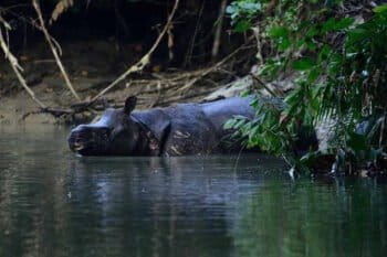
Deadly tsunami leaves Javan rhinos untouched, but peril persists
Asti Dian
28 Dec 2018
After the tsunami, a forest restored along a river in Aceh
Chik Rini
13 Oct 2015
Google Earth enhances oceans’ layer
Jeremy Hance
8 Jun 2011
Japan disaster to put logging pressure on rainforests in Indonesia, Malaysia
Jeremy Hance
5 Apr 2011
Pictures: Google Earth updates post-tsunami imagery
Mongabay.com
31 Mar 2011
Navy pictures reveal tsunami damage
Mongabay.com
17 Mar 2011
Photos of tsunami destruction
Mongabay.com
17 Mar 2011
Pictures of tsunami devastation, including a house floating in the open ocean
Mongabay.com
17 Mar 2011
2011 tsunami: Before and after photos of Kesennuma
Mongabay.com
15 Mar 2011
2011 tsunami: Before and after photos of Minamisoma-Kashima
Mongabay.com
15 Mar 2011
2011 tsunami: Before and after photos of Sendai airport
Mongabay.com
15 Mar 2011
2011 tsunami: Before and after photos of the Oshika Peninsula and Iigoham
Mongabay.com
15 Mar 2011
2011 tsunami: Before and after photos of Watari / Lake Torinoumi
Mongabay.com
15 Mar 2011
2011 tsunami: Before and after photos of Ofunato Rikuzentakata
Mongabay.com
15 Mar 2011
2011 tsunami: Before and after photos of Odohama
Mongabay.com
15 Mar 2011
2011 tsunami: Before and after photos of Iwaki-Ueda
Mongabay.com
15 Mar 2011
2011 tsunami: Before and after photos of Watari
Mongabay.com
15 Mar 2011
2011 tsunami: Before and after photos of Sendai
Mongabay.com
15 Mar 2011
2011 tsunami: Before and after photos of Yamamoto
Mongabay.com
15 Mar 2011
2011 tsunami: Before and after photos of Yagawahama and the Oshika Peninsula
Mongabay.com
15 Mar 2011
2011 tsunami: Before and after photos of Rikuzentakata
Mongabay.com
15 Mar 2011
2011 tsunami: Before and after photos of Minamisoma
Mongabay.com
15 Mar 2011
2011 tsunami: Before and after photos of Minamisanriku
Mongabay.com
15 Mar 2011
2011 tsunami: Before and after photos of Fukushima
Mongabay.com
15 Mar 2011
2011 tsunami: Before and after photos of Central Ishinomaki
Mongabay.com
15 Mar 2011
Before-and-after tsunami satellite pictures
Mongabay.com
15 Mar 2011
Japan’s earthquake disaster may boost rainforest logging in Borneo
Mongabay.com
13 Mar 2011
Is Japan’s tsunami linked to climate change?
Mongabay.com
11 Mar 2011
Tsunami strikes Indonesia
Mongabay.com
26 Oct 2010
Tsunami alert lifted after strong earthquake in Indonesia
Mongabay.com
25 Feb 2008
1
2
Next »
you're currently offline