Google released satellite images revealing the devastation in the Oshika Peninsula and Iigoham caused by the March 11 tsunami and earthquake.
The satellite images are available on Google Earth and Google Maps.
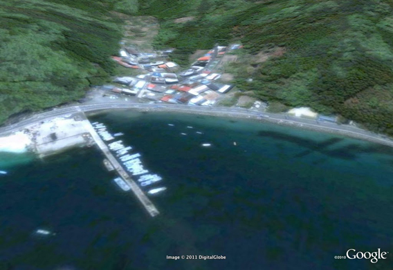
Oshika Peninsula Iigohama 2007. Satellite picture courtesy of Google Earth / GeoEye.
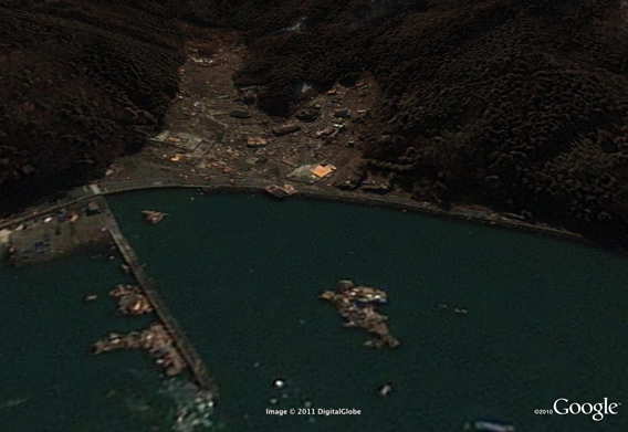
Oshika Peninsula Iigohama after the March 11, 2011 Sendai earthquake and tsunami. Satellite picture courtesy of Google Earth / GeoEye.
Credits
Rhett Butler Editor