Google released satellite images revealing the devastation in Fukushima caused by the March 11 tsunami and earthquake.
The satellite images are available on Google Earth and Google Maps.
Fukushima 3 km south of power plant 2004. Satellite picture courtesy of Google Earth / GeoEye.

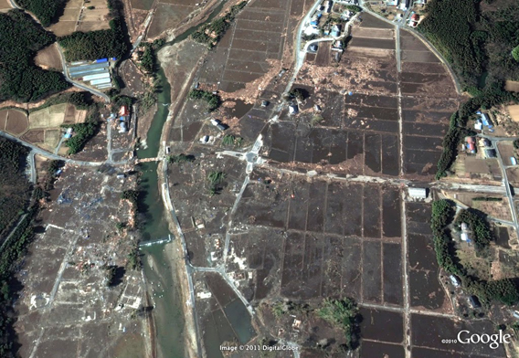
Fukushima 3 km south of power plant after the March 11, 2011 Sendai earthquake and tsunami. Satellite picture courtesy of Google Earth / GeoEye.
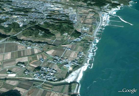
Fukushima Tomioka 2004. Satellite picture courtesy of Google Earth / GeoEye.
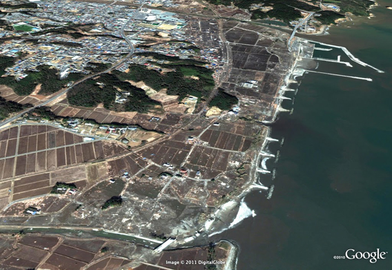
Fukushima Tomioka after the March 11, 2011 Sendai earthquake and tsunami. Satellite picture courtesy of Google Earth / GeoEye.