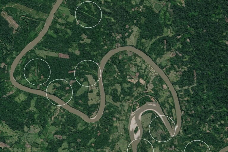
- Nearly 1,000 major fires burned in the Amazon during its 2022 fire season, according to the Monitoring of the Andean Amazon Project (MAAP).
- The Brazilian Amazon accounted for the vast majority of the fires, and most burned in recently deforested areas.
- MAAP uses unique satellite data detecting aerosol emissions alongside regular heat alerts, which helps filter out small fires.
- Fires clearing logging debris are linked to soy-driven deforestation in some Brazilian Amazon areas, where many soy-trading companies have not signed zero-deforestation commitments.
This year’s Amazon fire season was milder than the previous two years, but there were still nearly 1,000 major fires, many of them in recently cleared areas in the Brazilian Amazon, highlighting a key link between deforestation and fires.
Using ground and atmospheric data, the Monitoring of the Andean Amazon Project (MAAP) documented 983 major fires in the Amazon this year, which affected almost 1 million hectares (2.5 million acres), an area larger than all of Yellowstone National Park. The fires, like deforestation, were largely concentrated in the southern and eastern Amazon. Roads providing access to those areas of the Amazon are a key factor in fire locations, said MAAP director Matt Finer.

“For Peru and Brazil, anyway, it’s a very tight correlation between roads and fires,” Finer told Mongabay, pointing out where highways cut through areas with the highest concentrations of fires on the map on his computer screen.
The Brazilian Amazon accounted for 72% of the major fires this year, and of those, 71% were human-caused fires in areas that had been deforested within the last three years. But in some cases, when MAAP researchers looked back in time at satellite images of the fire coordinates, they found forest standing at the beginning of the year, which was later deforested and then burned in May or June to clear the debris.
MAAP also documented close to 100 major human-caused fires of standing forest in the Brazilian Amazon, burning roughly 110,000 hectares (about 272,000 acres). Fires that started in pasture or recently deforested areas may have escaped and spread, which was likely a key factor in severe fires seasons in drier years.
“We still documented almost 1,000 major fires [across the Amazon],” said Finer. “It was still a bad fire season because the deforestation is still so high, but it wasn’t catastrophic like 2020,” when MAAP calculated some 2.2. million hectares (5.4 million acres) of forest had burned.
This year, of the 983 major fires, the Bolivian Amazon accounted for 15%, the Peruvian Amazon accounted for 12% and the Colombian Amazon accounted for just 1%. MAAP recognized the Colombian figures were an underestimate because the fire season there, which occurs much earlier than the other countries, started before the project began collecting data — which is sourced and analyzed differently than by other fire mapping efforts.

“Everyone tracking fires in the Amazon, and anywhere else really, [is using] satellites that detect heat anomalies,” he said. “Right now, the fire season’s over but you could take a look at the data, and it would seem like the Amazon’s on fire today because small fires are a common occurrence.”
Rather than relying solely on heat alerts, MAAP uses them in combination with unique data from a European Space Agency satellite that detects aerosol emissions, which are associated with smoke.
“We’re basically able to filter out all of the small fires, like anyone going out and burning a 50-year-old field with very little biomass that would show up in the heat alerts,” said Finer. “We’re just focused on the fires that are burning a lot of biomass, which is related to what we’re concerned about, which is the areas that were very recently deforested so still have a lot of debris.”
Fires following logging linked to agricultural expansion
This year MAAP estimated that 120 fires clearing debris in recently logged areas in the Brazilian and Bolivian Amazon burned 58,000 hectares (more than 143,000 acres) to make way for new soy plantations. This was based on satellite imagery showing land cleared for row crops rather than pasture in expanding soy plantation regions. However, just because images indicated preparations for crops rather than cattle pasture does not mean the crop will be soy.
“Normally farmers use very fertile recently cleared areas to grow rice in the first years,” said Rachael Garrett, a professor of conservation and development at University of Cambridge who has been researching soy-driven deforestation.
The rice fields would likely end up being soy, but they could also become pasture, Garrett explained to Mongabay in an email, noting that most studies in the area do not make assumptions of what cleared land is used for based on what is initially planted. They wait 3 to 5 years because there is often a transition period where the land is used in various ways.
Brazil is now the world’s top exporter of soybeans. Some national and international commodity-trading companies in the Brazilian soy market have signed the Soy Moratorium, a soy-specific zero-deforestation supply chain policy with an agreement not to source soybeans from land deforested after 2008.
“As our recent work shows, there are many companies that haven’t signed the moratorium and it leaves half of the soy-suitable areas in the Amazon still vulnerable to soy-deforestation,” said Garrett. “Even in areas that have high coverage (in terms of their market share) by Soy Moratorium signatories, we estimate the moratorium only reduced soy-driven deforestation by 55%. Thus, deforestation for soy is still an ongoing problem.”
Between soy plantations and cattle pasture expansion, much of the deforestation in the Amazon is commodity- or agriculture-driven, said James MacCarthy, a research analyst with the Global Forest Watch team at the World Resources Institute.
“A lot of that actually ends up making the forest more susceptible to fires. It tends to reduce the amount of precipitation locally as well as the humidity of the area, which makes those forests more prone to fires,” MacCarthy told Mongabay.
“Especially when there’s an ongoing drought, then the fires that they’re setting to clear land can then escape into the forests, which cause the kind of increase in tree cover loss that we’re seeing in the Amazon and globally,” he said.
Wildfire management budgets in general are usually spent nearly entirely on responding to fires rather than on prevention, but the increasing quality and speed of data could help prevention planning, said MacCarthy. The satellite data Global Forest Watch use to determine the extent of a fire often has a lag of several months, so the MAAP data give a better up-to-date picture of what is going on in the Amazon.
“It’s really helpful to have that data they provide immediately after the events,” said MacCarthy. “They do a really good job of tracking individual fires.”
Citation:
Gollnow, F., Cammelli, F., Carlson, K. M., & Garrett, R. D. (2022, October 28). Gaps in adoption and implementation limit the current and potential effectiveness of zero-deforestation supply chain policies for soy. Environmental Research Letters. doi: 10.1088/1748-9326/ac97f6
Banner image: Fire in the Amazon. This area next to the borders of the Kaxarari Indigenous territory, in Labrea, Amazonas state, Brazil. Image © Christian Braga / Greenpeace.
FEEDBACK: Use this form to send a message to the author of this post. If you want to post a public comment, you can do that at the bottom of the page.
Related reading:
More than 250 major fires detected in the Amazon this year, despite Brazil’s ban
Fire and forest loss ignite concern for Brazilian Amazon’s jaguars
Fire season intensifies in the Brazilian Amazon, feeding off deforestation


