Features
Videos
Podcasts
Specials
Articles
Shorts
Donate
English
Español (Spanish)
Français (French)
Bahasa Indonesia (Indonesian)
Brasil (Portuguese)
India (English)
हिंदी (Hindi)
বাংলা (Bengali)
Swahili
Videos
Podcasts
Articles
Short News
Feature Stories
The Latest
Explore All
News
RSS
28054 stories
L
G
How narcos moved 108 tons of timber infused with drugs from Bolivia to Chile
Iván Paredes Tamayo
13 Jul 2026
Monkey vs machine: Nepal tests AI to fight crop-raiding macaques
Praveen Kumar Yadav
13 Jul 2026
Fossil fuel-based mega projects displace locals in Bangladesh, pushing youth out
Eyamin Sajid
13 Jul 2026
A marine protected area can ban fishing boats. It cannot stop drifting gear
Rhett Ayers Butler
13 Jul 2026
What will Africa’s story on ocean governance be? Interview with David Willima
Victoria Schneider
13 Jul 2026
Official tied to commercial breeding to represent US at global wildlife trade meeting
Spoorthy Raman
11 Jul 2026
Lydia Möcklinghoff, champion of the giant anteater, has died in a plane crash. She was 45
Rhett Ayers Butler
11 Jul 2026
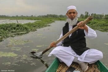
Restoring Kashmir’s lakes one community at a time: Interview with Manzoor Ahmad Wangnoo
Hashim Quraishi
10 Jul 2026
Conserving Sierra Leone’s western chimpanzees: Interview with Tacugama’s Willie Tucker
Patricia Sia Ngevao
10 Jul 2026
Meme-face Pallas’s cat traverses a complex conservation landscape
Sean Mowbray
10 Jul 2026
Beavers brought a volcanic wasteland back to life. Now it’s under threat
Isabel Gil
10 Jul 2026
Scientists use AI to produce first high-resolution map of global seagrass extent
Abhishyant Kidangoor
10 Jul 2026
Suspect charged and manhunt continues over Jakarta 3-ton pangolin scales case
Anggita Raissa
10 Jul 2026
Bangladesh gets ready for its first release of tiger rescued from poachers’ trap
Abu Siddique
10 Jul 2026
In Honduras, solar power has done more harm than good, communities say
Maxwell Radwin
9 Jul 2026
Can conservation change how the world sees the Strait of Hormuz? (commentary)
Iman Ebrahimi
9 Jul 2026
Lawmakers seek rights probe into Indigenous conflict at Indonesian timber firm
Hans Nicholas Jong
9 Jul 2026
Seeking swordfish, catching dolphins and whales: EU pushes to rein in driftnets
Victoria Schneider
8 Jul 2026
Could a blighted urban inlet become a global beacon of waterway renewal?
Jennifer Cole
8 Jul 2026
Dark earth: Ancient Amazonian soil can boost forest restoration, study finds
Evanildo da Silveira
8 Jul 2026
Microplastic pollution can fuel rise in antibiotic resistance, studies find
Claire Asher
8 Jul 2026
Like wolves, non-native lake trout have radically altered Yellowstone ecosystems (commentary)
Lyle Lewis
8 Jul 2026
Confronting culture to protect vultures: Interview with Nigeria’s Michael Williams
Kingsley Charles
8 Jul 2026
A fraction of promised climate money reaches Amazon communities: Interview with Latimpacto’s leaders
Beverley Choo
8 Jul 2026
Clinical trials begin in DRC epicenter of Bundibugyo strain of Ebola
Prosper Heri Ngorora
8 Jul 2026
‘A targeted, data-driven approach’: Interview with Vietnam’s antipoaching unit
Campbell Rusden
7 Jul 2026
Illegal fishing takes a toll on Australia’s sea cucumbers
Madeline Shaw
7 Jul 2026
Roads, loggers close in on an unprotected refuge for isolated Kakataibo
Aimee Gabay
7 Jul 2026
In AI race, Indigenous values could guide environmental issues, researchers suggest
Shradha Triveni
7 Jul 2026
Cabo Verde program and its fishers have been protecting the sea for 10 years
Alice Pistolesi, Monica Pelliccia
7 Jul 2026
Belief-based use increasing threat to yellow-billed kite, an important African scavenger
Sean Mowbray
7 Jul 2026
‘The only possible transition is a just transition’: Interview with WEF’s Clemence Schmid
Jackson Ambole Okata
7 Jul 2026
1
2
3
…
877
Next »
you're currently offline