- A remote region of the Peruvian Amazon is being invaded by farmers who are rapidly clearing mature forests for farms to grow coca.
- The invasions are occurring in the buffer zone of Alto Purús National Park and two reserves for isolated tribes, seriously threatening the Mashco-Piro, Peru’s largest isolated tribe.
- The farmers are from VRAEM, Peru’s largest cocaine-producing region, and are part of a growing movement of coca farmers from the Andean foothills to biologically and culturally sensitive lowlands near protected areas.
- The invasions are occurring in timber concessions and exemplify the problem with Peru’s reliance on timber companies to properly manage remote forests lacking state presence.
ATALAYA, Peru — Pascual cuts the motor and our dugout canoe glides below a massive tree trunk suspended a few feet above the river. I motion to the bank.
“We want to fly the drone!” I yell over the buzz of chainsaws coming from the opposite bank.
“No,” Pascual says, shaking his head. “We can’t stop here … the trees will fall on top of us … and these people are dangerous.”
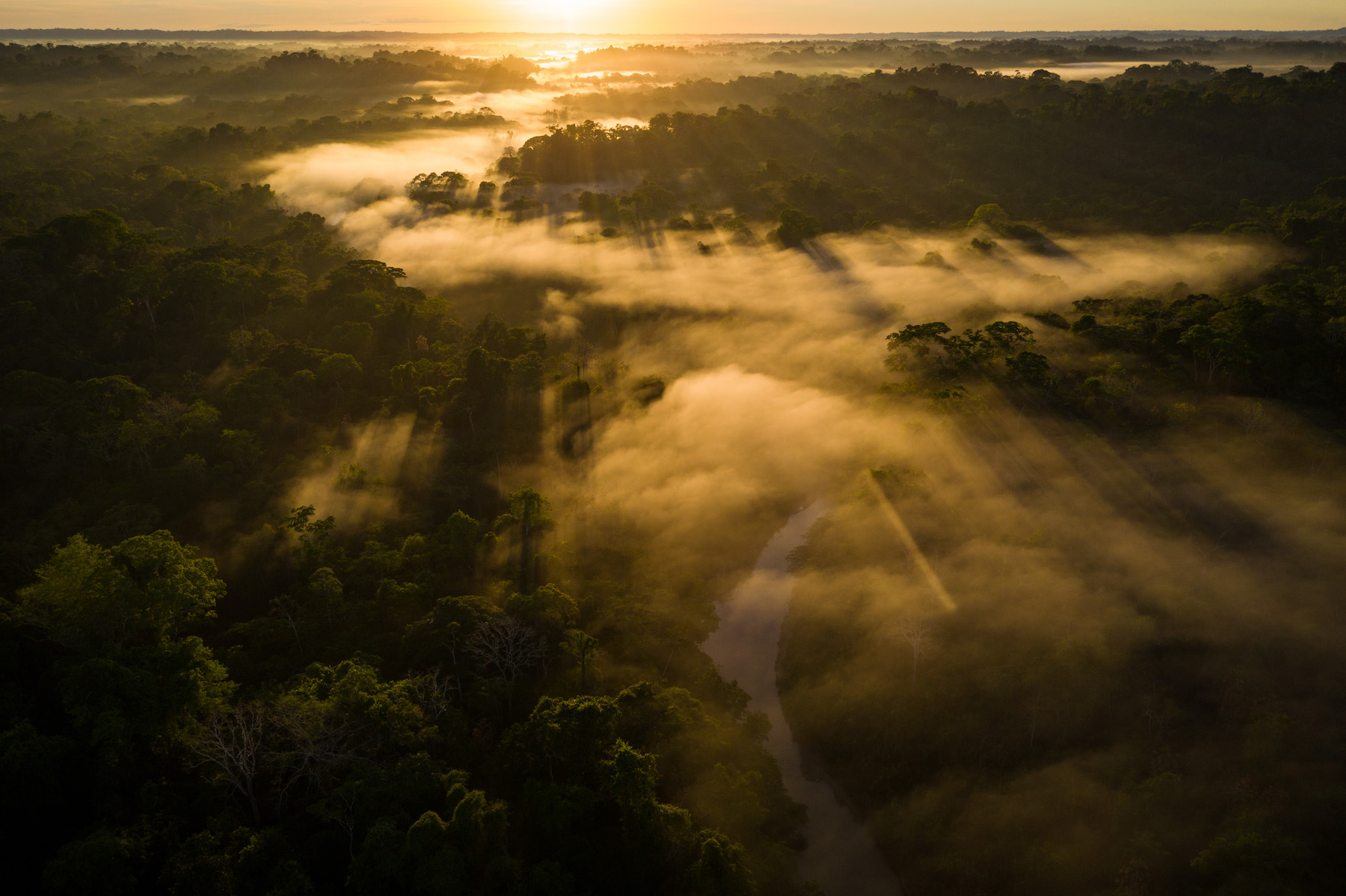
Pascual is Yine, one of a half-dozen tribes that live on the Sepahua River, a tributary of the Urubamba in the remote headwaters of the Peruvian Amazon. He’s the coordinator of the Sepahua vigilance committee, volunteers who help guards protect the buffer zone of Alto Purús National Park. We’ve come to verify rumors of a massive land invasion in the park’s buffer zone, and for the past week Pascual and three other local men have led us up the small river through a patchwork of mature jungle and brand-new clearings. The contrast is striking and disturbing. One moment it feels like the heart of the Amazon. Scarlet macaws fill the sky, and we count tapir and ocelot tracks on the muddy banks. And the next, the trees are gone and the air is full of smoke and ash from the burning fields that surround our boat.

Pascual pulls the starter cord and the canoe lurches forward. A moment later a tremendous cracking drowns out the motor as another giant tree crashes down the bank and explodes into the river behind us.
A new frontier for an illegal industry
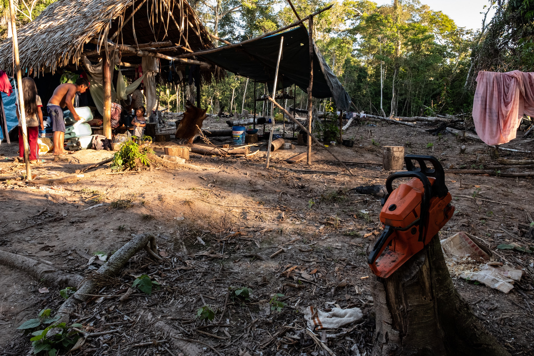
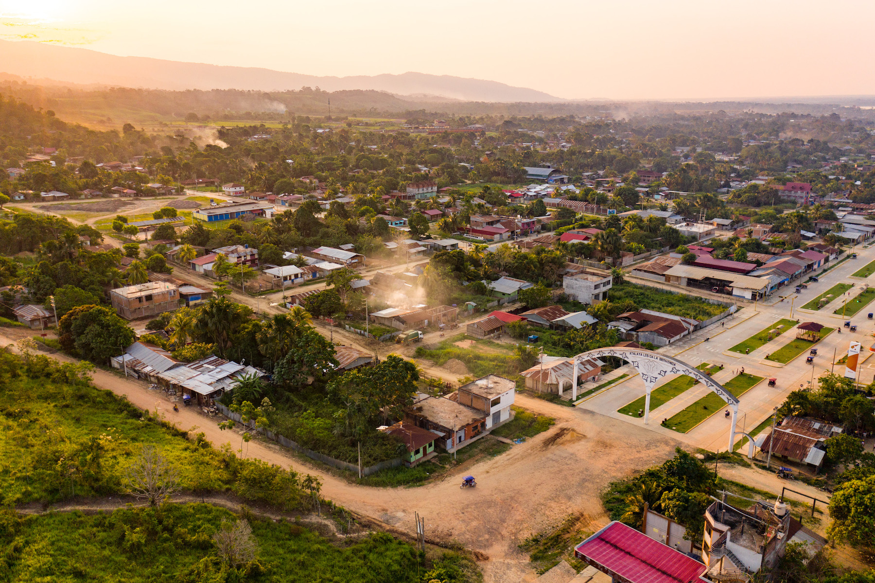
The men cutting the trees are from VRAEM, the Valley of Apurímac, Ene and Mantaro Rivers, a region notorious for terrorism and as the largest producer of cocaine in Peru. The movement of coca farmers from crowded coca growing places like VRAEM to unpopulated lowlands isn’t new. Coca eradication programs have displaced growers for decades, but nowhere near the scale and speed of what we’re witnessing now. Within a few months, the Sepahua has been transformed from a sleepy frontier town to a bustling hub of outsiders moving up and down the river in large metal boats brought from the city of Atalaya. Local Yine, Asháninka and Amahuaca tribespeople, whose ancestors settled here generations ago, are living in fear as they helplessly watch the forest they depend on disappear.

But they aren’t the only ones being impacted by the lawlessness. The Sepahua is part of the Purús-Manu Conservation Corridor, a massive 10-million-hectare (25-million-acre) complex of protected areas and indigenous lands twice the size of Costa Rica. This area is one of the most biodiverse places anywhere on the planet, and harbors one of the largest concentrations of isolated peoples. The Sepahua provides access to Alto Purús and Manu national parks and two reserves set aside for the isolated tribes. As the invaders move further upstream toward the protected areas, the territory for some of the world’s last isolated tribes continues to shrink.
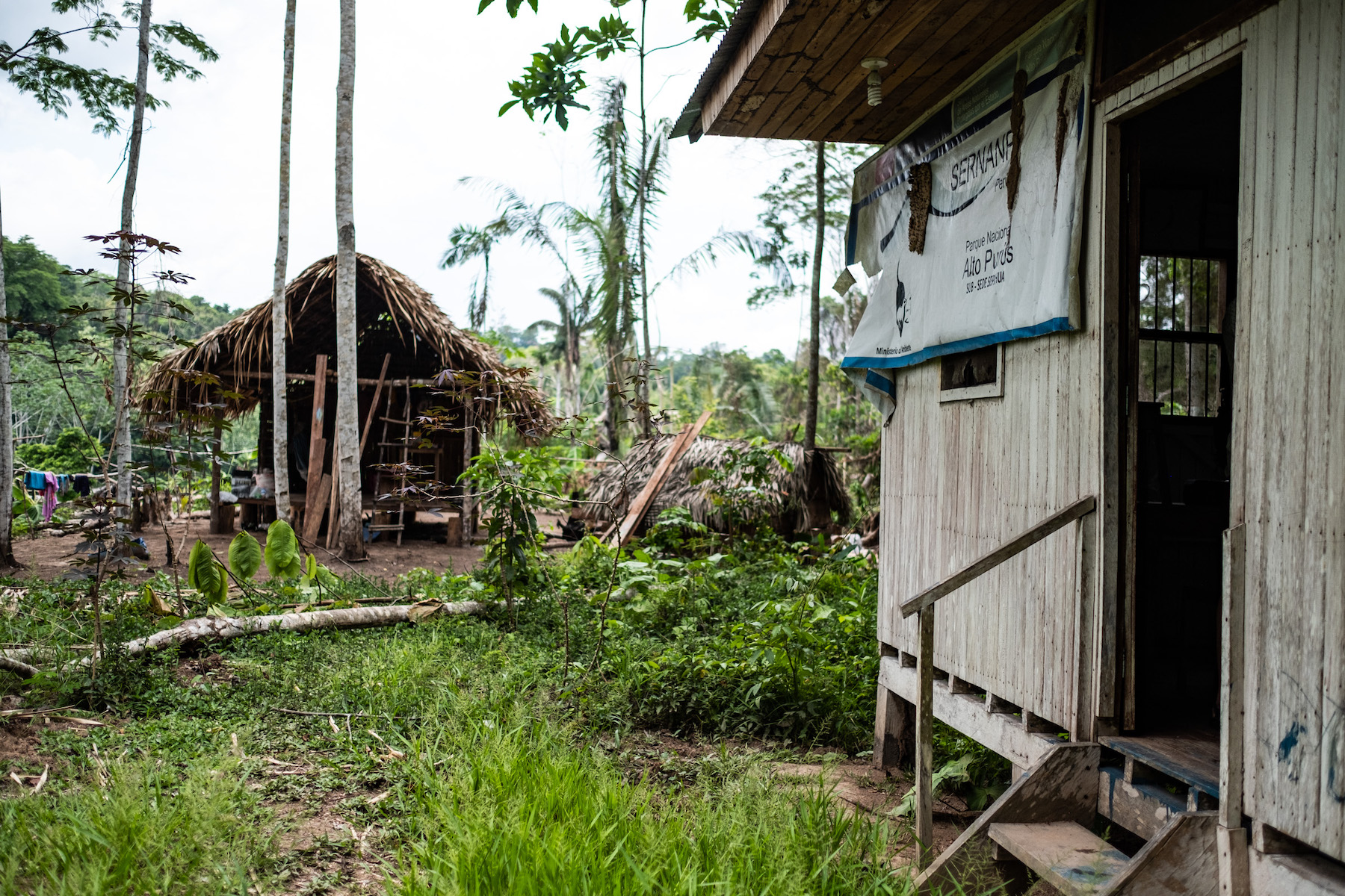
Our first day on the river we pass the control post for Alto Purús National Park, intended to prevent illegal activities in the buffer zone. The front of the building is covered with termite nests and the surrounding forest has been cut and replaced with partly burnt trees and manioc bushes. It hasn’t been staffed in more than two years and farmers have taken it over. The scene is discouraging and portends the next week on river.
Soon after passing the post, one of our Amahuaca guides points to the riverbank.
“Here is where the parcels start.”
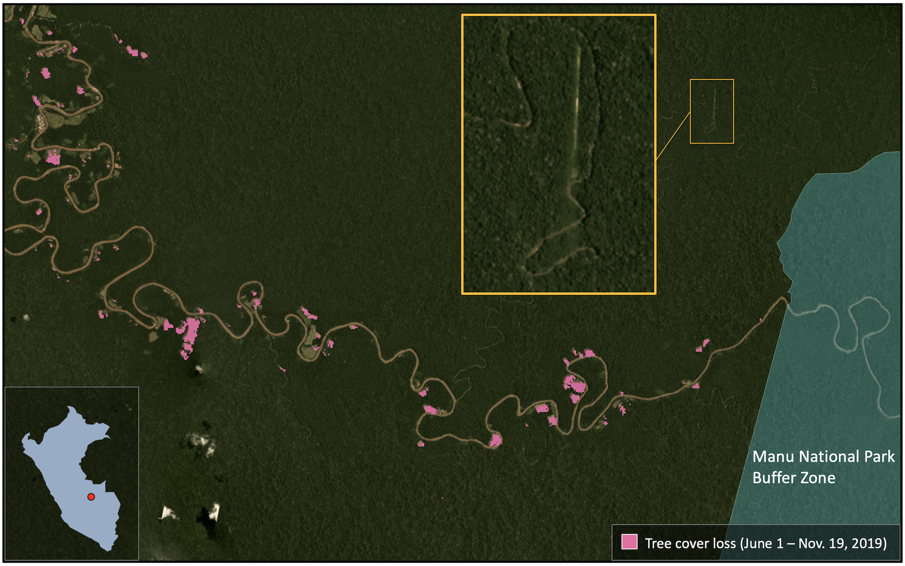
A large tree has recently been cut to create an opening in the otherwise dense forest perpendicular to the river. “P1” is painted in red on a standing tree next to the clearing, marking this place as Parcel No. 1.
Over the next week we count 180 parcels on the right bank and 74 on the left. They’re 100 percent illegal, cut from forest zoned for sustainable and selective logging and divided into timber concessions. Some are spaced 200 meters (650 feet) apart, others 300, and they all extend 1,000 meters deep into the forest, thus covering 20 and 30 hectares (50 to 70 acres), respectively. Not all are occupied, however. Of the 254 parcels, 73 are in some stage of clearing, the fields ranging from 1 to a few hectares. Most have been cut within the past few months, and they appear newer as we move upstream. The last one we find is located less than 10 kilometers (6 miles) from the park boundary.


We don’t see any coca crops along the river, but we didn’t expect to. The coca is grown deeper in the forest, hidden from passing boats, while these riverfront farms are planted with crops like cacao, maize and manioc and reportedly serve as a front to justify the farmers’ presence.
The movement of coca farmers from traditional growing areas like the Andean foothills to the lowlands began decades ago but has increased significantly over the past 20 years. Protected areas are often targeted due to their remoteness, arable soil and the lack of government presence. In addition to destroying coca fields, eradication efforts include improved government services and programs to help farmers transition to legal crops like cacao and coffee. However, a decrease in coffee prices and delays in the process of certifying organic beans is making coffee less profitable and may be causing farmers to abandon coffee and turn back to coca. Furthermore, legal farmers are finding it difficult to grow their crops in areas where coca is still prevalent. In early November, 3,000 cacao- and coffee-farming families in VRAEM demanded the government intervene to prevent chemical contamination from illegal coca plantations that are hindering the certification process for the beans and lowering prices.
Despite millions of dollars spent on eradication, the continued robust demand for coca has resulted in continued production. In 2018, Peru cultivated enough coca to produce 509 metric tons of cocaine, a steady increase from the 307 tons it could have produced in 2012, according to U.S. data. Farmers continue to grow coca, but in new, more remote places.