The controversy around the Heart of Borneo aside, it was clear to everyone that it will take more than official protected areas to maintain productive ecosystems and the services these areas afford across Borneo. On this front, one of the biggest opportunities is the forest managed by indigenous peoples and local communities. These customary forests are some of the healthiest in Indonesian Borneo because communities have an interest in protecting the resource that sustains them. Yet many of these forests are classified as state land, meaning that the government can seize them and hand these areas over to be razed by logging, mining and plantation companies. And that’s exactly what’s happened over the past few decades.

However the situation is changing. In 2013, Indonesia’s Constitutional Court ruled that indigenous and local communities have the right to manage their customary forests and the government must recognize that right by officially demarcating these lands. That decision has huge implications — by one estimate, 30 percent of Indonesia’s forest estate, or 40 million hectares (99 million acres), could be affected — but the demarcation process has been slow and only a few communities have actually secured land rights to their customary forests.

For this leg of my trip to Indonesia’s West Kalimantan province, I would be visiting a community that is directly affected by this court decision. The Dayak Iban community of Sungai Utik has maintained a 6,000–hectare (14,800-acre) tract of mostly old-growth rainforest for generations, but has still not secured legal rights to the forest. In fact, in the 1970s the government granted a company a permit to log the forest. It was only the Sungai Utik community’s resistance that stopped the chainsaws.

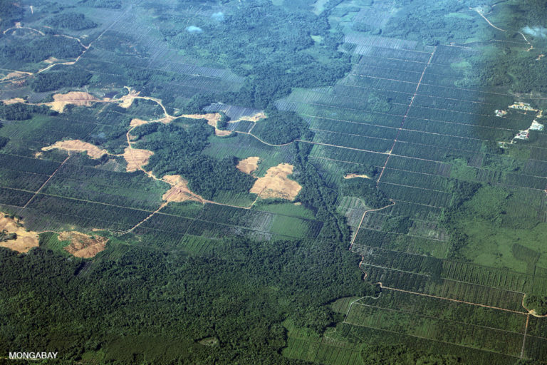
New palm plantation in Borneo. Photo by Rhett A. Butler.
New palm plantation in Borneo seen from the flight from Pontianak to Putussibau. Photo by Rhett A. Butler.
Deforestation for palm oil and mining in Indonesia. Photo by Rhett A. Butler.
Deforestation for palm oil and mining seen from the flight from Pontianak to Putussibau. Photo by Rhett A. Butler.

Getting to Sungai Utik is surprisingly straightforward. From the provincial capital of Pontianak, I take a direct flight to Putussibau, the administrative center for Kapuas Hulu district, accompanied by Mongabay Indonesia correspondent Aseanty “Levy” Pahlevi and hornbill conservationist Dian Hardiyanti from Rangkong Indonesia. We meet up with Nurma Irawati, also from Rangkong Indonesia, and then set off for the two-drive along the North Trans-Kalimantan highway to Sungai Utik.

Most of the drive consists of mosaic deforestation, and along the way we stop at an area of active forest clearing. I take out the drone and do some overflights as a man with a chainsaw fells trees in what appears to be primary forest.

We reach Sungai Utik mid-afternoon and are warmly greeted by Apay Janggut, or “Bandi,” the head of the Sungai Utik longhouse and his family. Bandi, our host during the visit, introduces us to members of the community and shows us around the community’s 214-meter (700-foot) longhouse.

Sungai Utik elder Bandi in 2019. Photo by Rhett A. Butler.
Apay Janggut, also known as 'Bandi', and Kudi in the rumah betang or longhouse at Sungai Utik. Photo by Rhett A. Butler
Apay Janggut, also known as ‘Bandi’, and Kudi in the rumah betang or longhouse at Sungai Utik. Photo by Rhett A. Butler

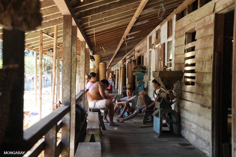
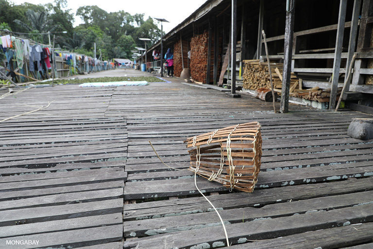
The longhouse, which was built in the 1970s using traditional Dayak Iban design and construction, is comprised of 28 bilik, which are effectively private houses that link to giant communal room called the ruai and a large veranda. Dark and built to maximize airflow, the ruai provides welcome respite from the sweltering afternoon sun. The walls of the longhouse are decorated with an eclectic collection of photos, posters, traditional tools and baskets, and framed awards and certificates.

I’m staying in Bandi’s bilik with him and his family. Bandi has two guest rooms, which he lets out to visitors.

The longhouse is quiet and the mood seems subdued. There has been a death in the community, so Sungai Utik is officially in mourning. There is a black flag flying outside the community to alert visitors.

A contingent of younger members of the community are out in the forest collecting plants for a ceremony and Bandi suggests it is a good time to visit the customary forest, which is about two hours by foot from the longhouse. We first pass through the community’s agricultural zone and then into secondary forest before entering primary forest along the Utik River, a tributary of the Embaloh River.

Utik means “white” or “clear” in Dayak Iban, and upon seeing the river, we can see it’s a well-earned moniker. The clear-flowing stream runs over smooth river stones through healthy, old-growth forests. Many of the trees are laden with epiphytes, like bird-nest ferns and orchids. Butterflies and dragonflies abound.

I use the drone to get a bird’s-eye view of the area. Navigating liftoff through the dense canopy takes careful maneuvering, but the view is spectacular once the drone gets above the trees and I can look down on the broccoli-like tree crowns and out at the rugged mountains in Sarawak to the north.

We head back to the longhouse as the light begins to fade. Members of the community are also on their way home from their fields and forest, carrying woven backpacks full of what they’ve collected and harvested for the day.

That evening, over a dinner of snakehead fish from the river, greens and rice, we have a long conversation with Bandi about the community’s traditions and history as well as the significance of the forest to the Dayak Iban people. He tells us about his tattoos, how Sungai Utik is adjusting to change, and the community’s needs and aspirations, including the desire for better mobile network connectivity so Sungai Utik can better develop and market cultural tourism via homestays.

Bandi also talks about Sungai Utik’s struggles to win official recognition of its land rights to the customary forest it has managed to maintain despite a spasm of deforestation occurring across Indonesian Borneo. He says different levels of government have different levels of understanding when it comes to the issue, making for slow progress. But he’s hopeful that Sungai Utik will soon get its overdue recognition, which he says will serve as a model and inspiration for other indigenous communities struggling with the same challenges. See the interview at Indigenous Iban community defends rainforests, but awaits lands rights recognition.

Community activity at Sungai Utik longhouse. Photo by Rhett A. Butler
Built in 1978, the 214-meter Sungai Utik longhouse houses 318 people. Bandi at Sungai Utik. Photo by Rhett A. Butler
An Iban woman returning to Sungai Utik after collecting herbs, resin, and medicinal plants from the forest. Photo by Rhett A. Butler
Woven Iban basket at Sungai Utik longhouse. Photo by Rhett A. Butler.
ban woman walking back from the forest from a in the fields and forest near Sungai Utik. Photo by Rhett A. Butler.
Iban man on a motorbike near Sungai Utik. Photo by Rhett A. Butler.

In the morning we set out early for Langkau Ngetu, a cabin located a couple of hours upstream from the longhouse in Sungai Utik’s customary forest. The hike takes us through some of the beautiful primary forest we got a drone’s view of the day before. After about two hours we reach the cabin and meet a group of men from Sungai Utik who spent the night at Langkau Ngetu fishing, hunting and collecting forest products ahead of the upcoming longhouse ceremony. They share some of the freshly cooked snakehead, which they spearfished that morning.

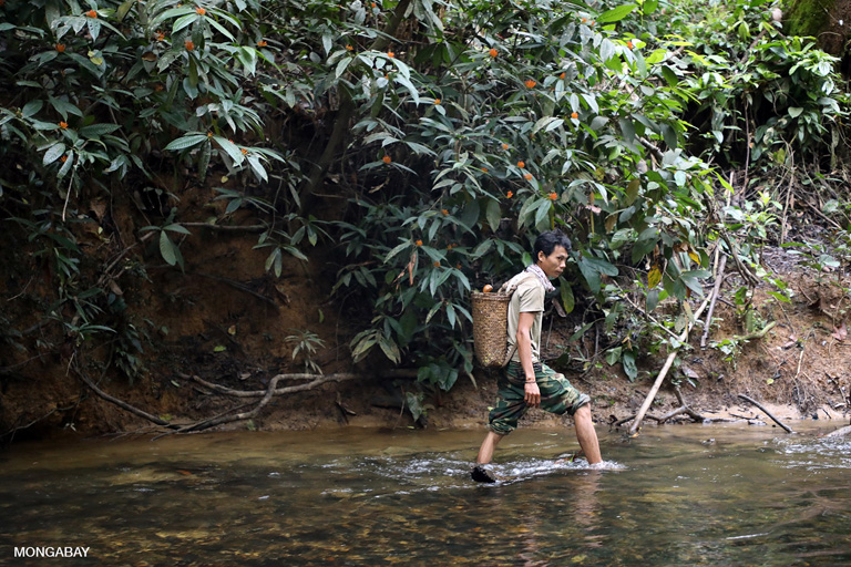
Iban man on patrol. Photo by Rhett A. Butler
Iban on patrol in Sungai Utik's customary forest. Photo by Rhett A. Butler
Iban on patrol in Sungai Utik’s customary forest. Photo by Rhett A. Butler
Langkau Ngetu cabin, which is located about 2 hours walk from the longhouse. Photo by Rhett A. Butler

We spend several hours walking in the forest around Langkau Ngetu before heading back to Sungai Utik and then returning to Putussibau that evening. On the way to Putussibau we stop at a sand mine and a couple of recently deforested areas, including one that appears to have been cleared for smallholder agriculture.

Deforestation in Kapuas Hulu, Indonesian Borneo. Photo by Rhett A. Butler.

If one views Putussibau on Google Earth, one of the most striking things is an area of forest clearing just west of the city. The area is massive — it easily dwarfs Putussibau. According to Global Forest Watch, this was an oil palm plantation that belonged to a company called PT Borneo. This plantation is to be the focus of our morning.

We map out some access points near the plantation where satellite imagery from Planet suggested there had been recent activity. However, it turns out that our driver had previously worked at the plantation and is confident that we can enter the plantation without issue. We debate this approach: on the plantation we would be quite exposed to company security. But there’s a complicating factor: a dense fog has blanketed the area, making visibility very poor. Flying the drone from a forest area to the plantation may be difficult because of the low visibility — emergent trees would be hard to see — as well as the restricted airspace due to the plantation lying in the flight path of Putussibau’s airport. So we go with the driver’s recommendation.

As we drive down the road to the plantation, the driver briefs us on the history of the plantation, which is far more complex than suggested on Global Forest Watch. Today, the plantation is owned by three multinational conglomerates, rather than a single company. And the area the plantation occupies was zoned for conservation long before it was cleared, suggesting it exists in a legal gray zone, which may explain why the oil palms were planted well after the forest was cleared. That’s an issue we plan to dig into further in the future.

When we arrive at the security gate, our driver exchanges a few words with the guards and they let us through. We drive for about 10 minutes and the driver indicates that we’re at a good spot for droning. I quickly unpack and launch the drone, but the visibility is terrible. So after a couple of minutes I circle the drone back. But then we hear the sound of a fast-approaching motorbike — it’s a plantation guard. I quickly send the drone up and away, so it’s now hovering 120 meters (400 feet) high, 1,500 meters (5,000 feet) away, and jump into the car. But the guard is on to us. The problem is the dense fog, which essentially bounces the sound from the drone’s propellers earthward and along the ground, making it much louder horizontally than it would have normally been.

The guard asks us to follow him back to the security office. We agree and let him speed off ahead of us, which gives me time to fly the drone back to the car and pack it up. Upon reaching the gate, my team says it’s best if I stay in the car and let them do the talking. They go up to the office and spend about an hour talking with the guards, who assume I’m an investor assessing the land. My team doesn’t disabuse them of the notion, and also explains that I’m due to catch the next flight out of Putussibau. Eventually they let us go with a warning, and we’re off to the airport.

Once I reach Putussibau, I learn that my connecting flight out of Pontianak has been rescheduled so it now leaves two hours earlier. That means I will miss the next two connections — to Kuala Lumpur and then Singapore, from where my flight back to the U.S. is departing that evening. That sparks a scramble to find other flight options that will get me to Singapore in time for the international flight home. It turns out the most adventurous part of my trip into the interior of Borneo isn’t visiting the Dayak Iban in the rainforest, but a quick jaunt to a plantation on the outskirts of the district capital and the airports.

Credits

Editor

Topics

you're currently offline