- WWF-UK has produced a website and series of best-practice guideline documents to help field teams deploy camera trapping, acoustic monitoring, and Light Detection and Ranging (LiDAR).
- The guidelines address issues ranging from assessing the relevance of each method to a particular project goal and ecosystem, to practical tips for deployment, to the physics behind the functioning of the technology.
- The resource should help readers planning a specific project using one or more of these approaches and include extensive lists of published studies for each method.
A conservation technology team at WWF-UK has produced a series of best-practice guidelines for three key data collection techniques—camera trapping, passive acoustic monitoring, and remote sensing through Light Detection and Ranging (LiDAR).
The group consulted experts in each method to compile the extensive peer-edited information now freely available through a website and downloadable guidance documents.
Paul Glover-Kapfer, WWF-UK’s Conservation Technology adviser, explained in an email to Mongabay-Wildtech, “We saw a lack of accessible information as one of the primary barriers to the effective use of conservation technologies. Paywall restrictions coupled with the high technical complexity and scattered nature of that information contributed to that barrier, and the downloadable guidelines and website are our attempt to breach it.”

Online tech basics
The website briefly introduces each technique—acoustic monitoring, camera trapping, or LiDAR—and where and how it is used. It also answers some specific Frequently Asked Questions (FAQs) about how the relevant technology works, how the data are collected and analyzed, and how it compares to similar techniques.
An Assessment for each method takes readers through an interactive series of questions to determine their level of knowledge of the technology and goals for using it in the field. It uses the reader’s answers to provide Instant Advice on deploying the technology to match the project goals, status, and location.

For example, the photo data needed to identify individual animals differ from those needed to merely confirm the presence of a species. The Instant Advice in the website’s camera trapping section, therefore, offers suggestions for camera features for a particular species and goal (e.g. an infrared flash, fast trigger speed, and wide angle detection for bird studies), the number and potential spatial layout of the cameras, and a minimum study duration. The camera trapping advice also identifies potential challenges that have been experienced by other users, as well as software for analyzing the data (e.g. MARK for Mark-Recapture data, EstimateS or the ‘vegan’ package in R for assessing species diversity).
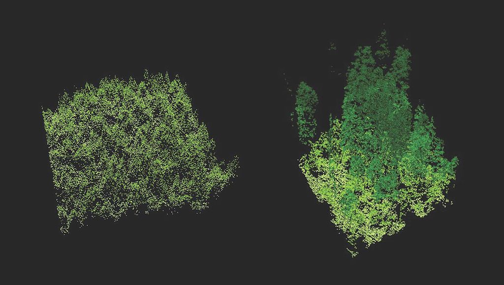
By comparison, most users will purchase, rather than collect, vegetation structure data produced with LiDAR, so the LiDAR FAQs and assessment provide advice on acquiring, processing, and using the data for different aims and vegetation types.
Results display with drop-down menus that readers can then select individually to produce different answers. The online answers are brief and direct interested readers to specific sections of the associated best-practice guidelines documents available for download as PDF files.
Detailed advice for project planning and implementation
Those planning a project using one or more of these approaches will want to consult the extensive guidelines for the appropriate technology, as well as one or more of the peer-reviewed studies provided in each series, for more information. The PDF guidelines documents have a structure similar to that of the website but with much more extensive and detailed information on:
|
|
The content of each guidelines document reflects the current state of use and development of each technology. More field teams have used camera trapping than acoustic monitoring, so the FAQs and discussion for camera trapping tend to be practical (e.g. “What camera trap model should I buy?”). Those for acoustic monitoring tend to address basics of how it works (e.g. “How do acoustic sensors work, and what data do they collect?”). Few readers will actually collect LiDAR data, so those guidelines focus on understanding, acquiring, processing, and analyzing the data.
WWF-UK designed the guidelines with its own field teams in mind. “Whilst the guidelines are designed to aid our teams in the field,” said Glover-Kapfer, “they should also be useful for novices that require a basic introduction to the technologies, highly skilled professionals that are primarily interested in the best practice guidelines for research, and citizen scientists that may have questions about what the technologies can and cannot do.”
The acoustic monitoring and LiDAR guides in particular include basics of the technology for those with little experience or knowledge of its use.

Keeping a reference thorough and updated
Advances in technology have expanded use of these technologies globally. Field research and conservation teams across the globe now conduct camera trapping studies to detect and monitor wildlife, whereas acoustic monitoring is still developing as a data collection technique. Collecting LiDAR data is still prohibitively costly, but governments are increasingly doing so and making the data available for scientific use.
Rapid technological advances can render a device or a primer, such as the WWF-UK tech guidelines, out of date the minute it is put on the market or published. For example, its camera trapping FAQs say human eyes must manually inspect all photos, yet the iNaturalist app has recently added automated photo detection algorithms that have been able to identify over 10,000 species.
Glover-Kapfer agreed this is a major challenge, reflecting, “How do you ensure that the guidelines and webpages that take 6-12 months to prepare are not outdated as soon as they are published?” He added, “…we do have a plan [for updating] and anyone interested should continue to visit the site and follow the project on ResearchGate for future developments. We are looking for potential partners if anyone is interested.”

The guidelines suggests links to project sites that do update regularly, and if the site can also be maintained, would serve as a resource for future users.
According to Jorge Ahumada, Executive Director of TEAM Network /Wildlife Insights, who reviewed the camera trapping guidelines, “Camera traps will likely become smarter, more connected and will collect more environmental information that is relevant to conservation. The conservation technology website should keep abreast of these changes and review relevant sections of their manuals. Same goes for new analytical tools to understand camera trap data. I see Wildlife Insights promoting and working with the conservation technology website to maintain this importance resource current.”
Glover-Kapfer says his group expects to expand the effort. “In addition to the continued evolution of the guidelines and website,” he said, “we’ll be releasing additional guidelines focused on satellite remote sensing and tracking tags and collars and associated webpages in the near future.”


