The number of fires burning in Sumatra’s Riau Province doubled on Sunday, raising concerns that dry conditions could unleash an especially severe haze this dry season in Indonesia.
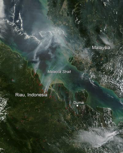
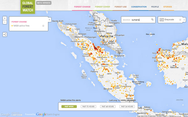
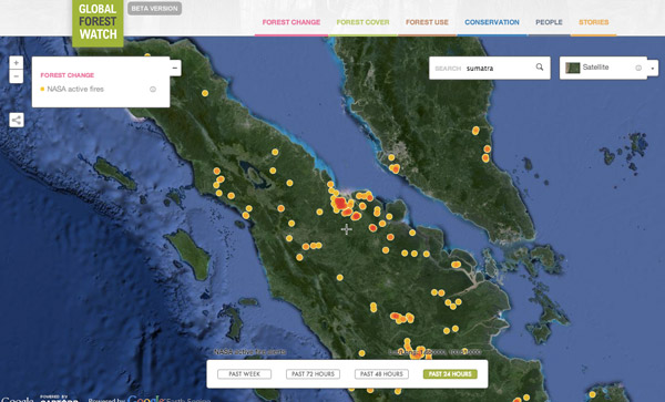
An image released on Monday by NASA showed 154 hotspots in Riau on Sunday, July 20, more than twice the 75 hotspots detected on Saturday. NASA fire data presented on Global Forest confirms that a large number of hotspots continue to burn in the region.
Fires in Riau Province are typically set to clear land for agriculture and plantations. Because much of the region has peat soils, fires are very difficult to extinguish once ignited. They also release unusually large amounts of particulate matter and carbon, triggering air pollution known regionally as “haze”.
Scientists fear this year’s fires could be particularly bad due to the potential return of El Niño, which typically causes drought in Sumatra and Borneo. The worst fires on record in the region have occurred in El Niño years.
 Terra and Aqua satellites detected 154 hotspots in areas across Riau province on Sunday, July 20, indicating forest and land fires had increased again following a decline in rainfall. The number of detected hotspots in Sunday’s report was far higher than what had been reported one day prior, which had reached only 75 spots. Credit: NASA image courtesy Jeff Schmaltz, MODIS Rapid Response Team / Caption: NASA/Goddard, Lynn Jenner |


Global Forest Watch images showing recent hotspots in Riau.


