Modeling program could be used to better manage areas held by indigenous communities
Indigenous groups control approximately half of the world’s vegetated areas. As globalization changes the ways in which traditional communities interact with the land on which they live, it is important to be able to predict how the surrounding environment will respond.
Scientists at Stanford University recently unveiled a new modeling program that can predict the response of the environment to the land-use changes of human communities. Using their model, they found that natural resources can support humanity – up to a certain point. They recently published their findings in the journal Environmental Modelling & Software.

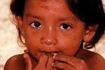
Orang Asli children, an indigenous group of peninsular Malaysia. Increasingly, communities are being displaced from their native lands to make room for plantation development. Photo by Sheema Abdul Aziz.
Their model showed that in an area in which food is acquired through mostly hunting and with some cultivating, a human community can remain in-balance with the surrounding environment if it stays within a certain population range.
“Once indigenous populations move outside that [range], the land use rapidly shifts to another state characterized by a much lower forest cover, with negative impacts on both biodiversity and carbon stocks in the vegetation,” said Eric Lambin, a professor and senior fellow at the Stanford Woods Institute for the Environment.
Lambin worked with project lead Jose Fragoso, a senior scientist at Stanford, and others to develop the model by incorporating many different ecological factors that are known to affect native communities, such as vegetation diversity and deforestation rate. They then projected how changes in these factors would impact the growth rate of communities through food availability. While the actual dynamic between human communities and the environment is more multifaceted and also involves a complex of social factors like education and policy, the researchers believe this initial version of their model will still be useful in predicting land changes.
“This makes it more of a universal model, because all people need calories,” said Fragoso. “They must meet their daily caloric requirement. If they farm more to do that, then they hunt less, or vice versa. But that drives the system and causes all the changes to occur.”
According to World Resources Institute, just 20 percent of the world’s old-growth forests still existed as of 2009, an amount that is getting smaller by the day as land is cleared for human development. Much of that which remains is home to communities that have lived in concert with forests for millennia. But many of these communities are being pressured by logging companies and other outside interests to change the way they interact with their surrounding environment.
The researchers suggest their model could be used by governments and institutions to help manage undeveloped lands held by indigenous communities.
“Few such areas may still remain in the modern world, but preserving that cultural diversity is very important,” Lambin said. “The model helps us to understand under what conditions these traditional, indigenous systems can be sustained.”

Deforestation for palm oil plantations in Sabah, Malaysia. Indigenous communities are often pressured by companies to give up their land for development. Photo by Rhett A. Butler.
Note: the original version of this article implied that Lambin led the team that developed the model. Jose Fragoso was actually the project lead. We regret the error.
Citations:
- Iwamura, T., Lambin, E. F., Silvius, K. M., Luzar, J. B., & Fragoso, J. (2014). Agent-based modeling of hunting and subsistence agriculture on indigenous lands: Understanding interactions between social and ecological systems. Environmental Modelling & Software.
Related articles
Using Google Earth to protect uncontacted tribes in the Amazon rainforest

(06/19/2014) In 2008, images of an uncontacted tribe in the Amazon rainforest in Brazil created ripples. With bodies painted in bright colors, members of the tribe aimed their arrows at a Brazilian government plane flying overhead, occupants of which were attempting to photograph the tribe to prove their existence. Now, a new study has found another way to survey such tribes safely and remotely—using satellite images.
After throwing out referendum, Ecuador approves oil drilling in Yasuni’s embattled heart
(06/02/2014) By 2016, oil drilling will begin in what scientists believe is the most biodiverse place on the planet: remote Yasuni National Park. Late last month, Ecuador announced it had approved permits for oil drilling in Yasuni’s Ishpingo-Tambococha-Tiputinin (ITT) block, an untouched swathe of primary rainforest covering around 100,000 hectares or about 10 percent of the park.
53 indigenous activists on trial for police-protester massacre in Peru

(05/15/2014) In the summer of 2009, on a highway in Peru known as Devil’s Curve: everything went wrong. For months, indigenous groups had protested new laws by then President Alan Garcia opening up the Amazon to deregulated logging, fossil fuels, and other extractive industries as a part of free trade agreements with the U.S.
New report reveals human rights abuses by corporations, governments in the Amazon

(05/14/2014) Regnskogfondet (the Rainforest Foundation of Norway) recently released a 52-page report that gives an in-depth account of the conflicts activists and indigenous peoples (IPs) are having with corporations and governmental agencies. It relays a situation that does not look good.
Papua New Guinea pledges to cancel massive land grabs by timber companies
(04/29/2014) Papua New Guinea’s Prime Minister, Peter O’Neill, released a statement last week saying that hugely controversial land leases under the country’s Special Agricultural and Business Leases (SABLs) will be cancelled if they are found to be run for extracting timber.
Loggers plan to clear 20 percent of tropical island paradise

(04/28/2014) Seven years ago, a palm oil company set its eyes on Woodlark Island—a small rainforest island nearly 200 miles off the coast of Papua New Guinea—but was rebuked by the local populace. But locals and conservationists who spoke to mongabay.com at the time felt that wouldn’t be the end of it: they were right. Recently, a company, Karridale Limited, has landed machinery on the island.
Chelonians for dinner: hunting threatens at-risk turtles and tortoises in India

(04/23/2014) The extinction risk faced by mammals is often in the limelight. But it may be surprising to learn that next only to primates, chelonians—or turtles and tortoises—are the world’s most imperiled vertebrate group. New research indicates that two such species are being threatened by hunting in the Western Ghats of India.


