- The Brazilian Amazon lost 184 km2 of forest in December 2017, 20 times more than was recorded in December 2016 (9 km2).
- The massive increase reflects Brazil’s use of a more accurate satellite monitoring system that incorporates radar, which can see land cover at night and through clouds, and suggests prior deforestation rates were likely underestimates.
- As the cost of radar and other satellite data decreases, continuous monitoring will enable officials and civil society to more accurately monitor and quantify forest loss over a broad range of spatial scales.
The Brazilian Amazon lost 184 km2 of forest in December 2017, according to the country’s Institute of Man and the Environment of the Amazon (Imazon). The data, obtained exclusively by the Brazilian news network GLOBO, show a significant increase in deforestation over that of December 2016, when just 9 km2 of deforestation was recorded.
More than a new surge in deforestation, this massive increase actually reflects an improvement in Brazil’s capacity to measure rainforest extent. Imazon, an environmental NGO that monitors the Amazon region, now incorporates radar imagery from the European Space Agency (ESA)’s new Sentinel-1 satellite. Launched into space in 2014, the Sentinel-1 is used to monitor everything from the Arctic thaw to earthquakes, oil spills, and volcanoes.
“Since August, we have been implementing the use of new sensors in [our] monitoring. We started with a higher-resolution sensor, which detects small-scale deforestation, and this month we implemented a satellite with radar images,” says Imazon’s Antônio Victor Fonseca, part of the team responsible for the monitoring system. “Now we can monitor the forest even when there is cloud presence. It is an advantage that did not exist in the Amazon until today.”

Brazil’s highly advanced forest monitoring system has always faced the challenge of detecting land cover during cloudy periods. Its standard optical satellite imagery works much like the human eye observing the planet from above. Clouds form a visual barrier, preventing the satellite from seeing the Earth below.
Radar can monitor land cover even through clouds, a big advantage during the Amazon’s rainy season.
Unlike standard satellite images, which indicate the reflectance of light off objects on the Earth’s surface and thus require the sun’s radiation, radar emits its own radiation, which hits the Earth and bounces back to its sensor, even at night or in cloudy conditions.
Detecting the deforestation that takes place during dark or rainy periods affords this new assessment greater accuracy than previous analyses. Using data from the new satellite, Imazon produced a more accurate satellite-based map of deforestation in regions with heavy cloud cover last month. The data indicate that the area around the Transamazon highway in the state of Pará experienced the country’s most extensive deforestation, with 83% of the alerts detected in the month. The remaining forest loss alerts occurred in the states of Rondônia (9%), Mato Grosso (6%), Amazonas and Roraima (1% each).

More than half of the forest clearing (55%) was done on private lands. Another 35% was provoked by agrarian reform settlements in Amazonia. Nearly 10% of the deforestation detected was in official protected areas, including sustainable use areas and indigenous lands.
Technology advances have substantially lowered the cost of satellite data, which can expand its use to a broader audience.
“Radar is not exactly new technology, but until recently it was very expensive,” said Rômulo Batista, coordinator of Greenpeace’s Amazon program. “Now that it is available, it is of fundamental importance to use this tool to monitor the Amazon in the rainy season.”

Batista believes that satellite monitoring played a key role in reducing deforestation between 2004 and 2012. However, illegal loggers have learned to evade satellite detection by cutting trees at night or during rainy season or by clearing narrow roads that cannot be easily detected from above.
“With the new satellite, continuous monitoring will prevent this from happening. It will also be possible to detect small clearings before they become scorched earth,” said Batista.
Gilberto Câmara, a researcher at Brazil’s National Institute of Space Research (INPE), said that official deforestation monitoring, which is done using INPE’s system, meets the country’s needs.
“It is important to generate new information,” he said, “but the problem of deforestation in the Amazon is not the quality of the information provided. It is the government’s lack of interest in combating deforestation.”
According to Imazon’s Fonseca, scientists still need to analyze the data to understand what is causing deforestation in these regions, including the impact of new roads.
“We need field information,” he added. “But we are seeing some areas of illegal logging, considerable deforestation in settlements, and [human] pressure in some protected areas of Rondônia.”

FEEDBACK: Use this form to send a message to the editor of this post. If you want to post a public comment, you can do that at the bottom of the page.
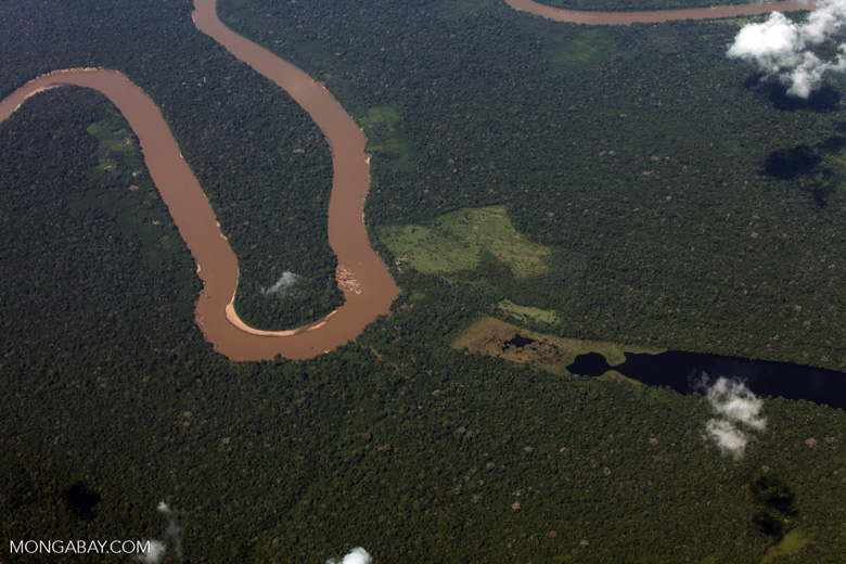
Banner image of western Amazon forest at the river’s edge. Photo credit: Sue Palminteri


