- The Philippines pioneered a community-based approach to marine protected area management in 1974, which balanced conservation and community livelihood. This became the blueprint of the more than 1,500 marine reserves in the country today.
- While the government depends on its MPA system in protecting its seascapes and meeting its international commitments, research suggest only a third of the country’s MPAs are well-managed and only protect around 1% of the country’s coral reefs.
- With management and resource challenges, these MPAs are threatened by overfishing and illegal fishing practices as well as the worsening impacts of climate change.
- Experts say strengthening the country’s larger MPA systems, synchronizing conservation with fisheries management policies, adapting newer models, and creating a network of MPAs may help the country buffer the impacts of climate change on its rich marine resources.
MANILA — In the town of Pilar in the central Philippines, a community of 11,308 residents looks after one of the most successful marine protected areas in the country: the Pilar Municipal Marine Park (PMMP). Established in 2005, the 179-hectare (443-acre) park stands out among the thousands of MPAs in the Philippines, which experts say are only protected on paper.
At the heart of the PMMP is a 29-hectare (72-acre) no-take zone, an area where fishing and all other marine activities are banned. Like in all MPAs, these no-take zones are spawning grounds for fish. To balance the livelihood needs of the community, the remaining 150 hectares (371 acres) of the PMMP have been allotted as a marine reserve open to limited fishing activities using non-destructive, basic fishing gear.
Susan Cataylo, a resident of Pilar, says the MPA was a lifesaver when Typhoon Haiyan struck in 2013 and cut her island off from the rest of the province of Cebu. “Camotes is far from Cebu City, which was also devastated by Haiyan,” she tells Mongabay. “If we waited for aid, we would have gone hungry. But the spillover fish from the MPA kept us alive.”
Rene Abesamis, the country’s foremost expert on MPAs, says marine reserves are known as such since they function as “piggy banks” — a stop-gap resource to alleviate community needs during drastic events.
Governments and communities have recognized the importance of MPAs in boosting fish stocks, generating local income through tourism, and cushioning climate change impacts, which in the Philippines manifest as a string of late-season super typhoons from the Pacific. The Philippines puts its MPA system at the forefront of its conservation strategy: In 2020, the country reported protecting 9.7% of its seascapes, narrowly missing its commitment under the Convention on Biological Diversity’s Aichi Biodiversity Targets to protect 10% of coastal and marine areas by 2020.

Yet the country’s accomplishments in sustaining its more than 1,500 MPAs have been beset with challenges. Experts say it’s possible that only a third of the country’s MPAs are well-managed, and the collective coverage of no-take zones barely protects the country’s corals.
While some MPAs report high fish abundance, overfishing in the areas surrounding these MPAs and the intrusion by fishing vessels due to weak monitoring and enforcement structures have doomed these reserves to the extent that experts call them “dummy parks” — protected on paper but not on the ground.
Experts point to various “moving parts,” factors that contribute to the effectiveness of marine protected areas and their promised bounty. At the top, laws and policies collide and overlap. On the ground, changing political will and community engagement exacerbated by resource limitations weaken the effectiveness of MPAs both as a conservation and a fisheries management model.
Varying levels of protection
Policies in the 1970s and 1980s focused on increasing fish yields, and the string of seas threading through the central Philippines became a playground for fishers using destructive gear. Fishing with cyanide-loaded explosives was the norm, so was the use of trawling techniques called muro-ami, baling-baling and hulbot-hulbot in the Visayan tongue. Despite the ban on these methods, recent studies show that some are still in use today.
The country is considered the “center of marine biodiversity in the world” by the Global Marine Species Assessment of the World Conservation Union, a designation that highlights its importance in the Pacific Coral Triangle. The country’s waters contain the third most extensive reef system in the world, spanning about 22,000 square kilometers (8,500 square miles). Threatened by coastal development, pollution, overfishing and destructive fishing practices, how the Philippines manages its seascapes impacts global marine conservation, a study states.
In the last decade, the Philippines lost one-third of its coral cover, and nearly 75% of the country’s fishing grounds are overfished — figures based on assessments done a decade ago, which means the situation may have worsened today, says Oceana Philippines, a marine NGO.
Coral protection was the focus of the MPA movement in the 1970s, and marine protected areas back then were adapted to allow corals to regenerate and to improve decreasing fish stocks. Initiatives started in two areas: off Sumilon Island, established in 1974, and Apo Island, in 1984. Both located in the central Philippines, these MPAs became the blueprint for the more than 1,500 MPAs that now dot the country’s waters: small, averaging just 15 hectares (37 acres); close to shore; and, most importantly, co-managed by the local government and the coastal community.
Studies by Angel Alcala and Gary Russ of Australia’s James Cook University show that MPAs can contribute directly to fish biomass and diversity. An MPA with limited to no fishing activities can see a rebound in fish stocks, as was the case in Apo Island. By contrast, Sumilon failed to meet its purpose of replenishing fish stocks and coral rehabilitation when it was opened for fishing for 10 years. Both case studies highlight the importance of protecting the most ecologically important part of the seascape, the “core zone,” which is usually the spawning ground for fish.

But to sustain a community-managed reserve requires social preparations, says Abesamis. “You can’t just tell fisherfolk to stop fishing in an area that’s important to their livelihood,” he says. “There’s a psychological impact in creating an MPA and there’s a lot of social preparations necessary to establish one.”
In Sumilon and Apo, locals’ livelihoods were a major consideration, if not the main driving force. Alcala tells Mongabay that the corals around the islands were zoned into two parts: 15-25% of the area of these reefs was within no-take zones, and the remainder was opened to “fishermen using only non-destructive fishing methods.”
While the country’s MPAs started small, Alcala pushed for a bigger system when he was appointed secretary of the Department of Environment and Natural Resources (DENR) in 1992. He influenced the creation of expansive, government-managed MPAs through the National Integrated Protected Area Systems (NIPAS) Act, which provided legal protection to three marine seascapes in 1992.
It would take 26 years, however, before the Philippines issued a follow-up: In 2018, the government enacted the Expanded National Integrated Protected Area Systems (E-NIPAS), supporting 32 marine protected areas with legislation, and including Apo Island under this protection scheme. Currently, the Visayas region holds the greatest number of NIPAS sites with seven MPAs covering 548,157 hectares (1.35 million acres).
The slow road to legislating government-managed MPAs, prompted local governments and communities to establish smaller ones in the 1990s through the Local Government Code (LGU Code), which gave them power to enact ordinances. This saw the mushrooming of 564 MPAs in the thousands of scattered islands in the Visayas, making it the region that holds a third of the country’s MPAs today.
While NIPAS and E-NIPAS sites receive steady funding from the national treasury, community-managed MPAs depend on a budget allocated by local officials, which are most often sourced from tourism receipts. As such, these sites have different levels of protection, their fates relying on political priorities.
More, but less
Pilar’s waters used to teem with reef fish species like the Napoleon wrasse (Cheilinus undulatus) and the bumphead parrotfish (Bolbometopon muricatum), Cataylo says. But during the 1990s, the parrotfish speared by fisherfolks were getting smaller in size, and by the 2000s, the seas were “empty” — devoid of fish, large or small. This forced fishers to go farther out to sea, up to 20 km (12 mi), spend more hours fishing and more money on motorized boats and expensive gear.
After Pilar established its protected area, the community devised a rigorous enforcement scheme that saw volunteers working in shifts to keep illegal fishers and poachers at bay. The results were immediate: In four years, the fish returned. Biophysical assessments done there, however, show the corals remain in poor condition. Despite this, the PMMP received the DENR’s “Para el MAR” award in 2009, a recognition given to well-managed MPAs in the country.
Pilar’s mayor said in 2009 that it was political will that led to the success of the PMMP. For community members like Cataylo, it was the enforcement: “When Haiyan struck, our watch house was washed away, but even then, we have volunteers watching over the marine protected area,” she says.
Other MPAs, however, are failing. In a study on community-managed marine protected areas in the Visayas in 2008, Alcala found that only about 34% of the 564 MPAs there were “working” in improving fish biomass. The lack of consistent monitoring and enforcement, compounded by meager community engagement, had created “dummy parks.”
Under the country’s Fisheries Code, municipalities are encouraged to establish fish reserves or sanctuaries to cover 15% of their waters. Today, barely 1% of municipal waters fall under the MPA scheme. Alcala says only 0.5% of municipal waters are designated as no-take MPA zones, and these areas only protect 2.7-3.4% of the country’s total coral reef area.
Abesamis takes it further. If he were to adapt Alcala’s 2008 study to assess the status of the country’s MPAs, it’s possible that only about 1% of the country’s corals are protected, he says, since two-thirds of the MPAs are not efficiently managed to begin with. “The current MPA count still fails to protect our country’s marine and coastal biodiversity,” he says. “The real counting should be closer to the ecological effect of these marine protected areas. Otherwise, it’s meaningless — we’ll continue to face effectiveness problems.”
Beyond corals
Experts point to a series of possible solutions: strengthening the country’s larger MPA systems, synchronizing conservation with fisheries management policies, adapting newer models, and creating a network of MPAs. “Larger MPAs, like Australia’s Great Barrier Reef, cover bigger areas so it’s protecting a larger ecosystem,” Abesamis says. “But when it comes to MPAs, the Philippines never moved beyond the small, nearshore level.”
Marine scientists are banking on marine protected networks — a series of interconnected MPAs, particularly no-take zones — to ease the protection gap. While efficient MPAs boost fish abundance, studies show that the waters surrounding isolated MPAs are burdened by heavy fishing activities and, in the worst cases, intrusion by commercial vessels capable of catching 800,000 kilograms of fish in a single trip.
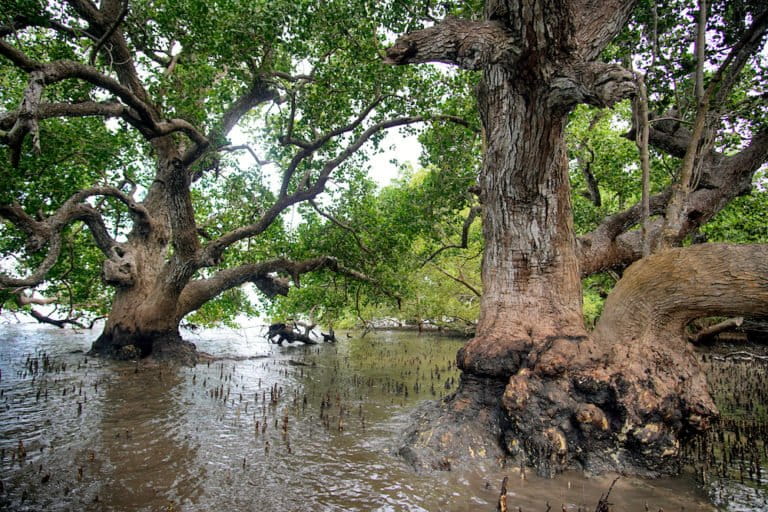
Interconnected MPAs, though, require a shift from a coral-centric mindset to one that treats all coastal areas as important to marine species. “Mangroves, seagrass beds, coral reefs — even the soft sandy bottoms,” Abesamis says. “These areas are part of a larger ecosystem that are well-connected physically and biochemically through the life cycle of certain fish and invertebrates. Ideally, a system of MPAs should be trying to protect all of these components, whether these are found in one MPA or in many different MPAs.”
Community acceptance of creating an MPA varies. Basic problems persist on the ground, including a knowledge gap about the marine resources, among others, and an aversion to closing 15% of municipal waters due to the perceived livelihood impact, Abesamis says. As such, the government has instead implemented closed fishing seasons in major fishing grounds to allow the fish population to rebound, with varying results.
In the Visayas region, though, communities like Pilar are receptive to MPAs due to the anticipated spillover of larval and adult fish driven by ocean currents moving northwest from the Pacific Ocean. “In the case of Apo Island, for example, we have evidence that fish larvae have spilled over to several areas in southwestern Negros Oriental province due to the prevailing ocean currents,” Alcala says.
For most governments, MPAs are attractive for their potential as tourism sites, as has been shown by successful ecotourism cases in Palawan. On the island of Panglao, another protected area in the Visayas, the municipality earned at least 11 million pesos ($230,000) from collecting environmental user fees from its more than five diving sites after the better-known Boracay Island closed down for rehabilitation in 2018 and divers looked for alternative sites.
Alcala says it’s necessary to repeat the surveys to determine the current state of the country’s MPAs and adopt newer methods. Current methods of administering these protected areas may be “too difficult” for MPA managers, resulting in irregular monitoring.
“One challenge in the management of MPAs is the adoption of newer methods and techniques in determining live coral cover and the fish biomass inside and outside of no-take zones,” Alcala says. “Our present techniques should give way to the newer technologies to make it easier for people to monitor their MPAs for coral cover and fish biomass.”
Establishing these networks, however, faces the same bottleneck in sustaining single MPAs: Politics.
‘Area feud’
Marine protected areas in the Philippines are small for political reasons. Their borders end where the neighboring municipality’s border begins. The seas flow unimpeded, but administratively they’re delineated by invisible lines, cut apart as if each were a thriving ecosystem on its own.
On the ground, experts say the prevailing framework for managing these MPAs is beset by overlapping policies between local governments and national agencies, as well as party politics at the local level.
Jurisdiction over marine areas is governed by complex, and at times overlapping, policies. More than 90% of the Philippines’ MPAs fall within municipal waters, which are under the jurisdiction of local governments. But once an MPA is included in the NIPAS or E-NIPAS system, its management becomes the responsibility of the DENR’s Protected Area Management Board.
This raises questions among local mayors, says Dennis Calvan of Rare Philippines. “Overlapping policies is one of the primary challenges being faced by our partner communities,” he says. “We are often asked: ‘How do we define municipal waters that are within protected areas?’”

Coastal management includes not just conservation but enforcement schemes. Crucially, it also encompasses streamlining conservation initiatives with fisheries plans, Calvan says. “In some MPA areas under NIPAS, there are no fisheries management plan, and yet, these areas are also among the country’s prime fishing grounds,” he says. “How to marry the conservation objectives of NIPAS and E-NIPAS with the production goals of the Fisheries Code is a persistent challenge — and it’s a big issue that needs to be addressed.”
While concessions have been made, in part due to local governments exerting their rights over MPAs, it’s unclear whether community-managed MPAs under the NIPAS and E-NIPAS structures receive budget allocations from the DENR. In the same vein, smaller MPAs sourcing funds from local governments may need a steadier flow of financing, especially during the pandemic, Abesamis says.
There have been efforts to create a network, both of MPAs and their managers. In northern Palawan, 18 municipalities created a network to link the 15 MPAs spanning 1,378 hectares (3,405 acres) in Coron, Culion, Calauit and Linacapan. Under this network, communities share expenses to cover monitoring and enforcement. Jose Mazo, chair of the network, tells Mongabay that joining forces has allowed them to cushion the impacts of the pandemic, which forced them to shut their marine parks and cut off their revenue streams.
Putting that system in place, however, took a decade, Mazo says. “At the onset, mayors tend to be hot and cold on the MPA network — one mayor likes it but when that mayor gets defeated by his opponent in the elections, the next mayor is averse to the network,” Mazo says. “We need to persuade them to support the MPA system again … It’s an area feud, you see. Sometimes, mayors from different political parties don’t want to talk to each other so the meetings stall.”
Conservation-fishing nexus
Another major problem besetting the country’s MPAs is the encroachment of commercial vessels into municipal waters. While considered illegal under the country’s fisheries law, these intrusions persist and may have gotten worse during the pandemic.
Figures from Oceana Philippines culled from the VIIRS vessel-tracking technology show that 40,204 commercial vessels entered Philippine municipal waters in 2020. Around 1,412 were detected in 15 larger MPAs, mostly in the Ticao Burias Pass Protected Seascape, in the Turtle Islands Marine Sanctuary on the border with Malaysia, and in the Malampaya Sound Protected Seascape and Landscape in Palawan.
“These vessels say that they are harboring there from inclement weather but the occurrence is too frequent to be ignored,” says Gloria Estenzo Ramos, vice president of Oceana Philippines. The presence of commercial vessels in municipal waters is particularly dangerous for communities and MPAs, Oceana says. An artisanal fisherman catches an average of 5 kilograms (11 pounds) of fish after a five-hour trip, but a commercial vessel could catch 800,000 kilograms — a disparity that impacts the sustainability of fish stocks within community waters and of MPAs.

While the government has invested in campaigning against illegal fishing, a recent report released by the USAID and the Bureau of Fisheries and Aquatic Resources (BFAR) calculates that 27-40% of fish caught in 2019 — valued at approximately 62 billion pesos ($1.3 billion) — are caught illegally. At least 30,000 municipal fishing vessels are unregistered, and commercial fishers fail to report up to 422,000 metric tons of fish catch each year.
For local fishers, the presence of commercial vessels within their waters — and within MPAs they manage and protect — can be disheartening. “We take turns watching over our MPA because if you volunteer to watch over it, you can’t go fishing,” says Ernesto Gabrino, a fisherman in Leyte, a province in the country’s eastern border region. “But those commercial vessels sneak in, take all the fish and in just one trip for them, our effort and sacrifices are wasted.”
The declining status of the Philippines’ seascape and the gravity of illegal, underreported and unregistered fishing prompted the BFAR to craft a fisheries management areas (FMA) framework, which was implemented in 2019. Among its grander goals was to curb illegal fishing by streamlining public and private initiatives on the ground. Under the revised Fisheries Code, the government has implemented a vessel monitoring system (VMS) to keep tabs on boats encroaching within community waters. But this has been challenged by the commercial fisheries sector through a bill in Congress that would legalize their entry into municipal waters.
“We see this bill as a retaliation from the industry,” Oceana’s Ramos tells Mongabay. “If you look at the timeline, this bill was filed in the same month that the BFAR issued an order for the full implementation of the VMS.”
Bigger factors at play
Abesamis and Calvan have been working on the ground for decades: Abesamis as a marine scientist tasked by local governments and civil society groups to assess marine resources; and Calvan as a fisheries specialist focused on shifting illegal fishing behaviors. They work in different communities in the Philippines.
Mongabay interviewed them separately, yet they raised similar points: science- and evidence-based policies are important; establishing MPAs and changing fishing behavior need major social preparations; there’s a need to harmonize conservation and fisheries policies; and a need to stabilize funding for MPAs, which directly impacts enforcement. They also point to an important element: time.
Corals grow at decadal rates, Abesamis says, adding that natural populations of reef fish also take time to rebound. A decade is also the minimum period to change fishing behaviors, Calvan says, since implementing such programs require various consultations with communities. But time is a luxury: sea-level rise, ocean acidification, warming waters, and other related impacts of climate change threaten to decimate shallow coral ecosystems here.
“Climate change is expected to impact negatively on our marine resources,” says Alcala, the former environment secretary. “High temperatures could wipe out our shallow coral ecosystems, and we may have to extend the concept of MPAs to deeper reef systems beyond 40-50 meters [130-165 feet] where marine water temperatures are expected to remain cool and thus could help save reefs and their fish populations.”

The Philippine model of MPA management is deeply rooted in communities. But with figures showing that this mechanism isn’t providing the level of protection necessary to sustain the marine ecosystems, experts say working across local governments and establishing alliances to improve management may be the best way forward.
“In theory, a well-maintained MPA connected to a network should be able to buffer some of the impacts of climate change,” Abesamis says. “But looking at the figures now … would it be enough? Right now, it’s hard to be optimistic, but we do what we can.”
While possible solutions would take years, decades even, both Abesamis and Calvan agree on the need to engage with non-politicized players on the ground and secure the tenure of the Bantay Dagat, the sea wardens hired by mayors to enforce fisheries measures and, sometimes, to watch over MPAs.
“There’s a lot of governance structures that need to be present for MPAs to be sustained, and at the same time, a lot of these actions are also trying to catch up,” Abesamis says. “But as long as there’s support from the barangay or local community, that MPA will survive and can be sustained. You need good governance too — you can’t get around that. The day-by-day management will be done by people living on the coasts and they must be supported by local governments, even national governments.”
Citations:
Alcala, A. (1998). Community-based coastal resource management in the Philippines. Ocean & Coastal Management,38(2), 179-186. doi:10.1016/s0964-5691(97)00072-0
Alcala, A. C., Russ, G. R., Maypa, A. P., & Calumpong, H. P. (2005). A long-term, spatially replicated experimental test of the effect of marine reserves on local fish yields. Canadian Journal of Fisheries and Aquatic Sciences, 62(1), 98-108. doi:10.1139/f04-176
Campos, W. L., & Aliño, P. M. (2008). Recent advances in the management of marine protected areas in the Philippines. Kuroshio Science, 2(1), 29-34. Retrieved from http://hdl.handle.net/10126/3159
Horigue, V., Aliño, P. M., White, A. T., & Pressey, R. L. (2012). Marine protected area networks in the Philippines: Trends and challenges for establishment and governance. Ocean & Coastal Management, 64, 15-26. doi:10.1016/j.ocecoaman.2012.04.012
Licuanan, W. Y., Robles, R., & Reyes, M. (2019). Status and recent trends in coral reefs of the Philippines. Marine Pollution Bulletin, 142, 544–550. doi:10.1016/j.marpolbul.2019.04.013
Pollnac, R., & Seara, T. (2010). Factors influencing success of marine protected areas in the Visayas, Philippines as related to increasing protected area coverage. Environmental Management, 47(4), 584-592. doi:10.1007/s00267-010-9540-0
Russ, G. R., & Alcala, A. C. (1999). Management histories of Sumilon and Apo marine reserves, Philippines, and their influence on national marine resource policy. Coral Reefs, 18(4), 307-319. doi:10.1007/s003380050203
Selgrath, J. C., Gergel, S. E., & Vincent, A. C. (2018). Shifting gears: Diversification, intensification, and effort increases in small-scale fisheries (1950-2010). PLOS ONE, 13(3). doi:10.1371/journal.pone.0190232
Weeks, R., Russ, G. R., Alcala, A. C., & White, A. T. (2010). Effectiveness of marine protected areas in the Philippines for biodiversity Conservation. Conservation Biology, 24(2), 531-540. doi:10.1111/j.1523-1739.2009.01340.x
Wells, S., Ray, G. C., Gjerde, K. M., White, A. T., Muthiga, N., Bezaury Creel, J. E., . . . Reti, J. (2016). Building the future of MPAs – lessons from history. Aquatic Conservation: Marine and Freshwater Ecosystems, 26, 101-125. doi:10.1002/aqc.2680
White, A. T., Courtney, C. A., & Salamanca, A. (2002). Experience with marine protected area planning and management in the Philippines. Coastal Management, 30(1), 1-26. doi:10.1080/08920750252692599
Related stories:
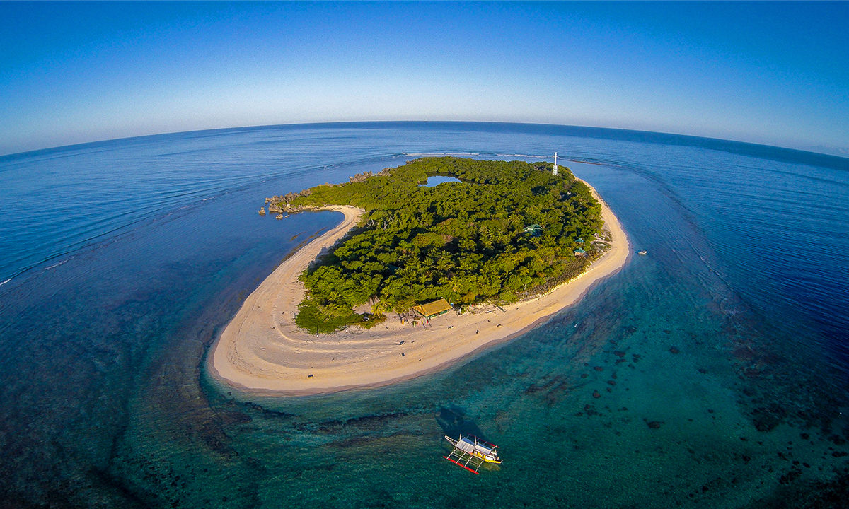
Banner image of Apo Island by macoy.mejia via Wikimedia Commons (CC BY-SA 4.0).
FEEDBACK: Use this form to send a message to the author of this post. If you want to post a public comment, you can do that at the bottom of the page.