- Using Sentinel-1 radar imagery from the European Space Agency, the Forest2020 project has mapped a part of Kenya’s previously hard-to-assess coastal forests.
- The project’s findings show that 45 percent of the 83.5 square kilometers (32 square miles) of mangrove forest in a pilot county is highly degraded and in need of rehabilitation.
- These initial micro-scale maps of Kenya’s mangrove forests will help local forest officers and communities in areas with receding or recovering mangroves to take necessary coastal protection measures.
Most of Kenya is arid, and lengthy droughts can lead to livestock loss, illegal grazing in protected areas, and violent interactions between nomadic herders and other landowners. Less known are its forests, located along its coast and along Lake Victoria, that are humid and often covered by clouds.

Using Sentinel-1 radar imagery, a multi-agency team says they are now able to map these previously hard-to-assess forests at the coast and in western Kenya, through a combination of satellite data acquisition and verification, processing and ground-truthing.
“This will now help us assess and monitor our national forest cover more accurately,” said Jamleck Ndambiri, deputy director of the Kenya Forest Service (KFS).
“But there were data gaps”
Historically, the Kenyan government depended on expensive and time-consuming ground surveys to inventory its forests. Between 2011 and 2013, the country engaged in its first-ever national forest mapping effort using satellite imaging technology, with funding from the Japanese government.
“The objective was to map all forest resources in the country while improving our capacity in the use of modern satellite imaging technologies,” Ndambiri said.
The project first trained local personnel from several relevant institutions and disciplines to use the new computing technologies and established a national Geographic Information System (GIS). Project data analysts combined Landsat images from 1990 to 2000 with images from the Japanese Advanced Land Observing Satellite (ALOS) from 2000 through 2010 to assess the extent of Kenya’s forests and changes in land cover over the 20-year period between 1990 and 2010.
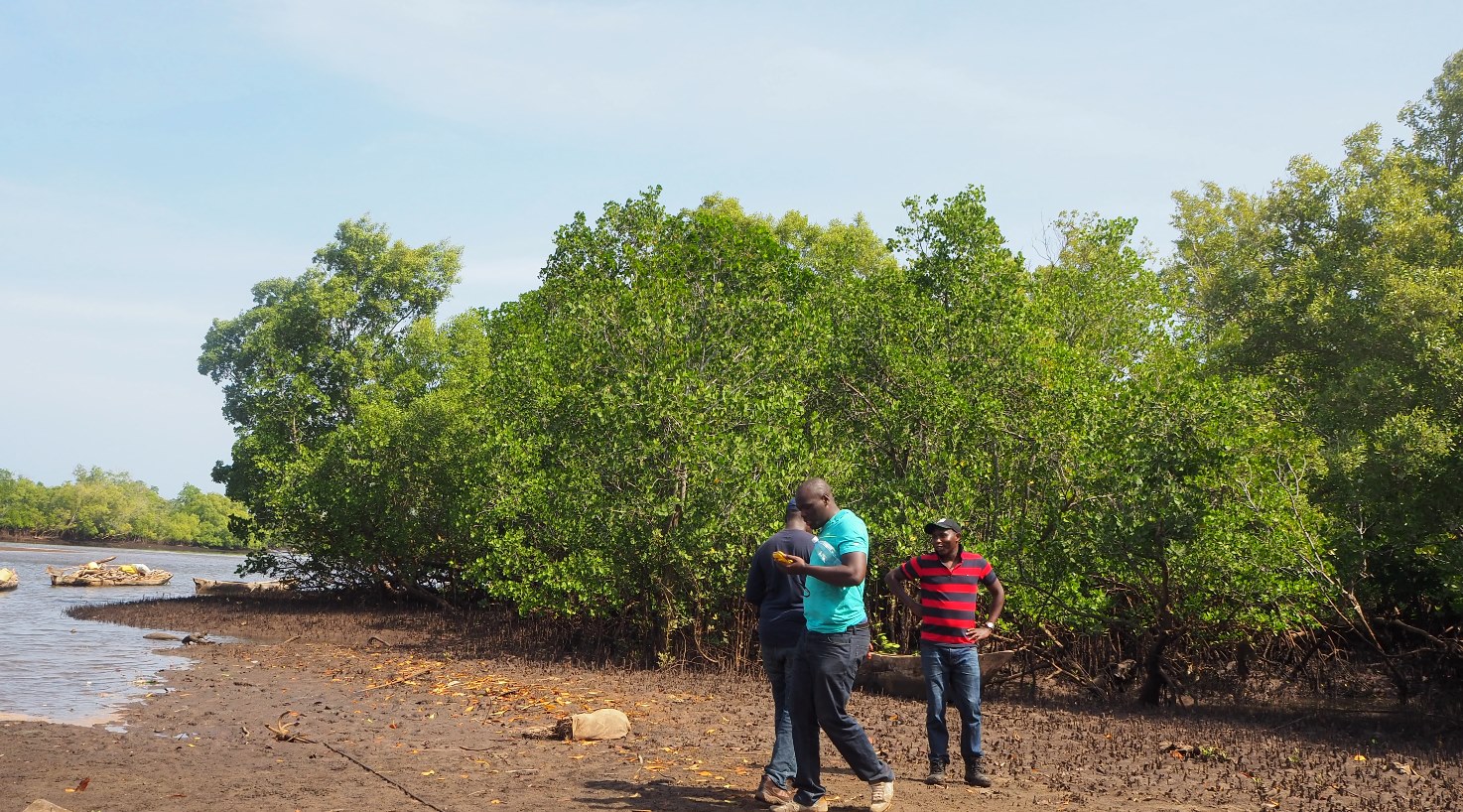
“This was a major leap in our forest assessment. It provided a baseline on which to track current and future land use changes,” Ndambiri said.
“But there were data gaps,” said Faith Mutwiri, a remote sensing officer with KFS, especially in two of the country’s frequently cloudy regions.
Parts of Kenya, particularly the coastal and western regions, experience persistent cloud cover for most of the year, due to their proximity to the Indian Ocean and Lake Victoria water bodies, respectively. Clouds present a barrier to light-dependent optical imaging satellites, such as Landsat, and KFS’s technical support provider urged the agency to adopt “cloudless imagery,” or radar to more accurately map these regions.
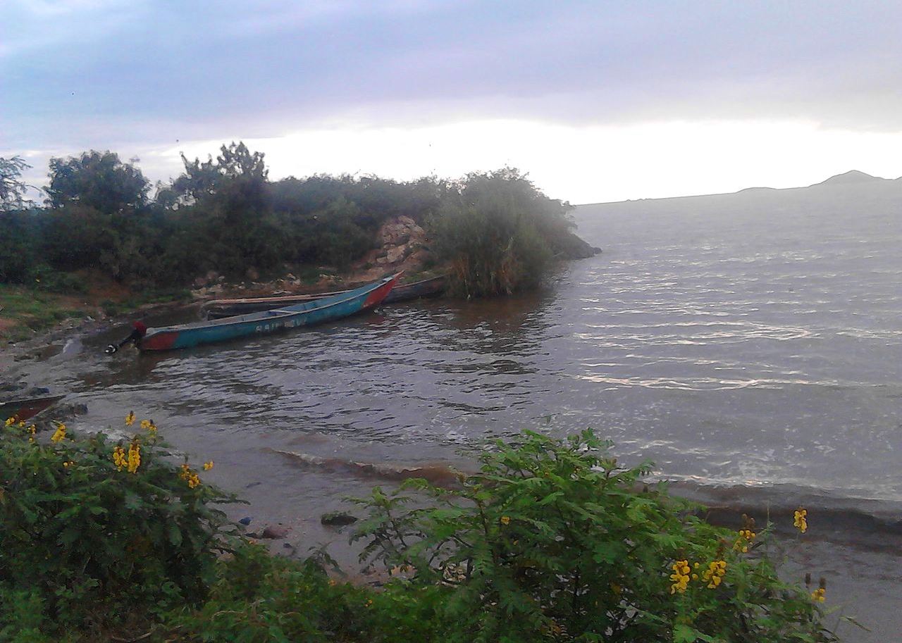
A 2013 study led by Bernard Kirui of the Kenya Marine and Fisheries Institute (KMFRI) that analyzed the Landsat data estimated that Kenya has 456 square kilometers (176 square miles) of mangrove forests along the coastal strip.
Kirui and colleagues estimated that 18 percent of the mangrove forest was lost during the 25 years to 2010. However, the high frequency of clouds in the coastal areas and the medium (30-meter, or 98-foot) resolution of the Landsat imagery used to analyze the complicated coastline may have caused the analysis to underestimate the area of coastal mangroves.
Other official documents indicate significant differences in mangrove forest cover. A 10-year National Mangrove Ecosystem Management proposal by the country’s Ministry of Environment and Forestry, which includes KFS, the mangrove forest cover at 613 square kilometers (237 square miles).
Mapping mangroves is important economically and ecologically. The low-lying coastal region is prone to frequent flooding, said Erick Okuku a research scientist at KMFRI. “Already the region is experiencing extreme climatic events, especially floods, droughts and strong winds,” Okuku said in a recent media briefing, “events that are projected to increase in frequency and intensity.”
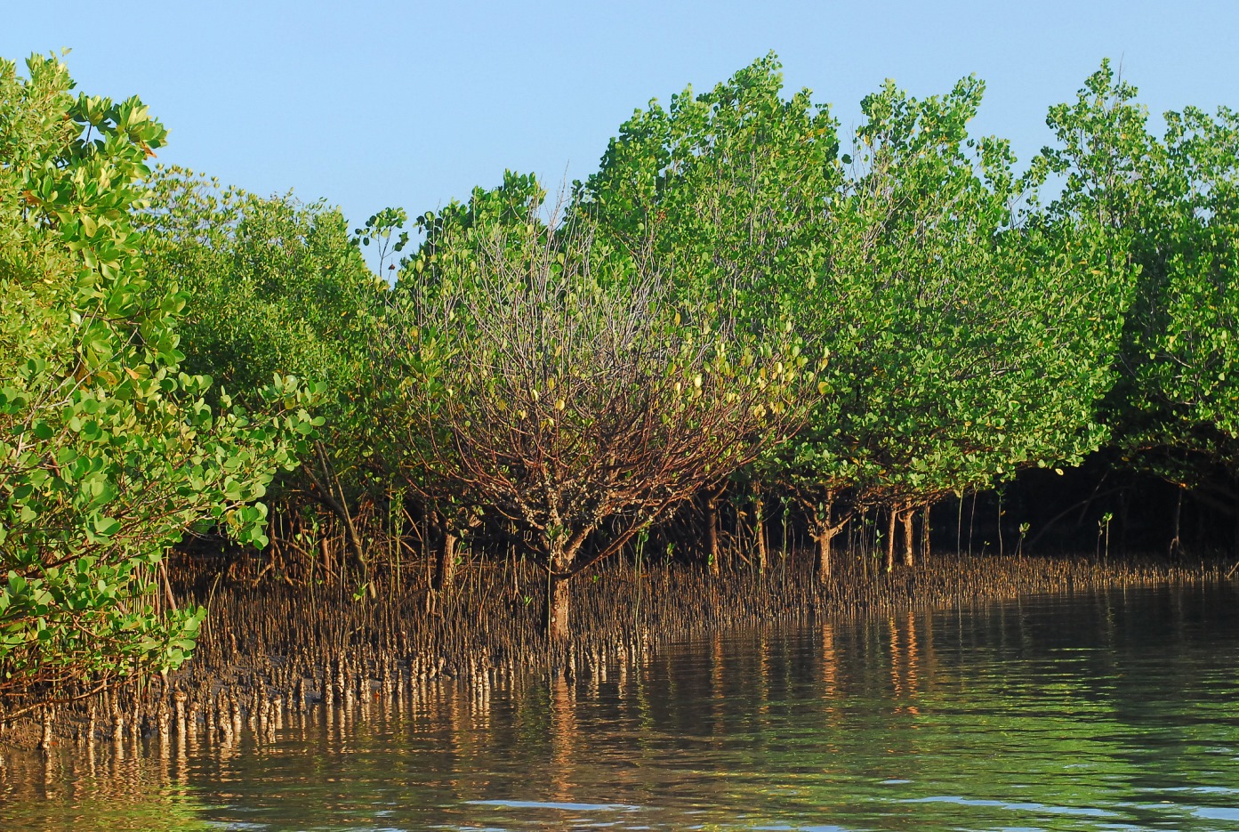
He added that rapid population growth, urbanization and climate change, have posed new challenges to livelihoods along the 600-kilometer (373-mile) coastline and that these events have exacerbated resource exploitation, especially of the area’s sensitive mangrove forests.
Radar to fill data gaps for cloudy areas
To address these gaps, Ndambiri said, KFS joined the Forest2020 project in 2014. Funded by the United Kingdom government through the UK Space Agency and coordinated by the consultancy firm Ecometrica, the project aims to help protect and restore tropical forests by improving forest monitoring in partner countries through the use of satellite data. Forest2020 also works in Ghana, Indonesia, Brazil, Colombia and Mexico.
The universities of Leicester and Edinburg in the UK provide technical assistance to the project. Locally, KFS is collaborating with Kenya Forestry Research Institute and Jomo Kenyatta University of Agriculture and Technology, both public institutions. The collaboration, said Ndambiri, has allowed for wider transfer of the new data collection, analyzing, processing and management technologies.
“We were looking for a system that is low-cost, quick to deliver, and independent of daylight and weather constraints,” said Mutwiri, the KFS remote sensing officer.
With these requirements, especially for mapping coastal forests, the Forest2020 team acquired image data from the Synthetic Aperture Radar (Sentinel-1) satellite. Sentinel-1 is one of two weather- and daylight-independent radar satellites launched by the European Space Agency in 2014. The Sentinel-1 project, which focuses on land and ocean monitoring, provides a constant supply of free, 20-meter (66-foot) resolution radar data for the entire planet.
The Kenya forest mapping project targeted 2,039 square kilometers (787 square miles) of Kwale County, one of six counties in the coastal region, which together cover about 80,000 square kilometers (30,888 square miles). “This was a pilot run to develop a competent methodology that, if successful, could be replicated in the whole coastal region and other areas of persistent cloud cover,” Mutwiri said.
The project team acquired and processed Sentinel-1 images for the prescribed area during September and October 2017, applying various data processing algorithms to classify the Kwale vegetation and land uses. To resolve persistent misclassifications, such as between mangroves and terrestrial forests, the team used DT – Decision Tree software.

With a draft map in hand showing the land use patterns across Kwale County human settlements, grasslands, farmlands, water bodies and forest types, “we were ready to go to the field for ground verification, or truthing,” Mutwiri said. This involved verifying whether the classifications in the draft map showed what was actually on the ground.
Their draft classifications, Mutwiri said, had a 78-percent accuracy, which is considered highly satisfactory. They used their ground verification data to further improve the map’s accuracy to 85 percent. “And that is how we got an effective and replicable methodology for the mapping of forest cover in cloud-persistent areas in our country,” says Ndambiri.
“Our results demonstrate that radar provides a good platform for monitoring forestry in mangrove and other forest ecosystems under persistent cloud cover,” wrote the Kenya Forest2020 team on the research project site ResearchGate.
But the current data suggest intense exploitation mangrove forests by a growing human population. Mangroves protect coastlines from storms and erosion, store atmospheric carbon, and are crucial for fish stocks. Many fish species breed and develop under mangroves for protection against predation and strong currents.
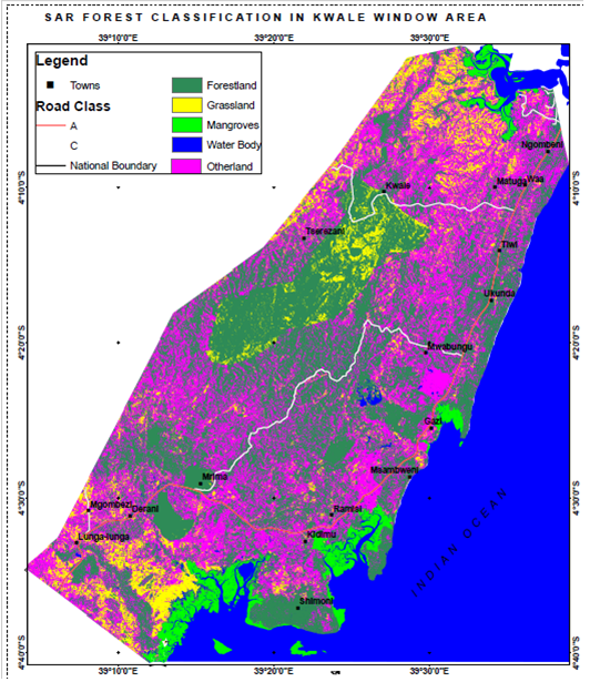
The project’s findings show that 45 percent of the 83.5 square kilometers (32 square miles) of mangrove forest in Kwale County is highly degraded and in need of rehabilitation. Most depleted, Ndambiri said, are Rhizophora and Ceriops mangrove species, which local communities exploit to produce building poles and firewood.
In the study area’s Gazi Bay and Kiduma villages, for example, residents rely heavily on the surrounding mangrove forests to build their houses, furniture, and boats; consequently, the ground-truthing revealed, approximately 70 percent of mangrove forests in these and other densely populated areas consisted of crooked trees, which are in low demand.
Applying radar data across forest types
Poor internet connectivity and slow downloads times sometimes hindered their work to map these forests in detail, Mutwiri said, as did regular power outages, which are not unusual in the country.
Despite the operational challenges, “this is the first time actual mapping of a mangrove forest has been done in Kenya at such a micro scale,” Mutwiri said. “We have managed very detailed maps of the target area, which we will soon share with our implementing units.”
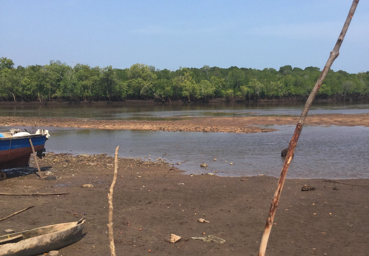
For example, in areas showing either receding or recovering mangroves, KFS will alert local forest officers and communities to take necessary measures. Ndambiri says KFS plans map the rest of the coastal forests between now and next year and share the findings with local communities through its county conservator’s office.
Mutwiri said that mapping of the coastal forest is just one of several activities of the Forest2020 initiative. Others include an ongoing biomass pilot study of Kenya’s dryland forests and levels of degradation in the 1,200 square-kilometer (463 square-mile) Cherangani forest in the Rift Valley.
KFS expects to roll out the tool for use at a national scale for forest and biomass monitoring. Current estimates show Kenya’s land area is roughly seven percent forest cover, against its target of 10 percent. Once KFS has mapped the forests in cloud-persistent and dryland forest areas, Ndambiri said, the agency will have a more accurate estimate of the national forest cover for future analyses.
Citation
Kirui, K. B., Kairo, J. G., Bosire, J., Viergever, K. M., Rudra, S., Huxham, M., & Briers, R. A. (2013). Mapping of mangrove forest land cover change along the Kenya coastline using Landsat imagery. Ocean & Coastal Management, 83, 19-24.


