- A pair of drones and the efforts of nearly 3,000 volunteers are helping scientists study tree canopies within a Peruvian rainforest, representing a new paradigm of crowdsourced research.
- Citizen scientists in the Amazon Aerobotany project helped analyze over 5,700 aerial images to count trees and monitor their leafing, flowering, and fruiting cycles.
- Ensuring the quality of data collected using citizen science takes planning, effort, and time but can harness the experience of a world of new collaborators.
A pair of drones and the efforts of nearly 3,000 volunteers have helped scientists carry out a detailed study of the trees within a 400-hectare (1,000-acre) patch of the Amazon, in what the researchers are welcoming as a new paradigm of crowdsourced research.
The Amazon Aerobotany project, part of a series of “Wired Amazon” projects sponsored by the Rainforest Expeditions ecotourism company, aims to apply new technologies and methods to the costly and labor-intensive task of monitoring the rainforest canopy.
“I saw a great opportunity to collect high-resolution imagery of the rainforest canopy that could be analyzed with the help of citizen science volunteers to generate useful data for ecological monitoring and conservation efforts,” ecologist and project lead Varun Swamy wrote in an email to Mongabay-Wildtech.

“We created the Amazon Aerobotany project using the free, open-source tools available on The Zooniverse, which also hosts the project and informs Zooniverse users across the world of its existence,” he added.
The project studies how the phenology (the leafing, flowering and fruiting cycles) of rainforest trees in the southwestern Amazon varies by season and by year. It also examines how this variability may be influenced by climatic factors, primarily temperature and rainfall. These cycles drive not just animal diets, but also the pollination of flowers and the dispersal of seeds, which, in turn, influence which trees reproduce and where.

The project also investigates tree population demography, including births, deaths and age structure. Researchers typically investigate the demography of tree populations by identifying, counting and measuring trees of all ages in the field, which can be expensive, laborious and time-consuming.
Taking botany to the skies
Swamy and his colleagues flew DJI Phantom 3 and 4 Pro unmanned aerial vehicles (UAVs), or drones, over a 400-ha ecotourism concession on the edge of the Tambopata National Reserve in southeastern Peru and took aerial photos of the forest canopy below. Both models have integrated cameras that can capture high-resolution still images and video.
The drones flew at a fixed altitude of 65 to 70 meters (213 to 230 feet) above ground while continuously capturing images with a 10 to 20 percent overlap, covering some 40 to 60 ha (99 to 148 acres) per flight, Swamy said.
The team’s goal was to use the aerial photos of the entire concession to collect phenological data of canopy trees, as well as demographic data on a common, ecologically important palm species called huasaí (Euterpe precatoria).
Swamy stressed the importance of preparation when adding new technology, such as UAVs, to research in a difficult setting like an intact rainforest. “It’s critical to understand the possibilities and limitations of the UAV model early on — battery life, flight time, camera resolution and features, drone flight software features — and plan accordingly,” he said. “Be prepared for unexpected disasters at any moment — we actually lost a UAV to an attack by a flock of swallow-tailed kites!”
 |
 |
 |
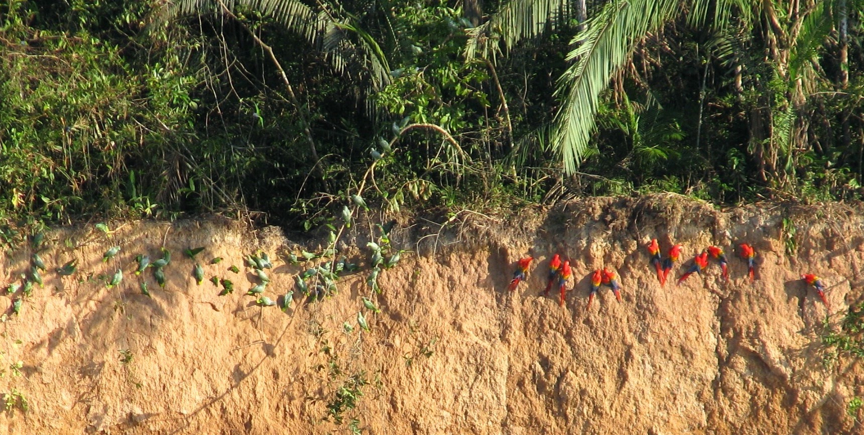
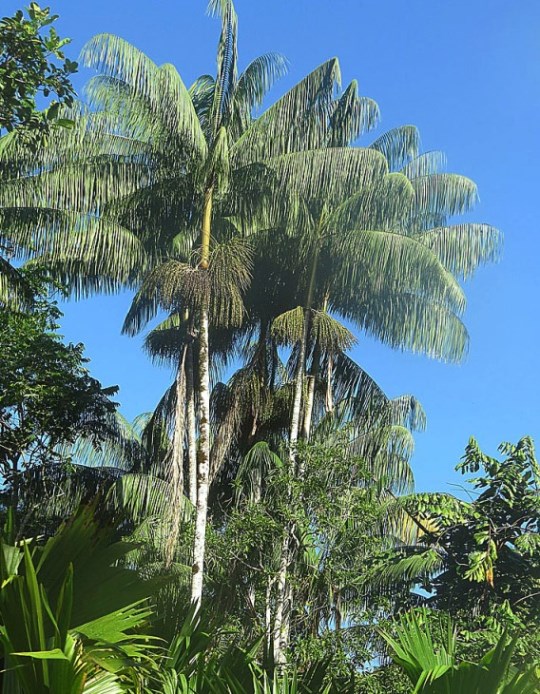
Amazon Aerobotany’s target tree crown types, which are distinguishable by citizen scientists from aerial images and identified with white circles. The distinct long leaves of the huasaí palms on the right. Image credits: Amazon Aerobotany
Bringing citizen science to long-term research
As access to aerial and satellite imagery expands, scientists seek cost-effective ways of educating and generating useful data from the images. Swamy turned to Zooniverse to bring volunteers on board to help assess the populations of several rainforest tree species that were photographed from the UAV-mounted cameras.
Zooniverse is the world’s largest platform pairing remote volunteers with professionals leading more than 50 participating research projects. The hundreds of thousands of volunteers from around the world help to collect, assess and verify information for studies that might not be possible or practical otherwise.
“Basically, the volunteers examine thousands of images of the rainforest canopy taken by the drone and uploaded onto Zooniverse,” Swamy said. “[They] log observations of interest in each image using the tools provided on Zooniverse, following instructions and examples we have provided. For the first iteration of Aerobotany, it involved drawing circles around crowns of flowering and leafless canopy trees, as well as huasaí individuals.”

The inner stem of the huasaí, known as palmito, or heart of palm, is a prized crop, which has led to overharvesting of the trees. Huasaí fruit is an important food for rainforest mammals, including monkeys and tapirs, and a popular snack for local human residents as well. Knowing the palm’s population status in a given area allows for better management.
Importantly for the Aerobotany work, the crowns of the huasaí and other palms have a distinctive shape that makes them easy to recognize in an aerial image of the rainforest canopy. The project trained volunteers to identify these crowns in the high-resolution UAV photos. Beginning in October 2016, nearly 3,000 volunteers made over 91,000 classifications of more than 5,700 tree subjects to complete the “data collection” of the first set of UAV images.
Photographing the canopy from above, making the UAV images accessible and coordinating the online review of the images by volunteers worldwide required combining several relatively new technologies. Nevertheless, the combination may offer a quicker, cheaper alternative to monthly field measurements and facilitate tree canopy research. After a full year of monitoring, the Amazon Aerobotany team is analyzing the counts to assess both the population and the process.

The initial counts will serve as baseline population distributions, and the project expects to repeat the population assessments each year.
Launching soon is a new iteration of Aerobotany that will focus on the phenology and ecological health of individual crowns of 145 castaña (Bertholletia excelsa), or brazil nut trees. Volunteers on this project will be studying the crowns of individual castaña trees to record health indicators such as broken branches and the presence of liana vines, as well as phenological activity, and count the number of visible fruit.
“The castaña tree is a cornerstone of the regional economy in the eastern Madre de Dios basin,” Swamy said. “Our goal is to generate data on health, phenology and fecundity of castaña trees that will be of immediate and long-term value to efforts aimed at sustainable resource extraction within thousands of square kilometers of primary forest in the Madre de Dios basin that are facing existential threats from unsustainable land use such as mining, logging, cattle ranching and agriculture.”

The data, both the raw images and the volunteers’ classifications, are freely accessible via Zooniverse. The Aerobotany team also plans to include an open-access version of the dataset used in their analyses in their eventual peer-reviewed scientific publication.
Quality control for citizen science data
Reaching this stage using data generated by citizen scientists, as well as managing and communicating with citizen scientists across the world, is “a MAJOR time investment,” Swamy said.
“The big challenge with citizen science data,” he said, “is ensuring adequate and consistent data quality — which, as you can imagine with contributions from thousands of volunteers with a wide range of experience, skill and attention to detail — involves considerable effort.”

He suggested that researchers interested in employing crowd-sourced data collection should carefully consider the feasibility and logistics before getting started and have a solid plan for their long-term data collection.
It takes “a HUGE amount of effort to design and launch a citizen science project that has even a hope of yielding valid, useful data … of sufficient quality for analysis that will ultimately prove useful for scientific research and management/conservation efforts,” Swamy said.
He recommended having a team member who is well-versed in data management to validate the data collected by citizen scientists and confirm whether it’s usable. “That said,” he added, “citizen science projects really highlight the potential to harness experience and brain power from all over the world. It really is a completely different and promising new paradigm for scientific research.”


