- A study that looked at changes in forest cover in 129 Indigenous territories in Brazil’s Atlantic Forest between 1995 and 2016 has found that deforestation rates were lower and reforestation rates higher in those where land tenure had been formalized.
- Among the reasons for this, researchers suggest, is the fact that Indigenous peoples felt more encouraged to revive the forest, safe in the knowledge that they will be protected by the law.
- However, securing land tenure, a process known as demarcation, has proved difficult for many Indigenous communities, with former president Jair Bolsonaro refusing to sign off on any demarcation during his time in office from 2019-2022.
- Under the new president, Luiz Inácio Lula da Silva, Indigenous leaders say they’re more optimistic about having their land tenure formally recognized.
PERUÍBE, Brazil — On Oct. 2, 2020, Brazil’s Supreme Federal Court overruled the marco temporal cutoff criteria for demarcating Indigenous lands, and upheld the 2016 homologation of the Piaçaguera Indigenous Territory. The court’s verdict came as a relief to the families of the last coastal piece of Tupi-Guarani land in Brazil’s southeast region, in the middle of the Atlantic Forest.
The long-drawn-out demarcation process, ending with the homologation that officially recognizes the land as Indigenous territory, began in 2000. That was the year when the Indigenous families returned to this area in São Paulo state after being evicted by squatters. Since then, they’ve had to hold out for two decades against attempts to retake and destroy their territory, which covers 2,795 hectares (6,907 acres) and is today home to 11 villages and 358 residents.
For eight of those years, they resisted a campaign of harassment led by controversial businessman Eike Batista, at one point the richest person in Brazil and No. 7 in the world. Batista, who in 2018 was convicted and sentenced to 30 years in prison for bribing a public official in exchange for state contracts, had tried — and failed — to convince the Indigenous families to sell part of their land to him to build what would have been the largest port in Brazil.
In 2011, the families blocked a concession that had allowed a mining company to extract sand in the region. That operation had left a cratered moonscape after five decades of exploitation, and the company, which claimed to own four plots of land overlapping with the Piaçaguera Indigenous Territory, repeatedly raised legal obstacles to prevent the demarcation of the land.
Seven years later, the families fought off plans for a coal-fired power plant and port in the municipality of Peruíbe, as well as a gas pipeline and a transmission line that would have cut across the coastline as far as the port of Santos and city of Cubatão, some 80 kilometers (50 miles) away.
“A lot of bad things were happening,” says Indigenous leader Catarina Delfina, one of the figures behind the reclamation of the territory at the turn of the millennium. “However, this changed quite a bit after we founded the first community and after the homologation later on.”
She says she remembers the sandbanks improving and the forest growing back. “But there are still people eyeing up our ancestral lands, which were the meeting point between Indigenous people who came from the northern and southern stretches of the coastline before the Portuguese arrived,” Catarina says. “This is the only area into which Peruíbe can expand, and the non-Indigenous people want to get their hands on it because it’s a spot near the beach, which is worth more money.”
At 73, Catarina, or Nimbopyruá as she’s called in her native language, says she’s satisfied to have preserved the forest and the ancestral heritage of her people. But she says she will only be able to relax once the odious prospect of the marco temporal is declared unconstitutional. Under the controversial criteria, Indigenous peoples are only entitled to claim lands they were occupying at the time that Brazil’s current Constitution came into effect in 1988.
“The demarcation and homologation processes are important in that they allow us to work on the territory, bring projects here and add things to the village, like the school and reforestation projects. Can you imagine if [our rights to] these lands are revoked again?” Catarina says.

Where there are Indigenous people, the forest grows back
The Tupi-Guarani leader’s words about the importance of holding legal tenure over their land echo the findings of a recently published study. The paper demonstrated how fully demarcated and homologated territories in the Atlantic Forest typically experience less deforestation and more reforestation.
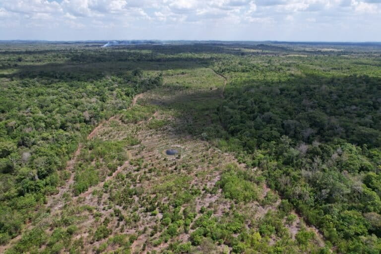
It analyzed changes in forest cover in 129 Indigenous territories, including Piaçaguera, between 1995 and 2016. The results showed forest cover change was 0.77 percentage points higher per year in tenured versus non-tenured lands. The Piaçaguera Indigenous Territory, according to unpublished preliminary data shared with Mongabay, regained 55 hectares of rainforest over the period, equivalent to 2% of its total surface area.
In some Indigenous territories, the increase in forest cover surpassed 20% of the total surface area of the territory. This was the case in the Toldo Pinhal and Toldo Chimbangue Indigenous territories, both of which are located in the state of Santa Catarina and are home to the Kaingang Indigenous people, which recorded increases of 27.8% and 21.1%, respectively, over the course of the study period.
“The study focused on average trends and was not intended to look at specific cases. But there are possibilities to explain the circumstances,” says study lead author Rayna Benzeev, a tropical reforestation researcher at the University of California, Berkeley.
“One of them is the presence of non-Indigenous people in the territories before land rights were recognized, since after Indigenous tenure is established they are forbidden to use the land. Another possibility is that, once they were ratified, the federal government was obliged by law to enforce the rights of the Indigenous Territories, and the Indigenous communities can invest more into it when they can be sure that they will be protected.”
According to Benzeev, demarcation processes have ground to a halt in many Indigenous territories across Brazil. The country’s previous president, Jair Bolsonaro, vowed to not demarcate “a single centimeter” of Indigenous land, and did just that during his time in office from 2019 to 2022. The new government, under Luiz Inácio Lula da Silva, has the opportunity to reverse this by abiding by the Constitution and granting Indigenous peoples their right to self-determination. “Our discoveries have brought an environmental argument to the table for the recognition of Indigenous peoples’ legal rights to their land in Brazil’s Atlantic Forest,” Benzeev says.
Study co-author Marcelo Rauber, from the Federal Rural University of Rio de Janeiro (UFRRJ), notes that the Atlantic Forest is the most degraded biome in Brazil, subjected for centuries to pressure from urbanization, economic development, and high population density.
“This is the first rigorous analysis of the effects of ownership of Indigenous territories in this biome and fills a gap in most previous studies that have evaluated this relationship in remote locations,” says Rauber, whose research has focused on public policies for Indigenous peoples and land conflicts involving the demarcation process in Brazil.
In contrast to the Amazon Rainforest, where deforestation started to increase from the 1970s onward and where 80% of the rainforest still stands, the Atlantic Forest, one of the most biodiverse spots on the planet, had been assailed since the 16th century. It has experienced the highest rates of deforestation in the past two centuries, which have reduced the size of the forest to just 12% of its original area.

On Pataxó land, the struggle continues
“A large part of the conflicts relating to the demarcation of land occur in the Atlantic Forest, in the South, Southeast and Northeast regions, not in the Amazon, where a large part of Indigenous lands have been ratified,” Rauber says. “There they suffer from other kinds of problems, such as looting and land invasions.”
He points to the Pataxó territories of Barra Velha and Comexatiba, in the far south of the northeastern state of Bahia, as examples of areas that are still awaiting the conclusion of demarcation, and where pressure from deforestation and land conflicts persists.
“Claims have been made to the land since 1950 and, since the 1980s, heavy deforestation has taken place in the area that has not been demarcated in order to use the land for sand mining and livestock raising, mainly cattle,” Rauber says. “The forest that was left over was only protected because of the existence of Monte Pascoal National Park, which overlaps with the land that has been claimed [as Indigenous territory].”
The national park was designated in 1961, covering 22,383 hectares (55,310 acres), of which 8,500 hectares (21,000 acres) were reserved for Indigenous communities to settle in, making it the only legally enshrined Pataxó territory in the south of Bahia.
At the start of 2023, two young Pataxó men leading the occupation of a farm in the Comexatiba territory were gunned down and killed. Indigenous rights campaigners met with police and officials from Funai, the federal agency for Indigenous affairs, to demand an urgent investigation and call for a greater security presence in the area in the face of ongoing attacks on the community.

Aruã Pataxó, an Indigenous cacique, or chief, and president of the Indigenous Federation of the Pataxó and Tupinambá Nations of the Far South of Bahia (FINPAT), says it’s important to have effective demarcation to curb these waves of violence.
“We are fighting hard for the formalization of the ownership of our land. Now in the Barra Velha and Comexatiba Indigenous territories we are going through a process of self-demarcation,” he says. “Lives have been lost in this struggle. Four young Indigenous men were murdered at the armed hands of the state of Bahia. Military police are serving as gunmen for ranchers. Five police officers have been arrested and charged with these murders and so far no one who ordered these murders to be carried out has been arrested.”
Aruã Pataxó says the lack of security in Comexatiba is a far cry from the situation in a 9,000-hectare (22,200-acre) portion of the Barra Velha Indigenous Land that’s located inside Monte Pascoal National Park and has been homologated. In the latter area, he says, the community has access to public policies and affirmative action programs. The Pataxó are seeking the full demarcation of 44,000 hectares (109,000 acres) of their territory.
“There are successful examples of agroforestry and family agriculture projects such as in the village of Meio da Mata, in Porto Seguro,” Aruã says. “We also have a reforestation project run by the Forestation and Reforestation Cooperative in the Pataxó village of Boca da Mata [Cooplanjé], which has accessed resources through public funding schemes.”

The wait for land rights in Guarani territories goes on
Just like the Pataxó, the Guarani Indigenous people are also tired of waiting for their rights to be recognized and are demanding action from the new government. In February, a commission made up of Guarani communities from the states of São Paulo, Rio de Janeiro, Espírito Santo, Paraná, Rio Grande do Sul and Santa Catarina sent a strongly worded letter to the authorities.
Addressed to President Lula and the minister for Indigenous peoples, Sonia Guajajara, it says: “The only reason these lands were not demarcated already was because the pen of the previous government [of Jair Bolsonaro] worked against the Indigenous peoples of Brazil — illegally bringing the demarcations to a halt when everything was already underway.”
The letter notes that 12 Indigenous territories located in the Atlantic Forest region don’t have any outstanding issues and are ready to be demarcated. Eight are awaiting a declaratory decree from the Ministry of Indigenous Peoples, which would qualify them for homologation by the president, and four can already be homologated.
Among the latter is the Tenondé Porã Indigenous Territory, located in the far south of São Paulo state, spread across the municipalities of Mongaguá, São Bernardo do Campo and São Vicente, and home to 1,500 people.
Spanning 15,969 hectares (39,460 acres), this Guarani territory had its declaratory decree signed in 2016. This decree guarantees the Indigenous community permanent possession of their land and opens up the way for the final stages of the demarcation process to take place: the placing of physical markers on the borders of the territory, the removal and compensation of non-Indigenous inhabitants from the area, and finally the homologation, signed by the president and formalizing the definitive registration of the Indigenous territory. Ever since 2016, however, the Tenondé Porã territory has been awaiting the president’s signature.

Hopes are high for homologation to finally come under Lula, and there are plans to restore 90 hectares (222 acres) of forest within the territory. While waiting, the Guarani communities have already started working to restore degraded areas by planting native trees, including fruit trees.
“The declaratory decree in 2016 made life more peaceful for all of us. [It gave] physical, dietary, cultural and spiritual safety,” says local leader Jera Guarani, who was born in the village of Tenondé Porã in 1987, when it measured just 26 hectares (64 acres) of demarcated land. “We already have one success that we are very happy with, which is the planting of native trees in danger of extinction, such as the cambuci [Campomanesia phaea], jaracatiá [Jacaratia spinosa] and palmito jussara [Euterpe edulis].
“I spent my whole life in this tiny area of land, where I could see people losing everything they had,” Jera says. “And now we have 14 villages, and in the forested areas now there are animals to hunt, raw materials, medicinal herbs and all kinds of animals from the Atlantic Forest. We are all really happy about it.”
This story was reported by Mongabay’s Brazil team and first published here on our Brazil site on March 20, 2023.
Banner image: A trail in the Pataxó territory that overlaps with Monte Pascoal National Park. Image courtesy of André Olmos.
See related coverage:
Expansion of Mennonite farmland in Bolivia encroaches on Indigenous land
Citation:
Benzeev, R., Zhang, S., Rauber, M. A., Vance, E. A., & Newton, P. (2023). Formalizing tenure of Indigenous lands improved forest outcomes in the Atlantic Forest of Brazil. PNAS Nexus, 2(1), pgac287. doi:10.1093/pnasnexus/pgac287


