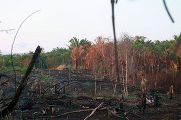
Deforestation in Belize amounts to an area the size of Rhode Island since 1980, according to new assessment.
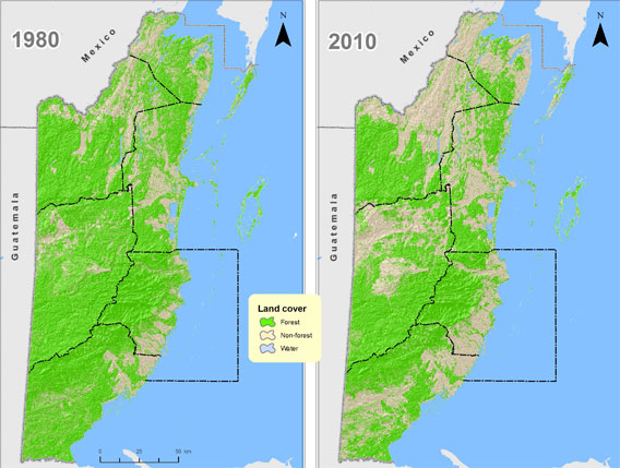
Forests in Belize have been cleared at a rate of nearly 10,000 hectares per year for the past 30 years, a recent study shows. In 1980, forests covered 79.5% of the land surface of Belize but as of February 2010 it had decreased to 62.7%. The area covered by forests in the country thus went from about 6500 square miles 30 years ago to around 5300 square miles today, losing an area the size of Rhode Island.
In the first study of deforestation in Belize since 1996, CATHALAC (Water Center for the Humid Tropics of Latin America & the Caribbean) and NASA used satellite imagery at different points in time since 1980 to visualize changes in the amount of land covered by forests.

|
The study not only sheds light on deforestation in the country, it also shows forests inside protected areas have not suffered much from deforestation in the past 30 years whilst a quarter of forests outside protected areas were cleared in that period. For CATHALAC, this indicates that protected areas have been highly effective in slowing down deforestation.
 Deforestation in Belize. |
The findings will also have important implications to the country’s international commitments. By estimating Belize’s current stock of forest carbon, it will allow the Government of Belize to fulfill one of its requirements for the REDD initiative (Reduced Emissions from Deforestation and Forest Degradation).
The new imagery system allowed the project to be completed in a short space of time. It forms part of CATHALAC’s region-wide investigation of land cover change in Central America. Neighboring countries have expressed interest in conducting similar studies.
EMIL A. CHERRINGTON, EDGAR EK, PERCIVAL CHO, BURGESS F. HOWELL, BETZY E. HERNANDEZ, ERIC R. ANDERSON, AFRICA I. FLORES, BESSY C. GARCIA, EMILIO SEMPRIS, AND DANIEL E. IRWIN. Forest Cover and Deforestation in Belize: 1980-2010. 2010
Related articles


