- An independent initiative has mapped 3 million hectares (7.4 million acres) of Indigenous lands in Indonesia since March, bringing the total since it started in 2010 to 20.7 million hectares (51.2 million acres).
- Only 15% of this mapped Indigenous land has been officially recognized by the government, with critics blaming a slow and costly bureaucracy, a lack of political will from government leaders, and an infrastructure development push that’s often competing for the same land.
- Indigenous rights proponents say legislation on the issue, which has languished in parliament for the past decade, needs to be fast-tracked and passed to address the bottleneck.
JAKARTA — An independent initiative in Indonesia continues to make rapid progress in mapping Indigenous lands, with an area the size of Belgium mapped in the past few months alone.
Since March, the Ancestral Domain Registration Agency (BRWA) has mapped 3 million hectares (7.4 million acres) of land claimed by Indigenous communities. That brings the total since the initiative began in 2010 to 20.7 million hectares (51.2 million acres) — an area nearly twice the size of the island of Java.
Nearly all of this land isn’t officially recognized by the government as Indigenous or customary territory. The BRWA was established by a group of NGOs to guide Indigenous groups in mapping their own territories, including forests, rivers and sea, in response to the government’s slow progress in recognizing these ancestral land rights.
So while demarcation in the BRWA database doesn’t guarantee this official recognition, it’s seen as a first step toward applying for recognition.
To date, the government has only recognized 189 Indigenous territories spanning a combined 3.1 million hectares (7.7 million acres) — just 15% of what the BRWA has mapped, spanning 1,119 territories.
This means that there’s still around 17.7 million hectares (43.5 million acres), or 85% of the mapped Indigenous territories, that haven’t been recognized yet.
Most of the areas mapped recently are in Malinau district, in the Bornean province of North Kalimantan, said BRWA head Kasmita Widodo.
“There’s a large Indigenous territory there called Apo Kayan, sized at 2.1 million hectares [5.2 million acres],” he said at an online press conference in August.
This and the other unrecognized lands are at risk of being appropriated for economic development projects, especially as the government pushes a slate of massive infrastructure development projects across the archipelago, according to Kasmita.
“We see [the government] speeding up the development of national strategic projects before the end of President Joko Widodo’s administration [in 2024],” he said.

Land-hungry infrastructure projects
According to data from Indonesia’s main Indigenous alliance, AMAN, one of the founding NGOs of the BRWA, Indigenous lands were the target in 13 cases of land grabbing in 2021. These cases affected a combined 251,000 hectares (620,200 acres) of land, which are home to 103,000 Indigenous people.
Among the projects that could harm Indigenous communities is the construction of a new capital city in East Kalimantan province in Indonesian Borneo, Kasmita said.
“Indigenous peoples in the two districts where the new capital city will be located in need to be identified,” he said. “There needs to be clear information and identification. Don’t let the new capital city displace Indigenous peoples.”
Forest-dependent Indigenous groups are especially vulnerable, he added. Kasmita said some 70% of ancestral forests overlap with state forests. Before 2013, all forests in Indonesia were considered state forests, but a landmark ruling that year by the Constitutional Court ruled that ancestral forests where Indigenous peoples live are not state forests, and thus the government should relinquish their control over such forests to the communities.
It’s the job of the Ministry of Environment and Forestry to return custody of these forests to Indigenous groups, but to date the ministry has only recognized 74,703 hectares (184,595 acres) of customary forests. That’s less than 1% of the 16.7 million hectares (41.9 million acres) of customary forests, or hutan adat, identified by the BRWA.
“This achievement is still very far [from ideal],” Kasmita said. “There needs to be stronger effort from the forestry ministry.”
Theo Litaay, an adviser to President Widodo on legal and human rights affairs, said Indigenous communities could apply for social forestry titles as an alternative if it’s difficult for them to get formal recognition for customary forests.
Under the social forestry program, the government aims to reallocate 12.7 million hectares (31.4 million acres) of state forests to local communities and give them the legal standing to manage their forests.
“With the current situation, we see the social forestry program as a good alternative [for Indigenous communities],” Theo told Mongabay in Jakarta in July.
Kasmita, however, said the social forestry program isn’t appropriate for Indigenous peoples, because it only grants communities the legal standing to manage forests for 35 years, while the status of the forests remains state forests.
With official recognition of customary forests, on the other hand, the government relinquishes its control over the forests forever.
“What’s appropriate for Indigenous peoples is customary forests,” Kasmita said. “The social forestry program doesn’t return customary forests [to Indigenous peoples]. They’re still state forests.”
Challenges upon challenges
Mapping Indigenous territories, which is required before the government can formally recognize Indigenous lands, requires money that, in some cases, the government doesn’t allocate enough of, Kasmita said.
Besides lack of funding, officials tasked with handling Indigenous affairs, including verifying Indigenous territories, also often don’t have the necessary capability, he said.
“There are even those who don’t understand Indigenous territories’ maps,” he said, adding that these problems needed to be addressed since 50% of Indigenous lands in Indonesia haven’t been mapped yet.
“Cartographers still have lots of work to do in mapping Indigenous territories throughout Indonesia,” Kasmita said.
And mapping their territory is just the first step for Indigenous communities seeking official recognition of their land rights. The actual administrative process starts with lobbying the local government to issue a bylaw, on the basis of the map, that recognizes the community has ancestral land rights. This bylaw itself then becomes the basis for an application to the central government in Jakarta for recognition of the territory associated with those rights. But just getting the bylaw passed is a long and expensive process, Kasmita said.
“It costs from 700 million up to 1 billion rupiah [$47,000 to $67,000] for a single bylaw,” he said. “And it takes at least one year [for it to be issued]. The ones that we helped facilitate took up to three to four years to be issued.”

Tourists welcome, Indigenous groups not
There’s also a lack of commitment from local politicians to protect and recognize Indigenous rights, Kasmita said.
Local governments in some regions have shown a strong commitment to protect Indigenous rights in their jurisdictions, such as those in South Sulawesi and West Kalimantan provinces.
“There’s quite a number of local regulations in South Sulawesi [that recognize Indigenous rights], and there’s also quite a lot of customary forests there that have been recognized,” Kasmita said.
But in regions like East Nusa Tenggara province, known as NTT, local governments have shown less enthusiasm for protecting and respecting Indigenous rights, he said. NTT is the site of several major planned infrastructure and development projects, and the provincial government appears reluctant to recognize Indigenous lands for fear of undermining those projects, Kasmita said.
“I’ve met the secretary [of the provincial government] multiple times, and they don’t want [to make the effort],” he said. “They’re still in doubt.”
As a result, Indigenous peoples in the region are threatened with displacement from their lands, particularly those living in Komodo National Park, a UNESCO World Heritage Site and home to around 2,800 Komodo dragons (Varanus komodoensis), Kasmita said.
In 2019, NTT Governor Viktor Bungtilu Laiskodat announced a plan to relocate the Ata Moda Indigenous people who live on Komodo Island, the largest of the more than two dozen islands and islets that make up the national park. He said the move was needed to revitalize tourism in the area and designate the island an exclusive tourism zone. That includes plans to build private tourism resorts in the national park, which conservationists and many in the local communities have criticized.
Soon after the designation of Komodo National Park in the early 1980s, the Ata Modo people lost their farming and foraging rights to the land. Today, the community subsists on less than 17 hectares (42 acres) of land, designated only for residential purposes and administered by the Ministry of Environment and Forestry.
“They don’t have land rights like other citizens. They don’t have certificates of land ownerships on Komodo Island,” NTT Governor Viktor said in 2019 to justify removing them from their ancestral land.
Umbu Wulang Paranggi, the director of the NTT chapter of the Indonesian Forum for the Environment (Walhi), said the fact that the national park is designated a “man and the biosphere reserve” by UNESCO means that the Indigenous peoples who live there are an integral part of the ecosystem.
“We know that people have been living on Komodo Island long before Indonesia even became a nation [in 1945],” Umbu said. “That’s why Komodo National Park is designated as a biosphere reserve. The plan to relocate people from Komodo Island shows the failure of the government in carrying out the mandate of a biosphere reserve.”
Indigenous rights law in limbo
Kasmita said it’s ironic that local governments won’t recognize Indigenous land rights inside biosphere reserves and national parks, but will gladly accommodate tourism infrastructure like resorts inside them. He said the BRWA had submitted requests to the Ministry of Environment and Forestry to recognize more than 60,000 hectares (148,000 acres) of customary forests in conservation areas across Indonesia.
“They [Indigenous peoples] want to be recognized not to exploit [nature], but because they want to protect [their forests],” Kasmita said. “If their rights to customary forests are recognized, they can drive away people who want to disturb their forests.”
But only around 5,000 hectares (12,400 acres) have been recognized so far, he said.
By recognizing the rights of Indigenous peoples in conservation areas, the government would actually strengthen environmental protection, as Indigenous peoples are known as the best stewards of nature, Kasmita said.
“But that’s not happening,” he said. “When it comes to Indigenous peoples who want to protect conservation areas, they’re ignored [by the government]. But in the case of Komodo [National Park], it’s wide open for companies [to develop tourism businesses].”
To provide recognition of the customary laws and land rights of Indigenous communities across Indonesia, legislation on Indigenous peoples and their rights is needed, said Erasmus Cahyadi from Indigenous coalition AMAN.
A bill on Indigenous rights was submitted to parliament in 2012. But it remains stalled despite being on the list of priority legislation for a decade now. Erasmus called on lawmakers and the government to speed up the discussion and passage of the bill.
“This will solve [the issue of] convoluted and sectoral procedure of the recognition and protection of Indigenous peoples,” he said.
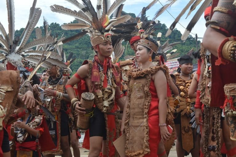
Banner image: Dayak Indigenous community members dance during a festival at the Pampang village in East Kalimantan, Indonesia, in 2022. Image by Hans Nicholas Jong/Mongabay.
FEEDBACK: Use this form to send a message to the author of this post. If you want to post a public comment, you can do that at the bottom of the page.


