
- Deforestation in the Brazilian Amazon is continuing to pace ahead of recent historical norms, reveals data released by Brazil’s national space research agency INPE.
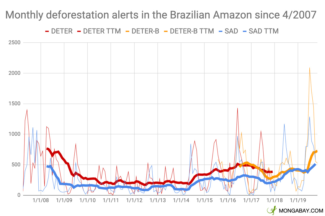
- INPE’s satellite-based short-term deforestation detection system has recorded 8,683 square kilometers of forest clearing since January 1, 79% higher than a year ago.
- According to INPE, forest clearing since August 1 has amounted to 4,217 sq km, 111% of last year’s tally.
- The new figures come less than a month after the Brazilian government published a preliminary estimate for deforestation for the year ended July 31, 2019.
Deforestation in the Brazilian Amazon is continuing to pace ahead of recent historical norms despite global outcry over ongoing destruction of Earth’s largest rainforest, reveals data released by Brazil’s national space research agency INPE.
INPE’s satellite-based short-term deforestation detection system has recorded 8,683 square kilometers of forest clearing since January 1, the highest on record since the agency started releasing monthly data in 2007. 2019’s figure is 79% higher than a year ago.

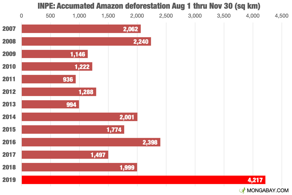
According to INPE, forest clearing since August 1 — the start of August 1-July 31 year Brazil uses for tracking annual deforestation trends — has amounted to 4,217 sq km, 111% of last year’s tally.
The new figures come less than a month after the Brazilian government released a preliminary estimate for deforestation for the year ended July 31, 2019. Government data put deforestation at 9,762 sq km, an increase of 30 percent over the prior year. But that estimate doesn’t include the sharp uptick in deforestation in August 2019, when smoke from fires burning in Amazonia made international headlines and put a spotlight on Jair Bolsonaro’s policies in the Amazon, which include weakening environmental law enforcement, encouraging ranchers and farmers to clear forest, and stripping protections from conservation areas and indigenous lands.
INPE’s data is virtually mirrored by data independently aggregated by Imazon, a Brazilian NGO.
Header image: Google Earth image showing deforestation south of Santarém, in the state of Pará.