- In a recent study, researchers took drone-based images to map the structure of sea turtle nesting beaches in northern Cyprus to determine their susceptibility to flooding from sea level rise.
- Automated drone flights with on-board cameras can record sequences of photos of the surface below, which can be merged in a process called photogrammetry to construct three-dimensional models of the survey area.
- The fast pace of innovation and versatility of drones can improve sea turtle conservation efforts through cheaper, more efficient monitoring.
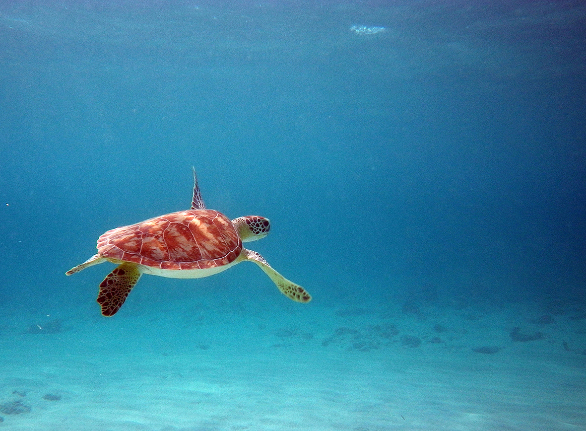
After months of fasting as she traveled hundreds of kilometers across the ocean, a female loggerhead sea turtle hauls herself up onto the sand: the shoreline she has returned to for many years to lay her eggs, and the very same beach where she hatched decades ago.
But this season is different, and for the worse. Creeping sea levels have swallowed up most of the sand in recent years, and a major storm the previous winter swept away many of the remaining dunes. Now, almost no beach remains between the water and human development, which has steadily expanded over the years. With no sites that provide the right conditions for her to dig a nest, she wanders up and down the shore in vain and could perish from the exhaustive beach traverse in the effort to produce her young.
This scenario is playing out among many of the world’s sea turtle populations. Although a surge in protected beaches have been lauded as a success, continued conservation effort is still needed to protect the world’s seven species of sea turtle, all of which are threatened.
Sea level rise is one of the most ominous impacts of climate change, advancing upwards on all shorelines, with sudden bursts in the form of hurricanes or flooding rains. While coastal human inhabitants can usually move inwards to higher ground, nesting turtles are not so flexible.
Some turtle beaches may be more vulnerable than others, and measuring how much of a beach will be submerged by sea level rise can help prioritize conservation efforts.
A team from the University of Exeter is flying drones to investigate. Their recent study documents how they used a drone, or unmanned aerial vehicle (UAV), to measure the structure of beaches in Alagadi, a Mediterranean hotspot for loggerhead and green sea turtle nesting in northern Cyprus.

“Most climate change studies are done on a global scale,” Miguel Varela, the study’s lead author, told Mongabay. “Drones are really stepping up the game in terms of monitoring to a local scale. This is especially important, as climate change will affect different regions of the planet in completely different ways.”
Change in sea level varies among different regions of the world. Some shorelines may be hit harder than others due to sea level rise: a narrow, flat beach will be submerged faster by rising oceans than a wide, sloping beach. If natural or artificial barriers such as forest or human development contain the beach, then female turtles have no higher ground to nest on as oceans advance upwards. Nests that are dug in lower portions of beaches are more likely to flood, which drowns the turtle eggs before they hatch.
Seeing the beach for more than the sand
To assess the vulnerability of turtles and other coastal inhabitants to sea level rise, researchers sought to map beaches in three dimensions, a task which lends itself to drone surveillance.
Flying at an altitude of 98 feet (30 meters), the researchers’ UAV-mounted camera snapped a picture of the beach once every second, frequent enough so that each photo overlapped with the ones taken before and after it. An on-board GPS recorded the UAV’s location as each photo was taken.

After each flight, the researchers used specialized software to analyze the photos for distinct features: a dark patch of seaweed laying on the pale sand, or a small crest in a dune that casts a unique shadow beneath it. If the same feature occurred in multiple photos, the software would stitch these overlapping photos together. They used the relative size and position of the features in each photo to infer their elevation. Through a mostly automated process (with some user correction), the software synthesized hundreds of photos into a cohesive three-dimensional model of the beach’s landscape.
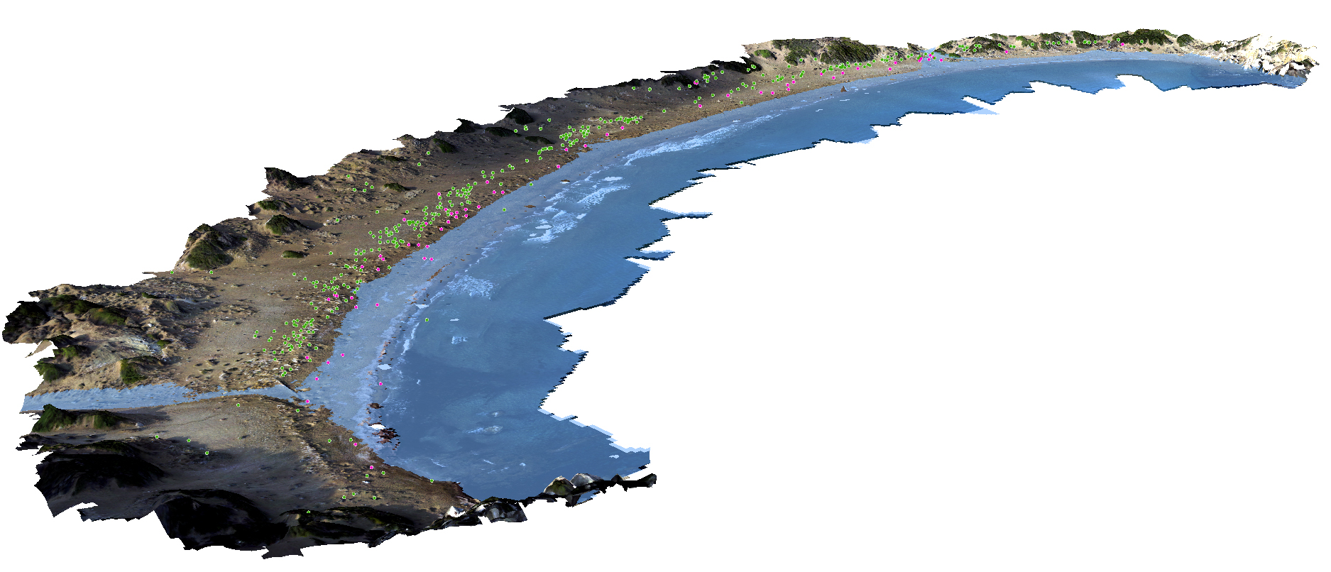
“This method allows us to create realistic digital models that are highly accurate (less than 10-centimeter [4-inch] error),” Varela said. “This is a fine scale when compared to global projections.”
Although much cutting-edge technology is expensive, drone photogrammetry can reduce the cost of surveying in three dimensions. UAV prices have dropped steadily over the past decade, and the Exeter researchers used Swift Navigation’s newly released Piksi Multi sensor, a low-cost, high-accuracy GPS system for UAVs. Drone and GPS combined totaled about £2,500, or $3,160 (turtles not included).
Training personnel to fly the UAV and the advanced computing power necessary to handle the large photogrammetric datasets required further investments.

Scientists at the University of Exeter in the U.K. used drones to map sea turtle nesting beaches to determine how vulnerable nests were to sea level rise. Video courtesy of University of Exeter.The Exeter team’s methods did not yield exact predictions of nest vulnerability to sea level rise: if increasing floods and higher sea levels caused sand dunes to collapse or the beach to erode, then the drone-derived 3D model of beach structure would be outdated. The authors acknowledged this downside and noted that future UAV flights performed in the same location would enable them to update their predictions.
A drone for each problem
Sea turtles face multiple threats that vary across their range and across different timescales, said Brendan Godley, who supervises the Exeter team. “Currently, the main threat to sea turtles in the Mediterranean is incidental capture in fisheries,” he told Mongabay, “but other threats such as climate-induced sea level rise and marine plastics are issues on the horizon that we need to understand if we are to manage and mitigate for them.”
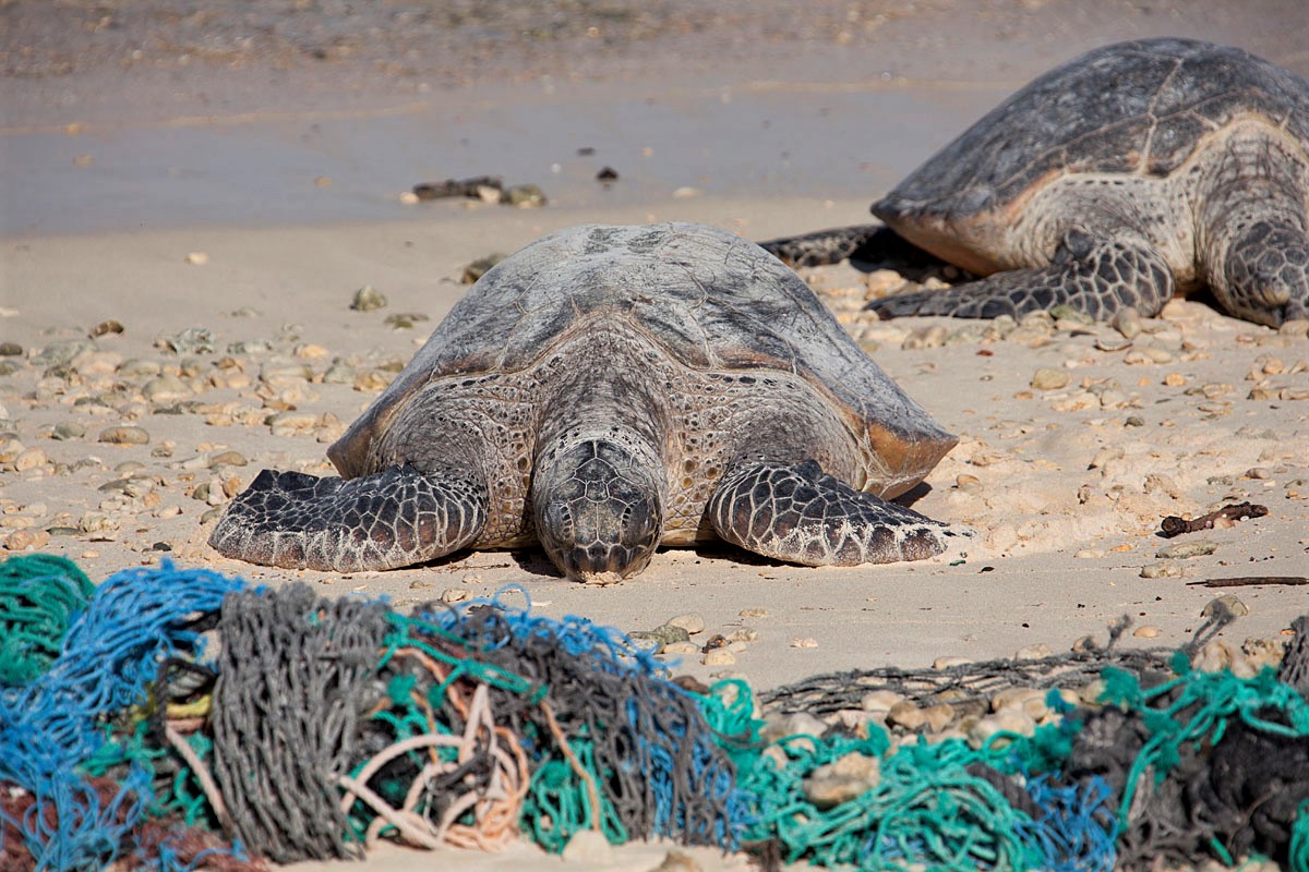
Drones can potentially help address a number of these threats. The Plastic Tide, a U.K.-based group named after the surge in marine plastic pollution in the past decades, has employed a triple threat of drone surveillance, citizen science, and machine-learning algorithms to quantify litter on beaches efficiently and extensively. Drone photos record shorelines, and volunteers identify the pieces of trash in photos posted on an online repository.
The citizen input of what is or is not litter is used to train an algorithm to identify trash in photos on its own, thereby reducing the amount of human effort needed. Improved monitoring of beach trash may reduce the load of litter that ends up in the oceans, which is a severe threat to global turtle populations.

Drones can be applied to approach a variety of issues related to sea turtle conservation. Video courtesy of University of Exeter.Researchers recently tested the capacity of drones to monitor the abundance and distribution of large marine animals such as shark, rays, and turtles beneath the surface. The test also revealed how coastal development is impacting marine animal populations.
Such data are necessary to press policymakers and land managers for beach protection, suggests Godley. “By better studying the impacts of climate change,” he said, “we can inform the public and lobby for conservation actions but also understand how to mitigate some of its impacts.”
Drone photogrammetry requires favorable weather and light conditions for the drone to safely collect the images. With the limited battery life of smaller drones, the pilot must remain vigilant to avoid running out of battery mid-flight.
“From drones to electric cars, [battery life] is the bottleneck funnel slowing down a potential even faster growth of technology,” Varela said. “In 5 years, batteries went from 15 min to 30 min flight time for consumer drones. I’m really excited to see how new technologies will address this in the upcoming years.”
Drones may usher in new partners, funding, and opportunities
Adopting high-tech methods to collect data, such as piloting drones, may also increase a research team’s profile in the eyes of the media, colleagues, or funding institutions. For example, training as a UAV pilot yielded new collaborations and funding opportunities for Varela.
“This method can be applied to other species, habitats or even for different purposes not related to science,” Varela said. “In fact, we have already been asked to apply this method in Brazil for a coastal tourism development project.”
“We have a highly visual tool that will allow us and any coworkers using the same methods to very graphically communicate future sea level scenarios,” Godley said. “This should help conservationists lobby for more sensible coastal setbacks to allow for managed retreat.”
As drones become more rugged and more affordable, and their batteries longer-lasting, their contribution to conservation efforts will likely increase. “Technology is changing at such a fast rate that is almost impossible to predict what we will have in 5 years’ time,” Varela said. “When I first started with drones and photogrammetry [5 years ago], we had to build our own drone from scratch.”
“The UAV growing trend is really booming because there are so many possibilities, and [they] can be applied to so many projects,” he added. “I would encourage people to try them out and think of new ways that they can help conservation projects move faster.”

Citation
Varela, M. R., Patrício, A. R., Anderson, K., Broderick, A. C., DeBell, L., Hawkes, L. A., … & Godley, B. J. (2018). Assessing climate change associated sea level rise impacts on sea turtle nesting beaches using drones, photogrammetry and a novel GPS system. Global change biology. https://doi.org/10.1111/gcb.14526
FEEDBACK: Use this form to send a message to the editor of this post. If you want to post a public comment, you can do that at the bottom of the page.