
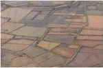
Map showing mangrove land cover in the Ayeyarwady Delta, Myanmar, in 1978, 1989, 2000 and 2011. The large island that has remained completely forested is the Meinmahla Kyun Wildlife Sanctuary. Image courtesy of Webb et al 2013
Mangrove cover in Myanmar’s Ayeyarwady Delta declined by nearly two-thirds between 1978 and 2011, leaving coastal areas more vulnerable to disasters like Cyclone Nargis, which killed 138,000 people in 2008, finds a new study published in the journal Global Environmental Change.
The research, led by a team of scientists from the National University of Singapore and the Mangrove and Environmental Rehabilitation Network in Yangon, is based on remote sensing and field data. It finds that dense mangrove cover in the Ayeyarwady Delta declined from 2,623 square kilometers in 1978 to less than 1,000 sq km in 2011, indicating an annual deforestation rate of three percent over the period. Most of the mangrove loss is attributed to agricultural expansion, primarily for rice production.
The findings, taken in context with the accelerating influx of foreign investment in Myanmar, portend a dire future for the country’s mangrove forests unless policies are quickly put into place, warn the authors.
“The centrality of agriculture to the Myanmar economy indicates that emerging policies are likely to tip the scales towards agricultural expansion, agroindustrial investment and potentially greater rates of deforestation due to the introduction of well-funded investors, insufficient land tenure agreements, and low governance effectiveness, the authors write. “The broad national challenge is to initiate environmental governance reforms (including safeguards) in the face of significant pressures for land grabbing and opportunistic resource extraction.”

Mangrove area statistics for the Ayeyarwady Delta, Myanmar. Data from Webb et al 2013
Under a business-as-usual scenario, the researchers project that unprotected Ayeyarwady Delta mangrove forests could be completely deforested by 2026.
“Business-as-usual deforestation scenarios suggest that most, if not all of the unprotected Ayeyarwady mangroves will be lost in the next few decades at a rate faster than other mangrove deforestation hotspots in the region, such as the Mekong Delta from 1965–1999.”
But the authors say that the fate of Myanmar’s mangroves is still far from sealed. Land tenure reform, improved land use planning, the establishment of protected areas, and the implementation of new environmental laws could help ensure the survival of these forests, which provide critical ecosystem services to the delta’s 7.7 million human inhabitants.
“As Myanmar’s government
takes steps toward political and economic reform and is
rewarded with increased international engagement, private
investment and overseas aid, it also potentially faces increased
environmental pressures. These necessitate proactive environmental
safeguarding and precautionary management.”
CITATION: Webb, E.L., et al., Deforestation in the Ayeyarwady Delta and the conservation implications of an
internationally-engaged Myanmar. Global Environ. Change (2013), http://dx.doi.org/10.1016/j.gloenvcha.2013.10.007
Related articles
Bangladesh plans massive coal plant in world’s biggest mangrove forest

(11/11/2013) On October 22nd Bangladeshi and Indian officials were supposed to hold a ceremony laying the foundation stone for the Rampal power plant, a massive new coal-fired plant that will sit on the edge of the Sundarbans, the world’s largest mangrove forest. However, the governments suddenly cancelled the ceremony, instead announcing that the project had already been inaugurated in early October by the countries’ heads of state via a less-ornate Skype call. While the governments say the change was made because of busy schedules, activists contend the sudden scuttling of the ceremony was more likely due to rising pressure against the coal plant, including a five-day march in September that attracted thousands.
Sea and storm: coastal habitats offer strongest defense

(10/11/2013) Surging storms and rising seas threaten millions of U.S. residents and billions of dollars in property along coastlines. The nation’s strongest defense, according to a new study by scientists with the Natural Capital Project at the Stanford Woods Institute for the Environment, comes from natural coastal habitats.
Mangrove deforestation 3x worse for climate than rainforest loss
(09/07/2012) Degradation and destruction of the world’s seagrasses, tidal marshes, and mangroves may generate up to a billion tons in carbon dioxide emissions annually, reports a new study.
Mangroves should be part of solution to climate change
(08/02/2012) Mangroves are under-appreciated assets in the effort to slow climate change, argues a new Proceedings of the National Academy of Sciences paper which makes a argument for including the coastal ecosystems in carbon credit programs.
NASA images reveal disappearing mangroves worldwide
(12/01/2010) In August, NASA and the US Geological Survey released the first-ever satellite analysis of the world’s mangrove ecosystems. What they found was dire: mangroves covered 12.3% less area than previously estimated. Now, NASA has released images of the world’s mangrove ecosystems (see below), which currently cover 137,760 square kilometers. Yet this number keeps shrinking: mangroves are vanishing rapidly due to rising sea levels, deforestation for coastal developments, agriculture and aquaculture.
Satellites show mangrove forest loss even worse than estimated
(08/19/2010) New satellite data shows that human actions are wiping out mangrove forests even faster than previous bleak estimates. Conducted by the US Geological Survey and NASA, the researchers found that mangroves comprise 12.3 percent less area than previously estimated. In total, satellites reveal that mangrove forests cover approximately 53,290 square miles (137,760 square kilometers). “Our assessment shows, for the first time, the exact extent and distribution of mangrove forests of the world at 30 meters spatial resolution, the highest resolution ever,” said Dr Chandra Giri from USGS.