
Overlooking rainforest in Guyana. Photo by: Jeremy Hance.
In a bid to gain legal recognition of their land, the indigenous Wapichan people have digitally mapped their customary rainforest land in Guyana over the past ten years. Covering 1.4 million hectares, about the size of Connecticut, the rainforest would be split between sustainable-use regions, sacred areas, and wildlife conservation according to a plan by the Wapichan tribe that will be released today. The plan says the tribe would preserve the forest from extractive industries.
“Recognition of our rights to control and manage our traditional territory would be one of the best ways of helping Guyana to fulfill its commitments to tackle climate change and meet its obligations under the Convention on Biological Diversity, which aims to conserve and sustainably use biological resources,” said Anglelbert Johnny, community leader of Sawari Wa’o Amerindian Village, one of twenty villages in the territory.
Located in the South Rupununi District of southwest Guyana, the forests are home to giant river otters (Pteronura brasiliensis), jaguars (Panthera onca), and bush dogs (Speothos venaticus), along with endemic birds like the Rio Branco antbird (Cercomacra carbonaria), according to a press release.
“Our land use agreements in our plan have been validated by the communities and include a proposal to establish a large Wapichan Conserved Forest in the eastern and southern parts of our territory as well as numerous plans to protect our sacred sites and local sites important for fish, game animals and wildlife,” says Patrick Gomes, Chairperson of the South Rupununi District Tosahos Council. Like many Amazonian tribes, the Wapichan practice small-scale agriculture along with hunting, fishing, and gathering.
If the communities are not granted rights, they say the region will be under threat from hydroelectric projects, road-building, logging, mining, and agribusiness.
The Wapichan communities held 80 meetings over the last few years to hash out the details of their land-use plan.
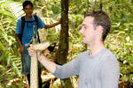
“Mappers from our own communities have used GPS technology to map the location of key livelihood, spiritual and cultural heritage sites that hold deep importance to our people and sustain our way of life. After ten years of painstaking work, we are very proud of the end result. We are now keen to share our territorial map with government authorities,” says Kid James of South Central Peoples Development Association (SCPDA).
Related articles
Indigenous technicians scour Amazonia to help researchers track wildlife populations
(11/09/2011) Scientists only have so many hands and eyes. That’s why ecologists enlisted hundreds of Makushi and Wapishana villagers to record the sights and signs of animals across 48,000 square kilometers of the Amazon basin near the Brazil-Guyana border. In the ongoing project, scientists seek to describe the interactions between indigenous peoples, their environment and the native fauna.
Prominent indigenous leader gets death threats in Guyana
(12/17/2010) Environmental groups have written to Guyana president Bharrat Jagdeo over recent threats against Tony James, the President of the Amerindian Peoples Association in Guyana.
Guyana: where’s the money pledged for saving rainforests?
(12/09/2010) Funds ostensibly set aside to reward tropical countries for protecting their rainforests are being held up, threatening to exhaust the political capital needed to advance the proposed reducing emissions from deforestation and degradation (REDD) mechanism before it even gets off the ground, warned the president of Guyana during a lively panel organized by Avoided Deforestation Partners on the sidelines of UN climate talks in Cancun, Mexico.