Features
Videos
Podcasts
Specials
Articles
Shorts
Donate
English
Español (Spanish)
Français (French)
Bahasa Indonesia (Indonesian)
Brasil (Portuguese)
India (English)
हिंदी (Hindi)
বাংলা (Bengali)
Swahili
Videos
Podcasts
Articles
Short News
Feature Stories
The Latest
Explore All
Heatwave News
RSS
93 stories
L
G
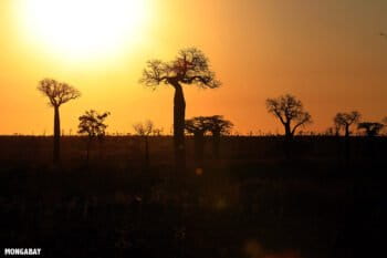
Record-breaking heat wave due to climate change hits Iceland & Greenland: Scientists
Kristine Sabillo
11 Jun 2025
Scientists underestimate frequency of South Atlantic heating events: Study
Bobby Bascomb
16 May 2025
Science lays out framework to assess climate liability of fossil fuel majors
Justin Catanoso
9 May 2025
Global warming hits hardest for those who can’t escape it
John Cannon
24 Apr 2025
Even the Gulf of Aqaba’s ‘supercorals’ bleached during 2024 heat wave
Ilan Ben Zion
14 Apr 2025
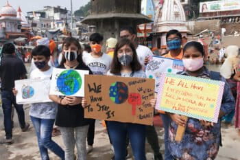
Heat wave scorches parts of India with record temperatures
Kristine Sabillo
11 Apr 2025
Ground-level ozone pollution poses growing threat to planetary health
Sean Mowbray
2 Apr 2025
Hotter weather threatens heart health, Australian study warns
Shreya Dasgupta
25 Mar 2025
Will Brazil’s President Lula wake up to the climate crisis? (commentary)
Philip M. Fearnside
12 Mar 2025
‘Unusual’ and weak La Niña confirmed, offers cooling respite after record El Niño
Shanna Hanbury
20 Jan 2025
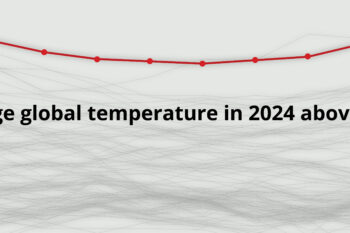
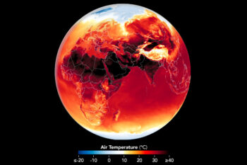
Global temperature in 2024 hits record 1.55°C over pre-industrial level
Shanna Hanbury
14 Jan 2025
World’s record heat is worsening air pollution and health in Global South
Simrin Sirur (with Orji Sunday and Karla Mendes)
13 Jan 2025
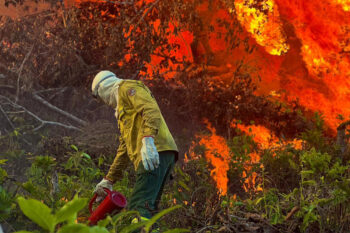
Climate change fueled record extreme weather events in 2024
Shreya Dasgupta
6 Jan 2025
Pacific’s ‘Blob’ heat wave killed millions more seabirds than thought: Study
Edward Carver
26 Dec 2024
Across continents, Mongabay fellows share insights from reporting in the field
Michael Esquer, Swati Thapa, Tarinipre Francis
23 Dec 2024
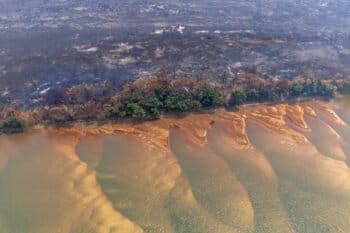
Climate change drives rise in rainfall, ‘Christmas typhoons’ in Philippines
Kristine Sabillo
11 Oct 2024
Rate of ocean warming has nearly doubled in the last two decades: Report
Kristine Sabillo
7 Oct 2024
Conserving & restoring waterways can mitigate extreme urban heat in Bangladesh
Riley Comstock
20 Aug 2024
Uttarakhand villagers thirst for water as tourism, temps & development rise
Swati Thapa
9 Aug 2024
Scientists are racing to save South Asia’s butterflies from the threat of extinction
Hailey Smalley
31 Jul 2024
More than 1,300 Muslim pilgrims die in Mecca under 50C heat
Mongabay.com
19 Jul 2024
2023’s top 10 Indigenous news stories (commentary)
Joan Carling, Joseph Itongwa, Juan Carlos Jintiach
28 Dec 2023
‘Alarming’ heat wave threatens Bangladesh’s people and their food supply
Mohammad Al-Masum Molla
28 Apr 2023
Extreme heat takes a toll on tropical countries’ economies
Calvin Rock Odhiambo
13 Jan 2023
Climate change is hammering insects — in the tropics and everywhere else: Scientists
Jeremy Hance
9 Dec 2022
‘Mind-blowing’ marine heat waves put Mediterranean ecosystems at grave risk
John Cannon
13 Sep 2022
What’s the chance of meeting Paris climate goal? Just 0.1%, study says
Mongabay.com
29 Aug 2022
2°C warming limit? More like 3°C and hotter, leading climate scientists say
Mongabay.com
2 Nov 2021
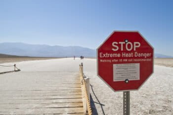
Extreme heat exposure in cities tripled in less than 35 years, study finds
Malavika Vyawahare
6 Oct 2021
Children born in 2020 will see spike in climate disasters, study says
Ashoka Mukpo
30 Sep 2021
Record heat waves are a taste of what’s to come under a changing climate
Elizabeth Claire Alberts
26 Jul 2021
Study sounds latest warning of rainforest turning into savanna as climate warms
Malavika Vyawahare
31 Mar 2021
« Previous
1
2
3
Next »
you're currently offline