- A global study tracking nearly 13,000 marine animals representing 111 species reveals they spend 80% of their time in just 63% of their range, yet only about 5% of these high-use ocean areas are currently protected.
- The research identifies Important Marine Megafauna Areas (IMMegAs) as ecological hotspots that span national waters and the high seas, where governance and protection are often lacking.
- Findings show that the global target of protecting 30% of the ocean by 2030 is insufficient to safeguard migratory species unless paired with additional mitigation measures outside protected areas, like bycatch reduction and ship speed regulations.
- Researchers call for stronger international coordination and more dynamic, movement-informed conservation strategies to effectively protect wide-ranging ocean wildlife.
A global study tracking nearly 13,000 individual marine animals has uncovered a sharp disconnect between where these animals actually spend their time and where marine protections exist. The findings raise concerns over whether current conservation targets can deliver for ocean giants.
Published in the journal Science on June 5, the study mapped the movements of 12,794 individuals from 111 marine megafauna species. The analysis drew from a global dataset built from nearly 16,000 original individual tracks comprising 11 million geoposition records. Researchers found that these animals spend 80% of their time in just 63% of the area they traverse — in zones the authors call Important Marine Megafauna Areas (IMMegAs). But only about 5% of these IMMegAs currently fall within marine protected areas (MPAs).
“It was very interesting to see that some areas are just used by multiple species in many similar ways, [which] clearly shows hotspot areas that are of high biological and ecological importance,” Ana Sequeira, the study’s lead author and an associate professor in the Research School of Biology at Australian National University, told Mongabay by email. “These areas represent good candidates for areas that should be considered for protection.”
The findings cast doubt on whether the 30×30 global target under the Kunming-Montreal Global Biodiversity Framework — protecting 30% of Earth’s land and sea by 2030 — can deliver for wide-ranging species without stronger alignment between protections and the places these animals actually use.
“It was concerning to see that even if the total increase to 30% of area protection was solely based on areas of importance to marine megafauna, that area still falls short of covering all the important areas needing attention,” Sequeira said. “This provided clear evidence that additional mitigation measures will need to be implemented in addition to increased area protection.”
A global mapping effort, decades in the making
To identify the IMMegAs, Sequeira and her team — 377 co-authors are listed on the paper — compiled and standardized a vast trove of movement data collected by research groups worldwide over more than three decades, from 1985 to 2018. They included studies on marine mammals, birds, turtles and fishes (mainly sharks). The result: a unified map of migratory corridors and core residency zones.
“Conservation of marine megafauna is challenging because these animals tend to be highly migratory,” Sequeira said. Movement data are expensive and ethically complex to collect, but they’re invaluable for showing how animals use space and useful for identifying areas of critical importance for conserving species, she added.
Key IMMegAs included regions in the central Indian Ocean, northeast Pacific, northeast and northwest Atlantic, and around Mozambique and South Africa, according to the paper. Maps also show hotspots in the South Atlantic and Southern Ocean.
“This confirms what we’ve suspected — that migratory species concentrate in key zones — but the stark imbalance between usage and protection was both compelling and alarming,” Leah Gerber, a professor of conservation science at Arizona State University not involved in the study, told Mongabay by email.
Gerber called the methodology “rigorous and innovative,” highlighting the “enormous synthesis effort” behind compiling and analyzing such a massive dataset. She said she found the use of machine learning and spatial optimization to identify key areas “particularly impressive.”
It’s clear they built the analysis on a solid foundation of conservation planning best practices,” Gerber added.
While the model used in the study considers existing protections and human pressures, she noted that more work is needed to factor in species-specific traits like demography and migration timing when shaping conservation strategies. Still, Gerber said, the global, multi-species modeling marks “a monumental methodological advance.”

Closing gaps in protection and knowledge
Sequeira said the study emerged from three key gaps in ocean data.
First was the lack of broad-scale knowledge on which ocean areas matter most to different marine megafauna, especially as countries work to meet the 30% protection goal under the global biodiversity framework and the High Seas Treaty. Also known as the BBNJ Agreement, the High Seas Treaty will lay the groundwork for protection of marine areas beyond national jurisdiction once it goes into force.
Second, Sequeira pointed to the vast troves of tracking data that remain underused because they are often siloed within research teams focused on a few marine species.
Third was the need to bring those scattered datasets into a common format to uncover insights only movement data can reveal, such as how animals use space.
The analysis revealed consistent, overlapping use of certain areas by multiple species — evidence of biodiversity hotspots that warrant stronger protection.
But many of these zones lie in the high seas, beyond any nation’s jurisdiction, making the findings especially urgent, Gerber said. “The fact that >60% of IMMegAs occur in the high seas highlights the global governance gap and reinforces why multinational coordination is essential.”
Beyond marine protected areas
While the authors say expanding MPAs is critical, they stress it must be paired with mitigating threats in areas unlikely to receive full protection.
“In practice, mitigation strategies would allow fishers and shipping companies to continue their practices while also decreasing the effects [on] species, particularly non-target species,” Sequeira said. “Subsidies can be used to assist the needed transition towards implementing mitigation strategies, such as less impactful fishing practices and creation of ‘go-slow’ zones for ships.”
Gerber called the study “foundational” but noted it’s just a starting point. “One gap that stands out is the lack of temporal dynamics — we know migratory patterns can shift with climate or prey availability, but that nuance wasn’t deeply explored,” she said. “I also think there’s room to unpack how species face different threats, even within the same areas. A hotspot for turtles may not function the same way for whales or sharks.”

Aligning policies with animals’ movements
To turn these findings into real-world improvements for marine megafauna, Sequeira said collaboration across sectors is key. “Governments need to implement and enforce mitigation strategies appropriate to different fishing practices and regions,” she said. “Fisheries managers need to be clearer about catches and gear restrictions so both management and mitigation can go hand in hand.”
Gerber urged governments and international bodies to prioritize MPAs in high-use zones, especially in the high seas where oversight is weakest. “Fisheries managers should be integrating this data into their spatial planning and actively modifying practices to reduce bycatch,” she said. “I also see a major role for the shipping industry in rerouting traffic and reducing speeds in overlap zones to prevent collisions.”
And for the public? “The takeaway is that conservation isn’t just coastal — it’s about invisible highways in the ocean that need protection,” Gerber said. “We need collective will and coordinated action across sectors to truly safeguard marine biodiversity.”
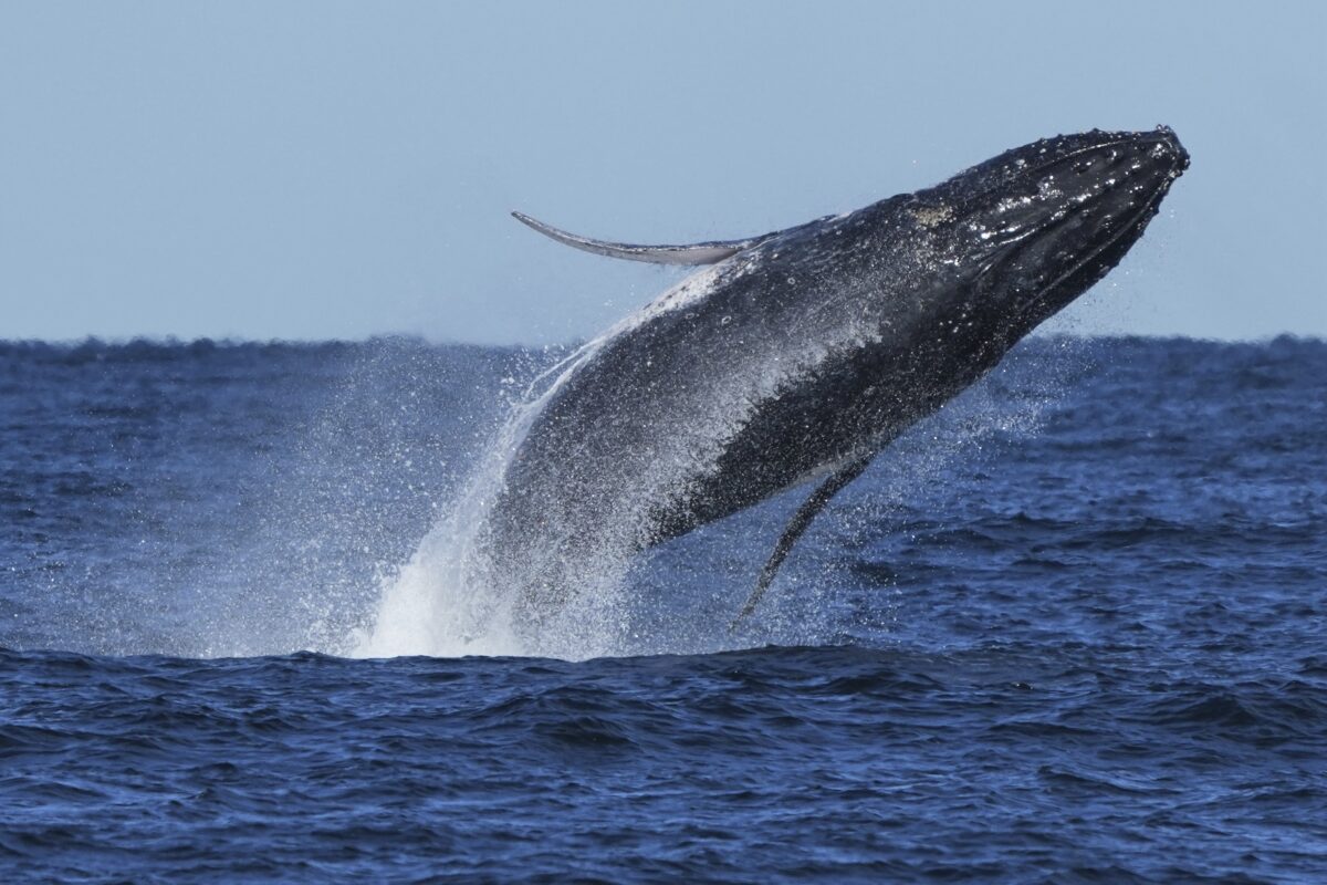
Banner image caption: A humpback whale (Megaptera novaeangliae) breaches off the coast of Port Stephens, north of Sydney, Australia, on June 18, 2025. Image © AP Photo/Mark Baker.
Citation:
Sequeira, A. M. M., Rodríguez, J. P., Marley, S. A., Calich, H. J., Van Der Mheen, M., VanCompernolle, M., . . . Eguíluz, V. M. (2025). Global tracking of marine megafauna space use reveals how to achieve conservation targets.Science, 388 (6751), 1086–1097.https://doi.org/10.1126/science.adl0239
Countries seek urgent CITES protection of more than 70 sharks and rays