
- The digital mapping platforms developed by Esri, including ArcGIS, have revolutionized conservation and environmental planning, management and policymaking.
- Esri co-founder Jack Dangermond calls geographic information systems (GIS) “a sort of intelligent nervous system for our planet at a time when humanity desperately needs one to address the environmental and humanitarian crises at hand.”
- He credits Esri’s success to a sustainable trajectory of heavy investment in R&D, not being beholden to outside investors, and providing discounted and free use of its software to environmental nonprofits.
- In this interview with Mongabay founder and CEO Rhett A. Butler, Dangermond says that technology, amid the current fractured political climate, should be employed to encourage understanding rather than dwell on divisions.
As Esri nears its 50th anniversary, Jack Dangermond exemplifies how geographic information systems (GIS) have grown from a specialized field into a critical tool for modern planning, environmental management, and decision-making. In a landscape often defined by fast-paced, venture-backed tech companies, Esri offers a contrast: privately held, purpose-driven, and committed to an approach that emphasizes service over spectacle.
Esri, which Dangermond co-founded with his wife Laura in 1969, has become a leading force in mapping technology. Its flagship product, ArcGIS, is central to the work of governments, researchers, and businesses, powering the billions of maps created daily across sectors ranging from urban planning to environmental conservation and corporate logistics. What began as a small consultancy in land-use planning has grown into a global leader, driven largely by the Dangermonds’ consistent vision: to leverage the “power of where” for broader societal benefit.

Dangermond’s journey began far from the tech world, with his upbringing in Redlands, California, where his Dutch immigrant parents ran a plant nursery. His early experiences nurturing plants and learning about ecosystems laid the groundwork for his future work. This practical knowledge, combined with the systems thinking he later honed at Harvard, helped shape his approach to integrating geography and technology. Today, Esri’s platform underpins a multi-billion-dollar industry, yet the company remains committed to its original mission of using geographic science to improve the world.
Esri’s evolution is not just a story of technical success but also of steady leadership. While many tech companies pursued rapid growth and venture capital, Dangermond opted to reinvest Esri’s profits into research and development. “We didn’t want to work for investors; we wanted to stay focused on applying these tools to solve real-world problems,” he explains. This approach of long-term stewardship—of both the company and the environment—has guided Esri through decades of growth while remaining true to its founding principles.

Central to Esri’s success is the idea that everything happens somewhere, and that understanding where something occurs can provide valuable insights. This geographic approach, as Dangermond has articulated throughout his career, goes beyond simply organizing data; it’s a way of understanding complex relationships between systems, whether environmental, urban, or social. GIS, he notes, “allows us to understand and model these systems,” offering a framework for more informed decision-making.
From his early days as a student, viewing the world through a systems-based lens, Dangermond has focused on mapping and analyzing Earth’s systems to better manage the future. His efforts—both through Esri and conservation initiatives such as the donation of the 24,364-acre Jack and Laura Dangermond Preserve—reflect his belief in the potential of technology to drive positive change. Whether it’s mapping city transportation networks or preserving biodiversity, Dangermond’s approach emphasizes the importance of spatial understanding in addressing global challenges.
Esri’s transition from consultancy work to software development was a natural shift, driven by client demand for the tools it had created for environmental analysis and mapping. “Clients wanted the tools and methods we were using so they could do the work themselves,” Dangermond recalls. This shift laid the foundation for Esri’s current business model, which focuses on empowering users through scalable technology, while maintaining its commitment to client-first service.
 Sea Ice Aware App. Esri
What distinguishes Esri in the tech landscape is its dedication to advancing GIS as both a scientific discipline and a tool for societal benefit. Dangermond sees GIS as a continually evolving language that fosters communication and collaboration across fields. He draws parallels to Galileo, whose telescope expanded the field of astronomy; similarly, GIS is pushing the boundaries of geography, helping address critical issues like climate change, biodiversity loss, and urban sustainability.
As digital solutions increasingly take center stage in solving global problems, Dangermond is confident GIS will continue to play a central role. The technology is already being used to map the impacts of climate change, from conservation planning to urban development for the Paris Olympics. The “power of where,” as Dangermond calls it, provides decision-makers with the tools needed to create a more sustainable future.
At the heart of Dangermond’s philosophy is service—service to clients, the environment, and future generations. This mindset permeates Esri’s culture, where collaboration, trust, and purpose drive innovation. “We’re in the business of creating understanding,” Dangermond says, and that understanding leads to better decisions and more responsible actions. As GIS technology advances, Esri, under Dangermond’s leadership, remains poised to continue helping the world navigate its future.

AN INTERVIEW WITH JACK DANGERMOND
Mongabay: Could you briefly reflect on your 50 years at Esri, touching on your inspiration and path?
Jack Dangermond: Well, it started when we were still at university—Laura and I. I was studying at Harvard, and both of us were working in the computer mapping lab there. We took classes with some fascinating people, not just in design but across campus—people like Carl Steinitz and others. This was in the mid to late ’60s, when Silent Spring by Rachel Carson had just come out, sparking environmental awareness.
Just before I graduated, Laura and I were sitting around one Saturday, trying to figure out what we wanted to do with our careers. We could have followed an academic path or gone into government or public service, but we wanted to return home. That day, we talked about what really interested us, and two things stood out: applying systems thinking—which we had been studying at Harvard—and computer mapping to fields like landscape or city planning, which was my original training.
For Laura, rational thinking was key. It was about applying rational approaches to whatever we did, and that really mattered to both of us. At the time, there was a lot of campus unrest, much like today, with people moving to extremes politically. But we weren’t interested in protest movements; for us, it was about living a more rational and sensible life. That mindset has stayed with us throughout our careers.
We were looking to lead a purposeful life—applying science and technology to the way people designed and planned things. I think that was one of the core principles that got us started, and it hasn’t really changed much since. Laura and I both came from modest backgrounds and barely made it through college financially. So, we decided to return to Redlands, where our families were. Through a variety of circumstances, we started what would become Esri.
It began as a consulting company where we made computer maps or conducted environmental studies using computer mapping tools. At that time, no one really understood what we were doing. We worked on projects that others needed, from cut-and-fill analysis for engineers to environmental mapping.
We didn’t emphasize the computer aspect too much, but we enjoyed doing that background work and serving our clients. Throughout the 1970s, we kept taking on larger and larger projects.

While working on these projects, we built software tools to help us, though they weren’t very sophisticated at first. They were practical enough to get the job done, but there weren’t really any product companies at that time. So, we kept investing in and refining these tools as we went along. Another guiding principle for us was hard work—long hours and a passion for inventing or applying tools to solve environmental problems. We worked on all kinds of projects, first small ones in the U.S. and then larger ones later.
We lived cheaply because we didn’t have much money. Everything was driven by project-based efforts. By the late ’70s and early ’80s, people started to become curious about what we were doing and wanted to do it themselves. So, instead of us doing all the work—which was fun and interesting—clients wanted the tools and methods we were using so they could do the work on their own.
This was challenging because we didn’t have a well-engineered software toolset at that time. Fortunately, a few talented people joined us—folks like Clint Brown and Scott Morehouse—and they started focusing on building tools others could use. This shifted the company from doing the work to creating tools that empowered others to do it.
In both models—doing the work ourselves and building tools—we were in service to our clients. So, I suppose that’s another core principle: service. First, we were doing the work, and later, we built tools that allowed others to do their work better.

We also embraced the idea of not borrowing money or taking on stockholders or venture capital. I think you mentioned this in one of your questions. We didn’t want to work for investors; we wanted to stay focused on our core purpose, which was applying these tools to solve real-world problems. That has been a central focus for us over the years.
Mongabay: You described the transition from doing the work to building tools that enable others to do it. Was that a major pivot point for Esri?
Jack Dangermond: It was a major pivot point in our company’s history. We didn’t start out that way—we simply began by doing the work. Over time, through our commitment to serving users and building tools that helped others do their work better, this shift naturally evolved. At the time, there weren’t really any software companies to speak of. Oracle didn’t exist yet. IBM had mainframe software, but Autodesk, Salesforce, and other major players hadn’t emerged. So, we had to invent everything ourselves. The idea of building tools just grew from that.
Mongabay: One interesting aspect of your book is the format. You have rich text, great images, and an online complement. What were the challenges of conveying what is often a highly visual medium in this format?
Jack Dangermond: It’s a beautiful book, and I’m very proud of it. But it’s not just my book, as you mentioned. Dozens of people contributed to it. In many ways, the book reflects collaboration—both from our users, who are doing amazing work, and from the people at Esri. I’ll take credit for putting my name on it, but it really represents a collective effort.

The book took a couple of years to put together, and one unique feature is that it doesn’t have a traditional table of contents. Instead, it has a table of questions. This aligns with our philosophy of being interested rather than interesting. Many people don’t know anything about what we do, but today, between four and five billion maps will be made using our software. Isn’t that fascinating? Millions of users are making maps every day.
And they’re making billions of maps.
And each one of those maps has a purpose. People design maps to tell stories, communicate data, and support decisions. One of the reasons for creating the book was to explain this company that few have heard of, yet which has a huge impact on how decisions are made worldwide. Many people say, “I had no idea this ecosystem of geographic knowledge existed.”
And it’s accelerating. A few years ago, a billion maps were being made—now it’s five billion. During the COVID pandemic, there was one map alone that was viewed 1.3 trillion times.
Mongabay: How do you think about the impact of Esri?
Jack Dangermond: We started by doing project work, and we still do. We have about a thousand people who work on projects, but we also have 3,000 companies building businesses around our platform. This has created a $40 billion industry built on top of our couple-billion-dollar operation. And millions of users are leveraging the tools we’ve developed.
Mongabay: Looking back on more than 50 years of leading Esri, what are the values or principles that have remained constant in guiding both your professional life?
Jack Dangermond: They’ve stayed consistent. We’ve never wanted to monetize Esri or go public. We run the company conservatively, and it’s never been about getting rich quickly. It’s always been about this philosophy of service: helping others, empowering them with scientific and technical tools to integrate science into decision-making. That’s what drives us and gets us excited—seeing people shift in positive directions using the power of geographic science and our tools.
Mongabay: I think many people take maps for granted and don’t think about how they’re made. What I found fascinating about the book was how it explains that process. What is your hope for how the book is used?
Jack Dangermond: I think the main goal is for people to understand what this is.
Last week, my wife and I took a rare vacation to Northern Italy. We had the chance to visit Galileo’s museum in Florence. It’s an amazing place. His telescopes are there, along with his navigation device inventions, all built on the mathematical and scientific principles from the time of Archimedes and others. Galileo created tools that allowed people to see things that hadn’t been seen before, challenging the established ways of thinking that went all the way back to Aristotle, who believed the Earth was the center of the universe. For thousands of years, models were built on that philosophy. What Galileo did was revolutionary—he showed that the sun was the center of the solar system, and that really upset people. They almost executed him, but fortunately, the Medici family protected him.
What Galileo’s story highlights is the role of tools in advancing science and understanding. I see geography and GIS as modern tools that follow a similar path. GIS is an instrument that advances the science of geography while transforming other fields like archaeology, geology, biology, and ecosystems. It’s helping people apply science in ways that integrate it into everything we do.

You asked about my hope for the book. My hope is that it will lead to better understanding. My good friend Richard Saul Wurman, who started TED Talks, has this great saying: “Understanding precedes action.” He always reminds me that we’re in the business of creating understanding, which leads to better planning, decision-making, and action. Businesses gain a geographic advantage by using our tools, whether optimizing their store locations or, like UPS, saving 400 million dollars annually by optimizing their truck routes. The geographic tools we provide have huge financial implications and help reduce fuel consumption, traffic, and carbon emissions. This is what excites me.
Mongabay: You describe geography as a framework to foster understanding that inspires action. Can you explain?
Jack Dangermond: Geography is the study of systems. I think I mentioned this in the book—flying across the landscape as a student, I realized that geography is about studying systems: hydrological systems, urban systems, ecosystems. This technology allows us to understand and model these systems. A city, for example, is a collection of systems—transportation, sewers, hydrology—and using geography as a framework to integrate and understand these systems is incredibly powerful.
Mongabay: Your book is rich with examples. Could you share one that illustrates how GIS is helping us restore balance with nature?
Jack Dangermond: GIS is now telling the story of the world’s environmental decline, and that’s a big accomplishment. Whether it’s NOAA’s climate change forecasting or NASA’s geographic modeling, GIS is helping people understand the systematic deterioration of our climate. One major contribution in your field is 30×30 planning, which was started by California Governor Gavin Newsom and Secretary of Natural Resources Wade Crowfoot. They invested millions into inventorying and mapping protected lands and identifying areas that should be protected. That 30×30 methodology, which we discuss in the book, has now been adopted by USGS and is the foundation for what was originally called “America the Beautiful,” now conservation.gov. It’s a politically sensitive topic, but I’m very proud of the systematic inventory work we’ve done.
The methodology is now being applied internationally. This year, Morocco is one of the countries embracing it. Yale’s Walter Jetz is modeling global ecosystems to prioritize areas of high biodiversity for conservation, and we’re working with him on the Half-Earth project.

It’s not just about conservation. When I was in Europe recently, I learned that the City of Paris used GIS extensively to prepare for the Olympics. Hundreds of users worked in engineering, transportation, and land use planning to ensure the event ran smoothly. UPS, which I mentioned earlier, now saves 400 million dollars a year by optimizing their delivery routes. GIS tools help them reduce fuel consumption, traffic, and emissions by 15%.
Cities like Singapore and Prague are using GIS to reintegrate nature into urban areas, making them healthier places to live. It’s happening all over the world—these are just some examples. GIS provides a geographic approach that helps integrate various disciplines, such as sociology, biology, climatology, and economics, into decision-making.
The challenge with sustainability is that people often don’t consider all the factors. The geographic approach offers a framework for integrating knowledge holistically. That was what excited me in university—the idea that mapping could bring together different disciplines to create a more sustainable future. Geography is key to sustainability, and the examples from Singapore, Prague, and hundreds of other cities show that this approach works.
Mongabay: I’d like to shift the conversation. You mentioned COVID earlier, and the book highlights the importance of public trust in science and geographic tools. During the pandemic, a segment of society seemed to lose faith in science. What strategies do you think are most effective in rebuilding trust, especially in the face of misinformation and skepticism about scientific data? What role can GIS play in addressing that?
Jack Dangermond: I don’t think anyone has fully written about the impact of COVID, especially its impact on science.
You know, COVID impacted our economy, but it also allowed people to get away with spreading false stories. I’m not sure if this was caused by COVID or just happened at the same time, but there’s been a general loss of trust in science. I’m not sure how we’ll fully regain that trust. However, one thing I’ve noticed is that people still trust maps. They believe their Google Maps when it provides directions or trust a map on voting behavior when it’s shown on CNN.

There’s something about the credibility of maps and mapmakers. Of course, maps can be manipulated just like any statistical or analytical tool, but people haven’t done that as much. So, I think maps still hold some level of trust in the public’s mind.
Mongabay: Do you think part of that trust comes from the transparency or documentation of how maps are created?
Jack Dangermond: That’s an old discussion in our field. Everyone believed Rand McNally maps and National Geographic maps. People still largely trust imagery, although that’s becoming more adjustable and subject to manipulation through image processing, so they may not trust it as much in the future.
Mongabay: Building on this, what is your perspective on polarization? You’ve focused a lot on cooperation to solve challenges. What have you learned from your work with governments, businesses, and communities about using GIS to build consensus and drive meaningful change?
Jack Dangermond: I had an interesting experience back in 1971 or 1972. I built a GIS system to create a land-use plan for the state of Maryland, and I met with the leaders and planners there. They were concerned that development would encroach on natural areas around the Chesapeake. So, we created about 50 GIS layers to model areas at risk for development and areas that needed conservation. When we overlaid the maps, it turned out that the areas in conflict were quite small.

Despite this, the political polarization around the issue was enormous. What I learned was that geography can help focus the actual areas of conflict and facilitate better conversations and collaboration. It taught me that much of the political noise often centers around relatively small geographic areas or issues.
Mongabay: Do you think conservation is an area where we can still bridge political divides?
Jack Dangermond: I think so. People today seem more interested in preserving natural areas than in the past. Over my lifetime, I’ve seen a shift from “develop, develop, develop” to a more enlightened approach, both at the political and business levels. People are recognizing that natural lands are disappearing, and maps and the stories they tell are helping raise awareness, especially among younger generations.

When I meet with executives, particularly in the energy sector, I see a lot of companies investing in renewable energy. They’re making significant financial commitments to figure out how they can continue providing energy while reducing carbon emissions. It’s not just a regulatory push—many of them genuinely care because they see themselves as part of the planet.
It’s not to say we’ve turned things around completely, but at the consumer level, people are buying electric vehicles, paying more attention to consumption, and at the executive level, companies are making changes. We even have politicians like the Vice President of Canada, who’s a geographer, running for office and really understanding conservation and geography. It’s encouraging to see.
Even our current president loves maps, and Obama was a big fan of them too. He was a map fanatic.
Mongabay: The concept of “creating a better future” includes ensuring equitable outcomes. How do you see GIS being used to promote equity and justice, especially in communities most vulnerable to environmental and social instability?
Jack Dangermond: At the state and local levels, people are starting to wake up to using maps as tools to address various issues in their communities. Equity is one example. You can see the results of the bipartisan infrastructure investment bill, with its $1.3 trillion in investments. The president made it clear he didn’t want that money going into areas vulnerable to future flooding, sea-level rise, or high fire risk. He ensured the bill included that legislation. As a result, NOAA built a climate software tool with map overlays. If you’re applying for that funding, you have to go through this process. He also mandated that 40% of investment money should go to impoverished areas. That’s what I’d call geographic literacy. It’s possible this initiative could change under the next administration, but there’s definitely a growing awareness at the local level—mayors and governors are recognizing this.
I recently received a letter from the governor of Texas, acknowledging how important geography is to his state and how much he appreciated the book. Another example is Governor O’Malley, who was also the mayor of Baltimore. He used geography to ensure policing was done equitably across the city, adapting New York’s city stats model. When he became governor, he applied that same geographic approach to state matters. Now, as head of the Social Security Administration, he’s using geography to ensure offices are performing equitably and to manage everything from fraud abatement to resource distribution.
I know I’m rambling a bit, but geographic understanding and spatial literacy can drive more equitable governance and communication. Redlining, for example, was addressed by Ralph Nader using GIS in the 1970s. He exposed cities and banks still practicing redlining by showing the data through GIS maps. It was a transformative moment in policy, and Nader hasn’t forgotten that. Even at 90 years old, he’s still advocating for equity using mapping.
Mongabay: It’s been really interesting to hear how leaders across the political spectrum are using GIS in policymaking. You’ve been a vocal advocate for the power of digital maps to visualize complex systems and influence policy. What do you see as the biggest barrier to wider adoption of GIS in policy-making, and how can it be overcome?
Jack Dangermond: There are enormous barriers. The biggest one is simply that people don’t know. In Congress, there’s growing awareness. The Library of Congress and the Congressional Research Service have a license for our software, and members can use maps for everything from understanding voter demographics to investigating policies. At the local level, with mayors and governors, awareness is growing. But there’s still a huge gap in understanding. That’s why we created the book—to raise awareness about the power of location, or as I call it, “the power of where.” I chose the word “where” over “geography” because it’s more accessible. If I had called the book “The Power of Geography,” I doubt many would have picked it up, but “where” is a powerful word that resonates with people.
If I ask you, “Where were you born? Where did you first drive a car? Where did you go on your first date?”—you immediately connect with those questions. We’re all wired for “where.” It’s a fundamental referencing system for human experience, and maps are the bridge between that experience and our understanding of the world. People look at maps and relate them to themselves—whether it’s a COVID map or directions from Google Maps.
As we extend maps as a language, we’re now at four or five billion maps a day. When it becomes 40 billion or 400 billion, maps will become as universal as consumer apps. We’re already seeing questions like, “Where is it? How do I get there?” But soon, it will expand to questions like, “Who will be affected by this decision?” I’ve had the privilege of watching the exponential growth of spatial literacy over my career.

You asked a thought-provoking question about barriers. The first is understanding the power of GIS and how it relates to our cognition. The second is educating the next generation. We’re promoting GIS through ads and initiatives to raise awareness, but more importantly, we’re working on education. We have partnerships with 12,000 colleges and universities offering GIS programs, but that’s not enough. We need to expand GIS education beyond geography and forestry departments into data science, statistics, and computing.
At the K-12 level, we’ve partnered with National Geographic to create a tool called MapMaker. It launched a few months ago, and already a million kids are using it. This is our gift to K-12 education, and it’s part of an effort to get geographic literacy into core curriculums—whether it’s history, environmental science, or social studies. Expanding geographic literacy is a big deal for me.
Mongabay: You mentioned the proliferation of maps, almost becoming like a language, which I found really interesting. I hadn’t thought about the idea of 4-5 billion maps being produced daily. It makes sense, but it’s still amazing. How do you see AI, especially generative AI, fitting into this? How can it help make maps more relevant and efficient?
Jack Dangermond: There are two branches of AI we’ve been exploring. One is the ability to analyze images or geographic relationships and pull out information—like automatically creating a map of roads or detecting forest change in Central Asia. That’s about automating data creation, and it’s progressing well. We’ve been working on that for about six years.
The other is generative AI, which aims to make GIS more accessible. People don’t necessarily want to learn GIS; they just want to ask questions and get answers. It’s similar to how graphical user interfaces (GUIs) transformed computing. When Xerox PARC invented GUIs and then Steve Jobs brought them to the Mac, and Bill Gates to Windows, it made computing accessible to the masses. It was a game changer. That’s what we need for GIS—tools that make it easier to use.
We’re working on that, particularly with tools like MapMaker. High school students can now learn to use it in five minutes, overlay maps, and explore real-time data, like seismic activity during an earthquake. It’s going to be revolutionary, especially in education.
Generative AI is like the next GUI. It will make interacting with GIS more intuitive. For example, in places like Washington, D.C., and Miami-Dade County, they’re piloting hub sites where citizens can ask natural language questions like, “Where’s the nearest park with a playground?” or “What are you spending money on?” These hub sites connect to all the data layers cities are building. We have about 17 research projects exploring how natural language interfaces can work with GIS, and I see it helping both GIS professionals and the general public.
For data scientists, it’s about automating programming or scripting. For the general public, it’s about making GIS more approachable. Both areas are still in their early stages, but in the future, I believe GIS professionals will serve a much broader audience. As I mentioned earlier, the question of “where” is wired into our brains. People always want to know, “Where is it?” or “Where can I find this?” This will open up even more possibilities.
Mongabay: I had a similar conversation today with Global Forest Watch, talking about the next generation of tools using natural language to expand the audience and make it easier to interact with data.
Jack Dangermond: Exactly. Applications like Global Forest Watch will have specific use cases, but if you look at something like the Living Atlas, which Esri maintains, it’s a massive resource. It contains about 10,000 layers of information, like land cover or vegetation change, that professionals use to build apps like Global Forest Watch.
It also has another part where users have shared 73 million datasets that others can overlay on their maps. GIS is amazing because of this community of 10,000 users who not only use the technology but also share their data. Sharing builds trust. Trust comes from relationships, and relationships come from collaboration—especially on projects like forest conservation.
When natural language systems can interact with vast geographic data libraries like the Living Atlas, it opens up new frontiers for science and for addressing societal issues. It will allow citizens to engage with their governments in new ways. I think it goes far beyond individual applications—behind the applications is content, and behind the content is community.
It’s a visual point of reality, so I can start asking interesting spatial questions about the digital twin reality. Many people are natural geoscientists, too—they just don’t have the language to access all that rich information. In fact, some of their creative questions may even be richer than those the geoscientists have traditionally focused on. But I don’t want to speculate too much on that.
Mongabay: We just talked about collaboration, and I wanted to dig a little deeper. What’s the origin of the collaborative spirit within Esri, which seems to have influenced the spirit of the global GIS community?
Jack Dangermond: You mean inside the company or across the whole GIS community?
Mongabay: Well, both—the idea of being collaborative versus competitive, especially compared to the direction some tech companies have gone in recent years.
Jack Dangermond: Collaboration happens at the speed of trust, as they say.
Esri was designed as a sustainable company. We charge for software, it’s not free, but all the money goes into R&D. One of our principles is that we spend over 32% of our revenue on advancing the technology, which then goes back to our customers. It creates an interesting ecosystem—it’s almost like a non-profit in that sense. We’re constantly evolving our tools based on what our users are doing.
For that to work, our customers have to trust us. That’s why all of our user conferences, which sometimes have 15-20 thousand attendees, are built on this foundation of trust. Inside the company, we also have a few key principles. One is trust within teams. We’re not highly hierarchical—there is leadership, but it’s a team-driven culture. Collaboration is essential here, and we foster a sense of purpose that isn’t money-driven but service-driven. That’s what stimulates collaboration.

We also avoid disincentives. For example, we don’t have sales commissions. No one gets a bonus for selling software. Instead, they’re in service to their users. That’s important because incentives can rob people of their dignity and integrity.
We’ve been operating like this for 55 years. Employees get paid for the hours they work, and if someone works 80 hours, they’re paid more. It’s not a perfect system, but it recognizes contributions differently. We also prioritize serving our customers, creating a great place to work, and being successful in business to sustain the first two priorities. This transparency helps everyone self-regulate.
We also have a profit-sharing program. While we’re not a highly profitable company, we take 20% of our profits and reinvest them into employees through various programs.
Mongabay: It’s such a contrast to many Silicon Valley companies.
How has the concept of “where” influenced your decision-making as a conservationist, particularly with the creation of the Jack and Laura Dangermond Preserve?
Jack Dangermond: The location of the reserve is one of the most biodiverse areas, which made it attractive from a scientific perspective. It’s also near where Laura and I camped during our honeymoon, so we’ve always loved that Central Coast geography. Additionally, we had a friendship with The Nature Conservancy in California, and we had looked at the property for many years but could never afford it.
We actually tried to buy it 20 years ago, but we were outbid by a wealthier buyer. However, when it came up for sale again, because of all the environmental constraints from the Coastal Zone and others, we were able to afford it. So, we went all in and put our personal fortune into it.

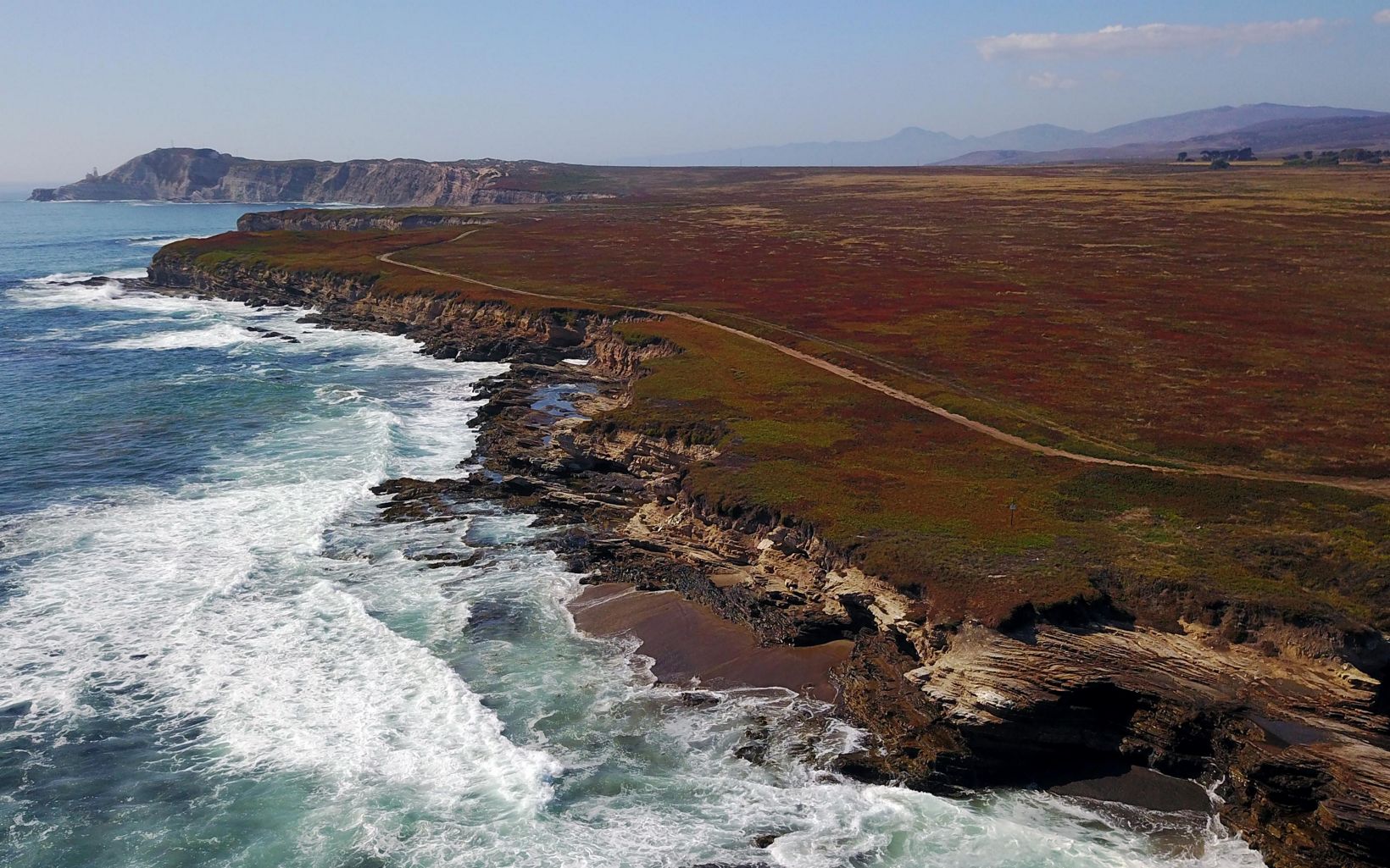
You might be interested in what we’re doing with it. It’s not just a preserve. While it doesn’t have public access due to the sensitive areas, we’re turning it into a digital twin. There’s a lot of talk about digital twins these days, but this was part of our vision from the start, seven years ago. The idea is to allow open research by any university, but they must practice open science, meaning that any data they develop stays available for the next researcher.
We’ve had numerous research projects, including ones from the Smithsonian, NASA, and NOAA. They’re using the digital twin for experimentation—some for hydrological studies, others for biological studies, change analysis, and fire succession. It’s becoming a rich GIS database, and universities like UC Santa Barbara and Cal Poly are bringing students to do work there, managed by The Nature Conservancy (TNC). Eventually, the hope is that it will become a virtual laboratory where students and researchers can look at it, baseline it against history, and study changes over time.
Mongabay: What future direction do you envision for GIS?
Jack Dangermond: Let’s start with the future direction. Esri has played a major role in the development and evolution of GIS. We operate in a competitive marketplace, including the open-source community, which is exciting. We’ve had competition for 50 years, and we use that as motivation to keep pushing the envelope. We have a couple thousand engineers who integrate innovations from companies like Microsoft, Amazon, IBM, and others into our product.
Our goal is to keep advancing geographic science and GIS technology. The future is bright, but unpredictable—just as it has been since the beginning. Who could have anticipated the rise of cloud-based or AI-based GIS server technology? Every year, we combine our own innovations with others’ to build products that our users can benefit from.
We estimate Esri is a couple-billion-dollar operation, but it supports a $40 billion ecosystem of other companies, partners, and users. I think the future of GIS will see it evolve from project-based systems to enterprise-wide systems, much like ERP or CRM systems in business. Cities like New York, Paris, and Los Angeles are integrating their departmental data into one system to transform their organizations. The same is happening with major corporations like ExxonMobil and UPS. GIS is bringing the entire organization together.
Mongabay: What advice do you have for young professionals?
Jack Dangermond: For young professionals, GIS is a fantastic career. Back in the 1980s, we noticed that students who had taken GIS courses earned 40% more than their peers. Recently, we saw a presentation by our business sector team, which supports Fortune 500 companies, and they said it’s hard to retain GIS professionals because they keep getting hired by other departments or promoted.
There’s incredible demand for GIS professionals, both in the private and public sectors. In cities and counties, the career opportunities are growing, and there’s a shortage of people with the necessary skills. NGOs also need people who can build and support GIS systems. So, I’d encourage students to at least take a class. Just like computing and statistics, GIS is becoming a core skill that professionals need.
