- The Cambodian Ministry of Environment has blocked Indigenous communities from receiving ownership over thousands of hectares of customary farmlands and culturally significant forests in the Keo Seima REDD+ project zone.
- The Wildlife Conservation Society, which works with the ministry to administer the project, did not disclose these land disputes caused by the project’s activities to standard setter Verra, and its auditors failed to identify these issues.
- Indigenous peoples in the REDD+ project face arrests, imprisonment, crop destruction and property confiscation as a result of unclear boundaries and insufficient land allocated to their communities.
- This reporting project received support from the Pulitzer Center’s Rainforest Journalism Fund.
This is the first article in our two-part series on Indigenous land rights and the Keo Seima REDD+ project. This series was co-written by a Cambodian journalist whose name is being withheld due to security concerns. Read part two here.
Lan and her elderly husband, Peam, were arrested in 2020 for farming rice in a restricted conservation area.
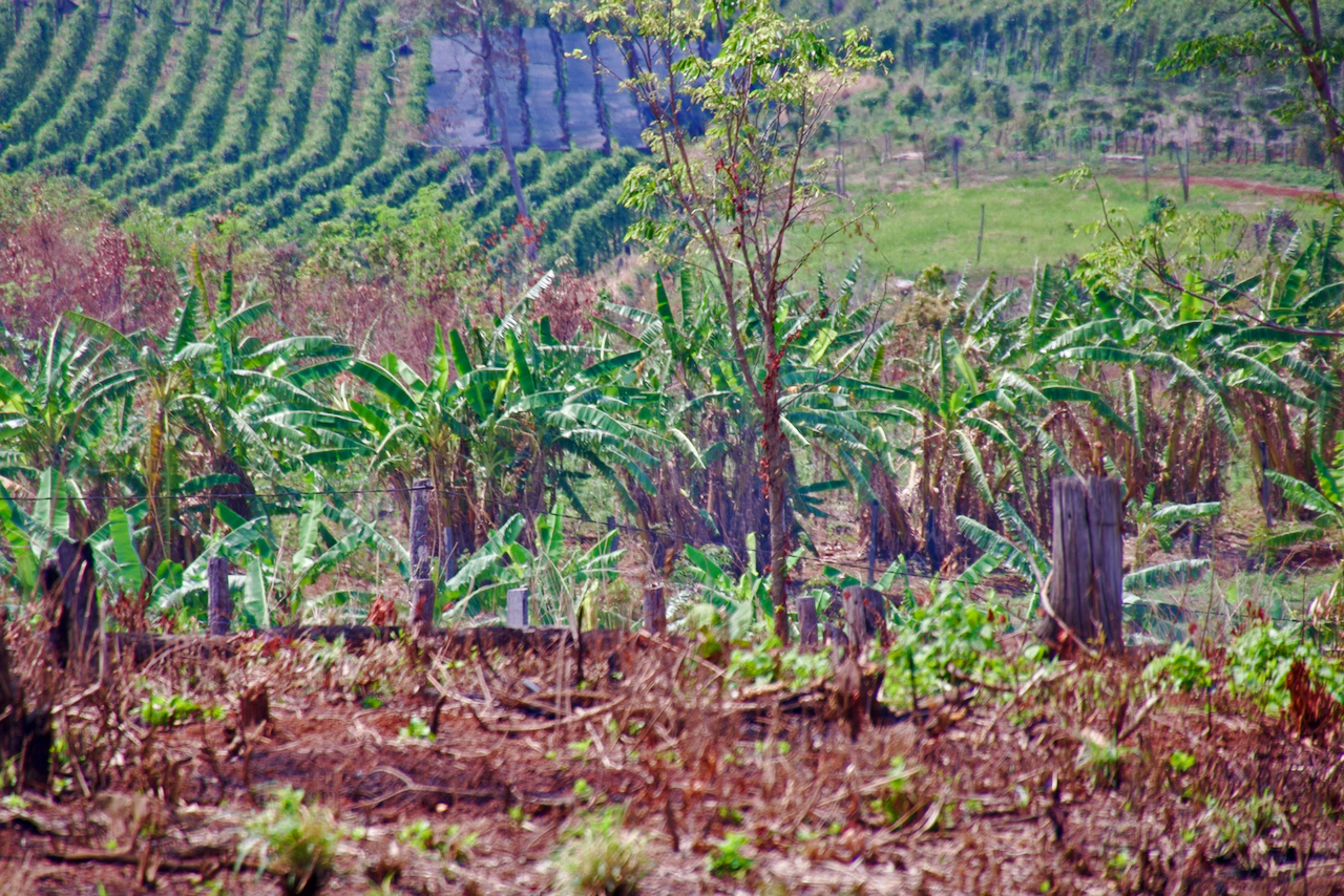
The small plot of land they relied on to feed their family lay in the middle of the 292,690-hectare (723,250-acre) Keo Seima Wildlife Sanctuary in northeast Cambodia, a forest rich in biodiversity and intermixed with local and migrant farming communities. Much of the forest is now part of one of Southeast Asia’s most prominent carbon offset projects.
Like many of their neighbors in remote Kmoum village, Lan and her husband identify as Bunong, an Indigenous ethnic minority group which has traditionally engaged in swidden agriculture and lacked records of official land ownership. Peam was imprisoned on the charge of illegally clearing state land, his wife recalls.
Government rangers also confiscated the couple’s motorbike, which their children relied on to attend school, and authorities ignored a petition by more than 100 of Lan’s neighbors requesting her husband’s release due to the family’s “extreme poverty.” Lan eventually managed to gather the several thousand dollars in fees necessary to free her husband after he spent nine months in prison. Years later, the family remains in debt from the expense.
Lan and her husband, whose names have been changed, still cultivate rice in the same place and say they run at the sound of approaching rangers.
“I have no choice but to keep farming here, I have no other farmland, it’s just to support my seven children; I am poor,” Lan said. “I use it for my family only — if I don’t use this land, what do I use?”

The question raised by Lan is one echoed by many Indigenous families across Keo Seima, who risk legal consequences for farming in and around the carbon offset project. And it goes to the heart of an issue plaguing the project: What restrictions should be placed upon Indigenous peoples to promote conservation goals?
A two-part Mongabay investigation into Indigenous land rights found Bunong farmers in the wildlife sanctuary face arrests, imprisonment and harassment from authorities as they try to eke out a living amid rising economic pressures and land insecurity. While these issues are not unique to Keo Seima, the REDD+ project here presents securing and promoting land rights and ownership for Indigenous communities as the core of its mission.

REDD+, which stands for “reducing emissions from deforestation and forest degradation in developing countries,” allows corporations and individuals to offset their carbon emissions by paying to preserve forests and financially support local communities, with the aim of reducing their need to engage in illegal logging, unsustainable agricultural practices and other drivers of deforestation.
Recent research suggests that the carbon offset industry has vastly overestimated its impact, including in Keo Seima, but the latter project reports having led to more than 20 million metric tons of carbon emissions reductions since it began in 2010. Companies like BlackRock and Boeing have purchased its carbon credits, and passengers using Grab, the ubiquitous Southeast Asia ride-hailing app, can make their trip carbon neutral with a payment to Keo Seima. The project is run by the Ministry of Environment and New York-based nonprofit the Wildlife Conservation Society (WCS).
Auditors paid by the project and approved by Verra, which sets the most widely used global standards for REDD+ projects, certify Keo Seima as complying with Verra’s Climate, Community &Biodiversity Standards (CCB). This certification, which can increase the value of the project’s carbon credits, verifies that the Keo Seima REDD+ project “recognizes, respects and supports rights to lands, territories and resources, including the statutory and customary rights of Indigenous Peoples and others.”
While the REDD+ project has not publicized its total revenue, the Ministry of Environment and WCS have earned millions of dollars from the Keo Seima REDD+ project – and a percentage of these earnings have gone back to Indigenous communities primarily for infrastructure such as roads and wells for drinking water. Bunong leaders in Keo Seima were quick to note that these investments had made meaningful impacts for their communities.
In an emailed statement, WCS said the Keo Seima REDD+ project meets Verra’s standards: “We are confident that the project has demonstrably and significantly improved the situation for IPLCs [Indigenous peoples and local communities].”
Yet the reality remains more complicated.

Even as the Keo Seima REDD+ project profits from the concept of Indigenous empowerment, the Ministry of Environment – ultimately responsible for the REDD+ project – is undermining the rights of Indigenous communities. The ministry’s governance and policies enacted as part of the REDD+ project often exacerbate the conditions pushing Indigenous farmers to engage in what the Ministry of Environment considers illegal forest clearance, which community members are then punished for.
Government records obtained by Mongabay reveal the Ministry of Environment has played a key role in blocking at least four Bunong villages partnered with its REDD+ project from receiving ownership over thousands of hectares of actively cultivated farmlands, and has redistributed sacred sites to private developers. Other Indigenous villages within the REDD+ project zone have also been stymied from receiving communal land ownership due in part to the Ministry of Environment’s interventions.
In these villages and other communities throughout Keo Seima, Indigenous and local farmers daily risk arrest, crop destruction, property confiscation and imprisonment by authorities linked to the REDD+ project, through uneven enforcement of unsettled and unclear boundaries between areas where people can live and farm and restricted conservation areas.
While project partner WCS has attempted to mitigate some of these negative impacts, the conservation NGO privately defended the Ministry of Environment’s actions when Verra’s auditors raised questions about harsh tactics and confusing boundaries. WCS has also not disclosed to Verra, as required by Verra’s standards, the significant land conflicts with Indigenous communities caused in part by the Ministry of Environment’s policies and REDD+ project-supported initiatives.

To reach these conclusions, Mongabay conducted in-depth interviews with more than 70 Bunong residents of Keo Seima, including community leaders, volunteer patrollers, local authorities and REDD+ village representatives paid by WCS. Mongabay also spoke at length with WCS leadership, Ministry of Environment rangers, Indigenous activists, lawyers and numerous conservation researchers working in Keo Seima, as well as reviewed land surveys and maps, government records, legal documents and more than 1,300 pages of project monitoring reports and audits submitted to Verra.
Mongabay spent nearly three weeks visiting 11 of the REDD+ project’s Indigenous partner villages between October 2023 and April 2024, equivalent to the time Verra-approved auditors have spent visiting Keo Seima communities since 2015.
Many of the leaders in Bunong villages Mongabay visited reported not having sufficient land for their growing communities to use for farming due to the Ministry of Environment’s refusal to fully recognize their land ownership claims. They also said repeated requests for access to additional land under the Ministry of Environment’s jurisdiction were ignored or rejected by authorities.
Similar issues raised by Human Rights Watch last year led Verra to suspend another of the Ministry of Environment’s major REDD+ projects in the Southern Cardamoms.
“Cambodia’s Indigenous peoples risk losing their land and resources because only a fraction of them have their customary land rights formally recognized,” said Luciana Téllez, a HRW researcher and lead author of the investigation into the Southern Cardamoms REDD+ project. “Dispossessing Indigenous peoples for carbon markets is unacceptable and counterproductive.”
The Ministry of Environment did not provide comment. WCS disputes that the REDD+ project has prevented Indigenous communities from using their farmlands or that it “knowingly misled” Verra’s auditors.
Presented with a detailed list of Mongabay’s allegations, a Verra spokesperson said “we take any allegations of improper conduct in Verra-certified projects very seriously” and noted that Mongabay’s findings “differ dramatically from the documented evidence” provided by Verra-approved auditors. The spokesperson added that Verra did not presume wrongdoing occurred but will “properly review, assess and decide what action (if any) to take.”

A ‘leopard’s skin’ of Indigenous lands
Much of what became the Keo Seima Wildlife Sanctuary in 2016 – though it had been under protection with WCS’s support since 2002 – was previously a timber concession granted in the 1990s to Malaysian conglomerate Samling.
Throughout the 1990s and 2000s, the government granted hundreds of concessions for logging and industrial agriculture; the country has lost nearly one–third of its total forest cover in the past two decades. With the surrender of the Khmer Rouge in 1998 and increasing road access into Mondulkiri province, thousands of Cambodians migrated to this eastern province to carve out farmlands from the forest and try to make better lives for themselves. This combination of forces led Mondulkiri’s 75,000-hectare (185,300-acre) Snoul Wildlife Sanctuary to suffer near total forest cover loss.
The REDD+ project was designed to save Keo Seima’s forests from the same fate and claims to have prevented 25,000 hectares (62,000 acres) of deforestation, though analysis from other researchers published in the journal Science argues the amount of deforestation prevented should be less than half of that due to flawed calculation methodologies. (WCS and Verra say they stand by the project’s calculations.)
Either way, “there would be no protected area [in Keo Seima] if it wasn’t for WCS,” said Sarah Milne, a conservation researcher at Australian National University who worked as a WCS consultant in the early stages of the REDD+ project.
Milne said that in Keo Seima, WCS attempted “all of the policy dreams that anyone would try,” such as pushing, unsuccessfully, for Indigenous communities to gain the right to sustainably harvest and sell timber following the start of the REDD+ project in 2010. But she says these kinds of policies proved politically unfeasible for an authoritarian government reliant on natural resource extraction to fuel its patronage system.

Among the REDD+ project’s goals was to make use of the landmark 2001 Land Law creating a communal land title to allow Indigenous communities to obtain shared ownership of culturally significant forests and swidden farmlands. The Khmer Rouge regime in the 1970s destroyed all property records, and by the early 2000s, after decades of conflict, few Cambodians had formal land ownership. Indigenous communities, who as part of their shifting agricultural practice traditionally left farm plots fallow for years at a time, were at particular risk of losing their land. Since the REDD+ project’s inception, securing communal land titles has been touted as part of its “core strategy” to support communities.
Delivering on this promise was never going to be easy due to the arduous, costly and complex process for obtaining a communal land title. However, the project initially made headway. Of more than 450 Indigenous communities in Cambodia, just 40 have received their communal land titles — seven of them affiliated with the Keo Seima REDD+ project.
While NGOs and communities mapped out large Indigenous territories of thousands of hectares, these claims were ultimately whittled down by government policies to fragmented patches of rice fields and farms. Milne describes this outcome as a “leopard’s skin” of fractured Indigenous lands surrounded by corporate land concessions and state-owned protected areas.
Out of the remaining 13 Keo Seima REDD+ project partner villages, none have received communal land titles in the past decade, even though some of these villages have been in the final stage of the process for years after provincial authorities authorized support to grant them this land. That’s heavily influenced by the fact that in 2016, the REDD+ project and all other protected areas – more than 40% of Cambodia’s land mass – came under the authority of the Ministry of Environment.

This gives the Ministry of Environment de facto veto power over requests made by other branches of the government to reclassify and enable registration of land in Keo Seima as communally titled land at the very end of a village’s application.
“There is currently no process allowing communities to object to the instructions from the Ministry of Environment,” a 2020 report from the United Nations High Commissioner for Human Rights in Cambodia notes, pointing out that registering communal land titles inside protected areas has become an “impossibility.”
“The Ministry of Environment does not want to support Communal Land Titles within protected areas, for them it’s like having a state within a state,” said agroeconomist Jean-Cristophe Diepart. “They [the Ministry of Environment] would be losing control, losing authority.”
Blocking ownership over thousands of hectares of Indigenous lands
Despite telling Verra that it would support Indigenous communities to obtain land ownership, the Ministry of Environment has in practice undermined efforts to deliver communal land titles to Bunong villages in and around the REDD+ project.
Between 2015 and 2020, the Mondulkiri provincial government surveyed 4,772 hectares (11,792 acres) of land that it initially intended to include in the communal land titles for four different Bunong villages partnered with the Keo Seima REDD+ project: Pu Nhav, Pu Kong, Kmoum and Chak Char.

Provincial authorities ultimately requested the Ministry of Environment approve registration of 3,186 hectares (7,873 acres) of land as part of the communal land titles for these four villages, inhabited by more than 300 families representing thousands of people.
Instead, the Ministry of Environment approved registration of less than 500 hectares (1,235 acres) for communal land titles. In other words, it allowed ownership of just 15.5% of the land that provincial authorities and other branches of the national government had already recognized as belonging to Indigenous peoples and intended to grant to these communities.
Largely due to the Ministry of Environment, Bunong residents in these four communities were blocked from registering ownership over at least 2,269 hectares (5,607 acres) of “current farmland,” based on the surveys completed by the provincial authorities. The amount of “current farmland” excluded from registration in their communal land title applications is likely much higher, given that the amount of land approved by the Ministry of Environment appeared to include plots of residential land as well. The rest of the excluded land included residential plots, culturally significant spirit and cemetery forests, and reserve forests for future generations’ farming needs.

Even before this point, the communities had already been denied the opportunity to obtain communal land title over tens of thousands of hectares of land they had claimed.
In the case of Kmoum, which lies in the heart of the REDD+ project, the provincial government, in consultation with the community, surveyed about 6,050 hectares (14,950 acres) of the village’s reserve forest land. This allocation was later reduced to about 400 hectares (990 acres) after the head of the provincial department of environment stated this was too much land for the community to manage, according to minutes from a 2016 government meeting.
Meanwhile, Pu Kong had more than 14,000 hectares (34,600 acres) identified as part of its customary land, according to a 2004 map prepared in collaboration with a local NGO. The village is currently on track to receive communal ownership of less than 300 hectares (740 acres).
Other Indigenous communities with land inside the Keo Seima REDD+ project zone have also had large portions of land intended for their communal land title denied to them by the Ministry of Environment.
In 2020, government records show the Ministry of Environment refused to approve registration of more than 872 hectares out of 1,578 hectares (2,155 out of 3,900 acres) requested by the provincial government to grant for the communal land title of the Bunong village of Khtong. The village straddles the project zone but was not identified by WCS as a REDD+ partner village at the project’s inception. The ministry said the village should wait until it established community protected areas, which offer communities 15-year contracts to manage the land without exclusive rights or ownership.
No community protected areas have been created since, and the village “does not agree” with the Ministry of Environment’s decision, says Khtong resident Met Chanthy, who heads the committee overseeing the village’s communal land title application, representing more than 200 families. Chanthy adds his community identified more than 3,000 hectares (7,400 acres) of land in initial surveys for their communal land title.

“People do not have enough land to farm on the community land and they tend to overlap with the Ministry of Environment’s jurisdiction,” said Bun Kheng, the chief of Sre Chuuk commune, which oversees three villages – Khtong, Chak Char and Kmoum – impacted by the Ministry of Environment’s decisions. “The Ministry of Environment’s jurisdiction spans over what was previously hundreds of hectares of community land.”
To date, none of these villages have received their official communal land title from the state. Six REDD+ partner villages, including Kmoum and Chak Char, have received “interim protective measures” for some of the areas included in their requested communal land titles, but even this has not prevented government-facilitated giveaways of that land.
Mongabay could not obtain records of government decisions over communal land title registration in other REDD+ partner villages. Some of these villages, like Pu Keh and Sre I, are still in earlier stages of the registration process despite beginning preparations for the application years ago.
Though Verra requires that REDD+ projects certified by its standards identify land disputes, especially those caused or affected by the project’s activities, WCS did not disclose that the REDD+ project proponent had vastly reduced the land eligible for communal land titles or else blocked it entirely in three monitoring reports WCS prepared and submitted to Verra and its auditors since 2017. In two reports prepared by WCS, the project merely stated under the relevant Verra standard: “No ongoing disputes reported to date.”
Verra-approved auditors also failed to identify these issues in three separate audits.
“At the time of writing the 2020-2021 report, there were no ongoing disputes with a clear legal basis, considered legitimate, affecting the project area, or caused by project activities,” WCS told Mongabay in an initial written statement.
In a later statement, WCS changed its stance: “We acknowledge that some disputes may have been missed for various reasons.”

Chea Phalla, the WCS representative overseeing communal land-titling efforts in the REDD+ project, told Mongabay that rejecting requests for land to be allocated in communal land titles had been a “big mistake” by the Ministry of Environment. He also indicated in an interview that he and WCS had been aware of these issues for years.
Minister of Land Management Say Samal, who served as the minister of environment between 2013 and 2023 and signed off on decisions to deny approval for thousands of hectares of lands for communal land titles in Keo Seima, told Mongabay in a Whatsapp text message that “nothing is changing the statu[s] quo.”
“The land has been registered or being approved. Everything is done in accordance to our law,” he wrote, when Mongabay shared its findings. “All of our indigenous khmers [sic] are recognize[d] under our laws and ancestral lands have also been registered.”
The Ministry of Environment rejected REDD+ partner village Pu Nhav’s communal land title request in its entirety in 2017, saying the area had already been established as a community protected area. In fact, none existed at the time and would only be created four years later. Pu Nhav community leaders told Mongabay they wanted ownership of their land, not the short-term lease offered by the community protected area.
The Ministry of Environment also later granted land surrounding a waterfall sacred to Pu Nhav to private developers instead, requiring the relocation of a Bunong shrine. WCS helped Pu Nhav villagers secure financial compensation for this conflict.
In Kmoum village, the provincial government had identified more than 1,200 hectares (3,000 acres) of “current farmland” out of 1,632 hectares (4,033 acres) of land belonging to the community inside Keo Seima. But the Ministry of Environment said in 2017 that it would approve the registration of only 137 hectares (339 acres) of land for the village.
In neighboring Chak Char village, the Ministry of Environment authorized the registration of only 95 hectares (235 acres) of land for more than 75 families in 2017, out of the nearly 600 hectares (1,480 acres) that the provincial government requested be granted for the village’s communal land title.
Leaders in both villages said this was not enough land for their communities, and that farmers were constantly at risk of arrest by the Ministry of Environment.

Environmental Services, Inc., the auditor reviewing the Keo Seima REDD+ project between 2016 and 2017 – a period when the Ministry of Environment had already made decisions to drastically reduce the amount of land allocated to several villages – did note that “project developers should pay special attention to whether land use needs of existing communities are growing” and that “future auditors should investigate whether land either titled to indigenous communities or recognized as belonging to indigenous communities is sufficient to sustain the communities.”
This item was flagged for mandatory review for the 2018-2019 period, but the subsequent auditing team for Aster Global Environmental Solutions – a different firm but overseen by Aster co-founder Shawn McMahon, who was listed as the lead verifier for the previous auditor – did not visit two of the most affected places, Kmoum or Chak Char villages. Auditors appeared to accept at face value the claims of WCS and the Ministry of Environment in their monitoring report submitted to Verra in 2020 that “resources are currently more than sufficient” for Indigenous communities and “population growth within the communities has not reached the level of the reserved area in each ICT [Indigenous Communal Title].”
Environmental Services, Inc. and Aster Global Environmental Solutions, the latter of which led a subsequent audit of Keo Seima for the 2020-2021 period, did not respond to requests for comment, nor did Shawn McMahon.
In a written response, WCS acknowledged that some Indigenous communities had received less land than what had been identified in surveys through the project. But it said “a lack of title over lands used by communities does not completely negate the ability of communities to make land use decisions in those areas.”
In theory, the leaders of a village’s communal land title committee can approve community members’ use of additional land by making requests to authorities. However, village leaders Mongabay spoke to say in reality this is not happening due to the Ministry of Environment’s rigid view that all land in the Keo Seima Wildlife Sanctuary is state-owned land.
Community leaders overseeing Bunong villages like Pu Kong, Khtong and Pu Nhav have submitted requests for access to more land under the Ministry of Environment’s jurisdiction, but these requests have been ignored or outright rejected.

As Bunong elder and Pu Keh village resident Nyek Paine says, when it comes to receiving access to farmland for their children inside the REDD+ project zone, “the Ministry of Environment strangles the process.” Across almost every village Mongabay visited, community leaders shared a similar sentiment. They noted the inability to receive additional land or expand farms was particularly difficult for newly married couples and young adults forced to share their parents’ land.
“People have asked to expand the farm or make ways for new farms on the community land but we do not dare to give them because of the environment ministry’s claim of their jurisdiction,” said Dum Ten, a Kmoum representative overseeing the village’s communal land title application. “People in this community do not have enough land for cultivation. REDD+ does not allow us to clear or expand the existing farm.”
When Mongabay shared a series of land disputes with WCS, the organization declined to comment on individual cases but said that “many of the apparent locations … represent areas of recent forest clearance for cash crops in areas with no long-standing patterns of community use, including no cyclic or seasonal use.”
Without functioning pathways to legally obtain land access to new land – or to allow for the expansion of existing farmland – the poorest and most vulnerable community members are among those clearing new plots, Bunong leaders say.

One Pu Keh villager in his 20s said he does not have his own farm to support his young family: “I have to find other ways to supplement my income, like harvesting resin or picking mushrooms, but I cannot earn much.”
In the past few years, he and his siblings have lost several motorbikes to rangers as they tried to expand their father’s farmland, he said, and other Bunong farmers have had their crops ruined.
“My cashew trees were about to yield fruits, but they [the Ministry of Environment] destroyed them all,” said one Kmoum villager, who had planted around 20 cashew trees in a restricted conservation area. “I cleared this farm in 2019 because I did not have my own farmland at the time.”
When he tried to raise concerns to the Ministry of Environment, officials threatened to arrest him if they saw him at the farm again, he said.
“I did not get a fair solution,” he said. “I feel resentful but I don’t know what to do. I’m illiterate and uneducated, I don’t know about the law or how to make complaints, so I stayed silent after that.”

Unclear boundaries and destroyed crops
Last year, law enforcement officials burned down a hut built by Bunong farmer Len, whose name has been changed. He had attempted to expand his small plot of farmland by about 50 meters (160 feet) but Ministry of Environment rangers destroyed his crops on the grounds he was illegally expanding his land. Len said he has not dared to farm on any of his land there since then, and the plot is now overgrown with grass.
“Since the incident happened, I have mostly abandoned my farm … I am afraid the Ministry of Environment rangers will come back,” said Len, a resident of REDD+ partner village Sre I, which is in the process of applying for its communal land title. “I had expanded my farm because I did not have enough land to plant crops and keep it for the next generation. If I did not do this, I would not have enough land for my livelihood.”
Traditionally, Bunong farmers expand their land at the “head” (the front) or “tail” (the back) to meet their needs, as well as to engage in shifting agriculture by leaving some plots fallow for several years to allow the soil to recover, and requiring undergrowth and small trees to later be cleared when the land is used again.
In the majority of villages throughout Keo Seima, such as Sre I, there is a lack of clarity as to where Bunong people can farm, both due to the stalled communal land titles and murky boundaries separating farmland from protected conservation areas.

All protected areas in Cambodia are required by law to be “zoned” by the Ministry of Environment to identify where people can legally reside and farm and where they cannot. However, complete zoning of Keo Seima Wildlife Sanctuary has not been officially approved.
WCS said the REDD+ project is securing communities’ rights to use their land by classifying “community zones” to allow for farming and that communities are consulted in the process. Yet WCS said there can be “a significant delay” in approving zoning “which can lead to a lack of legal clarity.”
One Bunong community leader in a village where auditors raised concerns, requesting anonymity because they work with WCS and the Ministry of Environment, said “regarding the protected area boundary, especially the community zone where people can farm, the community is unaware.”
Across Keo Seima, almost all Bunong leaders Mongabay spoke with said most people in their communities have no idea where the boundaries are to distinguish farmland from prohibited areas – and for many villages these boundaries are in flux and do not yet exist formally.
WCS senior staffer Phalla, who oversees Indigenous communities, said contradictory zoning and land-titling initiatives have muddled farmlands with restricted conservation areas, creating “a really complicated conflict” in the REDD+ project that was driving communities “crazy.”

In a written statement, WCS acknowledged there were “overlapping zones” and “unclear boundaries” in the REDD+ project and said “in cases where the law’s unsympathetic application severely disadvantages vulnerable community members, the project is committed to supporting legal resolutions that avoid unfair negative impacts wherever possible.”
Yet WCS defended the project’s law enforcement practices against Indigenous and local farmers when Verra’s auditors raised concerns in their most recent report over “potentially unnecessarily harsh punishment and unclear rules” in two Bunong villages, Sre I and Pu Keh, which they visited in 2022.
In a document covering 10 land disputes in these villages prepared by WCS and submitted to auditors in 2023, but not included in its public reports, the NGO said punishments such as arrest, property confiscation and crop destruction were all “appropriate” in cases of recent forest clearance outside of what the project considered the communities’ traditional use areas. In eight of these cases, WCS said farmers had “no legal basis” for using the land – despite the unsettled zoning boundaries and unfinished titling processes in these villages and across the majority of the land encompassed by the project.
WCS told Verra’s auditors last year that several of the farmers later had their plots of land incorporated into community zones in November 2022, offering the possibility of legal use and individual ownership.
But WCS acknowledged in response to questions from Mongabay that upon further review and with access to “recently available data,” the information it provided to auditors contained inaccuracies. In fact, all 10 of the land disputes WCS referenced in its report to auditors appear outside community zones and in areas set to become sustainable use zones where farming and ownership are prohibited. This was the case even though two of these farm plots were already identified as “within traditional and customary use area,” according to a 2017 WCS land-use survey for Sre I village, indicating the zoning process does not reflect the realities of community land use.
WCS told Mongabay that “the position of the Ministry of Environment is that active farmland currently used in Sustainable Use Zones can continue to be used” and that “no involuntary displacement occurred” in these areas.

WCS also told auditors that all these disputes were resolved – which is not true, nor does it appear to be the case that the Ministry of Environment is allowing farmers to use plots of land in sustainable-use zones in practice.
In the case of one land dispute that WCS told auditors had been resolved, Moa Sok Heng, a Khmer resident of Pu Keh village who bought land from a Bunong neighbor, said his family remained afraid to use the farm after being threatened with criminal charges by rangers. The farm, just inside the border of what is set to be a sustainable-use zone and along a main road, was no longer in use when Mongabay visited in April.
In another case WCS told auditors had been resolved, Koy Duk, an ethnic Bunong Sre I villager, was initially arrested in 2018 and had his cashew trees destroyed by rangers for allegedly farming on state land. He has faced new criminal charges since then for farming on his plot, which is currently slated to become a sustainable-use zone, despite its location along a road surrounded by neighboring farms.
“I have appeared in court four times, most recently in January,” he told Mongabay in April. “The people are living in the persecution of the Ministry of Environment. They confront us and accuse us of encroaching on state forest land.”
WCS declined to share how many Indigenous or established local community members had been arrested by the REDD+ project’s law enforcement program, but said there have been “dozens” of cases.
In Bunong villages like Kmoum which have been granted approval to legally use only a fraction of their actual farmland, Ministry of Environment rangers are taking legal actions against Bunong farmers using land in areas slated to be zoned for sustainable use.
In one example, WCS representative Phalla shared a series of messages in which a Ministry of Environment ranger said he had confiscated the grass cutter of a farmer in Kmoum village because he was farming inside a draft sustainable-use zone. (Phalla told the ranger that he should let the farmer use the land as it belonged to the community and the zoning was unfinished).
Other farmers who spoke with Mongabay shared court summonses charging them with illegally clearing state land, which carry prison sentences of up to 10 years, even when community leaders said these plots should be considered as the community’s land.
Not even WCS seems to know where communities in Keo Seima can legally farm.
In 2020, Verra’s auditors noted that when it came to boundaries to distinguish legal farmland from restricted conservation areas, “WCS provincial staffs were unable to provide a new map and any details [sic] information on this matter.”
Years later, WCS still appears to be in the dark. WCS recently shared a map with Mongabay containing the most up-to-date draft zoning for the REDD+ project that it has access to, including the approved community zones from November 2022. The map shows zoning changes for the entire country without precise data points. WCS said in June that it still does not have full access to detailed spatial data sets for community zones.

“The way they enforce the rules seems irrational,” says Nhornh Ni Yeut, who formerly led the communal land title committee for Pu Keh village. The Ministry of Environment’s jurisdiction “seems to overlap with people’s customary land. As ordinary people, we can only fume in our minds.”
The Ministry of Environment has also wielded its authority against Indigenous community members who try to challenge what they consider unfair law enforcement practices.
Sre I villager Koy Brop, a respected Bunong elder who is on the committee overseeing the village’s communal land title application, intervened in a dispute between Ministry of Environment rangers and farmers last year. He and another neighbor were then charged with encroaching on state forest land and impeding law enforcement officials from carrying out their duties, a charge that can lead to a hefty fine and up to 10 years’ imprisonment.
Brop and his neighbor told Mongabay in April that for months they had been required to travel weekly to the Ministry of Environment’s ranger station, an hour away from their village, and clean the station.
Although a grievance process exists for community members to voice concerns or raise issues with the REDD+ project, few appear to have faith in this mechanism or otherwise lack awareness of how it operates. Members can write a complaint and anonymously leave it in a box set up in the village, but Brop said he is illiterate. They can also make a phone call to the project, but Brop said he has no phone.
“I was not aware of the grievance box,” Brop told Mongabay. “I do not know how to file a complaint.”

Livelihoods
The hallmark of the Keo Seima REDD+ project has been financial support for its 20 REDD+ partner villages, yet these investments appear unable to compensate for the loss of land and restrictions placed on farming in all communities. They have had limited success in bolstering individual livelihoods at a large scale.
Between 2018 and 2023, the project reports having channeled just over $1 million from carbon credit revenue with a focus on improving or adding infrastructure like roads, meeting halls and solar lights to its 20 partner villages through a performance-based payout system depending on factors like community participation and deforestation rates. (The Cambodian government first takes a 20% cut of the gross revenue, and carbon credit sales also cover project site management costs such as law enforcement.)
WCS said its research shows the project is improving life for people compared to if the conservation program did not exist, adding the project has improved educational access for children and water quality for more than 2,000 people. Many people Mongabay spoke with said they appreciated the benefits brought by REDD+ funds.
“But the question is whether these benefits basically incentivize them to not deforest,” said Diepart, the agroeconomist, who has conducted in-depth independent research on Indigenous communities in the Keo Seima REDD+ project. “The conditions that push and incentivize people to need land, this is not addressed by the REDD+ project.”
To reduce deforestation, the Keo Seima REDD+ project said it invests in “alternative and improved livelihoods” for communities. Around 15% of the funds sent to communities focus on income-generating activities.

WCS’s flagship livelihood initiative is the IBIS Rice program, which encourages communities to cultivate organic rice that IBIS Rice, founded by WCS, purchases at a premium well above market rates on the condition that farmers do not expand their land or use chemicals. But the organic requirements have often proved onerous and economically disadvantageous to communities, leading to limited uptake. IBIS Rice CEO Nick Spencer said the program is planning to expand the kinds of crops included to better align with farmers’ needs.
As of 2023, Spencer said, IBIS had 15 certified members in Keo Seima who, combined, sold less than 10 tons of organic rice that year. He added that there are nearly 100 more farmers in the process of becoming certified.
Yet there are 20,000 people in the 20 Keo Seima REDD+ project partner communities.
“I think that access to markets and deriving broad scale benefits from community projects is always going to be niche,” WCS country director Alistair Mould told Mongabay.

What is likely the REDD+ project’s most successful livelihood program started by WCS, the Jahoo Gibbon camp, employed 21 Bunong staff and earned $56,797 in 2023. An elephant sanctuary run by another partner NGO employs 44 Bunong villagers from several nearby REDD+ partner villages and has become one of Cambodia’s top tourist destinations, earning more than $200,000 in revenue from visitors last year.
But the majority of Indigenous villages affiliated with the REDD+ project zone currently lack access to those kinds of ecotourism projects that can generate large-scale employment and consistent income streams.
Instead, the Ministry of Environment has granted dozens of ecotourism concessions to private developers to operate inside Keo Seima, often around desirable and culturally significant areas like waterfalls and in at least one case overlapping with a planned WCS-supported Indigenous community-led ecotourism project.

WCS told Mongabay that in late March it succeeded in lobbying Environment Minister Eang Sophalleth to verbally commit to canceling all private ecotourism projects inside Keo Seima.
Sophalleth declined to confirm this to Mongabay and directed all requests for comment to his ministry’s under-secretary of state, Paris Chuop, who oversees the Keo Seima REDD+ project. Chuop did not respond to requests for comment.
Agroeconomist Diepart said that rather than funneling money primarily for infrastructure through authorities, villagers could receive direct payouts. WCS said it is studying direct cash transfer options to communities, but that there is not enough data to determine if this an effective option for reducing deforestation and poaching in Cambodia.
Communities do receive funding to support their patrols, but patrollers say the fees for several days of work a month are relatively small, generally at $7.50 per person per day.
To directly support livelihoods, the REDD+ project provides fish, chickens and cows for some villagers,and WCS said “the majority” of the 98 families who participated in its chicken-raising program reported positive experiences. Community leaders in villages like Pu Kong and Pu Keh gave a more lukewarm perspective, saying these livestock provisions and payments for patrolling were insufficient to significantly compensate for the restrictions placed on their communities’ farm-dependent livelihoods, especially for those without access to much land.

“REDD+ gives [our village] five cows to raise, but it takes years to benefit from it,” said Niv Kanong, a Bunong resident of Ou Chra village who leads community patrols. “People need monthly income, so how is that possible to help people? People take out loans, so they need to cut down forests to farm in order to harvest their crops and sell them to pay the loan. This needs to be taken into account.”
Many people are affected by spiraling debt tied to Cambodia’s microloan industry; the average household in Keo Seima owed $3,656 in debt in 2022. There’s $13 million worth of land collateralized for loans among the project’s 20+ partner communities, a 2023 WCS study found. WCS told Mongabay that microfinance debt is a national issue and cannot be solely addressed by its conservation programs, though it has established a savings group with nearly $90,000 available for its approximately 9,000 members to draw on.
At the end of the day, community patroller Kanong said, matters most to his village is having food on the table. He leads three Bunong villages in their efforts to manage the 3,348-hectare (8,273-acre) Sre Preah Community Protected Area, a mostly degraded forest area where impoverished community members have faced legal consequences, including imprisonment, for trying to carve out new farms on the dwindling land left amid rampant forest loss driven by industrial agriculture and hundreds of outsiders claiming the community’s land.
A REDD+ initiative to develop a sustainable bamboo-harvesting production group in the Sre Preah Community Protected Area generated just $520 in total for the three Indigenous villages between 2022 and 2023.
“REDD+ depends on the community who takes part in it. The community does not care about REDD+,” Kanong said. “They care about food security. People think of their own stomach.”

Conclusion/Evictions
In the absence of the REDD+ project, according to WCS, there would be less advocacy for Indigenous rights and more land giveaways and evictions.
“Without the project and carbon finance, no work on ICLTs [Indigenous communal land titles], zoning clarification, or community support would occur,” it said.
It added that it funds local Indigenous organizations to support ongoing communal land-titling efforts and to advocate for changes to a sweeping new Environmental Code that Indigenous activists warn undermines their communities’ rights in protected areas like Keo Seima.
The REDD+ project has shown it has the power to deflect large-scale government land giveaways. Last year, the Ministry of Environment approved and then quickly suspended a 4,000-hectare (9,900-acre) mining concession overlapping with the carbon credit-issuing forest section, which might have otherwise spelled the end of the REDD+ project.

Yet government land giveaways in Keo Seima have continued, and Indigenous lands in the REDD+ project zone that lie outside the nucleus of the profit-generating carbon credit area appear more vulnerable. The project is also solidifying a process of dispossession in which villages like Kmoum and Chak Char are set to gain just a fraction of what had been identified as customary land intended for their communal land titles or zoned to allow for farming.
“It’s incredibly hard for any international operator or international NGO to meaningfully change the game on rights and power relations [in Cambodia],” said Milne, the conservation researcher. “This is because the Cambodian regime will do what it wants, and it will serve elite interests as required. So Verra needs to be honest about this, and the limitations of its standards. They need to recognize that these credits come from an authoritarian regime, which means that to some extent, they are partaking in that, or deepening its effects, which can include rights violations and the dispossession of Indigenous people.”
In Pu Rang, a primarily Bunong REDD+ partner village, the provincial government in 2011 granted a protective status stating that pending the finalization of the communal land title process, none of the land could be sold, purchased or transferred. Nevertheless, the provincial government announced earlier this year that 255 hectares (630 acres) of the community’s land once earmarked for its communal title had been given to Choeung Thean Seng, son of one of the country’s biggest tycoons. Dozens of Bunong families await possible displacement from their farms – the deadline to vacate was mid-April – as they petition government officials to reconsider.

“We staunchly oppose government-sanctioned evictions,” WCS told Mongabay, adding that it was supporting the community’s land claims.
Pu Rang elder Srev Nhean, dressed in a traditional red-and-black Bunong vest, told Mongabay in April that his community has been awaiting its communal land title for decades.
Even if the evictions are halted, no one in the village knows if they will ever get their communal land title, or whether the land allotted to them would even be enough to sustain them. As of July, the future of the village’s land remains in limbo.
“People have been living here for generations already so if the state wants it back, where are people going to live?” Nhean asked. “Or do they want to annihilate the whole race of indigenous people here?”
Read part two here.
Do carbon credits really help communities that keep forests standing?
Correction: an earlier version of this article said HRW researcher Luciana Téllez, was co-author of a report on the Southern Cardamoms REDD+ project. She was lead author.
FEEDBACK: Use this form to send a message to the author of this post. If you want to post a public comment, you can do that at the bottom of the page.