
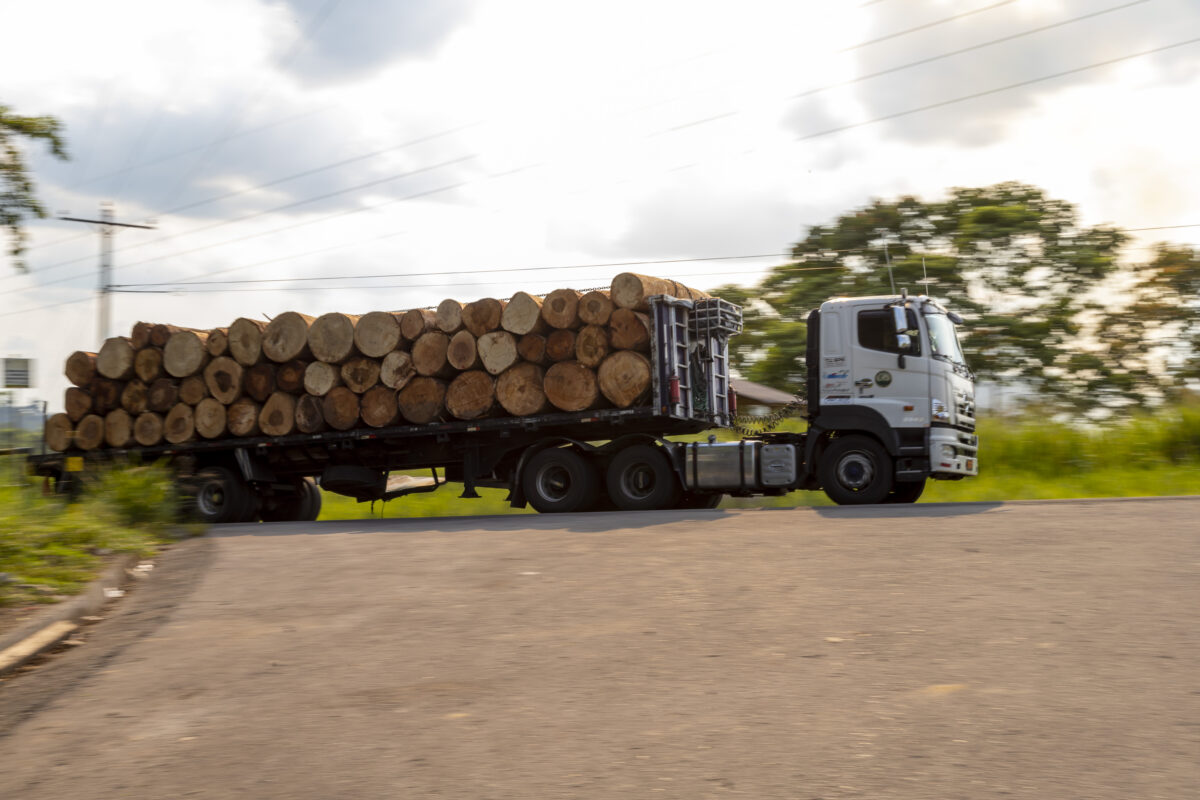
- Roads constructed for the oil industry have facilitated timber extraction in the Amazon for decades. Recent deforestation alerts show that this problem is ongoing.
- In Via Auca, one of the most deforested areas of Ecuador’s Amazon, farmers are turning to planting oil palm under the contract farming model.
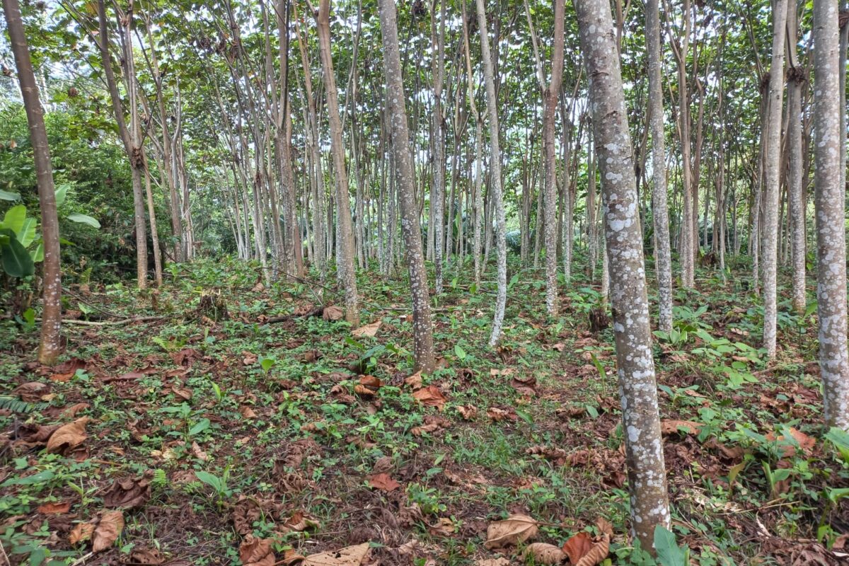
- On the Via a Loreto, Indigenous Kichwa people are focusing on cultivating balsa trees used for a material that has been in high demand in the wind energy industry for the last five years.
In the Ecuadorian Amazon, a region marked by half a century of extractive industries, mainly oil, deforestation is a constant. In recent years, a new threat to the conservation of these forests has emerged: the cultivation of balsa and oil palm under a contract farming model, that is, production developed under a prior agreement between farmers and buyers.
This was corroborated by a team from Mongabay Latam and La Barra Espaciadora that visited the “Via Auca” and “Via a Loreto” roads in the center-south and west of the province of Orellana. The team traveled to some of the areas that were deforested between January and March 2023, according to information from Global Forest Watch (GFW).
“Ecuador is among the five most deforested countries in Latin America,” said Natalia Greene, vice president of the Ecuadorian Coordinating Body of Organizations for the Defense of Nature and the Environment (CEDENMA). The epicenters of deforestation, Greene said, are around the large extractive projects for which roads have been built since the mid-20th century. This infrastructure has given free rein to loggers and settlers seeking land for agricultural and livestock production. In Orellana, which is in northeastern Ecuador, these areas border Yasuní National Park and the foothills of the Andes Mountains, where there are diverse and endemic ecosystems. “Their destruction can cause habitat fragmentation and species extinction,” Greene said.
However, the country’s Ministry of Environment, Water and Ecological Transition (MAATE) doesn’t think so, according to their response to a request for information for this article: “There is a low risk of fragmentation [in the province], because there are conservation categories such as the Socio Bosque Project, National System of Protected Areas, Forests and Protective Vegetation, Intangible Zones and initiatives promoted by this Ministry that are conserving the forest in the province of Orellana.”
Satellite images and field reporting, however, paint a different picture.

Orellana: One of Ecuador’s most deforested provinces
MAATE’s series of historical land cover change maps shows that between 2018 and 2020, the most recent period with available data, Orellana was among the five provinces in Ecuador with the highest annual gross deforestation rate, with 8,417 hectares (20,800 acres) of forest lost, an area 25 times the size of New York’s Central Park. Meanwhile, GFW reports that in 2022 alone, the province lost 6,170 hectares (15,250 acres) of primary forest.
According to early warnings from MAATE’s National Forest Monitoring System, 376 deforestation alerts were issued in Orellana between January and March 2023, mainly in the cantons of Joya de los Sachas and Francisco de Orellana, also known as Coca. Each alert represents the loss of at least one hectare (2.47 acres) of forest in areas that do not have environmental permits for logging, mining or oil concessions, agriculture, or other activities, according to Alex Quizhpe, coordinator of Forest Governance for MAATE’s REM Program, which receives international cooperation funding to reduce emissions from deforestation.
For its part, GFW registered 64,316 deforestation alerts throughout the province of Orellana between January and March this year. For GFW, each alert represents the possible loss of 30×30 meters (100×100 feet) of tropical forest, approximately the size of a basketball court.
In addition to the increase in deforestation, “there is a lack of consistency between regulations,” said Alonso Jaramillo, part of the Ecuadorian Social Group Fondo Populorum Progressio (FEPP) and former director of Yasuní National Park. “While it is true that there are laws to protect biodiversity, there are also regulations that allow large-scale logging,” he said. In fact, between 2018 and 2022, the MAATE issued 1,364 logging licenses on 25,952 hectares (66,600 acres) in Orellana, according to information sent by the entity to this journalistic collaboration.
MAATE responded that forest harvesting licenses that “allow the sustainable harvesting of forest resources (timber and non-timber) in the humid Andean and dry forests […] are issued to the owners of the properties in which Integral Management Plans, Forest Management and Cutting Programs have been previously approved.” Meanwhile, Jaramillo alleges that this type of exploitation benefits from illegal timber extraction. “They launder it, that is, they extract wood from protected areas where they do not have a license and load it where they do have a license. That’s how they legalize it,” he said.

Via Auca: A history of deforestation
Via Auca is located in the Francisco de Orellana canton (Coca), the most deforested canton in Ecuador between 2001 and 2020, according to a report released in late 2022 by Mapbiomas, an initiative that integrates a collaborative network of specialists on issues such as land use, remote sensing and programming. According to the information from MAATE, the canton saw deforestation rates of around 5,339 hectares (13,200 acres) per year between 1990 and 2000, 3,000 hectares (7,400 acres) per year between 2000 and 2018, and 4,300 hectares (10,600 acre) per year between 2018 and 2020.
GFW has more current data and records indicating that Francisco de Orellana lost 3,480 hectares (8,600 acres) of primary forest in 2022. The canton recorded 36,561 deforestation alerts between January and March in 2023, which represents 56.8% of all alerts in the province.
The Via Auca road connects Francisco de Orellana, the provincial capital, with Petroecuador’s Auca 61 oil block. Both the road and the block are named so because the area used to be the territory of the Waorani, called Auca (“savages”) by the Kichwa Indigenous people. Today, little remains of the forests and swamps that were once home to crops of morete or aguaje palms, the fruit used by the Waorani to make chicha (a fermented beverage), or to the animals that were historically hunted for food. Now, the area is inhabited mainly by settlers and, to a lesser extent, by Indigenous Waorani, Kichwa, and Shuar communities.
The Via Auca was built in the 1970s, when Texaco, an American oil corporation, began exploration in the Auca oil field and when mestizo migrants from the provinces of Manabí, Bolívar, Guayas, and Loja arrived in search of productive land. The road crosses the city of Francisco de Orellana, as well as the rural towns of El Dorado, Dayuma, and Inés Arango. The latter two are within Yasuní National Park.
“Agriculture is very much exploited,” said Carlos Martínez, president of Inés Arango. In past decades, settlers mainly grew cocoa, coffee and corn, while, in the meantime, oil activity continued to grow. The Auca block produces about 70,000 barrels of oil per day in 246 active wells, according to a production report released by Petroecuador on May 29, 2023.

The expansion of the agricultural and oil frontiers has taken its toll. On the one hand, oil spills are frequent, according to Washington Wilca, a territorial technician at the Alejandro Labaka Foundation, which works on research, cultural promotion, and organizational support for the Indigenous peoples of the northern Ecuadorian Amazon. On the other hand, “there are very few primary forests [left],” Martínez said. “Most of them were exploited many years ago to illegally extract timber. The remaining primary forests are in the territories of the Indigenous nationalities.”
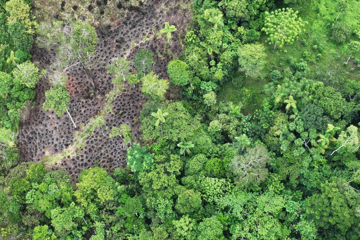
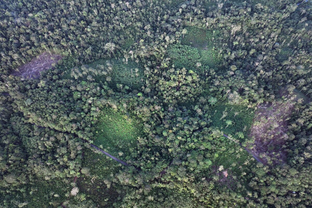
This journalistic team captured images and videos of deforested areas that were reported between January and March 2023 in the GFW alerts. Wilca assures that these areas are destined for balsa and palm cultivation. In fact, some palm crops can be seen in satellite images. The Labaka Foundation technician has observed a phenomenon related to a recent plantation where small investors used savings or money received from the oil companies’ payouts to buy farms in Inés Arango or Dayuma to plant African palm, since these areas are cheaper than locations closer to the provincial capitals. “It’s incredible how much oil palm cultivation is advancing,” said Alonso Jaramillo of FEPP.
Until 2022, the area destined for oil palm production in Ecuador was in decline due to “bud rot, reduced crop yields, the impacts of COVID-19, and the war between Russia and Ukraine,” the Ministry of Agriculture and Livestock said in response to a request for information for this article. The planted area was 16,071 hectares (39,700 acres) in 2017 and fell to 11,546 hectares (28,500 acres) in 2022. The Ministry did not provide data for 2023 but stated that Francisco de Orellana is the canton with the largest area of oil palm cultivation in the province, with 7,955 hectares (19,600 acres) planted in 2022.
Both Wilca and Jaramillo agree that oil palm monocultures require a lot of pesticides which, due to the water cycle, will end up in the rivers and cause bioaccumulation of toxins in the larger fish species, and eventually in humans. There are also other effects: “There is complete clearing of the land, avoiding reforestation with the native ecosystem,” said Natalia Greene. According to Carlos Martínez, president of Inés Arango, there are about 150 hectares (370 acres) of land for palm cultivation in this parish. In addition, he assures that in a few months, “more palm plants [from small investors] will be ready for transplanting in new hectares.”
The increase in oil palm cultivation is partly explained by the fact that oil companies provide facilities for farmers to plant: they supply seeds, give technical advice, and ensure the purchase of the production.

Via a Loreto: The raft keeps them afloat
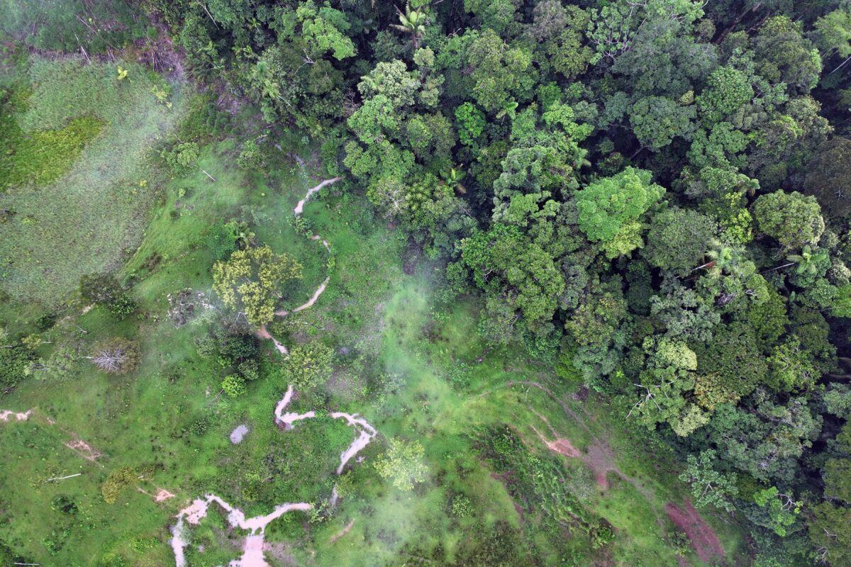
The Via a Loreto runs from the canton of Francisco de Orellana to the canton of Loreto, in the west of the province. It runs along a stretch of the Transversal Norte E20 highway, which connects the Amazon with Quito in the Andes and with the coastal province of Esmeraldas. Francisco de Orellana and Loreto are mostly inhabited by Kichwa communities with global property titles, although there are also settler communities, according to Marino Calva, an employee at the canton’s environmental office.
Most of the deforestation in this area occurred between 1990 and 2010, according to data from MAATE’s historical land cover change maps. Therefore, “the current forests are mostly secondary,” said Calva.
GFW recorded the loss of about 1,370 hectares (3,385 acres) of natural forest in 2022 in the canton of Loreto and generated 9,963 deforestation alerts between January and March 2023, equivalent to 15.4% of the alerts in the province of Orellana. Currently, Calva said, deforestation in these areas is due to small-scale rotational agriculture.
Ramón Grefa, leader of the Altomanduru Kichwa community, located on a stretch of the Via a Loreto in the Francisco de Orellana canton, assures that his community conserves 60% of its territory, while the remaining 40% is used for houses, farming, and livestock. For the past three years, the community members have been cultivating gmelina (Gmelina arborea Roxb), an exotic timber species, and balsa.
“There is still high demand for this product [balsawood], despite the fact that the price fluctuates from $30-40 per cubic meter [35.3 cubic feet] of roundwood. It has become evident that most of the administrative authorizations for balsawood harvesting programs are issued by the Ministry of Agriculture and Livestock, despite the fact that, in some cases, they are natural regeneration trees and not plantations,” MAATE told the reporters.
According to the Ministry of Agriculture and Livestock, “Balsa is a pioneer species that regenerates in agricultural production sites or abandoned sites that do not constitute native forest.” In the last six years, the Ministry has issued 262 administrative authorizations for balsa harvesting programs in Orellana, with an approved volume of 172,376 cubic meters (6 million cubic feet). The figure was 2,538 m3 (90,000 ft3) in 2018; 4,515 m3 (160,000 ft3) in 2019; 12,717 m3 (449,000 ft3) in 2020; 1,115 m3 (39,300 ft3) in 2021; and a record 80,988 m3 (2.8 million ft3) in 2022. As of May 2023, the approvals were already at 70,504 m3 (2.48 million ft3) of balsawood harvested; if the trend continues, 2023 will see the most timber harvesting ever recorded in the province.
The increase in demand for balsa is due to the upturn in renewable energy, as it is used in the construction of blades for wind turbines. Its cultivation requires less investment and effort than palm, and in addition, about six months after deforestation, this native species of the Amazon reappears as its seeds are dispersed by winds and grows fast.
On the Via a Loreto, community members have turned to cultivating balsawood, a fast-growing species. Photo: Courtesy of local sources.
“One of the main effects of the change from secondary forest to balsa cultivation is the decrease in ecosystem recovery,” said Belén Paéz, president of Fundación Pachamama, an NGO that works with Amazonian Indigenous peoples on autonomous territorial management.
Even though it is a native species, the cultivation and logging of balsa prevents forests from recovering. The result is a loss of ecosystem services such as nitrogen fixation, soil improvement, and erosion prevention. In addition, there can be a loss of carbon sources and habitats, as well as changes in microclimates and water patterns. The high demand for this product is causing “an exponential increase in the rate of deforestation that’s not only affecting secondary forests but also extending to primary forests,” Páez said.
Grefa, the Kichwa leader, estimates that in his community, which has about 3,100 hectares (7,660 acres) of land, there are about 50 hectares (124 acres) of balsa. “The forest has not been affected. They have been planted in secondary forests, not in primary forests,” he said. Marino Calva said that along the Via a Loreto, balsa crops have expanded on land that had already been transformed. “Very few have cleared forest to plant balsa,” he added. However, he is concerned that this new commercial dynamic promotes the felling of this species, which has important environmental functions.

The Kichwa communities along the Via a Loreto, unlike those near the Via Auca, do not plant African palm. “It’s not good for us,” Grefa said. “We don’t like it. We want to cultivate naturally, organically, so the soil, air and water aren’t affected.”
Given the increase in the area dedicated to palm and balsa cultivation, the experts consulted for this report agree that it is urgent that Ecuador’s Ministry of Environment and Ministry of Agriculture increase efforts to train farmers so that their crops productivity increases. Fundación Pachamama, on the other hand, together with the Achuar community of Sharamentza in Pastaza province, created a sustainable balsa management plan based on the compensation provided for not cutting down trees in fragile areas, which they hope can be replicated in Orellana.
Natalia Greene believes that another option to address deforestation caused by palm and balsa monocultures is to involve more communities in monitoring the land and biodiversity.
Banner image:Along the Via Auca, it is common to find patches of deforested land that will later be planted with agricultural or agroforestry crops. Image by Rhett A. Butler / Mongabay.
This article is the result of a journalistic collaboration between Mongabay Latam and La Barra Espaciadora in Ecuador.
This article was first published on Mongabay Latam website here on Apr. 19, 2022.
“Sinchiurco is coated with oil”: The Kichwa people going up against Petroecuador