
- Spurts of green spread across the African continent taken together accounted for over 400,000 square kilometers (154,000 square miles) of greening, an area the size of Zimbabwe.
- According to researchers, it’s important to distinguish how much of this greening is due to human efforts and how results much from broader climatic shifts.
- The team compared greening trends in target plots with neighboring plots; the latter, they hypothesized, would reflect changes in vegetation driven by broader climatic trends.
- Despite these advances, satellite imagery-based monitoring of vegetation growth can be a blunt instrument, especially where the data don’t capture differences in the greening, like those arising from agricultural expansion or reforestation.
Efforts to green the planet are in full swing, promising everything from mitigating climate change to stalling land degradation. But how well do these actually work?
Often, they sprout up as small-scale tree-planting or agroforestry schemes in far-flung areas. Pinpointing gains isn’t always easy. Visiting each site and verifying vegetal growth over time is a nonstarter, so researchers usually rely on satellites to monitor changes.
In a recent analysis, scientists from Wageningen University & Research in the Netherlands showed how monitoring of localized efforts can be improved. Across Africa, spurts of green accounted for more than 400,000 square kilometers (154,000 square miles) of greening, an area the size of Zimbabwe. But how much of that was driven by humans?
According to the researchers, the key is to distinguish the impacts of human efforts from trends that arise from broader climatic shifts. Historical climate records suggest that Africa oscillates between prolonged periods of greening and browning.
In the 1970s and 1980s, the continent experienced widespread droughts, one of the reasons for desertification along the Sahel belt that borders the Sahara Desert. It was initially thought to result from human activities, but recent climatological analysis linked the shift to El Niño, an unusual warming of the tropical Pacific Ocean, and other variations in sea surface temperatures. But during the past few decades, Africa has seen a trend of increasing vegetative cover.
How do we tell whether climatic conditions or human intervention are behind the small-scale transformations? To do so, the team compared greening trends in target plots with neighboring plots. The latter, they hypothesized, would reflect the larger patterns.
Greening hotspots are those where the amount of greening exceeded that in neighboring areas when there was a generally favorable environment for flora to flourish. Or when some greening showed up where surrounding areas remained unchanged. Or sites that bucked a background browning trend.
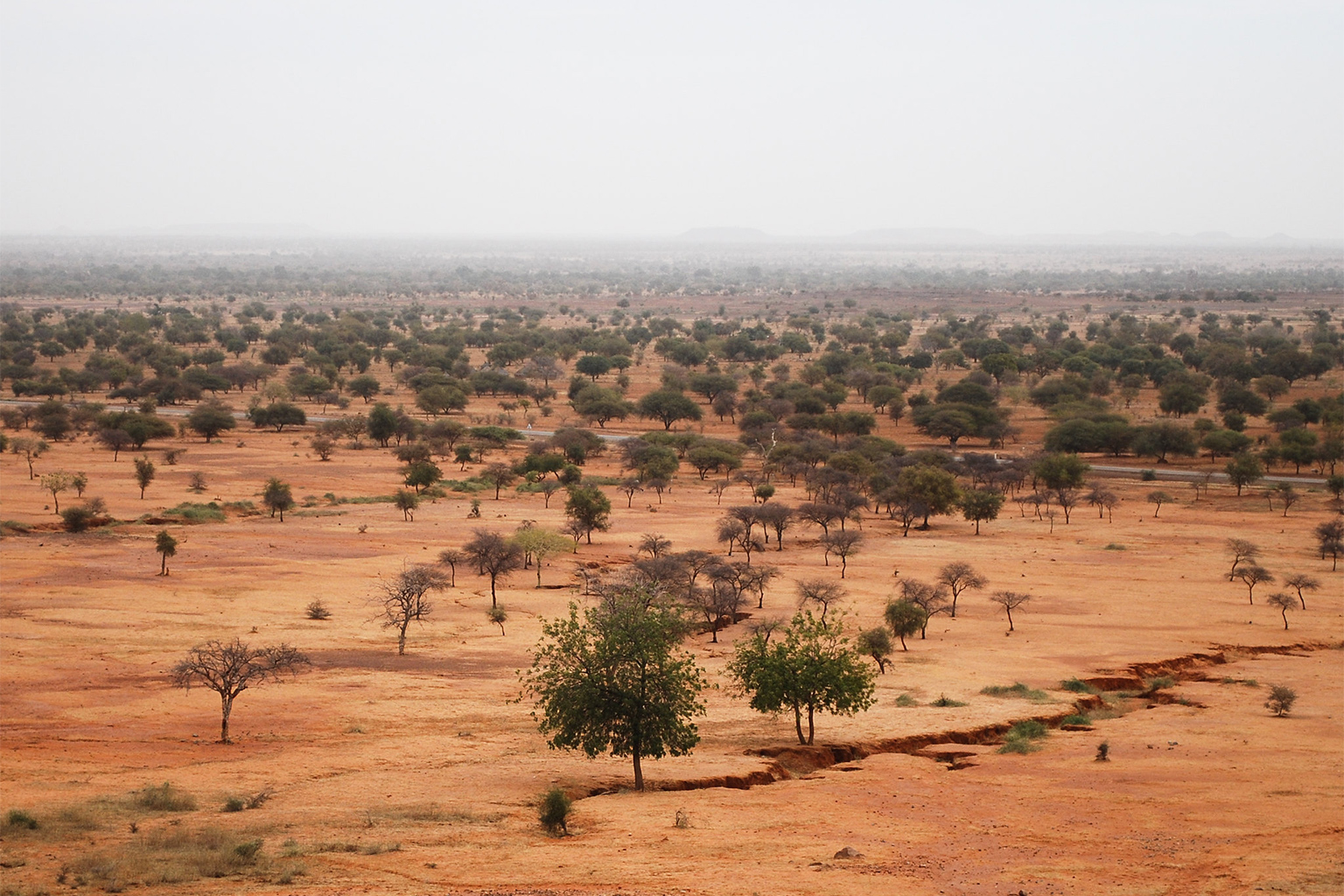
The team zoomed in on 434 sustainable land management initiatives operating across 628 sites. These ranged from plots actively being restored to others set aside to regenerate naturally. The hotspots appeared in the Sahel belt that runs across the continent, as well as in Kenya and Tanzania in East Africa, and parts of Southern Africa.
Greening efforts in semiarid areas perform especially well, the researchers found. Spikes in vegetative cover were less evident in already densely vegetated areas. (The team purposely excluded areas with very meager vegetation to begin with, like the Sahara Desert.)
Despite these advances, most satellite imagery continues to be a blunt instrument. It paints the green of land restoration in Kenya, forest cover change in South Africa’s protected areas, and woody encroachment into Lake Chad’s watershed with the same brush.
Remote sensing also doesn’t necessarily distinguish reforestation efforts from agricultural expansion, for example, as a result of environmentally damaging monoculture plantations. Even activities that can be legitimately considered part of restoration efforts, like tree planting, can be a gray area. Misguided or haphazard tree planting campaigns can do more harm than good: undermining native biodiversity, promoting nonnative species, or skewing water availability.
Banner image: A tree planting project in Rwanda. Image by Ministry of Environment – Rwanda via Flickr (CC BY-ND 2.0).
Scientists map nearly 10 billion trees, stored carbon, in Africa’s drylands
Citations:
Ruijsch, J., Teuling, A. J., Verbesselt, J., & Hutjes, R. W. (2023). Landscape restoration and greening in Africa. Environmental Research Letters, 18(6), 064020. doi:10.1088/1748-9326/acd395
Giannini, A., Biasutti, M., & Verstraete, M. M. (2008). A climate model-based review of drought in the Sahel: Desertification, the re-greening and climate change. Global and Planetary Change, 64(3-4), 119-128. doi:10.1016/j.gloplacha.2008.05.004
Veldman, J. W., Overbeck, G. E., Negreiros, D., Mahy, G., Le Stradic, S., Fernandes, G. W., … Bond, W. J. (2015). Where tree planting and forest expansion are bad for biodiversity and ecosystem services. BioScience, 65(10), 1011-1018. doi:10.1093/biosci/biv118