
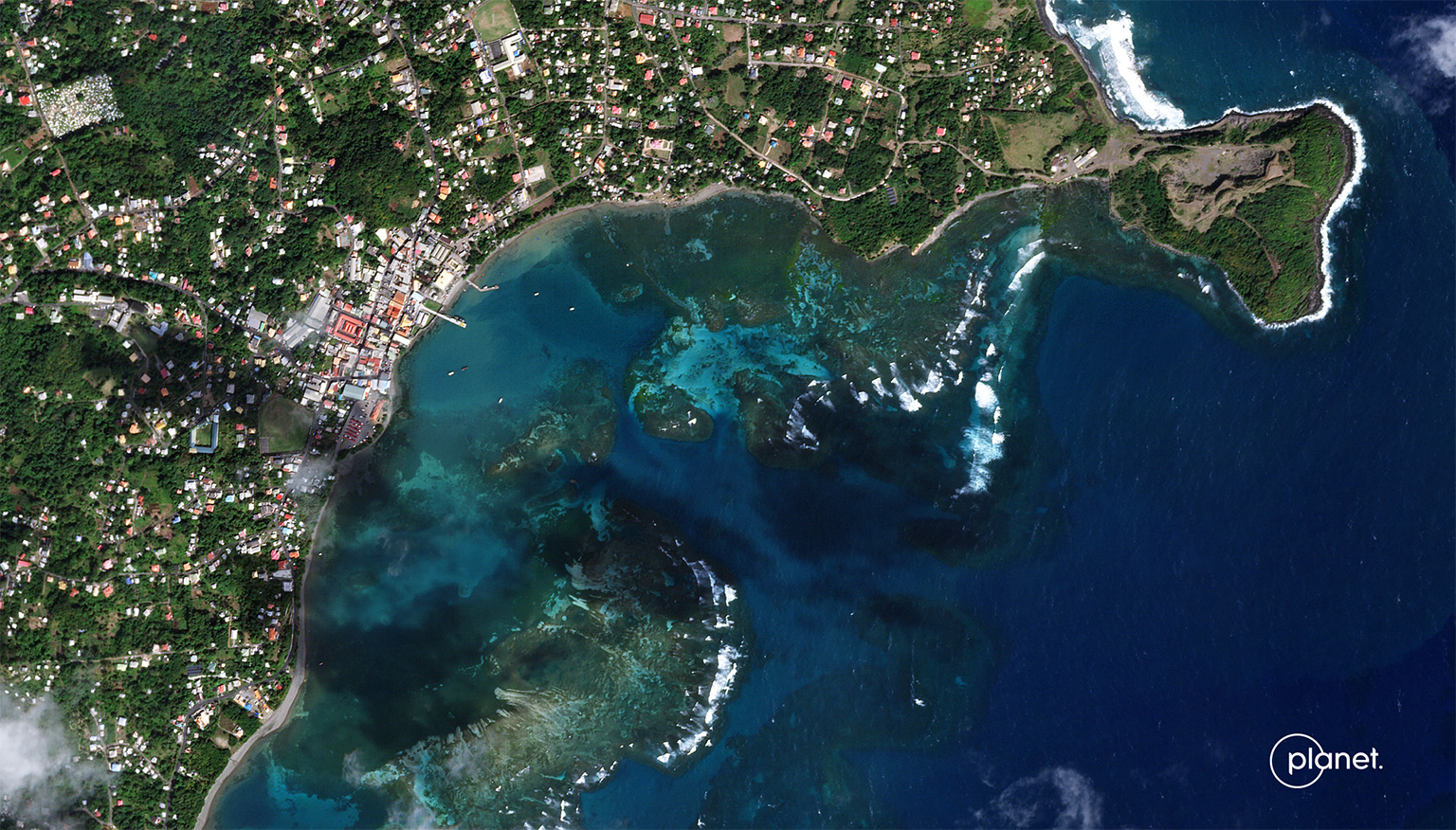
- The Blue Carbon Explorer, a digital tool developed by the nonprofit Nature Conservancy and the Earth-imaging company Planet, combines satellite imagery, drone footage and fieldwork to map mangroves and seagrass in the Caribbean, Papua New Guinea and Indonesia.
- The tool aims to help scientists, conservationists and governments gauge mangrove health and identify areas in need of restoration.
- The Blue Carbon Explorer comes at a time of growing interest in blue carbon ecosystems as potential nature-based solutions for climate change.
When Hurricane Dorian blazed its trail of destruction through the Bahamas in 2019, it ravaged the country’s mangroves. Almost overnight, coastal communities were deprived of a natural barrier that protected them from high tides and storm surges. Since then, several nonprofits and local organizations have taken up restoration projects to revive mangroves in the island nation.
But given the scale of destruction, where do you begin? How do you determine which areas to prioritize?
Florida-based nonprofit Perry Institute for Marine Sciences used a recently developed online tool to answer these questions. The Blue Carbon Explorer mapped out mangroves in the Bahamas, including a color-coded depiction of how their health had changed over time: red for mangrove loss, black for no change and green for mangrove growth.
With the help of this data, the Perry team was able to pinpoint areas where mangroves had degraded and were not likely to recover naturally and used this information to prioritize sites for restoration. The team is currently working with local groups to try out a suite of methods to restore mangroves in the worst-affected areas, including direct planting, letting waves disperse propagules naturally and dropping propagules from drones in hard-to-reach areas.
“The data in the tool found … degraded mangroves that are more isolated from the healthier ones,” Valerie Pietsch McNulty, conservation scientist at the nonprofit Nature Conservancy, told Mongabay in a video interview. “Those areas are less likely to recover naturally because they aren’t close to a seed source.”

The Nature Conservancy and the Earth-imaging company Planet developed the Blue Carbon Explorer, launching it in April. It combines high-resolution satellite images with drone footage and fieldwork to map out mangroves and seagrass. While the Bahamas was the first location where data from the Blue Carbon Explorer was applied for conservation purposes, the freely available tool also displays mangrove and seagrass vegetation across the Caribbean, Papua New Guinea and Indonesia, with plans to scale up across the world currently underway.
The Blue Carbon Explorer is not the first tool to map coastal ecosystems. However, because it uses satellite imagery from Planet, which operates one of largest satellite fleets in the world, the platform provides images in a high resolution, giving conservationists and governments access to data at a granular level.
“It’s a major advance because high resolution data lets these types of models be more accurate at scales that are more relevant to local populations,” Nicholas Murray, a senior lecturer in global ecology and conservation at James Cook University whose research focuses on coastal ecosystem changes and the application of scientific research in conservation, told Mongabay in a video interview. “This data will be extremely useful for people at a local level rather than just giving a broader picture, which is common in these types of analyses.”
The tool’s launch comes at a time of growing global interest in blue carbon ecosystems — mangroves, seagrasses and salt marshes — as potential nature-based solutions for climate change. Mangroves, for instance, sequester carbon from the air and store it in the soil and roots; per hectare, they can store four times more carbon dioxide than terrestrial forests, according to a 2011 study published in the journal Nature Geoscience. Seagrass meadows, on the other hand, store twice the amount of carbon dioxide per hectare as terrestrial forests, according to another study published in the same journal in 2012. These ecosystems also help buffer coastal communities against flooding and sea level rise, provide livelihoods for them, and are critical habitats for a wide variety of species.
Mapping and monitoring these important carbon sinks in high resolutions over spatial and temporal scales is imperative to conserving them, scientists say. “For knowing where negative changes are happening and whether conservation is working or not, these types of large-scale monitoring studies are important,” Murray said.
To make better estimates, the scientists who developed the Blue Carbon Explorer also derive information about mangrove canopy height from the GEDI mission, an effort to estimate biomass on Earth using lasers mounted on the International Space Station that is on hiatus until 2024. Apart from displaying the spread of mangroves and details on their health, the tool also enables users to extract other insights from the data.
“Sometimes, we don’t know what’s causing the degradation,” McNulty of The Nature Conservancy said. “Being able to see when the degradation started allows us to relate it to a hurricane or some kind of coastal development, and that gives us some insight on how we can mitigate those threats and make sure restorations are effective.”
As with any technology, McNulty said, the tool is to be used only as a guide. She emphasized that the expertise and knowledge of local communities take priority when governments and conservation organizations make plans for restoration. “It’s not a final decision-maker and needs validation on the ground at the local level,” she said.
The team is now working with the Bahamian government’s forestry department and local universities to set up monitoring programs to gather more field data, including information about tree height and canopy density. Determining the dimensions of mangroves accurately will improve estimates of the carbon they store.
McNulty said the field data also comes in handy for corroborating information from satellite imagery. For instance, while setting up the Blue Carbon Explorer, McNulty’s team initially misclassified another ecosystem as mangrove.
“Specifically in the Bahamas, there is this habitat called coppice that grows right up to mangroves,” she said. “We had to collect a lot of field data from right at the edge of where those habitats transition in order to make sure that those weren’t being mapped as mangroves.”
In September, Planet announced that in 2024 it would launch satellites with hyperspectral imaging capabilities that analyze a bigger spectrum of light than most satellites currently do, resulting in clearer, more detailed images. This could amp up the Blue Carbon Explorer’s utility.

“Their advanced sensing capability could look down at mangroves and seagrass and they would be able to differentiate between species, tell us about the biodiversity and how it is spread across the region,” Andrew Zolli, Planet’s chief impact officer, told Mongabay in a video interview. “They are also good at detecting methane and carbon dioxide emissions from these ecosystems.”
Zolli said he believes these data will be essential to track and monitor blue carbon as it emerges as a potential climate financing pathway. “If you can understand where it is, you can potentially finance climate adaptation and mitigation activities and help the communities that have stewardship over those coastal ecosystems do a more effective job,” he said.
Scientists who study coastal ecosystems say tools such as the Blue Carbon Explorer have reshaped how they access and analyze satellite data. The next step, they say, is to ensure that the data get to them faster so they can implement conservation actions more quickly.
“These tools have made cutting-edge science available to people and are breaking down barriers between science and real-world conservation,” Nicholas Murray said. “When I think of the world in 2030, I want the next step to be able to use this billions of dollars worth of space infrastructure to understand changes in the environment at a temporal scale that is really short and quick.”
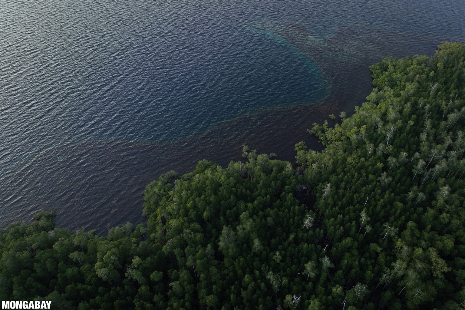
Banner image: Coral reef, ocean, mangroves, and forest in Raja Ampat, Indonesia. Image by Rhett A. Butler / Mongabay.
Abhishyant Kidangoor is a staff writer at Mongabay. Find him on Twitter @AbhishyantPK.
Return of the GEDI: Space-based, forest carbon-mapping laser array saved
Citations:
Donato, D. C., Kauffman, J. B., Murdiyarso, D., Kurnianto, S., Stidham, M., & Kanninen, M. (2011). Mangroves among the most carbon-rich forests in the tropics. Nature Geoscience, 4(5), 293-297. doi:10.1038/ngeo1123
Fourqurean, J. W., Duarte, C. M., Kennedy, H., Marbà, N., Holmer, M., Mateo, M. A., … Serrano, O. (2012). Seagrass ecosystems as a globally significant carbon stock. Nature Geoscience, 5(7), 505-509. doi:10.1038/ngeo1477