
- Increasingly severe flooding in Bangladesh threatens the homes and livelihoods of some 10 million people who live on river islands known as chars.
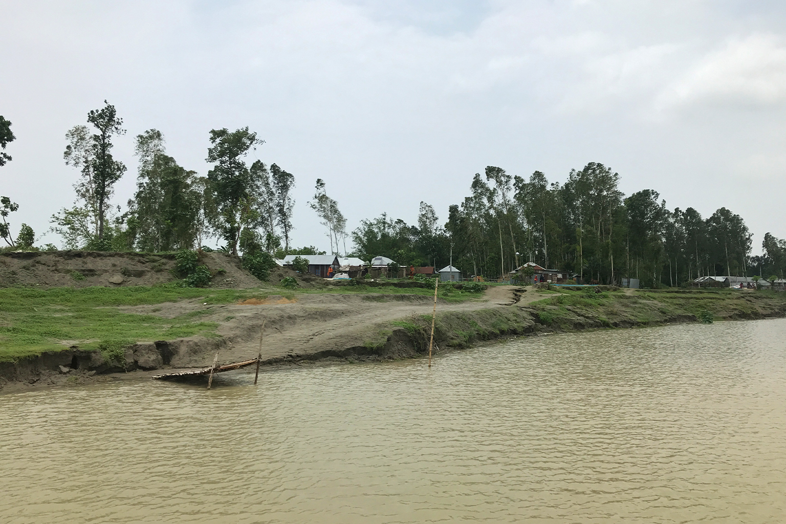
- The rate of erosion of these chars has increased in recent years amid an intensified monsoon season that swells the volume of the Ganges, Brahmaputra and Meghna rivers where the low-lying chars are located.
- As an adaptation measure the government and NGOs are supporting char communities to raise the height of their homesteads to protect themselves during the monsoon.
At 49, Hamid Ali has moved house at least eight times in his life. The reason each time has been the same: the erosion of the char lands, or river islands, in the Brahmaputra River as it flows through Bangladesh’s Kurigram district.
In the early 1980s, the char of Astomir was completely submerged, forcing Hamid Ali and other inhabitants of the island to move to another char, Notakandi. Astomir reemerged from the water in the late 1990s, allowing the inhabitants to return. Since then, Hamid Ali has lived there with his family, growing crops on a fifth of a hectare, or less than half an acre.
According to the National Char Alliance, about 10 million people in Bangladesh live on 109 coastal and river chars, exposed to the vagaries of the annual floods. These chars cover around 10% of land in 32 of the 64 districts of Bangladesh, including Kurigram.
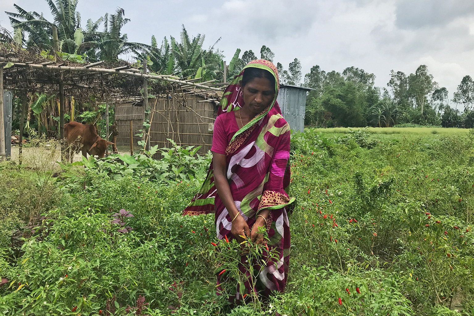
The people living in chars tend to be poor. Some of the relatively better off in these areas have long adopted the practice of raising the height of their homesteads during the monsoon, when a massive volume of water passes through the transboundary rivers that carve through Bangladesh on their way to the Bay of Bengal.
Between November and March, when the water is low, these char inhabitants raise the height of their homes by building a base with earth collected from other places. They also build a ghat, or flight of steps, for access to the raised platform, and plant grass and water vegetables along the boundaries to prevent erosion.
This traditional practice by char inhabitants is now being adopted across the region, even by people who couldn’t afford to do it before, with support from the government and NGOs, as a form of adaptation to weather extremes.
Initiatives supporting this practice include the Chars Livelihoods Programme and the Community Climate Change Project (CCCP) of the Palli Karma-Sahayak Foundation (PKSF), all aimed at reducing the vulnerability of char dwellers.
“Taking the experience of locals, we are building cluster-wise plinths where the most vulnerable people live,” said Fazle Rabbi Sadeque Ahmed, deputy managing director of the PKSF.

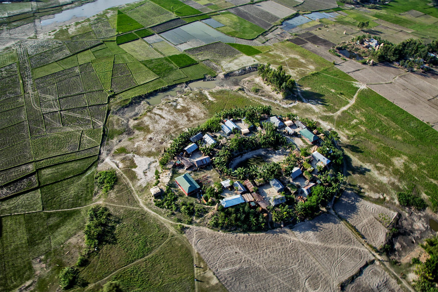
Friendship, an NGO, has introduced a new plinth design: oval-shaped and standing 2.4-3.7 meters (8-12 feet) above the ground, they’re compact and designed to minimize the impact of the water flow from the north. Each plinth is effectively a village for 18-30 houses.
“Around 120 to 200 families and their livestock are accommodated on each plinth,” said Md Labibul Islam, project manager at Friendship. “The height of the plinth is set according to historical records of flood and water level.”
Moslem Uddin Fakir, 50, lives on Notakandi Char, also in Kurigram district. He began his new life in a raised homestead in 2018.
“Nowadays, we feel secure during the monsoon because we know our house and cattle will be saved,” he said.

Floods, erosion, migration
Some of the major climate change impacts on Bangladesh include river erosion, flash floods, and recurring and prolonged monsoon floods due to changes in rainfall patterns within the country and in upstream regions in India.
In recent years, the Centre for Environmental and Geographical Information Services (CEGIS) has been monitoring erosion caused by three major rivers in Bangladesh: the Ganges, Brahmaputra and Meghna. In 2019, it recorded 725 hectares (1,792 acres) of land swallowed by the Brahmaputra and 1,240 hectares (3,064 acres) lost to the Ganges (the lower stretch of which is known in Bangladesh as the Padma).
In 2020, more land was lost to these rain-swollen rivers: 1,120 hectares (2,768 acres) to the Brahmaputra and 1,265 hectares (3,126 acres) to the Ganges. Roads, arable land, schools, health facilities, government and nongovernment establishments stood on this land that had been eroded.
CEGIS also found the average width of the Brahmaputra had widened from 8.5 to 12.2 kilometers (5.3 to 7.6 miles) between 1973 and 2009.

Every year, about 10,000 people lose their homes and livelihoods to river erosion, according to Bangladesh Water Development Board data.
“Proper and adequate river training could lower the impacts of erosion,” said Maminul Haque Sarker, senior adviser on river, delta and coastal morphology at CEGIS. He added, “we need to also consider many other aspects, including the changing pattern of rainfall, navigability, and deforestation upstream, which increases the amount of sand in water.”
Nearly two-thirds of people living on chars depend on agriculture for their living, according to Bangladesh Bureau of Statistics data. The rate of poverty among char residents is 32.4%, far higher than the national average of 24.3%.
“Many people from the chars used to travel the country as seasonal laborers, while some left the region permanently,” said Atiur Rahman, an economist and professor at Dhaka University who leads the National Char Alliance.
Rahman called on the government to allocate more money for char residents to improve facilities like housing and livelihood options, so that migration from these areas can be halted.
Banner image: Houses built atop a plinth on one of the islands. Image courtesy of Friendship.
Citation:
Ansari, M. S., Warner, J., Sukhwani, V., & Shaw, R. (2022). Implications of flood risk reduction interventions on community resilience: An assessment of community perception in Bangladesh. Climate, 10(2), 20. doi:10.3390/cli10020020
Feedback: Use this form to send a message to the author of this post. If you want to post a public comment, you can do that at the bottom of the page.