
- Marine researchers are increasingly turning to aerial drones for a new view of the ocean, given that their resolution is much finer than that of satellites.
- While drones are used in all kinds of ways in marine studies, researchers say drones can be equipped with special sensors to track small changes in the ocean’s movements that drive much of marine life.
- Drones could be especially helpful in finding and tracking local and dangerous algae blooms, for example.
- Researchers remain hindered by regulations and cost, but that hasn’t stopped them from using drones to increase our knowledge of our blue planet.
How do you keep an eye on the expansive ocean? You could hop on a boat and get really close to the water. You could do it from tens of thousands of kilometers away using satellites that orbit our planet each day. Or you could use a new tool: aerial drones.
In fact, drones, which fly at much lower heights than satellites but higher than sea-based surveys, offer perspectives that can fill in key observational blind spots in the ocean, according to a new review published in Frontiers in Ecology and the Environment.
“From a ship, you’re just moving along and taking one sample after another. So they’re kind of point samples,” said Patrick Gray, the study’s lead author and a Ph.D. student at the Duke University Marine Lab in North Carolina, U.S.
Satellites give a different view, but also limited. For example, the smallest thing a satellite can “see,” also called its resolution (or pixel size), ranges from a few hundred meters to a kilometer, according to Gray. By contrast, drones can have a resolution that’s as small as few centimeters wide.
Drones are already being used to the study the ocean in a variety of ways. Their onboard cameras are being employed to map coastlines. They’re also being used to track whales and dolphins, and to better understand the behavior of seabirds. But there’s one growing use of aerial drones that Gray and his colleagues are particularly interested in: remote sensing.
Like satellites, researchers can equip drones with specialized sensors that measure the color and temperature of the ocean. These are proxies that scientists use to understand various physical and biological changes close to the ocean’s surface. Unlike satellites, however, drones can observe these changes at much smaller scales.
Gray, for instance, uses drones to study an oceanic front or “boundary” that separates coastal water from the open ocean water.
“These huge water bodies are just smashing up against each other, and you can see an individual line in the water that divides them,” he said.
In a satellite image, this meters-wide front would look like a blur in a pixel. But Gray and his colleagues have flown drones along and across the oceanic front, over and over again to capture intricate details.
“We can see how the front is changing, and how it’s moving,” he said. “And because of the way the front works, it drives this vertical circulation, which brings nutrients from deeper in the ocean up to the surface layer.”
It is these fine-scale movements of the ocean water that determine where a lot of marine life thrive. Consider, for example, phytoplankton, a diverse group of microscopic, photosynthesizing marine organisms that are critical for life on our planet. By using their chlorophyll to create food, phytoplankton form the basis of the ocean’s food web. They are estimated to produce nearly half of the daily oxygen in our atmosphere. And they’re important for slowing climate change: when phytoplankton die, they sink to the ocean floor, taking a huge amount of carbon with them.
Phytoplankton grow and die in a matter of a few days. And where they grow, or not, depends on factors like changes in light and nutrients in the ocean at very fine scales. Aerial drones with sensors for ocean color can be especially useful to track changes in where the phytoplankton are, Gray said.
This has implications for our health, too. If there’s a sudden influx of nutrients, such as from agricultural runoff, certain types of phytoplankton can grow explosively, forming algal blooms that produce harmful toxins. When such blooms cover large areas in the ocean, satellite images can pick them up. But in many cases, blooms are small in extent.
“Knowing exactly where these harmful algal blooms are is really important,” Gray said. “Oftentimes they’re pretty small and you want to make sure people aren’t swimming there or fishing there. So, it’s a really nice use of drones because you can go out, fly your drone and say, OK, the harmful algal bloom is right here. People should stay away from it.”
Drones have another advantage in tracking algal blooms. Many of these blooms occur on the coast, Gray said, at the intersection of land and water where satellite images can be hard to interpret. “If you look at ocean-observing satellite imagery right along the coast, the pixels are so big — let’s say it’s half land, half ocean — you don’t know which is which.”
But the drone, with its heightened resolution, can track a local bloom far more effectively.
Moreover, unlike satellites, drones can measure ocean color or temperature under cloud cover.

“The review paper brings forward some excellent points regarding the ability of aerial drones to complement satellite-imagery/remote sensing techniques,” Lilian Lieber, a marine ecologist at Queen’s University of Belfast, U.K., who was not involved in the study, said via email.
Lieber and her colleagues recently used low-cost, consumer-grade aerial drones to capture how seabirds interact with turbulent sea surfaces to find prey.
“Satellite imagery does not yet allow the temporal and spatial resolution to capture these highly dynamic interactions and therefore, aerial drones provide a great alternative to address these blind spots,” she said.
The full potential of drones is yet to be unlocked, according to Gray. Drones need better sensors that can measure more color bands with greater sensitivity, for example. That would help researchers distinguish between different species of phytoplankton, he said.
Making drones more autonomous could also be hugely beneficial; an autonomous drone could take off every morning by itself and check areas where people swim for algal blooms. There’s also the possibility of deploying swarms of drones.
“Some of my work is with the Gulf Stream, which moves at 3 to 4 meters per second [10-13 feet per second], and it’s changing as it’s moving,” Gray said. “The satellite isn’t quite right to capture what’s going on, but a single drone isn’t quite right either. You need a dozen drones or a half dozen drones to go map some of these eddies and currents.”
As with any technology, there are limitations to what drones can achieve. Drone footage can be affected by weather, for example; if it’s raining and the sensors get wet, the images can be blurry. Or when wind speeds are high, the seawater can get white and foamy, which makes it hard for drones to capture good data.
A good drone, sensor, and software setup can also be expensive, and operating drones requires training, Gray said. Additionally, there are regulations to consider.
In the U.S., for example, drones cannot be flown higher than about 120 m (400 ft). They must also stay within the operator’s line of sight, which often means about 2 km (1.2 mi), Gray said.
“In the open ocean, you may want to go further away. If you have to follow the drone with a big, expensive boat, it takes away a lot of the advantages of having the drone in the first place.”
Researchers can apply for waivers, but it definitely limits what they can do, Gray added.
Despite these challenges, he said he’s excited about what the future holds.
“People want to use drones; they have the money to buy these things. They just don’t know how to do it,” Gray said. “So, we need more coordination on what the best sensors are, what the best platforms are, and how to best analyse the data we collect using drones. Not everything’s going to be quickly fixed, but we’re on the way.”
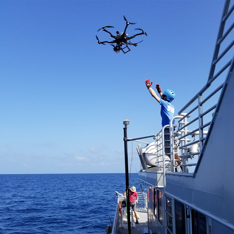
Banner image: A marine researcher launching a drone off the deck of the R/V Shearwater for ocean color surveys of the Gulf Stream just off Cape Hatteras, North Carolina, U.S. Image by Patrick Gray.
Citation:
Gray, P. C., Larsen, G. D., & Johnston, D. W. (2022). Drones address an observational blind spot for biological oceanography. Frontiers in Ecology and the Environment. doi:10.1002/fee.2472
Lieber, L., Langrock, R., & Nimmo-Smith, W. A. M. (2021). A bird’s-eye view on turbulence: Seabird foraging associations with evolving surface flow features. Proceedings of the Royal Society B: Biological Sciences, 288(1949). doi:10.1098/rspb.2021.0592