- The Earth Defenders Toolkit is a growing collection of apps, resources and blogs where Indigenous peoples and their allies can come together to connect and mobilize.
- The goals of the toolkit are to support local autonomy, allowing Indigenous communities to maintain ownership of data and reduce the need for outside support.
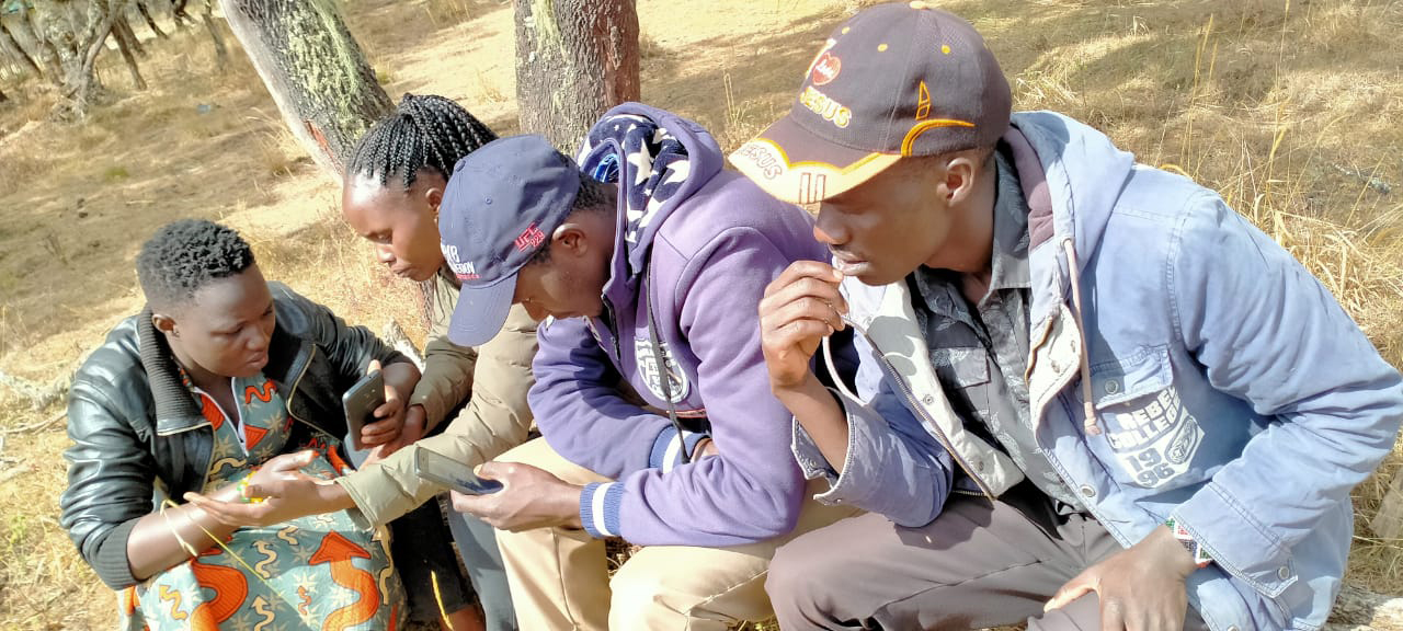
- One successful app within the toolkit, Mapeo, helps Indigenous communities around the world map and monitor environmental and human rights information.
- The toolkit keeps the needs of Indigenous communities at the forefront, overcoming barriers inherent to technology, like participation and security.
To hear an audio version of this article, listen here:
Technology isn’t always a practical solution for Indigenous communities fighting for their land rights. Some technology requires internet access, which often isn’t available in remote areas. And some technology can be needlessly complicated and expensive, alienating some community members.
The Earth Defenders Toolkit is working to help overcome these barriers. It’s a living collection of tools and resources for Indigenous communities on the front lines of defending their land. The toolkit is also a space where environmental and human rights defenders and allies can connect, share stories and mobilize together. It supports local autonomy and data sovereignty while minimizing dependency on outside support.
“We’re hoping to create more spaces for community so earth defenders can sort of share stories and successes and pain points and obstacles,” said Rudo Kemper, a program manager at Digital Democracy.

Digital Democracy, along with local partners, created the Earth Defenders Toolkit after seeing that two effective apps, Mapeo and Terrastories, closely aligned in the fight for Indigenous rights. The toolkit formally launched in June 2021.
So far, the toolkit includes helpful guides for communities looking to get started on a project, collaborative forums for allies to connect and share knowledge, and case studies from earth defenders using technology successfully. And if a land defender doesn’t know where to start, there’s an interactive tool finder that helps users learn what is out there and what might be best suited for their goals.
Many communities use social media, like Facebook and TikTok, to share information. But earth defenders often need a platform where they can share information securely without putting sensitive information on the internet, especially when a government may monitor social media platforms.

Monitoring Indigenous lands with Mapeo
The Waorani Indigenous people, who live in the forested headwaters of the Ecuadoran Amazon, have long struggled to protect their lands from the oil industry. Along with Alianza Ceibo and Amazon Frontlines, the Waorani approached Digital Democracy to help map their sacred lands.
Together, they created Mapeo, a simple map editor for earth defenders to document environmental and human rights information on their land. Users can record important places or resources, like ceremonial houses, hunting grounds, and medicinal plants. In fact, mapping the lands helped save 180,000 hectares (445,000 acres) of Waorani land from oil drilling in 2019.
Mapeo doesn’t have the steep learning curve typical of other mapping technologies, so it doesn’t isolate community members, said Aliya Ryan from Digital Democracy. It can also work offline in remote areas and without a central internet server that governments can sometimes control.
Some information “might not seem sensitive to us, but within the community is seen as sensitive and maybe not even everybody in the community has access to certain bits of information,” Ryan said, adding that the community decides how the data get used.

Mapeo is a landmark app in the Earth Defenders Toolkit. And now, other Indigenous groups are using it, like the Ogiek of Mount Elgon in Kenya. The Ogiek are the original inhabitants of Kenya’s highlands, but after ongoing evictions that began in the early 20th century by the government and more dominant communities, the Ogiek now only live on a fraction of their ancestral land. Today, their land rights are not fully recognized.
The Ogiek created the Chepkitale Indigenous Peoples’ Development Project (CIPDP) in 2003 to help get their land rights recognized. In partnership with Digital Democracy and the Forest Peoples Programme, CIPDP uses Mapeo to monitor their resources to help the Ogiek shift local power dynamics.
Mapeo lets “the community collect and leverage data describing their land and resource use … to better defend and advance their land rights,” said Phoebe Ndiema, a project officer with CIPDP.
Telling place-based stories with Terrastories
More than 300 years ago, when the Dutch ran Suriname, many imported slaves escaped to the country’s forested interior instead of enduring a life of enslavement on the coastline. After battling and evading Dutch soldiers and helping to liberate others, the Matawai, as this group came to be known, forced the colonial government to sign a peace agreement. A displaced community, they depend on stories to find resources and uphold a cultural connection to their homelands. To do this, the Matawai of Suriname helped create Terrastories, a place-based storytelling app that serves as a repository of traditional knowledge through oral history and storytelling.

Gold mining, telephone towers and logging roads threaten the Matawai villages by bringing wide-ranging changes, with some young people finding work in the mines or leaving to live a more modernized life.
Using Terrastories, communities link audio or video content to places on a map, helping young people get to know their history and cultural identity.
The Haudenosaunee people at Six Nations Reserve in Canada are also using Terrastories to map ecological knowledge, Indigenous stories and water quality data.
Strengthening voices
Technology is only a small part of this process. For technology like this to work, it must consider the entire system: culture, history, and environment.
“At the end of the day, it’s human processes … that matter the most. And technology can help to supplement those processes, but it can’t be the primary solution,” said Digital Democracy’s Kemper.
One byproduct of the mapping projects is boosted solidarity as nearby villages get to know each other and communicate more than ever, he added.
And there are many ways to get involved. Earth defenders can design new tools, write blog pieces or translate existing resources into other languages.
Digital Democracy is looking to users to see what works and what doesn’t. Right now, the toolkit focuses mainly on monitoring tools. One next step is to focus on language activism because many communities are losing their native languages.
“I hope this work will inspire others … who are facing land rights struggles to learn from us … strengthening their advocacy voices,” said Phoebe Ndiema.
Caitlin Looby is the 2021 Sue Palminteri WildTech Reporting Fellow, which honors the memory of Mongabay Wildtech editor Sue Palminteri by providing opportunities for students to gain experience in conservation technology and writing. You can support this program here.
Editor’s note: This story was supported by XPRIZE Rainforest as part of their five-year competition to enhance understanding of the rainforest ecosystem. In respect to Mongabay’s policy on editorial independence, XPRIZE Rainforest does not have any right to assign, review, or edit any content published with their support.