
- Nearly 800 mining concessions in Indonesia are located in areas prone to earthquakes, landslides and floods, a new report shows.
- Environmental activists say the proliferation of these concessions shows a lax attitude by companies and the government toward environmental risk assessment.
- They warn that mining activity in these areas could lead to disaster for local communities and the environment, including spills of toxic tailings and pollution of water sources.
- Communities living near many mining concessions have voiced their concerns over such risks.
JAKARTA — Hundreds of mining concessions across Indonesia lie in areas prone to earthquakes, landslides and floods, making them ticking time bombs for local communities, according to a new report.
The Mining Advocacy Network (Jatam), an Indonesian NGO, says 104 mining concessions, covering a combined area of 1.6 million hectares (3.9 million acres) — half the size of Belgium — are vulnerable to earthquakes. Forty-nine of these concessions are located on the island of Sumatra, with 23 on Sulawesi and 21 in the Malukus. Most are opposed by communities living in those areas.
“These mines aren’t operating in vacant space,” said Jatam legal researcher Muhammad Jamil. “The majority of them are operating in disaster areas.”
Jatam data from 2019 show the government has issued at least 783 mining licenses in disaster-prone areas. Eleven coal-fired power plants are also located in areas vulnerable to disasters that include landslides and floods.

‘Very real’ consequences
The issue of mining-related natural disasters has come under the spotlight recently following widespread flooding in the Bornean province of South Kalimantan in January. Environmental activists and a senior minister attributed the scale of the flooding to the degradation of the water catchment area by coal mines and oil palm plantations. The environment minister and the president, however, blamed the high volume of rainfall.
Not so, said Arie Rompas, Greenpeace Indonesia’s forest campaign team leader, pointing to data showing that the forest cover in South Kalimantan’s watershed area has declined to less than 30% on average due to the expansion of the oil palm and mining industries.
“Deforestation and land use have very real contribution to the flood in South Kalimantan,” he said. “So this counteracts the narrative of the president and the government who don’t want to see the issue of land use change, but only see rainfall.”
Jatam has identified 70 coal-mining concessions throughout major watershed areas in South Kalimantan, as well as 814 abandoned mining pits in the whole province.
Activists say the proliferation of mining activity will exacerbate disaster risks in areas that are already fragile in the first place as environmental destruction wrought by the mining industry has been linked to major natural disasters in the country.
Grita Anindarini, program director at the Indonesian Center for Environmental Law (ICEL), said all disaster-prone areas should been off-limits to mining because they are designated as protected zones.
“In principle, the utilization of protected areas should be very rigid and limited,” she told Mongabay.
In practice, however, authorities often issue mining and other licenses for commercial activity in disaster-prone areas, flouting zoning bylaws in the process.
Jatam executive director Merah Johansyah pointed out that President Joko Widodo once said in 2019 that infrastructure development projects should be allowed in disaster-prone areas.
“While he didn’t directly refer to mining … mining also has infrastructure components” such as roads, Merah told Mongabay.
Indonesia’s disaster mitigation agency, BNPB, said last year that if there are indications that mining in a particular area could potentially cause disasters, it must be halted immediately.
Another risk is that mining in an area that’s not disaster-prone could turn it into one, Grita said.
“Let’s say an area is designated for industrial activities, and then it is mined over and over again, causing its environmental carrying capacity to be exceeded,” she said. “Then the area has to be rehabilitated first.”

Corporate (lack of) accountability
Jatam’s Jamil said companies applying for mining permits and the government authorities that issue them are responsible for the natural disasters linked to those mining activities.
“The law states every mine has to have a disaster risk analysis when it is located in a disaster-prone area,” he said.
While not all licensed mining concessions are being actively mined, Jatam has identified 10 companies currently operating in disaster-prone areas: Agincourt Resources, Sinar Indah Persada, Citra Palu Mineral, J Resources Bolaang Mongondow, Gorontalo Minerals, Indotan Sumbawa Barat, PT Trio Kencana, PT Dairi Prima Mineral, Meridien Inti Energy, and Vale Indonesia.
Agincourt Resources controls the largest concession among these companies, at 130,252 hectares (321,860 acres) straddling three districts in North Sumatra province. Activists have long pointed to the potential for tailings from its Martabe gold mine to leak into surrounding villages and rivers if an earthquare hits the seismically active area.
That particular region sits atop the Great Sumatran Fault. U.S. Geological Survey data show that since 2000, there have been 15 earthquakes of magnitude 7 or larger on or near Sumatra.
In 2018, the Mining Monitoring Network (JMT) raised concerns about Agincourt’s tailings pond, where it stores the slurry of mining waste, being located in a hilly area adjacent to villages. The NGO said an earthquake could cause the tailings pond to breach, sending the waste into the villages and rivers.
Also in North Sumatra, PT Dairi Prima Mineral operates an underground zinc mining project, and has plans to relocate its tailings facility closer to villages. Gerson Tampubolon, a resident of one of the adjacent villages, said he’s worried about the plan, given that the area is already prone to earthquakes.
“This is worrying for people if the dam bursts,” he said. “Surely it will heavily affect villages, agriculture, rivers, biodiversity, and so on.”
Fellow villager Hasugian asked “What will happen if an earthquake comes? This will threaten people who live downhill, which is us.”
Hasugian said that in 2012, the company started exploring in the area, and waste from its activity polluted the villagers’ land and rivers, albeit at a small scale.
“What if it’s on a large scale?” he said. “We reject this project.”
Jamil from Jatam said pointed out that PT Dairi Prima Mineral’s biggest shareholder, the Bakrie Group, has a dismal track record when it comes to environmental disasters.
In 2006, a mud volcano erupted in a concession of Bakrie Group oil and gas subsidiary PT Lapindo Brantas in East Java province. Since then, the mud volcano, the world’s largest, has continued erupting, submerging thousands of hectares of land and displacing more than 40,000 people.
Lapindo executives insist the disaster was triggered by a distant earthquake rather than its drilling activities. But research published in 2015 by Australia’s Adelaide University concluded that the mud volcano was the result of oil and gas drilling.
Jamil said cases like that of Lapindo, in which the government has assumed responsibility for compensating the affected communities, is illustrative of how companies can shirk any liability whenever their activities contribute to disasters.
“Based on our findings, almost no companies have been prosecuted for causing man-made disasters,” he said.
Lax attitude to disaster risk
Eko Teguh Paripurno, director of the disaster mitigation study center at the National Development University (UPN) Veteran Yogyakarta, said Indonesia’s mining industry in general still doesn’t account seriously for disaster mitigation. As result, he said, it’s the communities near mining areas and the environment that bear the risks.
This lax attitude toward disaster risk might become more widespread under a series of newly passed regulations that make it easier for companies to obtain or renew their licenses, while at the same time weaken environmental safeguards, Eko said.
“I see an increase in disregard [for disaster risks] looking ahead, with legal products that create loopholes for these risks to fester,” he said, adding that policymakers tend to see environmental protections as barriers to development that should be brought down.
ICEL’s Grita cited the revised mining law and the deregulation package known as the omnibus law on job creation as the two new sets of regulation that will make it easier for miners to operate with less oversight.
“The omnibus law allows nationally strategic projects to be located in areas that fall outside zoning bylaws,” she said. “This is very dangerous because zoning plans and environmental impact assessments are crucial instruments to prevent environmental degradation, but they’re being weakened.”
She also highlighted an article in the new mining law that says once an area is zoned for mining, it can’t be reverted to its previous protected designation.
“If there is a natural disaster in a region that has been determined as a mining area, and then the carrying capacity of the environment there has been passed over, then there can’t be any change,” Grita said. “That region will remain as a mining area, instead of getting rehabilitated. This is very dangerous in the context of prevention of environmental degradation and pollution.”
And if landslides or other disasters that occur in these degraded areas, the government will once again blame natural factors instead of the mining activity that led to it, Eko said. The lack of serious assessment of environmental risk by mining companies “will culminate in disasters,” he said. “And when disasters strike, there’s a tendency for a hands-off attitude, and to seek a scapegoat.
“It feels like every [disaster] gets blamed on the weather,” Eko added. “In the end, God is the one that becomes the scapegoat.”
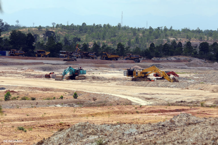
Banner image: The Batu Hijau mine is an open pit copper-gold mine operated by PT. Amman Mineral Nusa Tenggara. The mine is the second largest copper-gold mine in Indonesia behind the Grasberg mine of PT. Freeport Indonesia. Image by Rhett A. Butler/Mongabay.
FEEDBACK: Use this form to send a message to the author of this post. If you want to post a public comment, you can do that at the bottom of the page.