
- In early March 2020, Mongabay founder Rhett A. Butler visited the tri-border area of Peru, Colombia and Brazil and used the opportunity to explore a cluster of potential deforestation hotspots detected by Global Forest Watch’s GLAD alert system.
- According to Global Forest Watch, the patches were small and dispersed. Therefore Butler expected to find small-scale clearing for subsistence or local agriculture. But he was in for a bit of a surprise: forest within an indigenous reserve was being cleared for coca, unbeknown to the local community.
- Given the sensitivity and the potential security implications of the issue, Mongabay won’t be disclosing the name of the community or the location of the coca fields.
- This post is insider content, which is available to paying subscribers.
In early March 2020, I visited the tri-border area of Peru, Colombia, and Brazil and used the opportunity to explore a cluster of potential deforestation hotspots detected by Global Forest Watch’s GLAD alert system.
According to Global Forest Watch, the patches were small and dispersed. Therefore I expected to find small-scale clearing for subsistence or local agriculture. But I was in for a bit of a surprise.

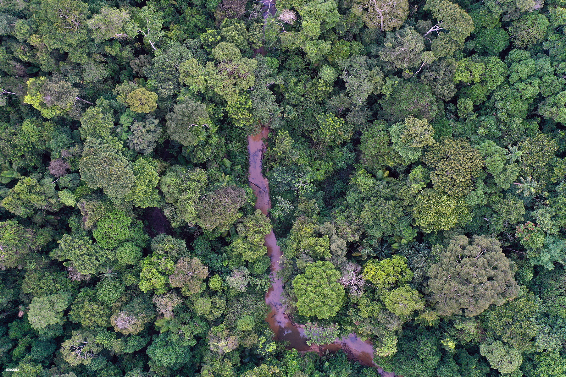
March is the height of the rainy season in this part of the Amazon, meaning that the floodplain forests are inundated and one can boat through the lower parts of the rainforest canopy. Global Forest Watch’s GLAD alert system showed some change in forest cover in these floodplain forest areas, but a look at satellite imagery from Google Earth and Planet suggested that these were indicative changes in water levels and rivers’ courses rather than actual forest loss.
However, there appeared to be some potential deforestation among the GLAD alerts in upland forest areas known as terra firme forests. Unlike the floodplain forests, terra firme forests are not seasonally flooded. They are also typically characterized by larger trees and a richer assemblage of species.
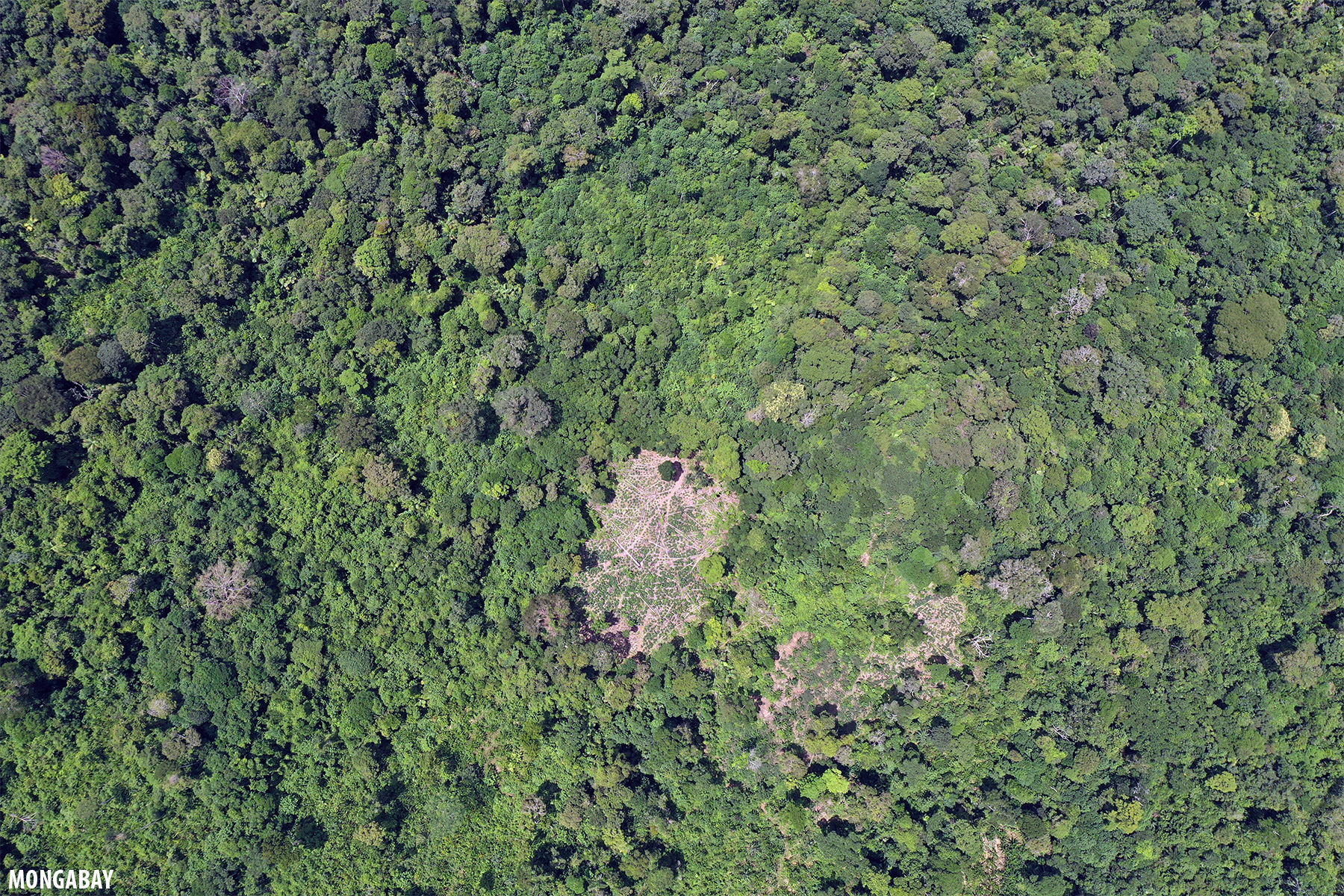
I stayed at a site a couple of kilometers away from where the GLAD alerts indicated potential deforestation. From the site there weren’t any immediate indications of forest-clearing activities so I asked for permission to fly the drone to get a bird’s-eye view of the surrounding landscape. The local indigenous community members were quite keen on the idea and were fascinated with the view once the drone was airborne.
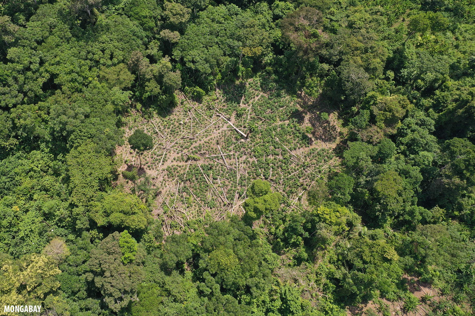
Eventually I flew over to the points identified via GLAD alerts on Global Forest Watch and found some small patches of recently cleared forest. The patches, which ranged from about half a hectare to a couple of hectares, had low-height vegetation, which I assumed to be cassava or another food crop.


At dinner, I asked Pedro, a senior member of the community whose real name is not being used to protect his identity, about the clearing I found with the drone. He asked to see the pictures.
“Where is this?” Pedro asked in Spanish. “Are you sure this is nearby? Or is it across the border?”
I scrolled through some other images that showed the surrounding area. He went back to the first image and used his fingers to zoom into the vegetation, his eyes widening as the plants expanded.
“Coca,” he whispered. “This shouldn’t be here.”

Pedro explained that coca has been an issue in the region, including on indigenous lands, but that his community hasn’t had to deal with the problem. He didn’t immediately know whether members of the community had covertly established small plantations or whether an outsider had trespassed and encroached on their lands.
Pedro said he would call a community meeting to discuss the issue. He asked for copies of the images and video footage.

Given the sensitivity and the potential security implications of the issue, Mongabay won’t be disclosing the name of the community or the location of the coca fields. However, the experience offers another example of the utility of GLAD Alerts, which pointed me to an area of recent deforestation. The drone then enabled me to safely get a closer look, leading me to find apparently unauthorized — and potentially illegal — deforestation in an indigenous forest reserve that the community was previously unaware of.