- Ujung Kulon National Park is the last habitat of the Javan rhino (Rhinoceros sondaicus), a critically endangered species.
- A recent tsunami increased calls for a new habitat to be found in which to establish a second population.
- Finding an ideal habitats elsewhere is important, but not as easy as some experts and conservationists think.
- This post is a commentary. The views expressed are those of the author, not necessarily Mongabay.
Ujung Kulon National Park is the last habitat of the Javan rhinoceros. There are only an estimated 67 of the one-horned animals left, according to the park management. A long history colors the journey of this rare and endangered animal, from its early range across east India, Bangladesh, mainland Southeast Asia, and Indonesia, to the last remaining individuals in the Ujung Kulon Peninsula, on the western tip of the island of Java.
Animals living in greatly reduced ranges, like the Javan rhino, are known as “relicts,” and are more vulnerable to extinction than endemic animals that have always had limited ranges. The International Union for Conservation of Nation (IUCN) has designated Javan rhinos (Rhinoceros sondaicus) as critically endangered, or one step from extinction.
On Dec. 22, 2018, a massive eruption at Mount Anak Krakatau caused a tsunami to slam into the coasts of the Sunda Strait. This powerful wave struck parts of Ujung Kulon National Park; the rhinos were reported to have been safe in their habitat.
So what’s the true situation at Ujung Kulon?

Ujung Kulon means “Western End” in the Sundanese dialect spoken in the region. The peninsula was previously best known for Goa Syanghyangsirah, a cave on the western edge of the southern beach of the peninsula that drew pilgrims from the far corners of Java. This cave is believed to be the final resting place of Prince Kiansantang, the son of a famed Hindu king, who was believed to have been instrumental in bringing Islam to Java. Today, Ujung Kulon is better known as the only Javan rhino habitat remaining in the world.
The peninsula is hemmed by the Sunda Strait to the north and the Indian Ocean to the south. Administratively, Ujung Kulon is located in Pandeglang district, Banten province.
It was first proposed as a national park in 1980. This area covered a territory of 575 square kilometers, or 222 square miles (Blower and Zon), including the Ujung Kulon Peninsula, Panaitan Island, and Mount Honje Nature Reserve, along with the protected forest area in the north alongside Mount Honje.
Through a Ministry of Forestry decree issued on Feb. 26, 1992, Ujung Kulon was officially named a national park, with an area of just under 1,230 square kilometers (475 square miles), consisting of both land (786 square kilometers) and marine (443 square kilometers) areas.

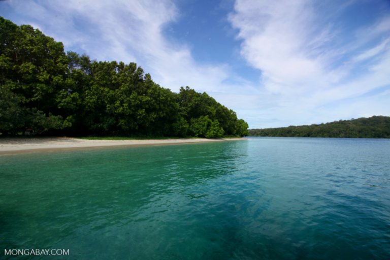
Ujung Kulon Peninsula is divided into three parts: the mountains that stand west of the Cibunar and Ciujungkulon rivers; the wide middle area with hills and lowlands stretching from the northeast to the south; and the northern tidal swamp area of mangroves spanning from Jamang to the east to close to the isthmus at Tanjug Telereng.
The mountains in the west form a range of narrow ridges and cliffs that rise perpendicularly from the sea. The peaks of Mount Payung (480 meters, or 1,575 feet) and Mount Guhubendung (500 meters, or 1,640 feet) are located in the southwest and are the highest points of the peninsula.
The ridge that extends along the southern coast, stretching from Cibunar to Cibandawoh, is a sand embankment formed from layers of rock and beach sand. It is about 10 meters high and not very wide, with layers of coral often visible.
Farther east, between Cibandawoh and Tanjung Tereleng, local rock formations of young limestone and coral stand upright. Here, coral protruding from the sea can be seen.
The main rivers found in Ujung Kulon are distinguished by two flow patterns. Rivers that originate from around the hills of Mount Payung and Mount Cikuya have fairly heavy flows. Other rivers originate from Mount Talenca. Most of these rivers are never run dry throughout the year.
Ujung Kulon along with Mount Honje and Panaitan Island are part of the young mountain system forming the Sunda Shelf before the Tertiary Period. During the Pliocene, Ujung Kulon and Mount Honje were separate from Java, and may have been part of Sumatra as an extension of the Barisan Mountains running like a jagged spine down the south of that island. It was then separated during the Pleistocene, when the dome of the Sunda Strait folded upward (Blower and Zon).
The central and eastern parts of Ujung Kulon consist of a composition of limestone and clay that arose during the Miocene. In the north, the alluvial layer is covered, and the southern coast is covered in sandstone, increasingly so as one moves southward (Hoogerwerf, 1970).
Schenkel and Schenkel (1969) stated that the sand dunes along the southern coast from Cibunar to Tanjung Tereleng are formed by layers of coral and sand.
In the north, sea and coral sand as well as clamshells are the geological base, although there are also widespread pockets of pumice that are thought to have originated from the eruption of Mount Krakatau in 1883. This eruption also affected most of the of Ujung Kulon vegetation structure as tidal waves as high as 20 meters struck along the north coast.

Records show the Ujung Kulon Peninsula has not been inhabited by humans since the Krakatau eruption (Hoogerwerf, 1970). In the mid-20th century, made their presence felt by carving out pastures in several regions in the north, including Nyiur, Jamang, Cikuya and Cidaon. These actions influenced the structure of vegetation, as has the activity of various foraging animals (Lusli, 1982).
The damage wrought through both human activity and natural phenomena has changed the structure of the vegetation. However, the forest on Ujung Kulon is a true lowland rainforest. The vegetation on Mount Payung, at the western tip of the peninsula, is primary forest that appears to have never been disturbed.
The lowland rainforest of the Ujung Kulon Peninsula is the last natural habitat of the Javan rhino. There is a sufficient variety of edible plants for the rhinos, consisting of five complex vegetation types: coastal forests, freshwater swamp forests, lowland rainforests, grazing fields, and introduced plants.
Thus, finding a second habitat for Javan rhinos outside their natural home in Ujung Kulon is not as easy as some experts and conservation activists think.
Moreover, a second habitat for Javan rhinos must be studied in consideration of their natural behavior. The second habitat must truly ensure Javan rhinos are safe, comfortable, and able to add offspring.
CITATIONS:
- Blower JH, Zon APM van der. 1977. Nature conservation and wildlife management project,(Indonesia). Proposed Ujung Kulon National Park including Gunung Honje, Pulau Peucang and Pulau Panaitan management plan, 1977–1981. Field report 2 (English). Forestry Dept. FAO, Rome.
- Hoogerwerf, A. 1970. Ujung Kulon, the land of the last Javan rhinoceros (with local and general data on the most important faunal species and their preservation in Indonesia). Leiden, Brill EJ.
- Schenkel R, Schenkel L. 1969a. “The Javan rhinoceros (Rhinoceros sondaicus Desm.) in Ujung Kulon Nature Reserve: its ecology and behaviour: field study 1967 and 1968.” Acta Tropica 26(2): 97–135, figs. 1–9, tables 1–9.
- Schenkel R, Schenkel L. 1969b. “The last remnants of the Javan rhinoceros in Ujung Kulon Nature Reserve, Java.” Biological Conservation 2(1): pp 68–70, figs. 1–2.
Haerudin R. Sadjudin is a senior rhino researcher who has been involved in rhino conservation program for over 40 years in Indonesia.
This commentary was first published on our Indonesian site on Feb. 3, 2019.
FEEDBACK: Use this form to send a message to the author of this post. If you want to post a public comment, you can do that at the bottom of the page.