
- The Indonesian government has launched a long-awaited unified map of land-use cover across the country, in an effort to resolve overlapping claims that have led to conflict, human rights abuses and environmental damage.
- With more than 17,000 islands and a combined land and sea area that is the seventh-largest in the world, Indonesia has a wide range of official maps, including for mining permits, free-trade zones, oil and gas blocks, and forestry areas.
- The unified land-use map, accessible online, is still missing maps of indigenous territories, while closely held maps of oil palm plantations are being added.
JAKARTA — The Indonesian government has published a long-awaited map that, for the first time, unifies all land-use data from a host of disparate sources.
The fractured nature of the land-use maps in force across the sprawling archipelago has led to overlapping claims and conflicts, which in turn have given rise to environmental damage and human rights abuses.
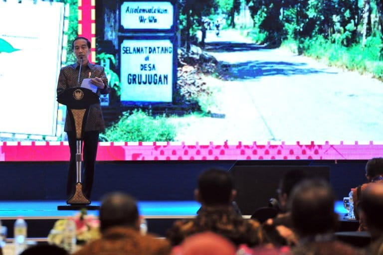
The unified map was launched Dec. 11 in Jakarta by President Joko Widodo.
“One reference, one database, and one geoportal, which essentially is set to prevent any overlap, to give certainty, to give clarity, and to have consistency in building this nation,” the president said at the launch.
The so-called one-map policy, conceived in 2011 to establish a single database for all government maps to eliminate disparities between the various maps currently in use by different government agencies, was initially slated for launch in mid-August this year, to coincide with the country’s independence anniversary.
The prevalence of mixed and often contradictory sources of reference across the different levels and arms of government is one of the biggest impediments to sustainable development in the country, experts say. This is particularly true for land-use maps, which are just as crucial in the management of Indonesia’s forests and natural resources as they are for infrastructure planning and development projects.
In February, President Widodo expressed hope that the one-map policy would be able to resolve the longstanding problem of illegal plantations inside forest areas. He noted that in Indonesian Borneo alone, a region known as Kalimantan, there was an overlap of some 40,000 square kilometers (15,440 square miles) between plantations and forests.
With more than 17,000 islands and a combined land and sea area that is the seventh-largest in the world, Indonesia has a wide range of official maps, including for mining permits, free-trade zones, oil and gas blocks, and forestry areas.
Under the one-map policy, the government reportedly reconciled at least 85 of these existing and disparate maps, which are currently managed by 19 different government agencies, for all 34 provinces nationwide.
Lack of transparency about information that should otherwise be publicly accessible has long defined the Indonesian bureaucracy’s governance of land and resources. To improve transparency, Indonesia passed the Freedom of Information Act in 2008. As a result, information that was previously not disclosed by default and only made public upon request must now be made publicly available by default.
But the government continues to be secretive about maps, particularly those related to the extractive industries, such as mining and palm oil. And the indications are that this will extend to the one-map database too.
The government contends there needs to be a regulation on who can access the unified database. To that end, the government was reported to be drafting ministerial and presidential regulations that will govern data sharing for the one-map policy.

The Indonesian government has also decided to not include maps of indigenous territory in its unified land-use map database, despite the fact that some of these territorial maps have been formally recognized by lower-level authorities.
The central government says these customary maps will be included once all of them have been formally recognized by local governments — a tedious and time-consuming process that requires the passage of a bylaw in each of the hundreds of jurisdictions in which indigenous lands occur.
The exclusion has drawn criticism from indigenous rights activists, who say it defeats the one-map policy’s stated aim of resolving land conflicts, much of which involve disputes over indigenous lands.
However, maps of customary forests will be included in the one-map database. Customary forests are part of customary lands that have received legal recognition from the Ministry of Environment and Forestry, under the president’s signature social forestry program, which aims to give local communities greater access to a combined 126,000 square kilometers (48,700 square miles) of land. So far, the forestry ministry has granted only a combined 200 square kilometers (77 square miles) of land under the customary forest scheme, to fewer than 20 communities across the country.
The unified land-use map, at a scale of 1:50,000, can be accessed here.
Banner image of a screenshot of the Indonesian unified land-use map from the National Geospatial Agency website.
FEEDBACK: Use this form to send a message to the author of this post. If you want to post a public comment, you can do that at the bottom of the page.