- Limestone is a vital resource for the construction industry, meaning it is not likely that forest degradation and quarrying in a developing country like Malaysia, where 445 limestone hills have been recorded to date, will be halted any time soon.
- That means it’s crucial to identify which hills should be prioritized for conservation. But in order to make such decisions, spatial and biological data on Malaysia’s limestone hills must be quantified, mapped, and, ideally, made publicly accessible.
- The authors of a new study published in Tropical Conservation Science have done just that, compiling the first map of all of peninsular Malaysia’s 445 limestone hills based on information collected from geological reports and scientific literature.
Malaysia’s limestone hills, or karsts, have been described as “arks of biodiversity,” but they’re facing intense pressures from mining and other human activities.
Limestone is a vital resource for the construction industry, meaning it is not likely that forest degradation and quarrying in a developing country like Malaysia, where 445 limestone hills have been recorded to date, will be halted any time soon.
That makes it crucial to identify which hills should be prioritized for conservation. But in order to make such decisions, spatial and biological data on Malaysia’s limestone hills must be quantified, mapped, and, ideally, made publicly accessible.
The authors of a new study published in Tropical Conservation Science have done just that, compiling the first map of all of peninsular Malaysia’s 445 limestone hills based on information collected from geological reports and scientific literature.
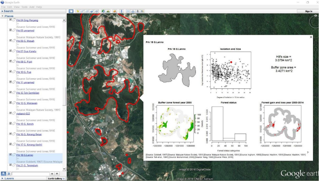
According to the researchers with Malaysia-based non-profit research group Rimba who compiled the map, scientists have been frustrated by the lack of geographic information on limestone hills in Malaysia for many years. “Till now, information on localities, shapes and sizes could only be obtained from books and journals, but not anymore,” they write in a post on Rimba’s website.
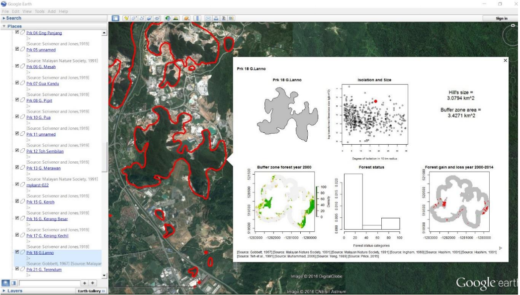
To assist in conservation prioritization, the team also quantified characteristics of each of the hills, including degree of isolation, size, and spatial distribution patterns. They then assessed the degree of habitat disturbance in each limestone hill in terms of forest degradation within a 250-meter buffer zone and the level of quarrying activity present.
A total of 73 of the 445 limestone hills showed signs of current or historical quarrying activities, they found. There was also at least one hill that had been completely quarried away. Half of the limestone hills “appeared to have good forest coverage,” the researchers write in the study, while 10 percent had buffer zone forests that were “highly degraded.”
All of the data the Rimba team compiled are stored in a file that can be accessed through Google Earth — but that doesn’t mean the authors consider the project to be finished.
“This map is not a final product, but can be constantly improved by anyone who wants to add spatial or biological information on limestone hills,” the team writes on the Rimba website. “All the methods and data are available for anyone to reuse, revise, remix and redistribute.”
The current version of the database, they note in the study, “should be seen as a first reference point to provide quantitative and qualitative information regarding limestone hills in Peninsular Malaysia that users can access and build upon.” The researchers acknowledge that their data lacks rigorous enough ground-checking for the map to be considered final, as there are many hills that require further verification.
“Nevertheless, limestone hills in different states within Peninsular Malaysia can now be prioritized for conservation through systematic conservation planning by using our physical and threat parameters as signifiers of their ‘irreplaceability’ and ‘vulnerability’, respectively,” they write.
“We hope that this user-friendly karst database can better facilitate the communication and sharing of spatial information, especially among ordinary citizens, to raise awareness and concern for the natural environment.”
CITATION
- Liew, T. S., Price, L., & Gopalasamy, R. C. (2016). Using Google Earth to improve management of threatened limestone karst ecosystems in Peninsular Malaysia. Tropical Conservation Science, 9(2): 903-920. doi:10.6084/m9.figshare.3153181