- Alex Piel, co-founder of the Ugalla Primate Project, explains the unique benefit to evolutionary research that Issa Valley chimpanzee populations provide.
- The increased variety of drone types are allowing researchers to produce ever-more accurate ecological maps in remote locations.
- The Jane Goodall Institute is all-in for the use of drones as conservation tools.
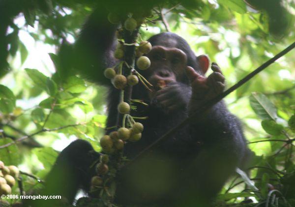
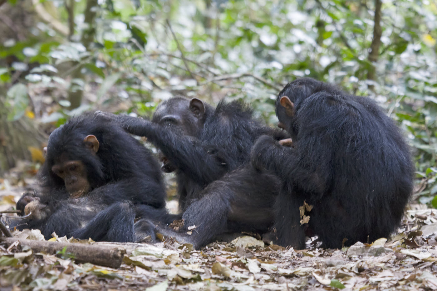
In 2008, Alex Piel, a lecturer in Animal Behaviour at Liverpool John Moores University, and his wife, Fiona Stewart, a Junior Research Fellow at Newnham College, University of Cambridge, launched the Ugalla Primate Project, located in the Issa Valley of western Tanzania’s Ugalla region. Their goal was simple: to foster collaborative primate research projects in this remote, relatively untouched region of central Africa. What began as a self-funded passion has grown into a hub for primate research. Today, some 13 volunteers live at the project’s research station at any given time, studying the behavioral ecology of Issa’s primates—red-tail monkeys, yellow baboons, and especially chimpanzees, our closest living relatives.
One of the biggest challenges that the researchers face in their study of chimpanzees in the Issa Valley has been simply keeping tabs on the peripatetic primates. The arid region’s hilly landscape is a mix of dense woodland broken by stretches of grassland, with little human interference. “In places like Uganda,” Piel says, “the chimps’ ranges are probably about five or six square kilometers.” In Issa, however, the chimpanzees can have ranges that stretch to 200 square kilometers.
While following the chimpanzees is challenging, and population densities in Issa can be 1/50th of those estimated at forested sites, comprehensively mapping their movements, nest-building habits and the social consequences of living such comparatively isolated lives could prove instrumental in the search for an answer to bipedalism. After all, says Piel, the Issa Valley resembles the African savanna of six million years ago, when hominids took their first steps as bipeds.
To better track the chimpanzees of Issa Valley, this summer Piel and Stewart teamed up with the Jane Goodall Institute (JGI) and a nonprofit called Conservation Drones, to test the application of unmanned aircraft systems, or UASs (also called unmanned aerial vehicles, or UAVs), to improve the Ugalla Primate Project’s (UPP) ongoing efforts to survey Issa’s chimpanzee habitat and distribution—mainly their nests, which are located in the woodland canopy.
To determine how effective drones can be in identifying areas of chimpanzee activity, Piel, Stewart and some of the UPP volunteers walked the same transect they sought to map with drones. “Walking through the forest to count unhabituated chimps in remote areas requires a ton of effort, manpower, and time,” says the ecologist Jeff Kerby, who served as Conservation Drones’ technical director for this collaboration. “A small team with a drone can cover a larger area in less time. We’re trying to figure out if the investment in drone operation and image processing skills is more efficient than sending out large patrols to do the same work on the ground.”

Aerial habitat mapping: from kites to drones
In recent years, drones have increasingly been used to survey endangered wildlife populations that have long been the target of poachers, such as elephants and rhinos. But with technology improving, product variety and accessibility rapidly expanding, and individual UAS costs dropping, researchers have been using drones for a wide array of conservation applications.
Jeff Kerby and Conservation Drones have been at the forefront of applying UASs to ecological research. As a doctoral candidate in ecology at Penn State University, Kerby first used kites when he was searching for an easier way to map caribou ranges in Greenland. The advantages of aerial mapping in Greenland’s remote, rugged landscape were immediately apparent. Kerby soon turned to an inexpensive, lightweight, fixed-wing drone—equipped with a GPS tracker and point-and-shoot digital camera—to monitor shrub expansion in Greenland. In addition to his work in Tanzania, Kerby has trained Surinamese conservation officers to use UASs to monitor the Central Suriname Nature Reserve. To promote UASs as not only effective but accessible conservation tools, Kerby and Conservation Drones focus on inexpensive, open-source autopilot technology—such as APM 1 and Pixhawk.
Serge Wich, the co-founder of Conservation Drones, is excited about the combined interest of small-scale researchers such as himself (he is a primate biologist) and the UPP, and larger organizations, such as the U.S. National Oceanic and Atmospheric Administration (NOAA). “It’s a blooming and booming industry,” Wich says. “There are quite a lot of people flying drones right now—both conservation organizations such as ours and researchers at universities.”
For Wich—who first got the idea to use drones, along with his Conservation Drones co-founder, Lian Pin Koh, when they were mapping the nesting sites of Sumatran orangutans—last summer’s collaboration with the UPP and JGI to map chimpanzee nests was a perfect fit. In addition to drones being used for anti-poaching efforts, Wich says that drones will become instrumental in helping to answer two other key conservation problems. “The first is wildlife distribution and density,” he says. “The second is land cover and monitoring.”
It’s not drones vs. humans, it’s drones and humans
“As you move east from where we are, chimpanzees are very spread out, so we stop encountering them, and we don’t know why,” Piel says of the challenges of conducting chimpanzee research in the Issa Valley. “There could be no food out there, no forest, no water; it’s an area that researchers really haven’t been to.”
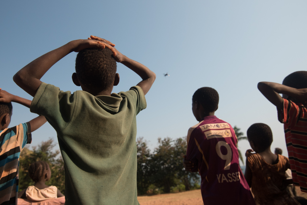
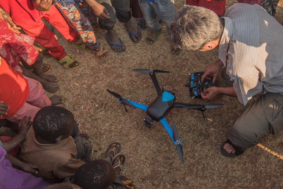
The team sought to address this remoteness issue this past summer as they set off from the UPP’s spartan research station with drones in tow. They used two of Conservation Drones’ small, high-resolution camera-equipped UASs—an IRIS+ quad-copter from 3D Robotics, an American company, and an X5 fixed-wing specially converted for the Issa collaboration by the Malaysian company Hornbill Surveys, which specializes in customizing UAS for mapping and conservation projects. Having different options proved crucial to the team’s data gathering. “We make our platform choice by balancing the needs of resolution vs. extent for different aspects of data goals and logistical limitations, like weather and landing areas,” Kerby says.
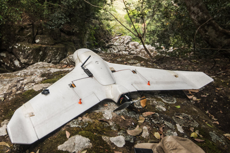
When they were in more open areas, Kerby and Wich were able to launch the X5 fixed-wing. “They fly faster and turn wider,” Kerby explains, though, he says, at the cost of high-resolution photos. In contrast, the IRIS+ could be launched in densely wooded areas, since it can take-off and land in tight areas and is more maneuverable. The other advantage of using a quad-copter to photograph the chimpanzees’ nesting sites is the drone’s ability to fly lower to the ground, thus producing closer, higher-quality images. Kerby does caution that the quad-copter’s close proximity to the canopy means the noise it generates can spook wildlife—particularly Issa’s chimpanzees, who aren’t yet entirely used to Piel, Stewart and the other researchers. The quad-copter’s battery life (about twenty minutes) is also not as long as that of the X5 and most other fixed-wing UAS (about an hour).
While the team did not typically fly more than one UAS at a time, Kerby says there are advantages to a combined effort, when possible—mainly that you can cover more ground faster. But having multiple drones with different capabilities—like the IRIS+ and X5—helps to mitigate challenges, such as launching in the thick underbrush or flying long enough distances to obtain sufficient imagery of transects and chimpanzee nests. “Sometimes we have two teams working and [they] will fly two units at that point, making sure they are using different frequency channels to avoid any conflicting control commands being sent,” says Kerby.
Surveying efficiency can be a tremendous advantage in a vast area like Issa; it also helps efforts like the UPP, where volunteers revolve in and out, and visiting project collaborators—like Kerby, Wich and the JGI researchers—have only a limited amount of time before having to move on to the next assignment.
For now, it’s important that Piel, Stewart and their research team walk the same transects covered by the drones in order to prove that what they’re seeing in the aerial imagery are in fact nesting sites, which can be positively identified at the ground level. They hope that they will soon be able to rely on the drones to cover parts of the Issa Valley too difficult to reach on foot. “For most cases it is very important to make these drone vs. ground observer comparisons to verify what is being captured and what is being missed,” says Kerby. “That said, drones can also go places no human could walk, so they open up new perspectives in areas where little to no information is available.”
Kerby says the challenge now is to “build capacity in various research groups, provide sound advice on project design, and to educate not only practitioners, but the general public and policy makers about the value of using UASs for [research and conservation] purposes.” There is no shortage of researchers eager to learn how to operate drones, to answer a variety of research and conservation questions.
For Alex Piel, the potential for surveying larger expanses of this region is significant. By improving survey methods for chimpanzees, who inhabit an environment that Piel, Stewart and other ecologists believe resembles the one where we evolved into bipeds, it is not a stretch to believe that there are more evolutionary clues to be discovered out there. “The question becomes what happens to your social system when you have to adapt to, basically, not regularly bumping into your friends or your enemies?” says Piel. “Or, how do you find mates and maintain relationships? Maybe these were the same types of problems that hominids were facing a long time ago.”