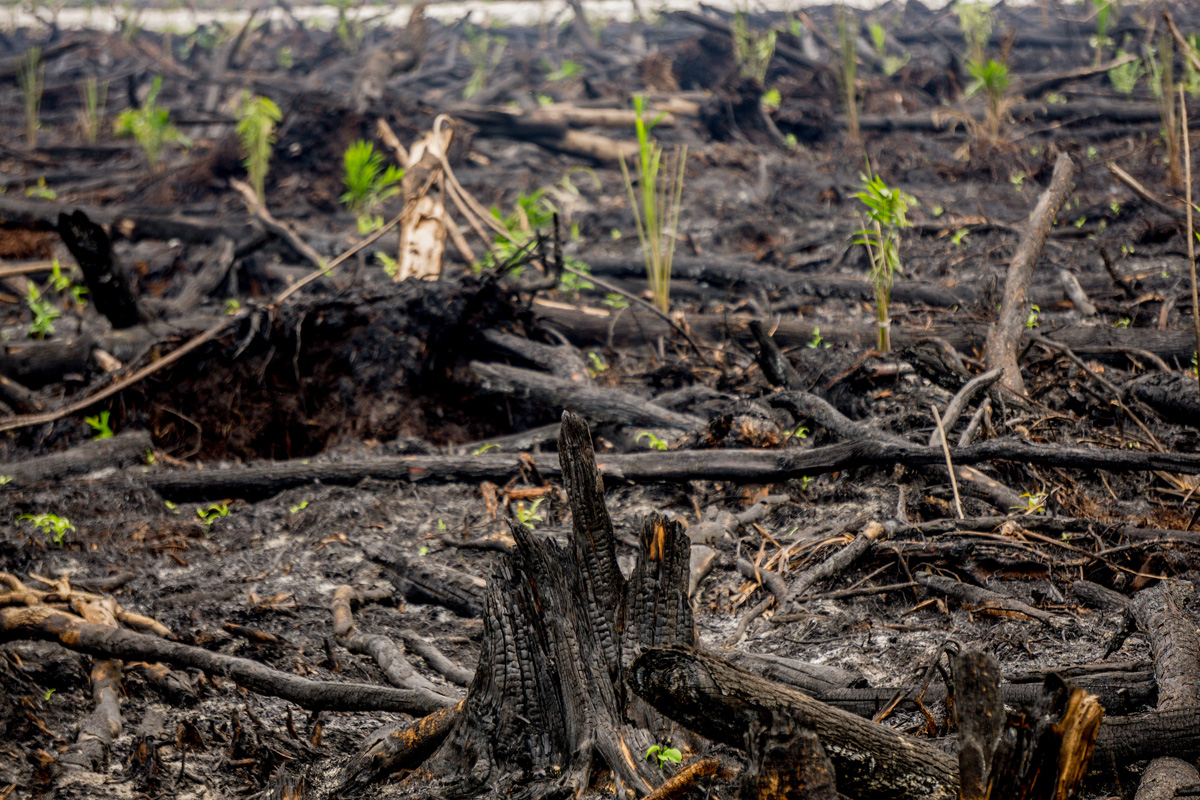
- New photos released today by Greenpeace show that palm oil developers are quickly planting burned peatlands with oil palm seedlings in Indonesian Borneo.
- The findings strongly refute a statement made by GAPKI, Indonesia’s palm oil trade association, which claimed that the country’s palm oil industry is the victim of a smear campaign.
- Greenpeace noted that there is no way to know who burned the land because the Indonesian government hasn’t released concession maps for the area in years. That makes it impossible to hold those responsible to account.
New photos released today by Greenpeace show that palm oil developers are quickly planting burned peatlands with oil palm seedlings in Indonesian Borneo. The findings strongly refute a statement made by GAPKI, Indonesia’s palm oil trade association, which claimed that the country’s palm oil industry is the victim of a smear campaign.
Last month Sutopo Purwo Nugroho, Indonesia’s National Disaster Management Agency (BNPB) Chief of Data and Information, sparked a maelstrom when he tweeted a picture of a burned area near Nyaru Menteng orangutan sanctuary in Central Kalimantan. The picture was accompanied by the caption: “After the fire, comes the oil palm.”
The tweet raised the ire of GAPKI, which asserted that the photo was staged to damage the reputation of Indonesia’s palm oil industry. In response, Greenpeace sent investigators to the site, who were told the area had been burned twice to prepare the land for oil palm.

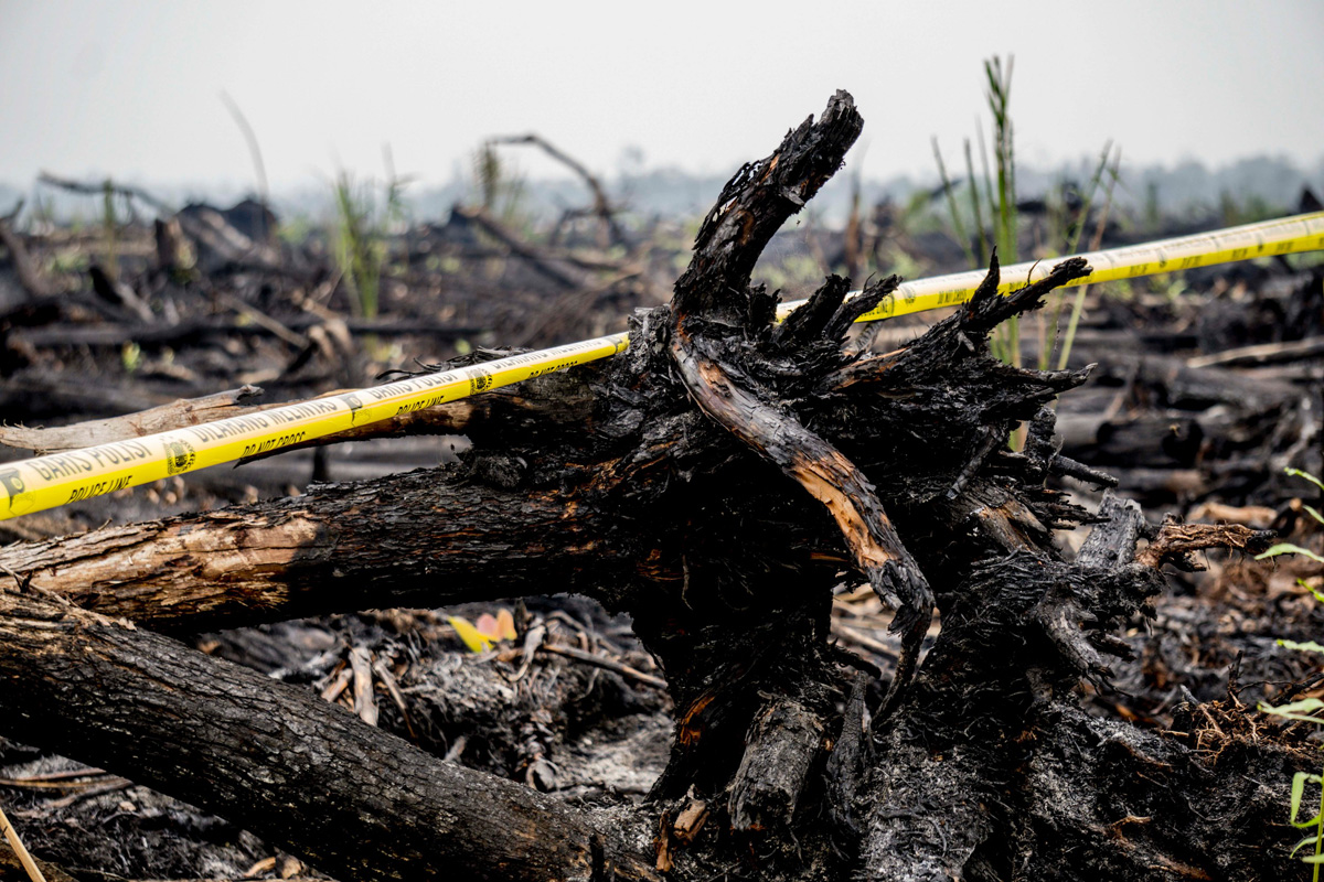


Greenpeace noted that there is no way to know who burned the land because the Indonesian government hasn’t released concession maps for the area in years. That makes it impossible to hold those responsible to account, says the group.
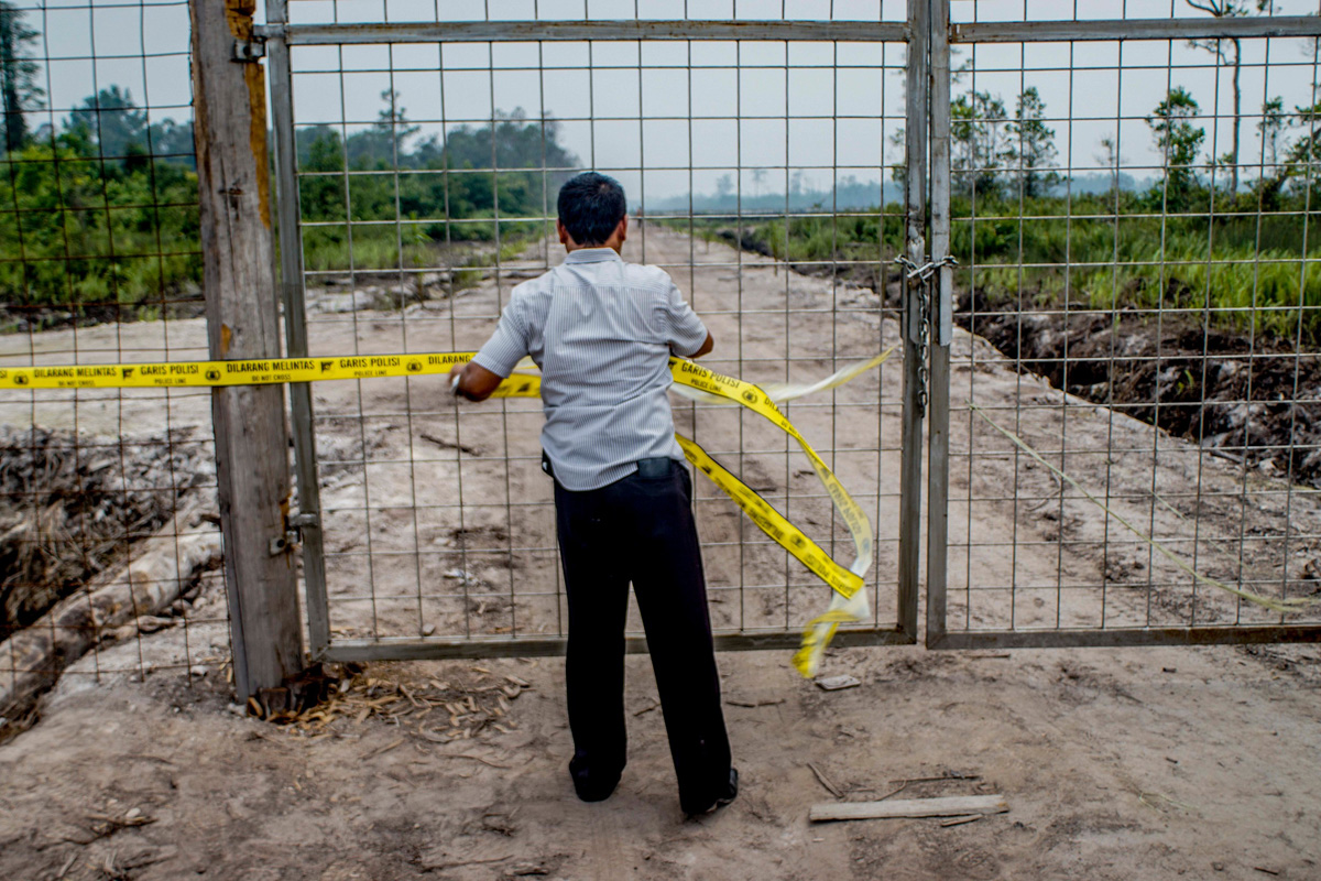
“The police are still investigating this area to find out if a crime took place. Yet someone is already trying to exploit this fire by establishing an oil palm plantation,” said Annisa Rahmawati, Indonesia Forests campaigner at Greenpeace Southeast Asia, in a statement. “Who owns this land? Were these fires started on purpose? We won’t know until the government makes good on its promise to publish concession maps and hold those responsible for these fires to account.”
The photo release comes on the heels of an investigation into a suspicious fire that destroyed records at the Central Kalimantan branch office of the Bureau of Finance and Economy. The government quickly noted that copies of the paper records were also held at a second site, meaning that if the intent was to interfere with potential prosecution of illegal land-clearing and fire-setting, the effort was in vain.
The contention that Indonesia’s palm oil industry is playing a contributing role in the haze crisis is not far-fetched. Over the past three decades, developers have cleared millions of forests and peatlands in Sumatra, Kalimantan, Sulawesi and New Guinea for oil palm plantations. Clearance, combined with drainage of peat soils, have greatly exacerbated fire risk, especially during dry years. And areas that were burned during past el Nino-driven droughts have been extensively planted with oil palm, which is one of the most profitable forms of land use across much of rural Indonesia. Palm oil is sold both into domestic and international markets, where it is used as a cooking oil and as an ingredient in processed foods, soaps, cosmetics, and other household products.