
- With assitance from NGOs, residents of Punan Adiu village in North Kalimantan have finished mapping their customary territory.
- At certain moments, the mapping campaign exposed latent conflicts between Punan Adiu and its neighbors, but residents were able to reach a compromise.
- Indigenous rights advocates hope the process can become a model for other communities.
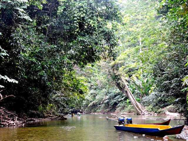
One night in June 2013, the rev of a car engine caught the ear of Markus Ilun, an indigenous leader in the remote Indonesian village of Punan Adiu. He was at home in his house abutting 17,400 hectares of forest claimed by the Punan, one of the various Dayak peoples that inhabit the giant island of Borneo.
Stepping outside with the village chief, Piang Irang, Markus recognized one of the men getting out of the car. It was Perminas, head of Selatan Hilir subdistrict. Markus didn’t know Perminas’ three companions, but they were quickly introduced as representatives of oil palm companies.
Markus smiled, invited the four inside, and then quickly shot off a text to villagers, alerting them that a meeting was about to take place. Dozens rushed over to join the discussion.
Once everyone was seated, the reps made their pitch.
“If we plant oil palm, the community will prosper,” one of the visitors declared, promising that expansion would be slow and sure, starting at 40 hectares in 2013 and topping out at 200 hectares by 2020.
Villagers grumbled, unimpressed by the proposal.
“Even if our people prosper,” Markus interjected, ”the fact remains we still lose our forest.”
In the end, the delegation left with little to show for its appeal.
New ‘weapon’
By the time the palm reps had converged to deliver their late-night proposal at Markus’ home, villagers were already busy developing a powerful new weapon in their anti-palm arsenal: a map of their lands.
“With good maps we can take a stand and reject companies that try to enter our forest,” Piang said.
A year earlier and in partnership with the national-level Participatory Mapping Network (JKPP), area residents founded the Punan Watchdog and Empowerment Institute of Malinau (LP3M) and the East Kalimantan Participatory Mapping Service (SLPP).
In January — a full two-and-a-half years after they started — the local Punan people finished mapping their land.
Across the country, the absence of an authoritative, national-level land-use map recognizing indigenous land rights has left customary forests like the one in Punan Adiu vulnerable to encroachment. The central government’s One Map initiative is an attempt to fix that, but the project’s fruition remains a long way off.
Meanwhile, community-level mapping campaigns have been embraced as a way to compel companies to respect indigenous territorial claims, as well as to organize community feeling around protecting homelands from deforestation.
Despite the success, the mapping campaign in Punan Adiu was not without complications. At certain moments, it created new conflict by bringing competing land claims into the open.
In one such case, a pair of neighboring communities disputed Punan Adiu’s claim to the 12-hectare Sigong Kelapa Lake.
Eventually, the three communities came to an agreement: the lake would be listed in Punan Adiu’s customary domain, but all three villages would have the right to fish its waters.
Such compromises are an important feature of the participatory model, which strives to engage all voices in the mapping process.
“Hopefully this process of participatory mapping can become a model for other villages in Malinau regency to follow,” LP3M director Boro Suban Nicolaus said.
According to Rahmat Sulaiman, JKPP’s head of organization, the next step is to register the map with the NGO-founded Ancestral Domain Registration Agency (BRWA) and for the regency government to set up an indigenous rights implementation body.
“This map not only concerns boundaries, but also spatial planning, such as where orchards can be planted or where people can hunt,” added Ahmad Suudi Jawahir Asyami, director of the Indonesian Rice Association.
He said the government should adopt the map and incorporate it into the regional spatial plan. Doing so would make the map legal and binding.
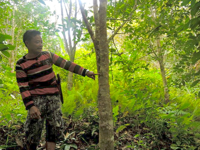
Piang said villagers had starting planting agarwood to mark their forest’s boundary.
However, he warned, encroachment could come at any time, and the community had to remain on guard.
“We cannot allow this forest to be given to any company,” he said. “This forest is our birthplace.”
CITATIONS:
Christopel Paino. “Ketika Dayak Punan Siapkan “Senjata” Melawan Penghancuran Hutan Adat.” Mongabay-Indonesia. 9 March 2015.