
- Mark Hebblewhite studies the intersection of predator-prey dynamics and human impacts.
- Merging animal tracking data with remote-sensing information from satellites is “perhaps the most productive tool to answer large-scale questions about human impact on the planet.”
- Collecting and synthesizing information from many tracking studies allows researchers to quickly draw robust conclusions about large-scale ecological processes and human impacts.
Mark Hebblewhite’s love of wildlife began paying off when he got a job as a Hudson Bay park ranger as an 18-year-old. Now an associate professor in the wildlife biology program at the University of Montana, Hebblewhite studies the delicate balance among predators, prey, the environment and humans. His work carries on the legacy of wildlife biology luminaries, such as the identical twins John and Frank Craighead, who together developed the first radio tracking collars used on grizzly bears.
WildTech spoke with Hebblewhite about his work, the technology he uses and the future of wildlife biology.
Tell us a bit about the kinds of questions you try to answer in your research.
I think that in those early years of wildlife biology there was a keen focus on basic natural history ecology. The kind of stuff that gets all of us excited: Why do animals do what they do; why do animals migrate; why do animals eat certain things? So at its core that still forms a lot of the questions and the problems I work on. But increasingly in the 21st century, there are almost no places left on the planet where you can ask those questions about what makes animals do what they do without having to think at the same time about how they mitigate or reduce the negative impacts of humans. 21st-century conservation is about how we understand the impact of humans on wildlife around the globe. Even the most pristine ecosystems that we think about as undisturbed and untouched — like the Himalayan plateau in Tibet or the North and South Poles — we now know those areas are absolutely being engineered by humans through climate change. Then you’ve got human-caused habitat fragmentation, overhunting, bush meat hunting, etcetera.
That’s where I enter: All the research questions I ask start from trying to understand what animals do, but in the context of how they do what they do when we’re doing what we do to them. And for many species, that’s led to endangerment and decline. Populations I’ve studied have even become extirpated while I’ve been watching them, and I’m not even in my mid-40s. This is going to become par for the course for ecology in the 21st century — just watching populations go extinct. Which is a bit depressing, but I think it gives us opportunities to understand why they did so that we can predict it and avoid it in other populations.
What technologies do you use and why are they important to your work?
The technology I use plays an increasingly important role for a number of reasons: One, when I think back to the way that people used to study wildlife, you know in the ’30s, ’40s, ’50s, and ’60s, when they would focus on one population in one area, study that in depth and then draw conclusions about why elk migrate, say, or why grizzly bears hibernate — whatever about that one population. But in this 21st-century vision we have the problem of not only trying to figure out why animals do what they do but also how are human impacts affecting them. Are we causing the decline or causing loss of habitat? To do that is actually much more scientifically difficult than a typical observation study.
Every year I do a field trip to the Charles M. Russell National Wildlife Refuge and I talk about Olaus Murie, who went there for eight months, wrote a report and created a park. I mean, that’s easy; that’s kind of what we all thought we’d be doing. Nowadays, we’re don’t have much room to eke out park expansions, or find places where animals aren’t getting hammered by humans, or find that wiggle space to give them some sort of edge so that populations of species we care about can make it or break it. And to do that, we often need not just an observation study, but comparative or ideally experimental studies where we study the effects of humans on populations across a big gradient. Studies areas that are hammered by people, study areas that don’t have as big of an impact, study areas in the heart of a protected area. It’s really only by studying distribution and ecology of endangered animals, say, in all those settings, that we can actually give managers the information they need. And that’s led me in my research to try and think really big scale, big picture, in a way that starts to challenge traditional technologies.
Oregon Department of Fish & Wildlife under a creative commons license.
For example?
A big question people have is, “What are the effects of recolonizing wolves on ungulates in western North America?” Wolves just hit California; boy, this is going to be fun. Pamela Anderson is wading into wolf management in Canada based on her huge track record of experience with wolves and wolf ecology. That’s kind of a joke, but it’s true. California’s got wolves, and everybody’s trying to figure out what the impacts will be on their favorite ungulate species. And that sets up a lot of conflicts between wolves and hunters. There are also a lot of things that wolves can do to benefit ecosystems through their effects on trophic cascades. But imagine you’re in California: You’re going to set up a study to monitor the effect of wolves on all these questions — on trophic cascades, on mule deer harvests, on yada, yada, yada. Well, you’re going to have to wait 10 years to figure it all out, and by then maybe things have happened. Maybe species have gone extinct or maybe they’ve had a negative impact. At the cost of millions of dollars a year, you’re only going to be able to study it in that one little system. You can see the limitations of a traditional observational approach to answer these big picture questions.
Instead, I’ve worked with a variety of state and federal management agencies, along with a bunch of other university types across all the western U.S., where we’ve pulled together all the elk data, say, from dozens of studies that have already gone on for other reasons. We’ve done analyses of 2,500 adult female radio-collared elk and more than 2,000 elk calves. That allows us to take a very strong, comparative approach across all these different systems without having to wait in one particular system to do the study.
The problem, though, that creates, is that now we have millions of elk telemetry locations across a huge area. How do we measure the resources and habitats in those locations? Traditionally, Olaus Murie would have recorded in his notebook the things he saw in the park he was trying to survey. We can’t do that for all these studies, so increasingly the big cutting-edge tool I end up using is remote sensing.
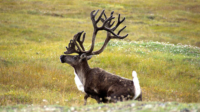
NASA has traditionally been thought of as a space exploration agency, but they have a huge division of effort that goes into monitoring biodiversity and terrestrial conditions on the planet. So one of the areas that I focus the most on is using that information from satellite data and being able to tie that back to what the animals are doing and how they’re responding to humans. The wolf recolonization question is a big one. Another big one is, how are wildlife species that we care about (such as caribou that are really important to lots of indigenous peoples through the North) going to respond to climate change? And again, how do you design an experiment like that? How do you do an observational study? It’s very difficult; these are global questions. We just can’t sit around and study one population at a time.
We’ve just been funded for a project with NASA that pulls together, with the key help of state and federal agencies, thousands of GPS collar data from caribou. Now we can look at barren-ground caribou, we can look at woodland caribou, we can look at caribou in areas with a huge amount of human disturbance, like Alberta, and areas without as much human disturbance. And we can take a look at those kinds of natural experiments and then we combine that with sometimes near daily information about whether the snow is freezing or thawing in the Arctic or whether there are real-time fires or real-time earthquakes or other disturbances—even the wind.
We’re looking for these interfaces between where technology has given humanity incredible tools to measure things about the planet, looking for opportunities to merge those with animal data that we’re also increasingly aggregating. Things like climate change can’t be answered one study area at a time.
In some of your papers, it seems like you’re sounding a note of techno-skepticism. Is that true?
Every time a new technology comes out, everyone runs after it. In some ways, there’s a productive tension in any field of science between technology driving the science and science driving the technology. What I mean is that some new technology comes out, and people run out and use it without really thinking about what it is they’re going to be able to answer. Not all technologies help, but I think the ones I just talked about do. The fusion or merging of real information from GPS collars about what real animals do over big spatial scales with remote sensing data has proven to be perhaps the most productive tool to answer large-scale questions about human impact on the planet, on all species.
The challenge for me, with my teaching hat on, is: How do we get people who can manage and analyze data from satellites and thousands of GPS collars and make sure they understand what an elk does? Maybe have them spend time in the field watching caribou, and really understand what it’s like to be a caribou instead of what it’s like to be a pixel or a line of code or a line of data.
Are you more interested in merging realms of information than creating moment-by-moment descriptions of what animals are doing?
Well, I think they obviously relate. And yet, at some level, it’s like asking “What is the weather now and what will it be in five minutes?” That may be important for some questions, but at a global scale, it’s not really important to understanding the impact of climate change on, say, caribou. Where understanding those small scale things helps is that they help us interpret the big picture patterns. It comes back to the analogy I used. Imagine a PhD student who has to analyze GPS collar data from 1,000 caribou. They need to have a good working model in their head. If they’re modeling movements of a caribou every 2 to 4 hours, they need to have a good understanding of what a caribou is trying to do every five minutes to scale up to 2 or 4 hours, days, etc. So I think the really fine-scale information that we get from technology informs our ability to understand really, really large-scale processes like habitat fragmentation and climate change. I’m not discounting it necessarily, but I think it behooves people studying at those fine scales, like my colleague Chris Wilmers, who has demonstrated this clearly by studying those things at really fine scales, to show “here’s how they impact, say, mountain lion and tiger kill rates which then influence their ability to reproduce and have babies.”
What are the two or three pieces of technology you depend on the most and how could they be improved?
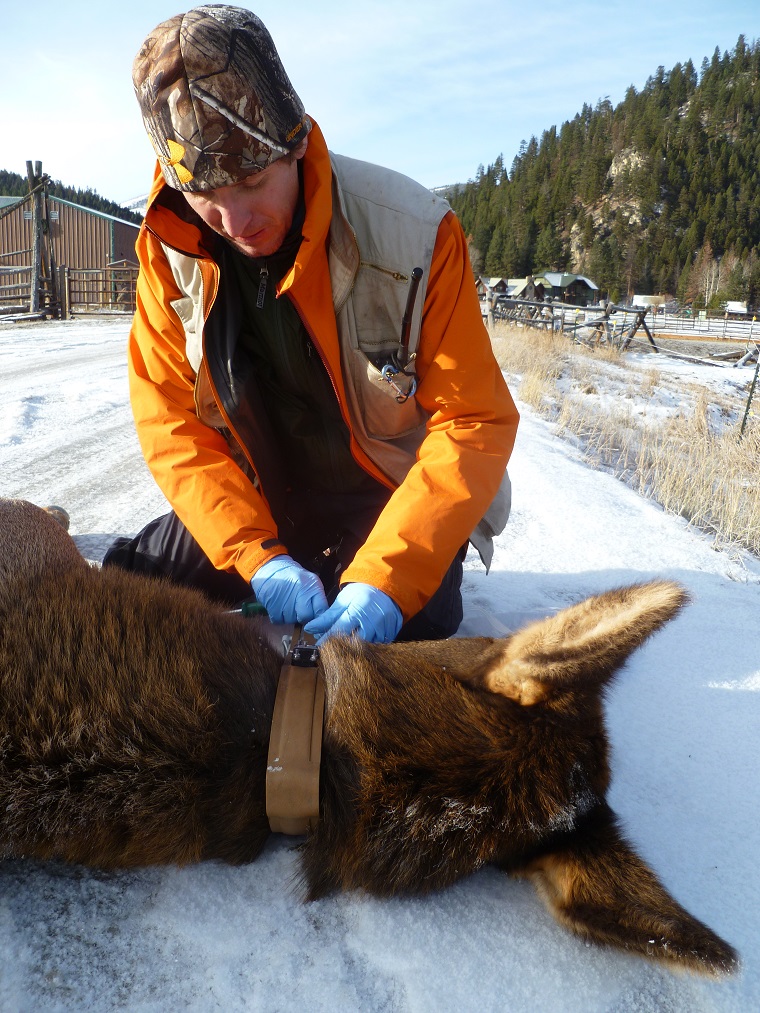
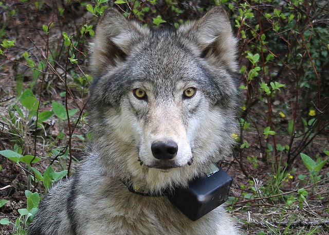
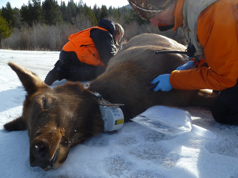
Number one is GPS collars. They’ve transformed the way wildlife ecology is done. And there are a number of things that continue to push the field — accelerometers on tracking collars for example. Another one is the addition of cameras. Collars now have cameras on them that take a picture every five minutes, so we can see what [animals] are actually eating. We just made a huge breakthrough in the caribou world where we now understand that caribou in the late summer and early fall are really eating mushrooms. The problem is that mushrooms are extremely digestible, so they don’t show up in the pellets when we do traditional diet analyses. So they’re mushroom-hunting big time, and that’s a huge amount of undetected protein that we didn’t know about. But we’re also using these cameras to tell us what kills animals. If it takes a picture every five minutes, well, it’s going to take a picture of whatever killed it. That’s an incredibly basic, yet innovative thing that we need to know for many wildlife studies.
There’s always a gap between what works in the lab and what works on a wild animal like a wolf or a tiger. We GPS-collared tigers in the Russian Far East, and it didn’t work. Tigers are really hard on equipment; same for wolves. I think there’s always a gap between when something might be good for an iPhone and when it’s good to attach to a 250-kilogram tiger.
There are not many organizations that really excel at doing the field testing. But in my own case, I worked very closely with one company to design a collar that would work on wolves. I went to their facility and worked with the engineer, and that’s the best way to get the biologist or the conservation person the product they need.
Another technology is remote sensing data from satellites. And NASA has done amazing work, really pioneering the development of incredible amounts of sensors. You wouldn’t believe what you can measure on the planet on any given day. It’s astonishing. For example, a colleague of mine here at the U teaches a course using Google Earth Engine, using the underlying software designed by Google to teach our students how to count the number of new oil well sites in an endangered caribou range or the amount of sagebrush habitat destroyed. Being able to train biologists to extract the information we need from remote sensing data—that’s where the bottleneck is. The remote sensing people are awesome; the NASA people can do this stuff in their sleep. There’s real room for collaboration with experts in remote sensing, but there are also technological jumps to be made. For example, if NASA can just get all their data on Google, that’d be great.
Where do you see technology heading in the next five to ten years?
I think we’ll be at the point where it’ll become easier and easier. There’s a facility called Movebank that’s pretty cool. I think it’ll become easier and easier and easier for these satellite remote sensing data to pipe right into these frameworks that your average biologist can use. And I think there will be more and more user flexibility with how we deploy GPS collars and the functionality that we can deploy on them. The big challenge has been expense — now we can only deploy five collars when we used to be able to deploy fifty. That’s the trade-off, and as these expenses come down we’ll be able to deploy more of these kinds of high-tech remote collars and other tools. Now we’re getting past [the limited sample sizes imposed by high collar costs], and that’ll be a big breakthrough in the next five to ten years.
What technology do you wish you had, but don’t?
I think one of the things we’re lacking is the ability to monitor the physiological state of the organism in real time. We can measure movements and X, and Y, and Z locations, and we can derive speed, but we still don’t really know the internal state of the organism. There are sensors that are coming out that are getting there, like a combined GPS and heart-rate monitor collar, so we can get their heart rate and therefore stress and blood pressure, and even more detailed stuff, like hormones, eventually to understand timing of migration, timing of reproduction, timing of molting. From a really fine-scale, hardcore perspective, having some of those tools to measure the internal physiological state of the organism would be pretty cool. They’re coming along, but the collars are still big right now, so there are some species we can’t deploy them on.
We know way more about what the animals are doing than about their habitat. Our remote sensing abilities have expanded across the globe, but there are some things we still can’t measure. There was a NASA proposal for a global LiDAR satellite that would have given us the ability to understand really fine-scale things about logged versus unlogged areas, for example. That seems really basic, right — was an area logged or not? But in the tropics, it’s really difficult to disentangle secondary growth from old growth in some cases.
Projects like the NASA global LiDAR satellite, which was shelved because of money, would have been a really great investment in our ability to have the same sorts of fine-scale information about habitat as we do animals. Because if we know what an animal does every five minutes but we can only say “this is a 250 square meter forest,” that’s not very useful. There’s a mismatch there, and I think technological advances that help us continue to monitor what humans effects are on the planet will be helpful.
This interview has been edited for length and clarity.