
This natural-color satellite image was collected by the Moderate Resolution Imaging Spectroradiometer aboard the Terra satellite on Feb. 28, 2014. Actively burning areas, detected by MODIS’s thermal bands, are outlined in red. NASA image courtesy Jeff Schmaltz, MODIS Rapid Response Team.
A new satellite image released by NASA highlights Indonesia’s ongoing problem with haze caused by land-clearing fires set across carbon-dense peatlands on the island of Sumatra.
The image, captured February 28 by the Moderate Resolution Imaging Spectroradiometer (MODIS) aboard the Terra satellite, shows smoke trails and thick haze rising from hundreds of fire hotspots across North Sumatra and Riau. The haze — which made headlines last June when it blanked Singapore with air pollution — appears to be hanging over the island of Sumatra, rather than blowing across the Malacca Strait to Malaysia and Singapore. While the issue is getting less attention than last year, it is nonetheless causing widespread problems locally, triggering airport and school closures, hospitalizations due to respiratory problems, and hand-wringing about how to control the fires, which are an annual occurrence in the region. Worryingly, the current fires are burning outside the typical dry season which generally runs from April through September or October.

Fires in Riau Province in February 2014. Photos by Rhett A. Butler.
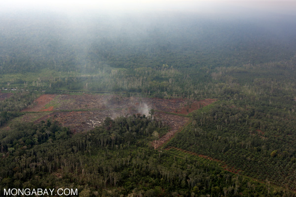
Fires are generally set to clear land to establish plantations, especially oil palm estates. Because much of the area consists of peatland, which is highly flammable when drained, the fires drive heavy pollution as well as substantial greenhouse gas emissions. A study published last year in the journal PLoS ONE estimated that palm oil expansion in Riau alone resulted in an average of 5.2 million tons of carbon dioxide emissions per year from 2000 and 2012. Nearly 70 percent of the emissions resulted from plantations on peat soils.
The current fires are severe enough that officials in Riau have declared a state of emergency, according to The Wall Street Journal.
CITATION: Ramdani F, Hino M (2013) Land Use Changes and GHG Emissions from Tropical Forest Conversion by Oil Palm Plantations in Riau Province, Indonesia. PLoS ONE 8(7): e70323. doi:10.1371/journal.pone.0070323